Southeast London Maps
-
 John Stow, Lambeth & Southwark, 1720£ 175.00
 -
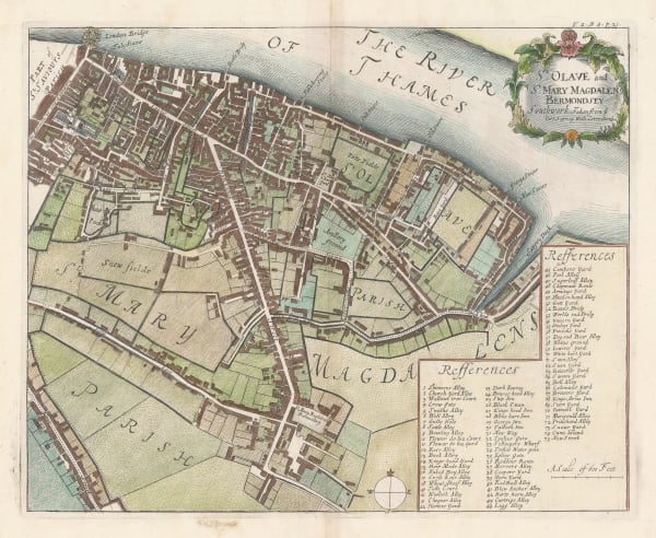
John Stow, London Bridge & Bermondsey, 1755£ 295.00
-
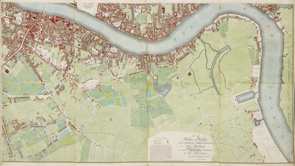
Richard Horwood, Southwark, Bermondsey, Rotherhithe & Wapping, 1799£ 4,850.00
-
James Wyld, Greenwich, Deptford, Lewisham, Brockley, Peckham & East Dulwich, 1849£ 395.00
-
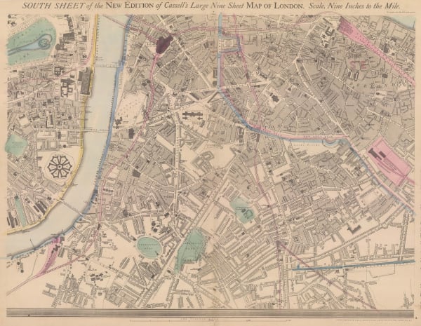
John Cassell, Lambeth, Vauxhall, Borough, Southwark & Kennington, 1868£ 345.00
-
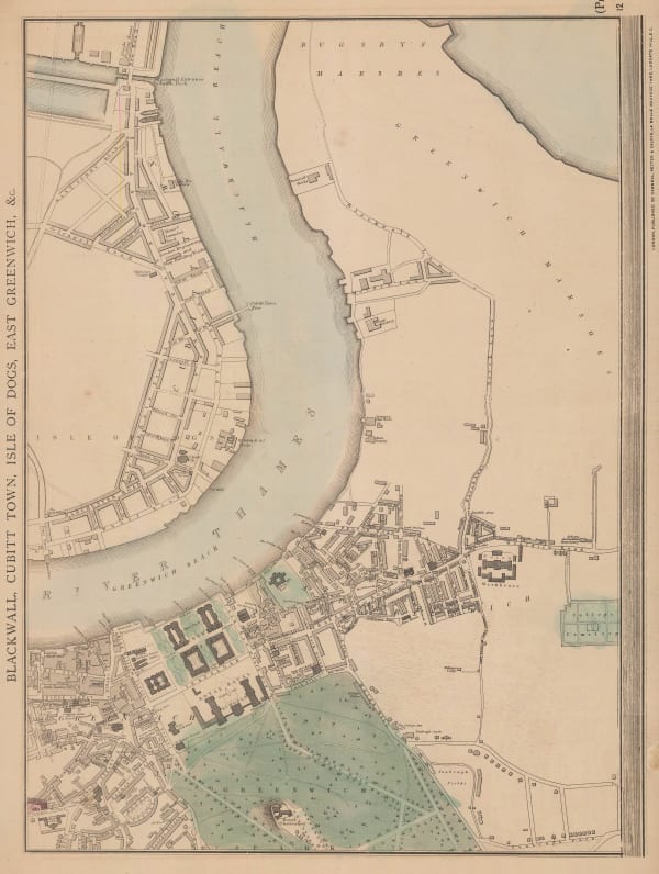
John Cassell, Greenwich, Isle of Dogs & Greenwich Peninsula, 1868£ 325.00
-
George W. Bacon, Greenwich, 1875 c.£ 395.00
-
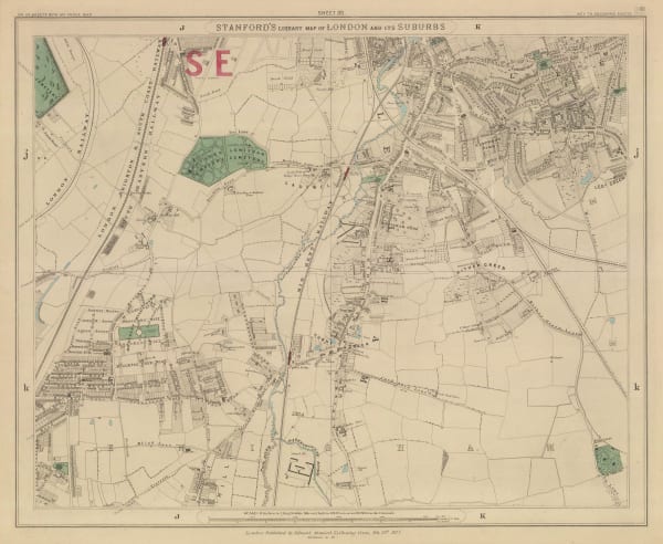
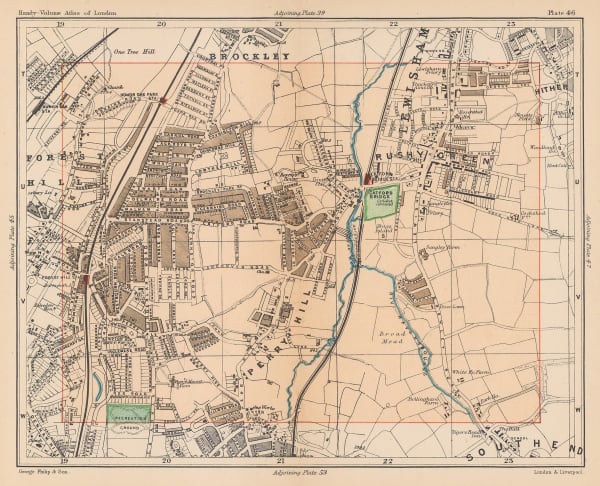
Edward Stanford, Lewisham, Ladywell & Hither Green, 1877£ 225.00
-
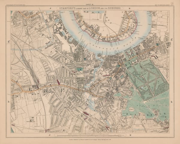
Edward Stanford, Greenwich, Deptford & New Cross, 1877£ 695.00
-
Edward Stanford, Peckham, Walworth & Camberwell, 1877£ 345.00
-
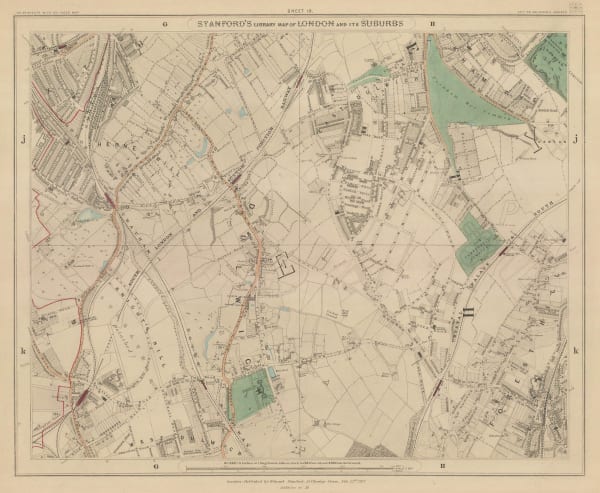
Edward Stanford, Crystal Palace, Sydenham, Norwood & Penge, 1877£ 395.00
-
Edward Stanford, Dulwich, Herne Hill, Forest Hill & Peckham Rye, 1877£ 695.00
-
Edward Stanford, The City, Southwark, Wapping & Whitechapel, 1877£ 1,150.00
-
Edward Stanford, Beckenham, Perivale & Sydenham, 1877£ 295.00
-
Edward Stanford, Limehouse, Canary Wharf & Poplar, 1877 c£ 445.00
-
Edward Stanford, Limehouse, Canary Wharf & Poplar, 1877 c£ 445.00
-
George W. Bacon, Peckham, New Cross, Nunhead & Deptford, 1880 c.£ 295.00
-
George W. Bacon, Stockwell, Brixton & Camberwell, 1880 c.£ 295.00
-
George W. Bacon, Dulwich, Norwood, Crystal Palace, Penge & Hither Green, 1880 c.£ 325.00
-
George W. Bacon, Southeast London, 1886£ 285.00
-
George W. Bacon, Mottingham, Eltham, Plaistow, Bromley & Chislehurst, 1886£ 175.00
-
George W. Bacon, Dulwich, Sydenham, Crystal Palace & Norwood, 1886£ 275.00
-
George W. Bacon, Southwark, Rotherhithe, Bermondsey, 1886£ 145.00
-
George W. Bacon, Greenwich Peninsula & Isle of Dogs, 1886£ 125.00
-
George W. Bacon, London, South East Sheet, 1886£ 295.00
-
George Philip & Son Ltd., Crystal Palace & Upper Norwood, 1891£ 55.00
-
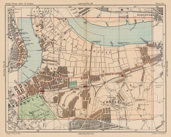
George Philip & Son Ltd., Greenwich & Charlton, 1891£ 56.00
-
George Philip & Son Ltd., Catford, Honour Oak & Forest Hill, 1891£ 45.00
-
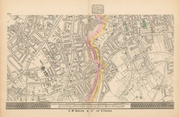
Thomas Sulman, Bird's-Eye View of London Bridge & Borough, 1894£ 115.00
-
Edward Stanford, Lower Sydenham, Catford, Beckenham & Bromley, 1894£ 195.00
-
Edward Stanford, Eltham, Sidcup & Chislehurst, 1894£ 195.00
-
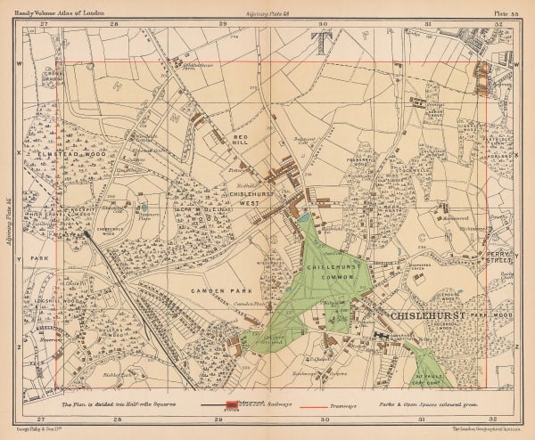
George Philip & Son Ltd., Chislehurst & Elmstead, 1895 c.£ 38.00
-
George W. Bacon, Bermondsey, Rotherhithe, Isle of Dogs & Deptford, 1895 c.£ 195.00
-
Charles Booth, Poverty Map of Greenwich, Deptford & Lewisham, 1900£ 1,275.00
-
Charles Booth, Poverty Map of Peckham, Brixton & Camberwell, 1900£ 1,250.00
-
George W. Bacon, South & Southwest London, 1900£ 395.00
-
George W. Bacon, Tooting, Dulwich & Streatham, 1900£ 245.00
-
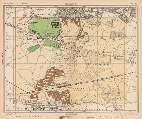
George Philip & Son Ltd., Shooters Hill & Eltham Park, 1900 c.£ 38.00
-
George W. Bacon, Greenwich & Charlton, 1900 c.£ 62.00
-
Charles Booth, Poverty Map of Woolwich & Plumstead, 1902£ 325.00
-
Edward Stanford, South London, 1904£ 445.00
-
George W. Bacon, South London, 1910 c£ 325.00
-
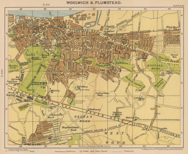
George Philip & Son Ltd., Woolwich & Plumstead, 1912£ 50.00
-
Ordnance Survey, Blackheath, 1919 c.£ 775.00
-
George W. Bacon, South London, 1920 c.£ 425.00
-
Ordnance Survey, South London, Kent & East Sussex, 1920 c.£ 450.00
-
Ordnance Survey, Dulwich, 1924 c.£ 425.00
-
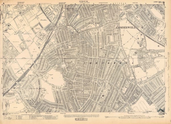
Ordnance Survey, East Dulwich and Camberwell, 1925 c.£ 425.00
-
J.G. Bartholomew, Southwark, Waterloo, Lambeth & Kennington, 1928£ 58.00
-
George W. Bacon, Rotherhithe, Deptford & Bermondsey, 1928£ 55.00
-
Charles Booth, Poverty Map of Wandsworth, Streatham, Tooting, Clapham & Dulwich, 1930£ 1,450.00
-
Charles Booth, Poverty Map of Royal Docks, Barking & Woolwich, 1930£ 650.00
-
George W. Bacon, South London & Suburbs, 1930 c.£ 650.00
-
J.P. Sayer, Southwark, 1948 c.£ 75.00