Justus Perthes
26 x 41 cm
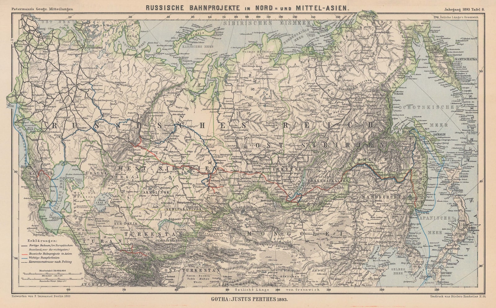
This map illustrates the rail route which the Russian government planned to build across Siberia. The map shows the extent of their rail network in western Russia and how it would link to the Trans-Siberian. This route is marked in red. The blue lines on the map show the major steamer routes which would also link to the railroad. Finally, there is also caravan route marked from Peking (Beijing) to a station along the railroad, Kjachta or modern Kyakhta.
The Geographische Mitteilungen, in which this map was originally published, is the oldest German language geographical journal - its first issue was in 1855 and it finally closed its doors in 2004. The magazine was conceived and edited by August Heinrich Petermann and published by the venerable firm of Justus Perthes in Gotha, Germany.
Its first article reported on an expedition into North Africa and the Sahara by Heinrich Barth and Adolf Overweg. This report was enough to secure a circulation of 4000 for the fledgling magazine and, more importantly, encouraged other important scientist-explorers of the day who were attracted by the magazine’s heavy scientific emphasis to send in their own reports. These included Hans Meyer, the first man to ascend the Kibo crater on Mount Kilimanjaro, Sven Hedin, the Swedish explorer of Central Asia and the Himalayas, and Alfred Wegener, the geoscientist who pioneered the theory of continental shift which led to the modern theory of plate tectonics.
In comparison to its contemporaries, such as the Geographical Journal of the Royal Geographical Society, the Mitteilungen had a far greater interest in ethnography and the physical and natural sciences, leading to the inclusion of many fascinating, but sometimes obscure, maps on the most recent theories related to climatology, meteorology, botany, and zoology.
Original colour. [RUS2682]


