Wolodymyr Kubijowytsch
90 x 52 cm
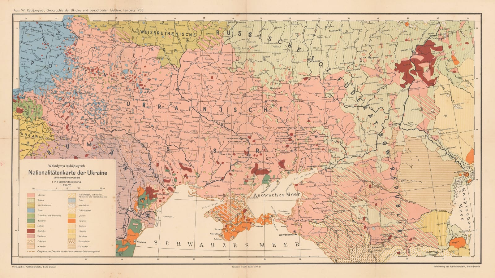
Ukrainians, Russians, Poles, Germans, Romanians, and Tatars are the most common ethnic groups noted on the map, though small populations of Czechs, Bulgars, Serbs, Greeks, Armenians, Hungarians, and Central Asian nationalities are also indicated. The many small bubbles of blue, brown, and green show how centuries of migration by Poles, Germans, and Russians into Ukraine often resulted in small ethnic enclaves around their colonies. A similar effect is shown in reverse with Ukrainian populations in modern-day Moldova.
This map was originally published in a German edition of Wolodymyr Kubijowytsch's 'Atlas of Ukraine and adjoining countries'. Other editions were printed in Russian or Ukrainian. Kubijowytsch was an anthropologist and geographer whose right-wing and anti-Semitic views made him an enthusiastic Nazi collaborator during the Second World War. He was a proponent of ethnic cleansing in Ukraine, a chilling fact given that these maps identify some of the very social groups the Nazis sought to eradicate. After the war he continued to work on his Encyclopaedia of Ukraine whilst living in exile in France. The Atlas and Encyclopaedia of Ukraine helped to establish a unified Ukrainian identity during the Soviet period and for the Ukrainian diaspora abroad, a positive outcome to an otherwise troubling history.
Printed colour. [RUS2664]


