F.A. Brockhaus
22 x 28 cm
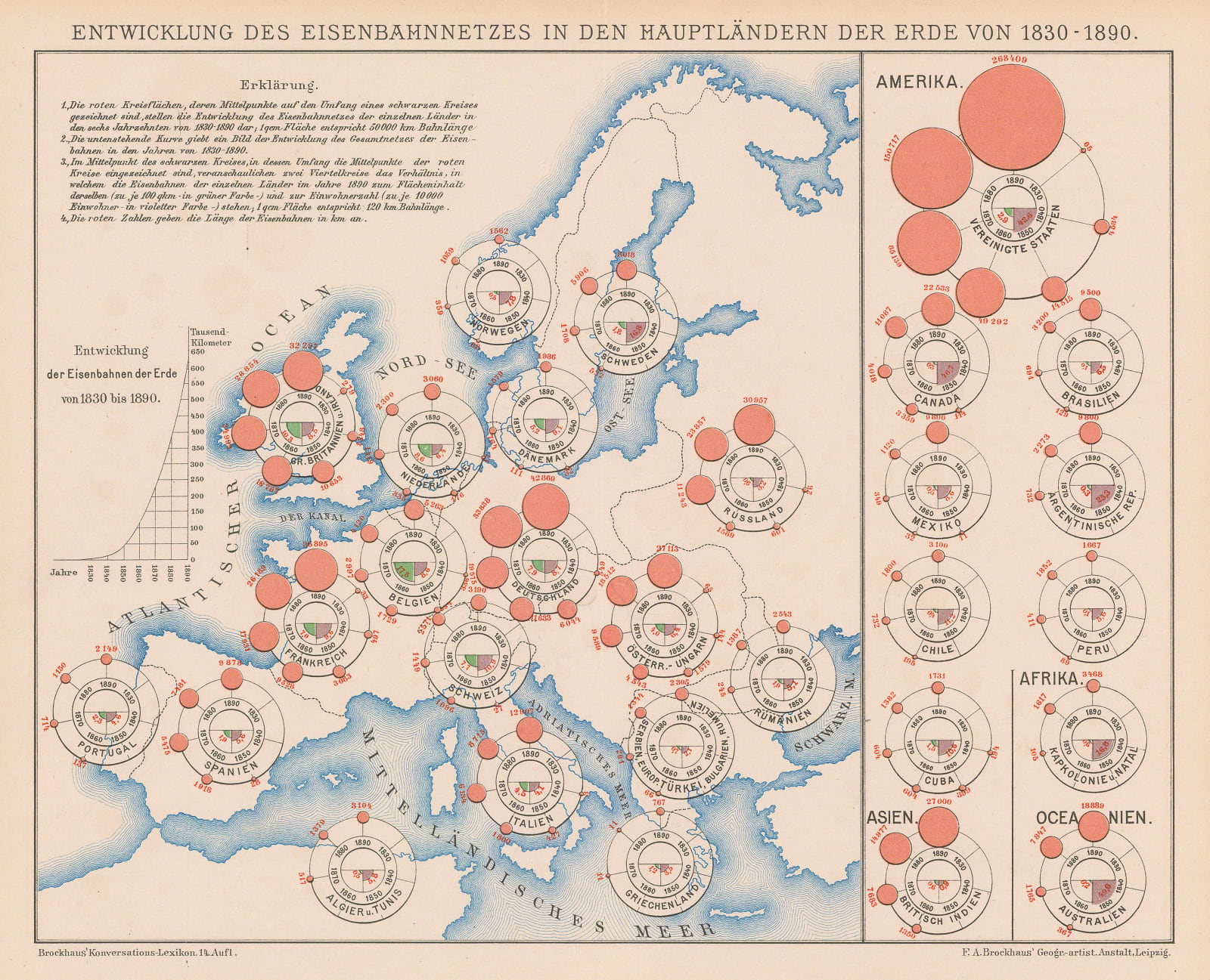
Two maps on one sheet showing the development of the railways from 1830 to 1890. The larger map focuses on Europe while the smaller diagram shows the rest of the world.
This curious infographic map shows the development of the railways in the 19th century. Each country has a circular diagram which charts the distance of track laid in kilometres. The larger diagram shows European development while the purely infographic group on the right shows the rest of the world.
Explanatory German text is present on the upper left.
Original colour. [WLD4862]


