Edward Stanford
95 x 170 cm
Stanford's Library maps were the firm's prestige items. Large, spectacular, and extremely accurate, they were both an advertisement for the firm as well as very expensive, aimed at their wealthiest clients. Initially, there were Library maps of the world, Europe, Africa, North & South America, Asia, Australasia, and London, but other areas were added as the firm prospered, including a very rare Library Map of Japan. These maps were constantly updated in new editions to reflect the changing political order of the world. The ability to convey this information rapidly was facilitated by the new invention of cable telegraph, a feature which is clearly marked on many of the maps.
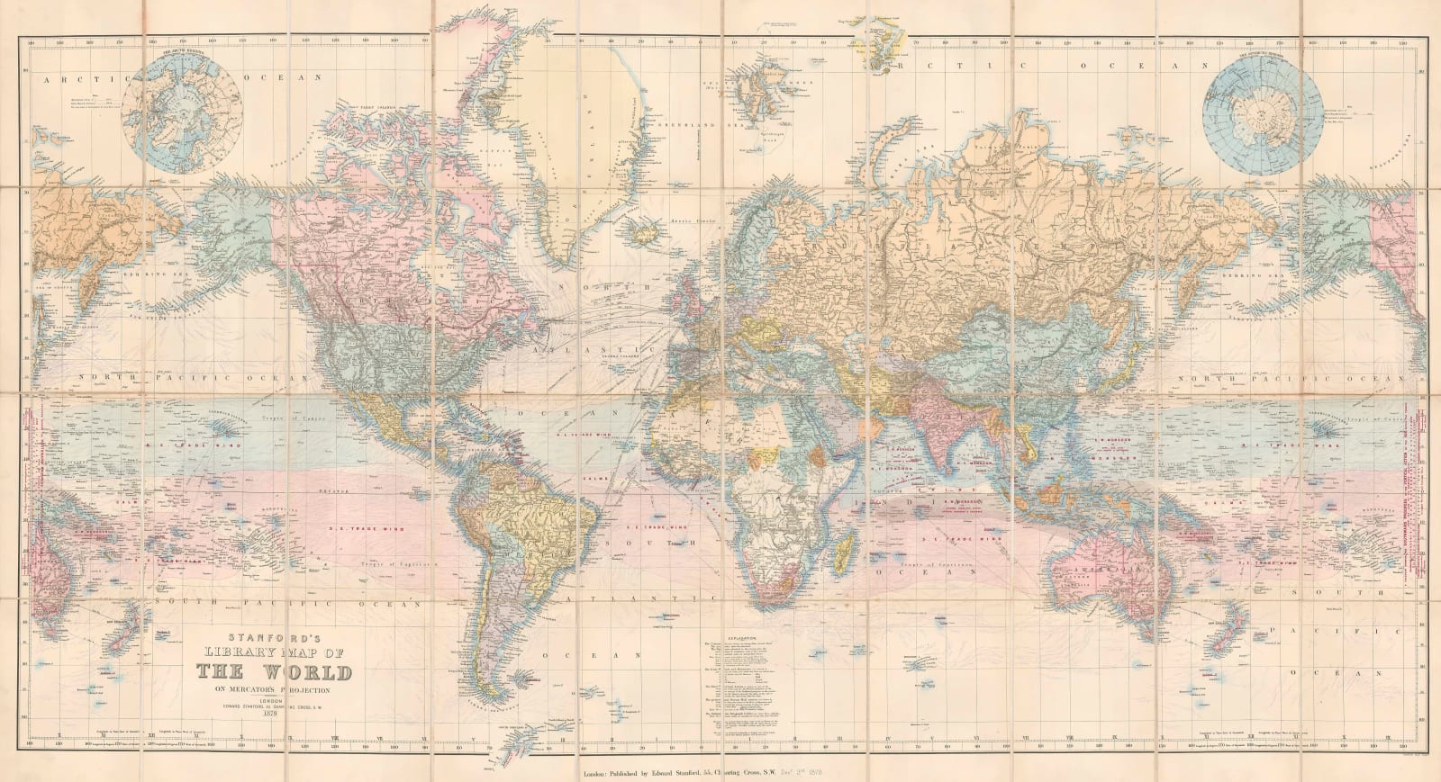
This 'Library Map of the World on Mercator's Projection' encapsulates the philosophy that Stanford employed for his project. It is a large, folding map that could be practically stored inside a custom made case on a bookshelf to be taken out and examined as required. With its strong linen backing, it could also be pinned onto a wall and was also available on custom-made rollers for an extra charge. Centred on the Atlantic, it shows the United Kingdom at the centre of the world.
Reflecting the Victorian fascination with the sciences, it is as geographically accurate as current information could make it, and includes new information about natural phenomena, such as the trade winds, warm and cold ocean currents, and the timings of the monsoons in both the Indian and Pacific Oceans. All of this reflects an increasing interest in oceanography and meteorology. Although the study of these sciences was in its infancy, more attention was beginning to be paid to the mysteries of the seas and the atmosphere.
On a more practical level, the steamboat mail routes between Europe and the rest of the world and the submarine telegraph cables are also prominently marked. This again emphasizes scientific progress across the British Empire and the word. Politically, the map is as up to date as possible and, as usual, the British Empire is marked in red. As with all of the Stanford Library maps, it features a mix of attractive hand colour and printed colour.
Starting in 1879, this map was re-issued and updated into the 1920s, although its style and appearance had greatly changed by that point.
Folded. [WLD4864]


