Charles Smith
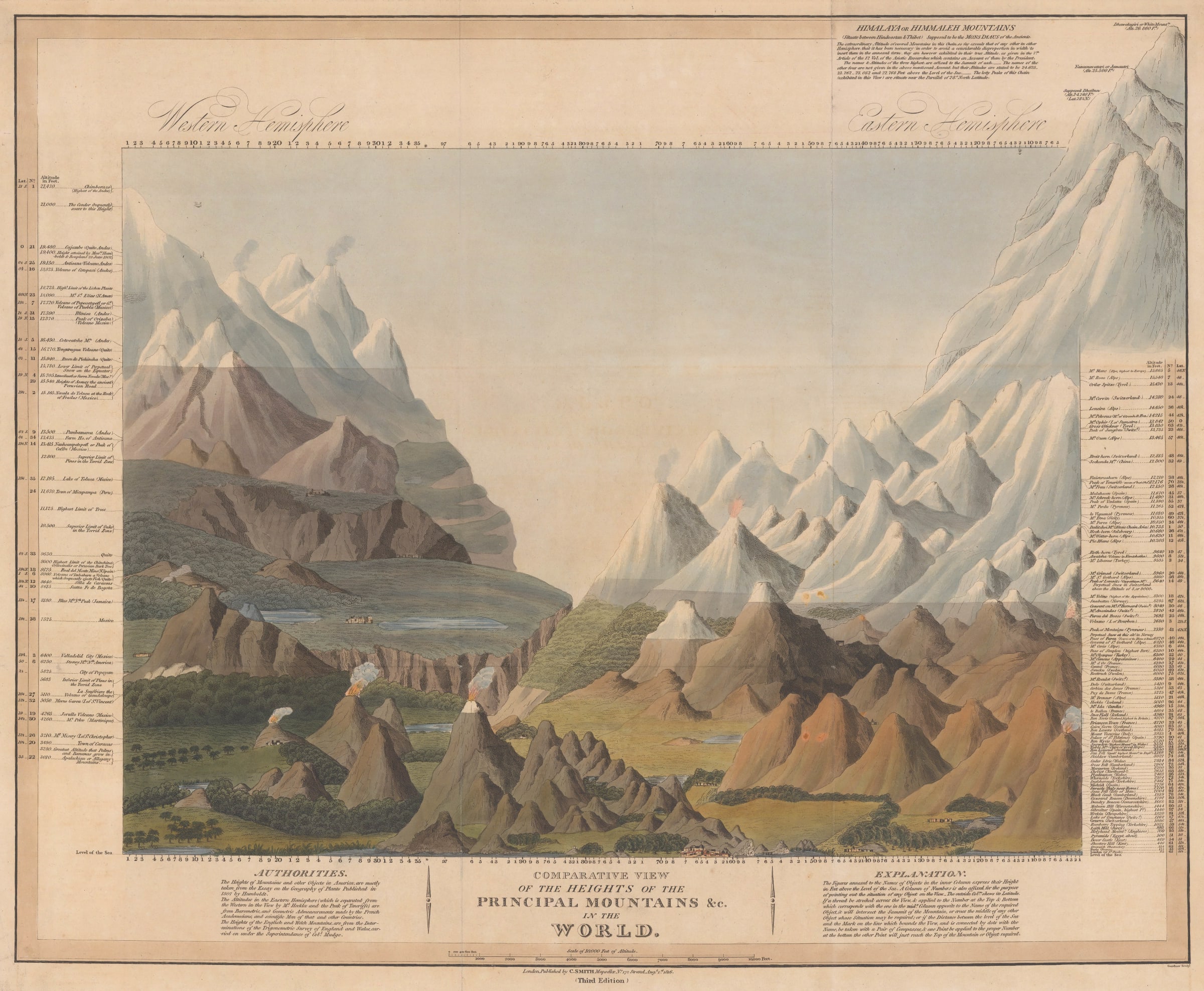
Comparative View of the Heights of the Principal Mountains of the World, 1816
21 x 25 in
53 x 63.5 cm
53 x 63.5 cm
WLD4808
Panoramic map illustrating the current knowledge of the world's highest mountains in the early nineteenth century. This extremely attractive panoramic map of the world's highest mountains was inspired by John...
Panoramic map illustrating the current knowledge of the world's highest mountains in the early nineteenth century.
This extremely attractive panoramic map of the world's highest mountains was inspired by John Thomson's similar map from the same period. Unlike Thomson though, Smith helpfully adds several text panels which state the sources for his information: Humboldt for the western hemisphere and "French Academicians" mainly for the eastern hemisphere. Information about British mountains are taken from Col. Mudge who was in charge of the Ordnance Survey.
The Himalayas deserved a special text panel on the upper right; Smith acknowledges a lack of knowledge of these but states that he was able to access the 7th article of the "Asiatic Researches" the journal of the Asiatic Society, which described the mountains.
At this time Dhawalagiri, " the White Mountain" now Dhaulagiri was believed to be the highest mountain in the world. Now, it is the seventh highest.
An extremely attractive piece in original colour. [WLD4808]