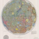
United States Geological Survey (USGS)
92 x 73 cm
Further images
The base layer of the map is the 3rd Edition (1966) photo-mosaic map by the United States Air Force Aeronautical Chart and Information Center (ACIC). One of the principal data sources for the topography of the map is photographs taken by Lunar Orbiter IV in May 1967.
Don E. Wilhelms (born 1930) is an American geologist who worked for the U. S. G. S., contributing hugely to the geologic mapping of the Moon and training NASA's Apollo astronauts for their geologic EVA (extravehicular activity) tasks whilst on the lunar surface.
Printed colour. Backed on archival linen. Colour key and associated scientific documents included with the map in the original USGS brown envelope. [CELEST1584]