Samuel Augustus Mitchell
National Map of the American Republic, 1843
24 x 34 ½ in
61 x 87 cm
61 x 87 cm
USA9777
National Map of the American Republic or the United States of North America First edition of Mitchell’s important map of the United States, here in its pocket form. Geographically,...
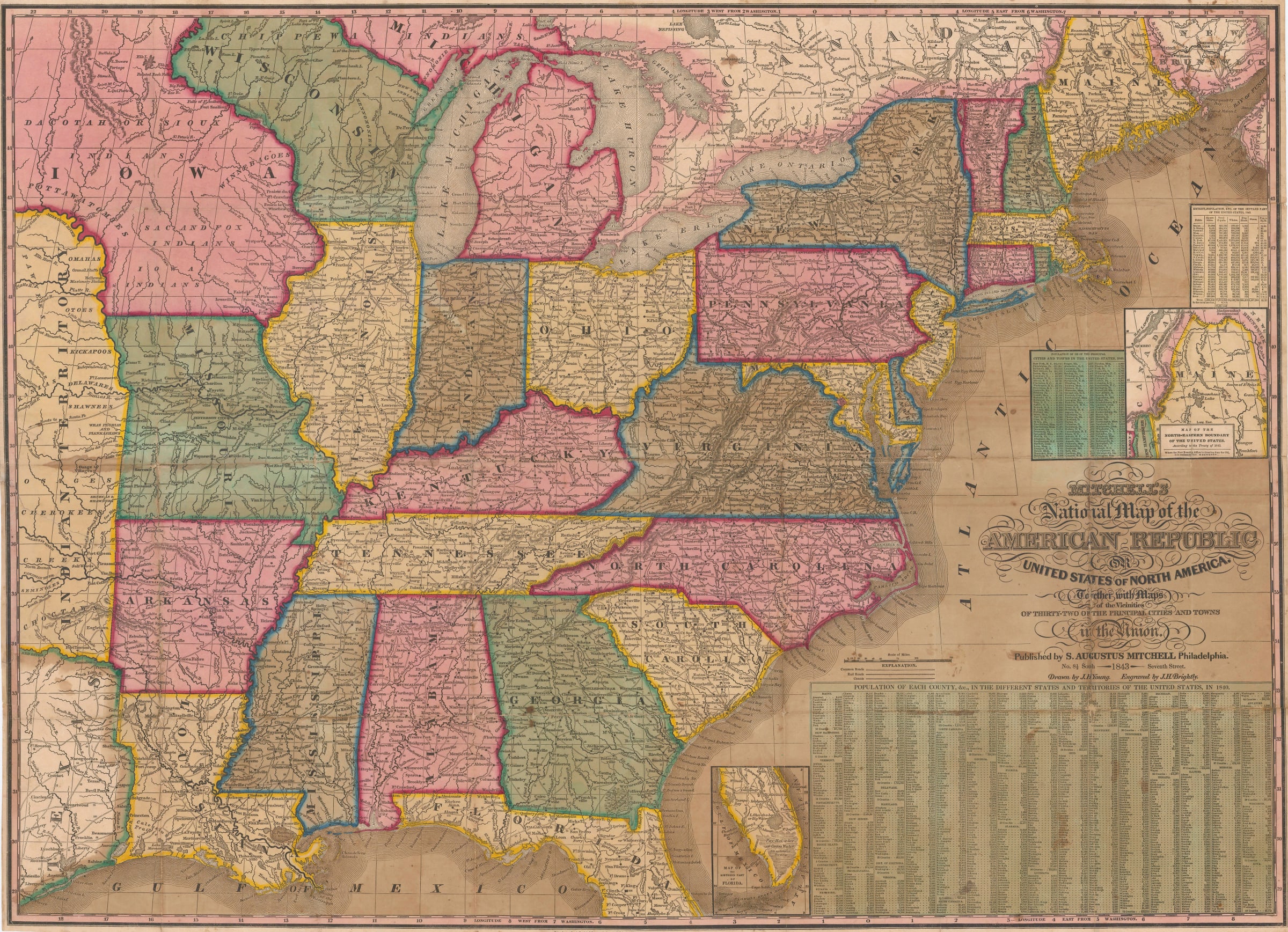
National Map of the American Republic or the United States of North America
First edition of Mitchell’s important map of the United States, here in its pocket form.
Geographically, the map shows the United States with a western boundary set on the Mississippi-Missouri River. Beyond that are Texas and the Indian Territory. At this time, Texas had claimed independence and the Indian Territory was nominally independent; the extent of the Oregon Territory was still under dispute with Great Britain. Two of these issues would be settled shortly with Texas accepted into the Union in 1845 and the signing of the Oregon Treaty in 1846.
In the north west of this map, the new borders of Iowa and Wisconsin are very much in flux and the Upper Peninsula is now part of Michigan. A small inset shows the newly agreed borders of Maine while the lower right corner bears a large panel of statistic to 1840.
This map came out in two formats: the first and comparatively the more common was as a wall map, usually on rollers and backed on linen, consisting of an augmented version of this map surrounded by a series of insets of either state capitals and their vicinity or important cities and their vicinity. The second format was as a pocket map, folded into a smaller leather case convenient for transport. This format seems to be relatively more unusual.
Our example is the pocket map version, on paper. Strong original colour. [USA9777]