Nicolas Sanson
Mexico and Central America, 1656
15 x 22 in
38 x 56 cm
38 x 56 cm
WIND4301
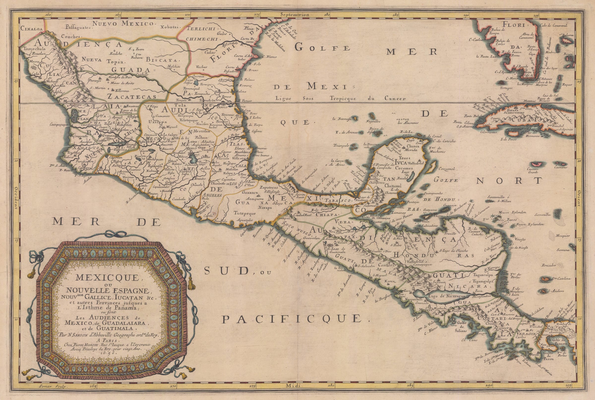
Early map of the Spanish Viceroyalty of New Spain, stretching from Zacatecas in Mexico in the north to Guatemala in Central America in the south. This is one of the...
Early map of the Spanish Viceroyalty of New Spain, stretching from Zacatecas in Mexico in the north to Guatemala in Central America in the south.
This is one of the earliest available folio maps of the ancient Viceroyalty of New Spain. It was one of the linchpins of the Spanish Empire in the New World and at its height it comprised of both this area but also islands in the Caribbean and several other islands in the Pacific including the Philippines. The map was published before the French establishment of Louisiana, hence the north western border abuts to the neighbouring Spanish territory of Florida, here seen on both the Peninsula and the region mentioned above.
Among many points of geographical interest is the portrayal of Lake Nicaragua, with a large river draining from the lake into the Caribbean. On the western side, the lake almost reaches the Pacific shore, providing another great example of geographical wishful thinking for a sea route between the Pacific and the Atlantic.
Coloured. [WIND4301]