Jean-Baptiste Poirson
41 x 66 cm
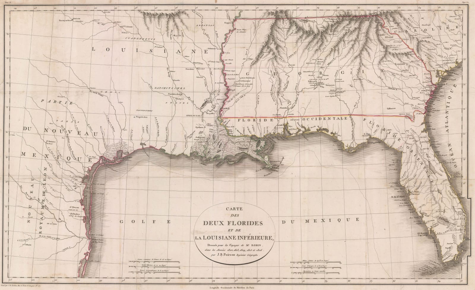
Poirson’s notable map of the Gulf coast of the United States from the Florida Peninsula to the shores of Texas.
This map was prepared for and bound in a geographical travelogue of the region by Charles Cesar Robin. Little is known about Robin’s early life, but in the early 1780s, he was the author of a history of the Revolutionary War as seen from the perspective of the French forces. Robin accompanied the Comte de Rochambeau, commanding general of the French army in the United States, as his chaplain.
He returned to France and in 1802, having survived the French Revolution, he set sail for Martinique and travelled through the West Indies until he reached New Orleans on the Gulf coast. As can be read on the cartouche, he spent several years in the West Indies and the United States, undertaking several expeditions into the interior of Louisiana, Texas, modern Mississippi, Alabama, Florida and Georgia.
On his return to France, he compiled his notes into a work detailing his experiences in the New World. He also contracted a professional geographer, J. B. Poirson, to compile a map illustrating the area in which he was active. Poirson used existing sources, such as Jose Antonio de Evia’s maps of the Gulf Coast as well as Robin’s own notes to draw a map which considerably advanced knowledge of the region. This is particularly so in the case of the nomenclature and placement of several Native American tribes.
In addition, another notable feature on the map is the vast area claimed by the State of Georgia, stretching from the east coast to the Mississippi. Two notorious land scandals had been exposed in the region during this period: The Yazoo Land Scandal and the Pine Barrens Speculation; these meant that in 1802, Georgia ceded all its land claims west of its current modern border to the United States government although this has not been made apparent on this. Instead the map features Georgian claims previous to its reduction.
Of similar zeitgeist interest is the Louisiana Purchase, finalised in 1803, which took place while Robin was travelling in the region although no note of this was made on the map.
Poirson’s map is unusual and evokes a foundational period in United States history.
Original colour. [USA9556]


