Nicolas de Fer
25.4 x 33 cm
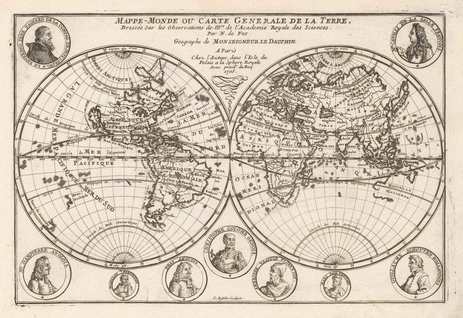
This is the 1705 edition of de Fer's double hemisphere world map adorned by the illustrations of multiple important navigators.
De Fer (1646-1720) was the son of a prominent engraver and produced his first map in 1669. He joined his father's business in 1673 and ultimately took over in 1687. He was a prolific map maker who produced over six hundred separate maps in multiple forms; as separate issues, bound within history and travel books, and as atlases. In the late 17th century he was made Geographer to the Dauphin.
This map is was originally issued in 1700. Geographically, it is closely based on a larger map published by De Fer in the same year. It bears the same distinctive style of the continental coastlines and the exaggerated jagged portrayal of the island of California.
Both of de Fer’s maps were ultimately sourced from his large wall map of the world first issued in 1694 although there are substantial updates on these later maps.
Aesthetically, this is a departure, with the margins of this map used as a board to portray images of several of the great names of the Age of Discovery, such as Drake, Magellan Columbus and Amerigo Vespucci.
The portrayal of famous navigators on maps is not new, with many famous cartographers such as Speed and Hondius using the same technique. It is unusual to have no less than nine portraits of them on the same map though. De Fer adds several newer influential figures onto the map including La Salle, who coined the name Louisiana and the infamous English circumnavigator and privateer, William Dampier.
Pierre Mortier, another influential Dutch map maker published a map with the same design and geography for his Atlas Portatif published between 1695-1700. It is a matter of some academic debate as to who acted as a source for whom on this particular map. Shirley 601. [WLD4787]


