Robert de Vaugondy
48 x 71 cm
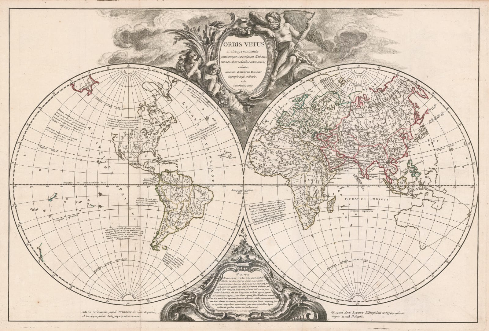
The production of “modern” maps integrating classical geography is not new. The tradition goes back to Sylvanus in 1511, who produced his map attempting to reconcile Ptolemaic geography with several of the advances of the Age of Discovery. In the 17th century, the concept was advanced by Nicholas Sanson, who issued a double hemisphere map of the world with classical nomenclature superimposed upon it. Sanson was the first map maker to identify the Americas with the mythical island of Atlantis.
Vaugondy bases his map on Sanson but updates the geography, particularly the shape of the continents and the shape of Australia. Much of nomenclature of Europe, Africa and Asia is sourced from orthodox classical geographers such as Strabo and Ptolemy. Some concession is made to new discoveries, such as the Philippines and Indonesia in the Far East, named Manilae and Sindae Insulae respectively while Japan is called the Jabadii Insulae.
The New World takes a more legendary turn. Several panels of text identify the western hemisphere with Atlantis while Vaugondy also places two mythical cities, Machimo or Bellatrix and Eusebes approximately in the positions of Mexico City and Cusco respectively. Both of these cities were settlements in the mythical continent of Hyperborea, where gods and beings of legend mixed.
The lower cartouche shows a panel of text entitled as “Monitum” which is generally interpreted as a warning in religious circles. The panel identifies Sanson as the cartographer who associated Atlantis with the Americas as well stating that the continent was divided into ten zones, each belonging to a son of the god Poseidon. The latter is an unusual myth.
Finally and most curiously, the panel also suggests that the Chinese had discovered America four hundred years previous to the publication of this map. This is a reference to the fashionable theory of the time that a lost Chinese colony, Fusang, was situated either on the coast of northern California or the coast of Siberia or the Kamchatka Peninsula. This theory was advanced by Joseph de Guignes, a notable Orientalist and Sinologist of the day. He was also convinced that the Dark Age Huns who attacked the Roman Empire were of Chinese descent and that Chinese civilisation was descended from the ancient Egyptians. This may explain why the whole panel is under a “Monitum”.
The ”Atlas Universel” which included this map was published in parts between 1751 and 1755 and as a whole work c.1757. It was Robert de Vaugondy’s and his partner Antoine Boudet’s most successful work. Original colour. [WLD4789]


