A.C. Willis
61 x 46 cm
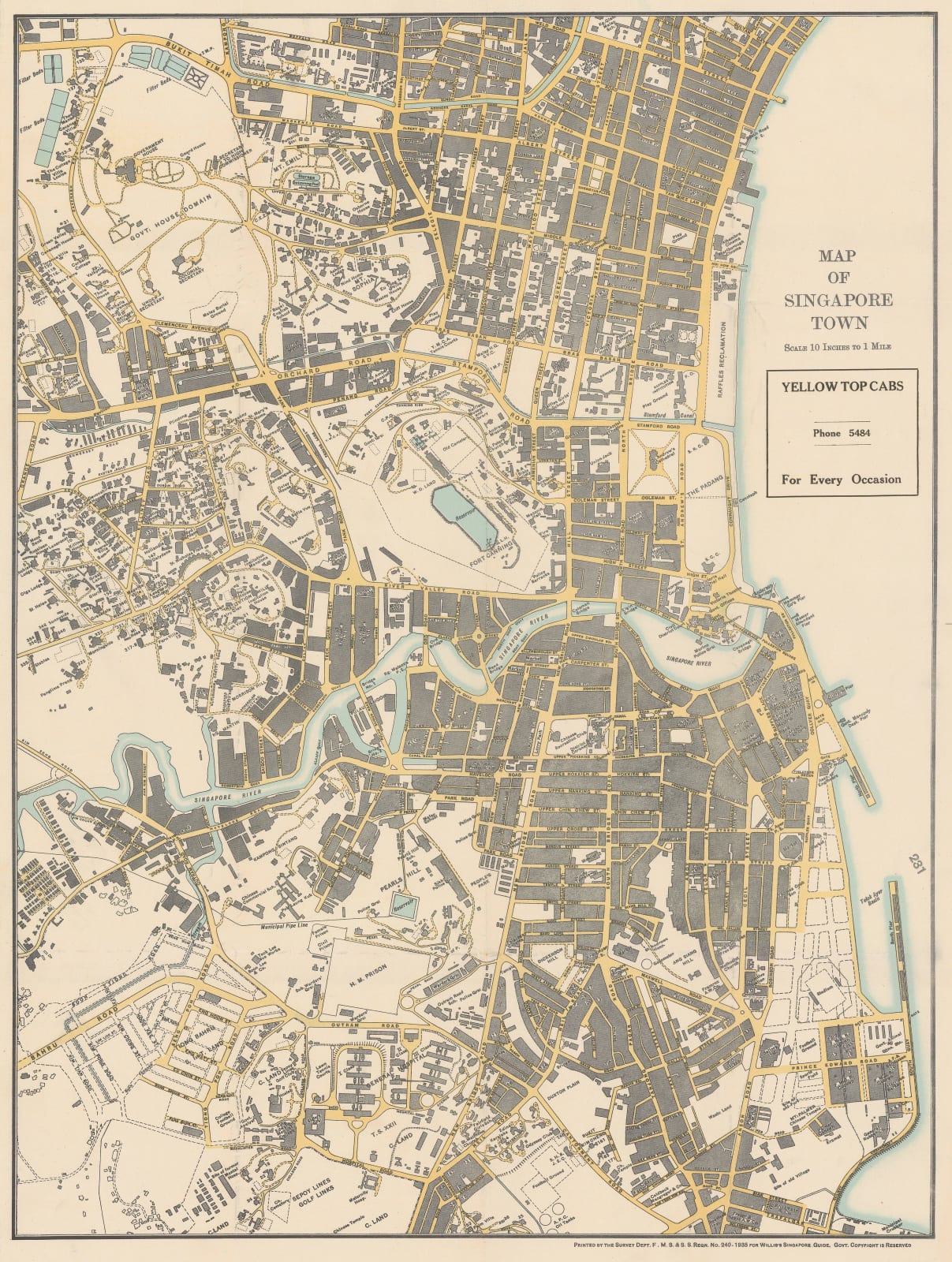
The central part of the map is Fort Canning, now Fort Canning Park. It stretches from Arab Street in the north to Trafalgar in the south and from Grange Road in the west to the waterfront.
A. C. Willis was the Steward of the Marine Hostel and became famous in the mariner community as a superb host for visiting merchant sailors. When he began work in the Marine Hostel in 1929, he organised tours, games, and entertainment which spread his fame far and wide. Anecdotes range from ships using their radios to organise football matches against rival teams in Singapore days ahead of their landfall, to legendary epicurian outings under Willis's stewardship. His only other publication apart from this Guide was a book of local recipes.
The Guide was conceived as an aid for the more adventurous sailors who wished to travel independently and was enormously popular. The map of the city was based on the surveys of the F.M.S. or Federated Malay States. It was first issued in 1934 and continued to be printed even after World War II with an edition recorded in 1949.
This is an early example from 1935. Original colour. [SEAS5432]


