-
 Martin Waldseemüller & Laurent Fries, Rare woodcut map of Italy, 1541£ 3,450.00
 -
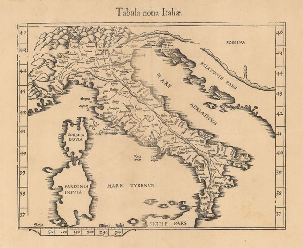
Claudius Ptolemy & Laurent Fries, Italy, 1541£ 3,450.00
-
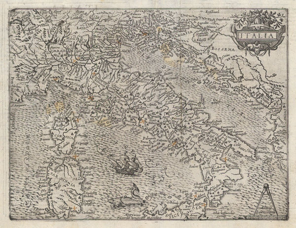
Girolamo Ruscelli, Italy, 1561£ 575.00
-
Antoine Du Pinet, Venice, 1564£ 1,650.00
-
Sebastian Münster, Italy, 1572£ 1,250.00
-
Matthias Quad, Early map of Italy, 1610 c.£ 985.00
-
Jan Jansson, Italy, Sardinia and Corsica, 1661£ 345.00
-
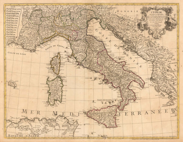
John Speed, Decorative map of Italy, 1676£ 4,500.00
-
Frederick De Wit, Italy, Sardinia and Corsica, 1680 c.£ 775.00
-
Robert Morden, Miniature map of Italy, 1688£ 225.00
-
Johann Ulrich Muller, Miniature map of Italy, 1692£ 225.00
-
Vincenzo Coronelli, Chart of the Adriatic Sea and Gulf of Venice, 1696£ 885.00
-
Nicolas Sanson, Italy, Sicily, Corsica, and Sardinia, 1700£ 595.00
-
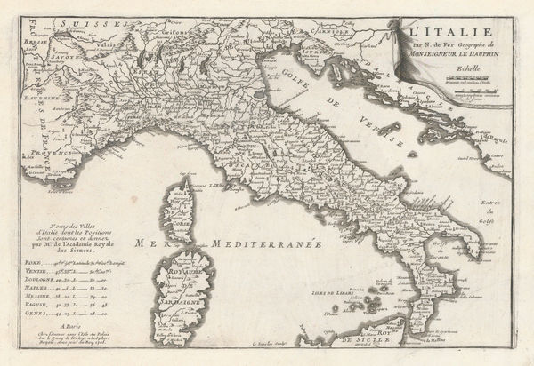
Nicolas de Fer, Italy, 1705£ 425.00
-
Herman Moll, Decorative map of Italy, Sicily, Sardinia and Corsica, 1714£ 3,250.00
-
Pieter van der Aa, Pavia and the Po Valley, 1714£ 495.00
-
Pieter van der Aa, Italy, Sicily, Sardinia and Corsica, 1714 c.£ 445.00
-
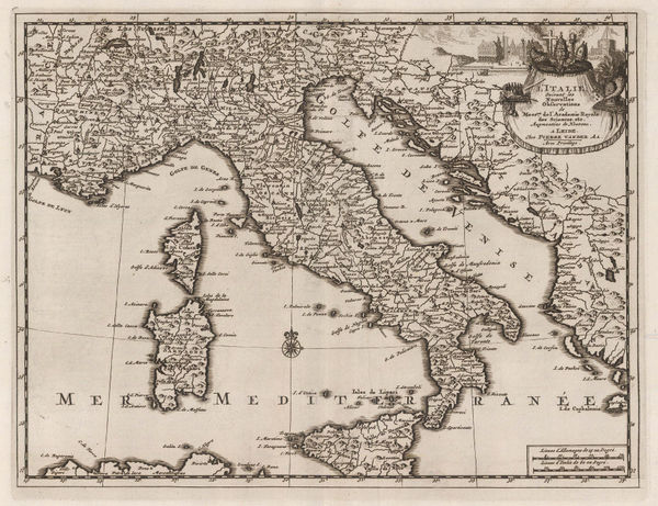
Johann Baptist Homann, Italy, Sicily, Sardinia and Corsica, 1715 c.£ 985.00
-
Matthaus Seutter, Italy, Sardinia and Corsica, 1740 c.£ 850.00
-
Philippe Buache, Italy, 1745£ 395.00
-
Philippe Buache, French map of Italy, 1745£ 325.00
-
Robert de Vaugondy, Italy, 1750£ 385.00
-
Tobias Conrad Lotter, Miniature map of Italy, 1755 c.£ 145.00
-
Andrew Dury, Miniature map of Italy, 1761£ 195.00
-
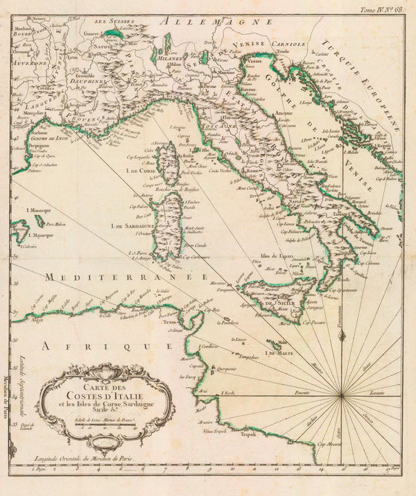
Jacques-Nicolas Bellin, The Coasts of Italy, Sardinia & Corsica, 1764£ 345.00
-
Richard William Seale, Italy, 1780 c.£ 675.00
-
John Harrison, Italy, 1783£ 115.00
-
Francois Santini, Italy, Sicily, Sardinia and Corsica, 1784£ 425.00
-
Thomas Kitchin, Italy, 1785£ 195.00
-
Robert Sayer, Italy, Sicily, Sardinia & Corsica, 1790£ 295.00
-
Charles Francois Delamarche, Italy, 1795£ 285.00
-
C. & E. Brightly, Italy, 1807£ 115.00
-
R. Juigne, Geographical Map of Italy, 1813£ 140.00
-
John Thomson, Italy, 1814£ 245.00
-
-
John Cary, Italy, Sicily, Sardinia and Corsica, 1821£ 425.00
-
C.V. Lavoisne, Geographical and Statistical Map of Italy, 1828£ 165.00
-
Alexandre Emile Lapie, Italy, 1831£ 120.00
-
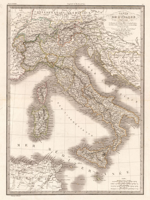
Adrien Brue, Italy, Sicily, Sardinia and Corsica, 1836£ 165.00
-
Thomas Kelly, Italy, 1840 c.£ 125.00
-
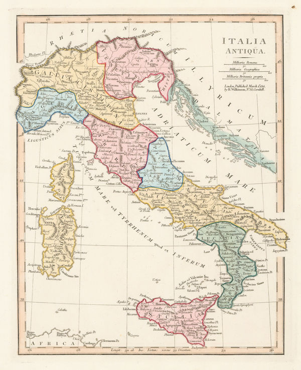
Robert Wilkinson, Ancient Italy, 1842£ 95.00
-
Society for the Diffusion of Useful Knowledge (SDUK), Florence, 1844£ 425.00
-
James Wyld, Italy post Treaty of Paris, 1850 c.£ 395.00
-
George Philip, Italy, 1856£ 285.00
-
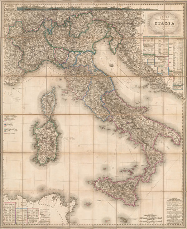
Stanislao Stucchi, Wall Map of Italy prior to Unification, 1859£ 1,350.00
-
Auguste-Henri Dufour, Italy, Sicily, Sardinia and Corsica, 1860£ 345.00
-
Archibald Fullarton, Rome with its Environs, 1860 c.£ 68.00
-
Johnson & Ward, Italy during the Italian Unification, 1863£ 145.00
-
Aleph, Scarce caricature map of Italy, 1869£ 1,250.00
-
Society for the Diffusion of Useful Knowledge (SDUK), Italy, 1876£ 175.00
-
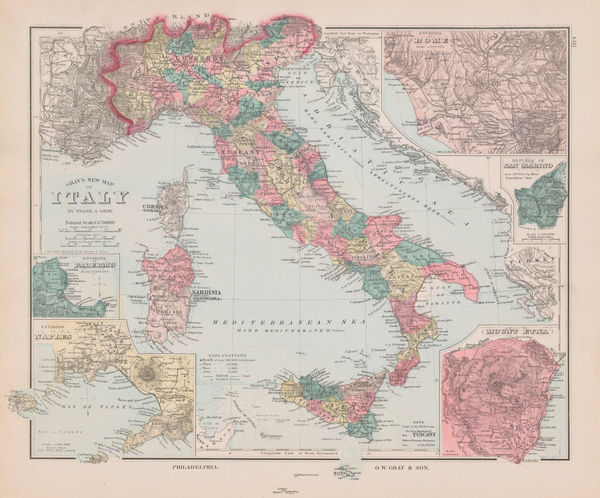
O.W. Gray & Son, Italy, 1881£ 145.00
-
Henry Cuthbert Tunison, Italy, 1885 (c.)£ 95.00
-
Arbuckle Brothers Company, Italy, 1889£ 115.00
-
George Philip & Son Ltd., Italy: Industries & Communications, 1910 c.£ 145.00
-
George Philip & Son Ltd., Italy Jigsaw Puzzle, 1930 c.£ 385.00
-
Giovanni De Agostini, Italia, 1941£ 350.00
-
Giovanni De Agostini, Italia, 1951£ 225.00
-
Giovanni De Agostini, Italy in 1945 & 1950, 1951£ 285.00
-
Heinrich Berann, Capri, 1965£ 195.00
All Maps
Our entire inventory of over 10,000 antique and vintage maps is now available to browse by region, date, cartographer, and subject