James Reynolds
Geographical Diagram of the Earth Adapted for Illustrating its Movements &c., 1840 c.
8 1/2 x 11 in
22 x 28 cm
22 x 28 cm
WLD4458
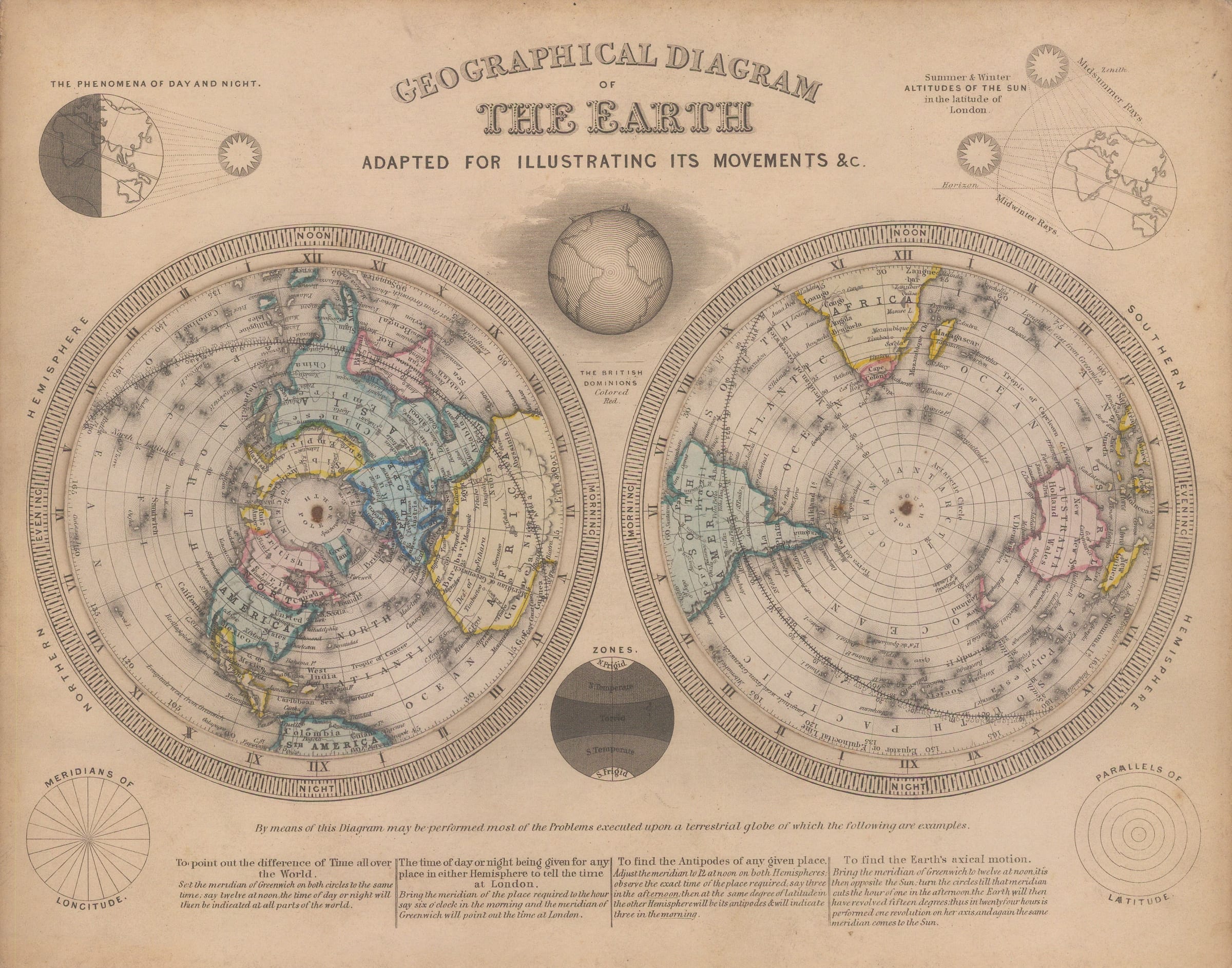
Charming double-hemisphere world map composed of two turning volvelles. Published to explain time zones, seasons, and day-night cycles to Victorian students. The volvelles can be rotated and, along with the...
Charming double-hemisphere world map composed of two turning volvelles. Published to explain time zones, seasons, and day-night cycles to Victorian students. The volvelles can be rotated and, along with the printed description at the bottom of the page, used to calculate the time difference between two places both in the Southern and Northern Hemispheres. Original hand-colour. [WLD4458]
Join our mailing list
* denotes required fields
We will process the personal data you have supplied to communicate with you in accordance with our Privacy Policy. You can unsubscribe or change your preferences at any time by clicking the link in our emails.
![]()
Join our mailing list
* denotes required fields
We will process the personal data you have supplied to communicate with you in accordance with our Privacy Policy. You can unsubscribe or change your preferences at any time by clicking the link in our emails.