H. G. Steward
Pictorial Map of the Isle of Man, 1960 c.
21 ½ x 17 ½ in
55 x 45 cm
55 x 45 cm
BI520
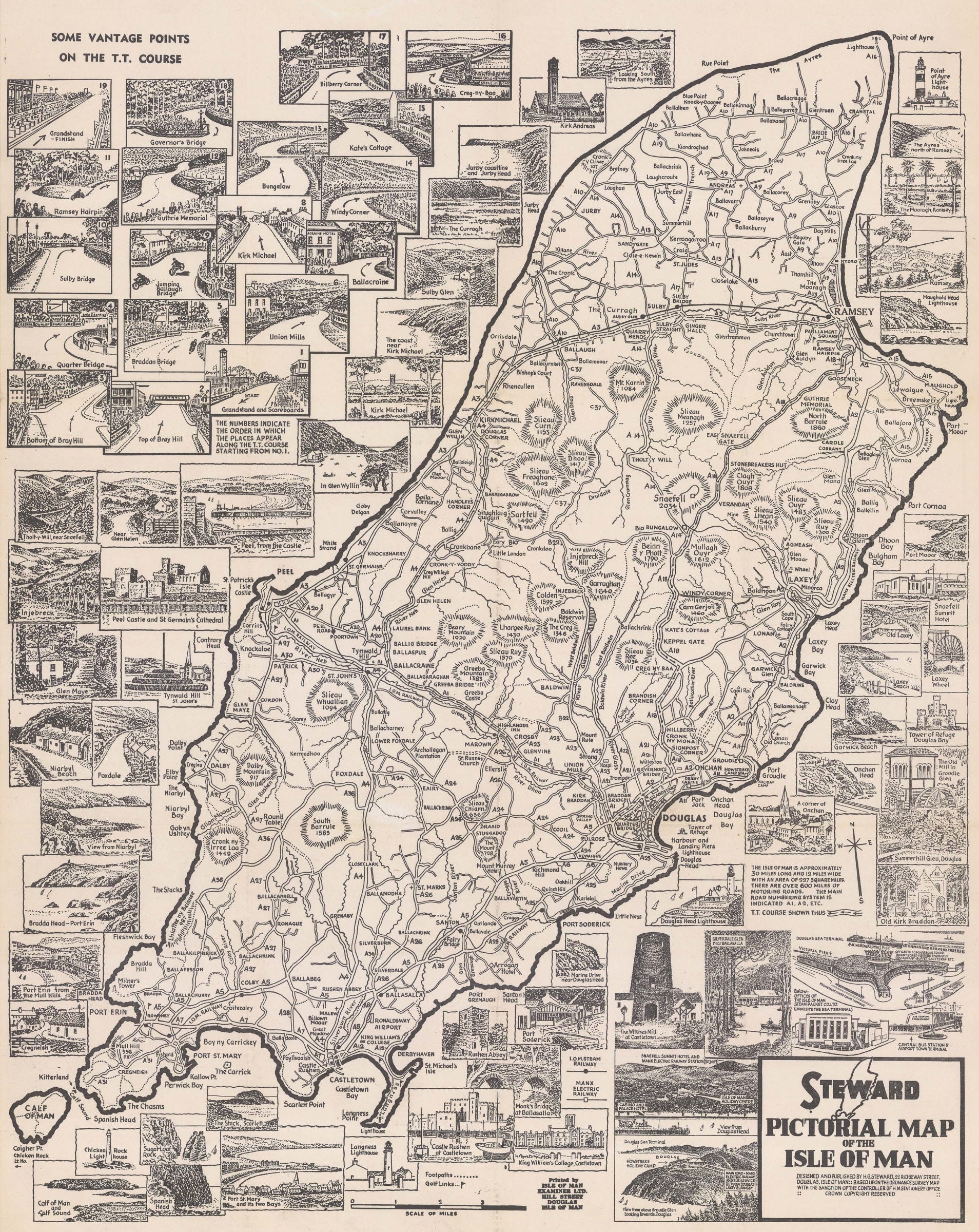
Pictorial map of the Isle of Man focusing on the course of the TT race and illustrated with multiple vantage points of the event. Steward used the Ordnance Survey map...
Pictorial map of the Isle of Man focusing on the course of the TT race and illustrated with multiple vantage points of the event. Steward used the Ordnance Survey map as his basis and marked the course of the TT race with arrows. The borders of the map are illustrated with multiple vignettes with the vantage points for the race concentrated on the upper left. [BI520]
Join our mailing list
* denotes required fields
We will process the personal data you have supplied to communicate with you in accordance with our Privacy Policy. You can unsubscribe or change your preferences at any time by clicking the link in our emails.
![]()
Join our mailing list
* denotes required fields
We will process the personal data you have supplied to communicate with you in accordance with our Privacy Policy. You can unsubscribe or change your preferences at any time by clicking the link in our emails.