-
 Robert Sayer, Russian Discoveries in Siberia, Alaska & the Bering Strait, 1775£ 1,325.00
 -
-
Thomas Jefferys, Turks Islands, 1775£ 1,350.00
-
London Magazine, View of Ancient Troas together with the Scamander and Mount Ida, 1775£ 175.00
-
Thomas Jefferys, Folding map of Ireland, 1775£ 950.00
-
Thomas Jefferys, Northern Yucatan, Cancun, Cozumel & Campeche, 1775£ 395.00
-
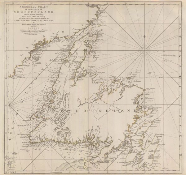
Capt. James Cook, A General Chart of Newfoundland, 1775£ 1,650.00
-
Henry de Leth, Southern Ukraine and Crimea, 1775 c.£ 2,450.00
-
Guillaume-Nicolas Delahaye, Chart of the Persian Gulf, 1775 c.£ 2,250.00
-
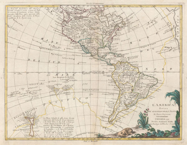
Francois Santini, L'Amerique, 1775 c.£ 675.00
-
Capt. Alexander Cluny, Detailed exploration map of the Northwest Passage, 1775 c.£ 160.00
-
Alexandre Olivier Exquemelin, Plan of Cartagena, Colombia, 1775 c.£ 375.00
-
Sayer & Bennett, Revolutionary War map of the 'Middle British Colonies', 1776£ 4,450.00
-
Homann Heirs, Kingdom of Bohemia, 1776£ 325.00
-
Carte Generale du Canada, de la Louisiane, de la Floride, de la Caroline, de la Virginie, de la Nouvelle Angleterre etc., 1776Francois SantiniSeries: VeniceFrancois Santini, Carte Generale du Canada, de la Louisiane, de la Floride, de la Caroline, de la Virginie, de la Nouvelle Angleterre etc., 1776£ 700.00
-
Antonio Zatta, L'America, 1776£ 550.00
-
Antonio Zatta, Central France, 1776£ 50.00
-
Antonio Zatta, Northern France and Southern Belgium, 1776£ 88.00
-
Antonio Zatta, Li Regni d'Inghilterra e d'Irlanda, 1776£ 385.00
-
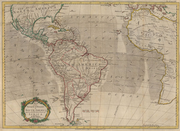
Map of the European Settlements in South America and on the Western Coast of Africa, 1776Thomas KitchinSeries: LondonThomas Kitchin, Map of the European Settlements in South America and on the Western Coast of Africa, 1776£ 495.00
-
Francois Santini, Louisiana, Florida and the Carolinas, 1776£ 985.00
-
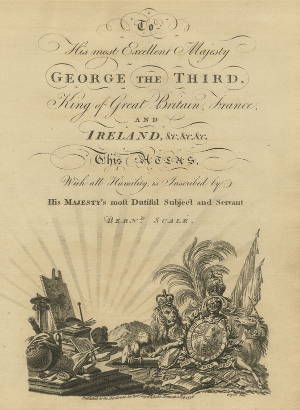
To His most Excellent Majesty George the Third, King of Great Britain, France, and Ireland, &c.&c.&c., 1776Sayer & BennettSeries: LondonSayer & Bennett, To His most Excellent Majesty George the Third, King of Great Britain, France, and Ireland, &c.&c.&c., 1776£ 60.00
-
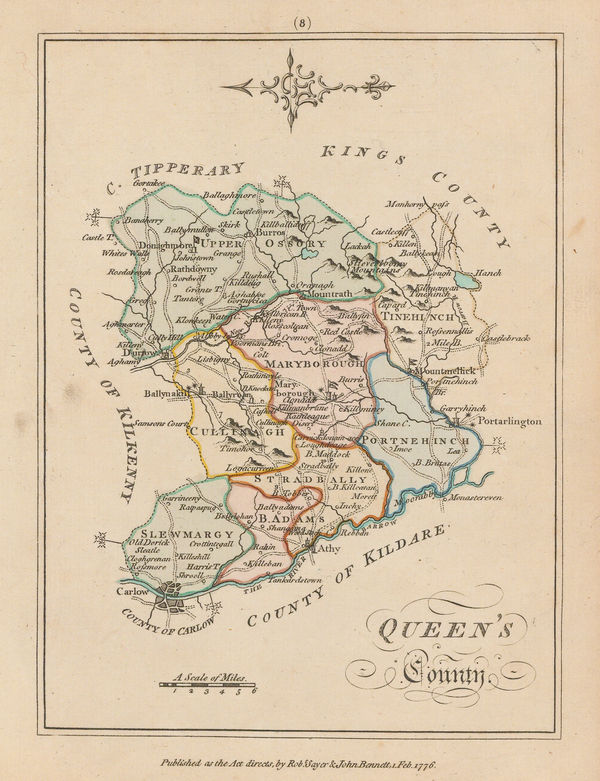
Sayer & Bennett, County Laois, 1776£ 125.00
-
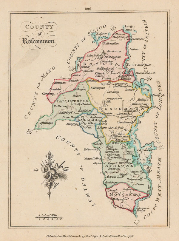
Sayer & Bennett, County Roscommon, 1776£ 95.00
-
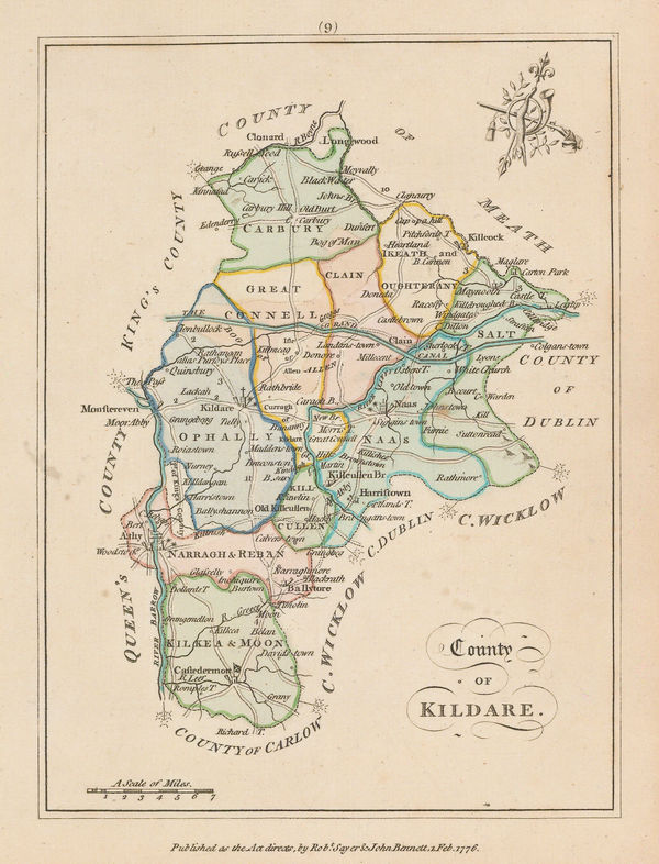
Sayer & Bennett, County Kildare, 1776£ 125.00
-
Sayer & Bennett, County Fermanagh , 1776£ 115.00
-
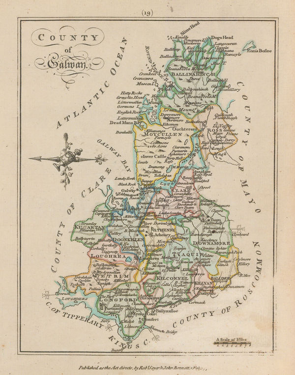
Sayer & Bennett, County Galway, 1776£ 135.00
-
Sayer & Bennett, County Down, 1776£ 150.00
-
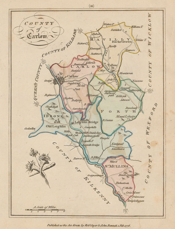
Sayer & Bennett, County Carlow, 1776£ 95.00
-
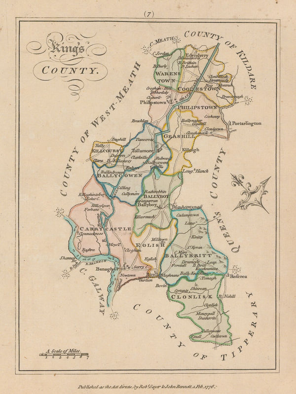
Sayer & Bennett, County Offaly, 1776£ 95.00
-
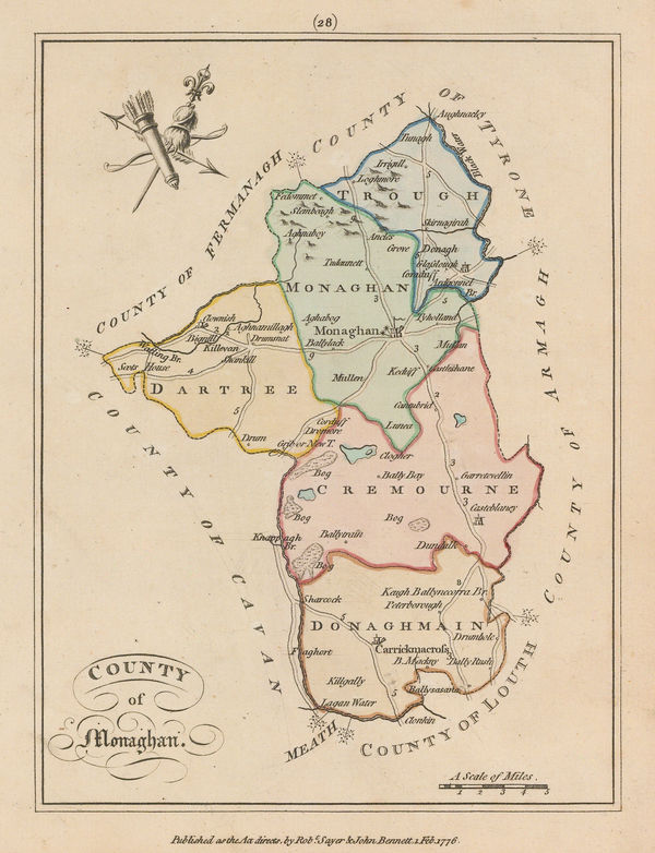
Sayer & Bennett, County Monaghan, 1776£ 95.00
-
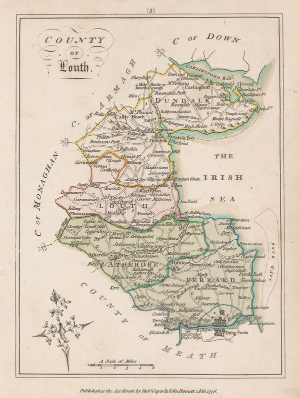
Sayer & Bennett, County Louth, 1776£ 125.00
-
Sayer & Bennett, Province of Munster, 1776£ 150.00
-
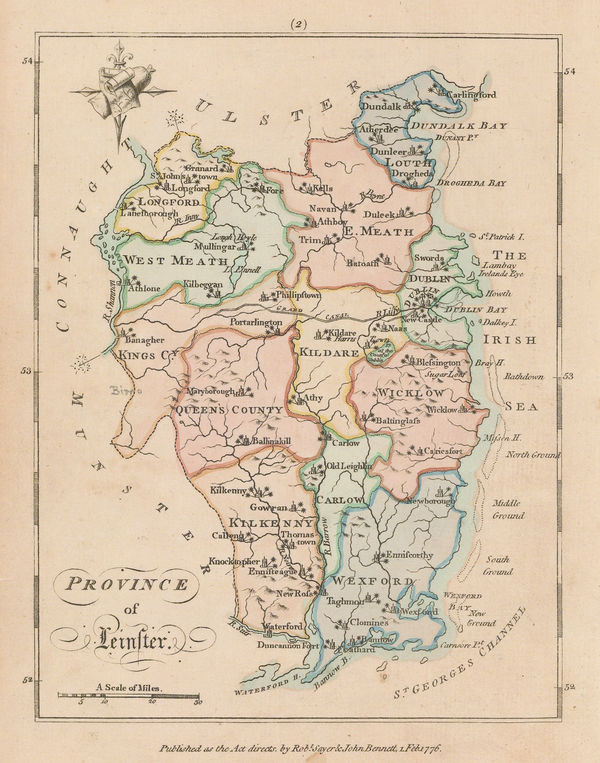
Sayer & Bennett, The Province of Leinster, 1776£ 150.00
-
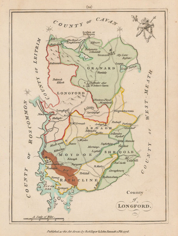
Sayer & Bennett, County Longford, 1776£ 95.00
-
Sayer & Bennett, County Londonderry, 1776£ 150.00
-
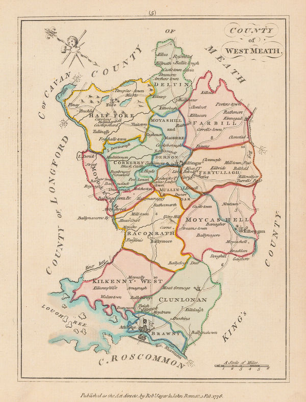
Sayer & Bennett, County of West Meath, 1776£ 150.00
-
Sayer & Bennett, Amelia Island, 1776£ 1,800.00
-
Antonio Zatta, Alaska, the Pacific Northwest, and the Bering Strait, 1776£ 1,250.00
-
Robert de Vaugondy, Virginia, Maryland & Delaware, 1776 c£ 4,500.00
-
Dr. William Robertson, The West Indies and the Gulf of Mexico, 1777£ 595.00
-
Thomas Bowen, 'Age of Reason' map of Europe, 1777£ 395.00
-
T. & E. Bowen, An Accurate Map of Cambridge Shire Divided into Hundreds, 1777£ 395.00
-
Emanuel Bowen, An Accurate Map of Derby Shire, 1777£ 485.00
-
Emanuel Bowen, An Accurate Map of Hartford Shire, 1777£ 545.00
-
Emanuel Bowen, An Accurate Map of Lincoln Shire, 1777£ 485.00
-
Emanuel Bowen, An Accurate Map of Nottingham Shire, 1777£ 495.00
-
Emanuel Bowen, An Accurate Map of the County of Bedford, 1777£ 295.00
-
Thomas Kitchin, An Accurate Map of the County of Huntingdon, 1777£ 295.00
-
Emanuel Bowen, An Accurate Map of the County of Lancaster, 1777£ 595.00
-
Emanuel Bowen, An Accurate Map of the County of Monmouth, 1777£ 295.00
-
Emanuel Bowen, An Accurate Map of the County of Surrey, 1777£ 1,450.00
-
Emanuel Bowen, An Accurate Map of the County Palatine of Chester, 1777£ 375.00
-
Emanuel Bowen, An Improved map of the Counties of Cumberland and Westmoreland, 1777£ 475.00
-
Louis Joseph Mondhare, Scarce Revolutionary War map, 1777£ 3,250.00
-
Thomas Bowen, County of Middlesex, 1777£ 585.00
-
Revolutionary War map of New York island north of Harlem, 1777Gabriel Nikolaus RaspeSeries: NurembergGabriel Nikolaus Raspe, Revolutionary War map of New York island north of Harlem, 1777£ 2,850.00
-
Antonio Zatta, North and South Holland, Utrecht, Brabant and Flevoland, 1777£ 95.00
-
Tobias Mayer, Poland, Lithuania and Prussia, 1777£ 425.00
-
Dr. William Robertson, Southwestern United States and Mexico, 1777£ 1,150.00
-
T. & E. Bowen, Monmouthshire - Divided into Hundreds, 1777£ 150.00
-
Thomas Bowen, North America before the Louisiana Purchase, 1777£ 695.00
-
Georges-Louis Le Rouge, Chart of North and South Carolina coast, 1777£ 3,850.00
-
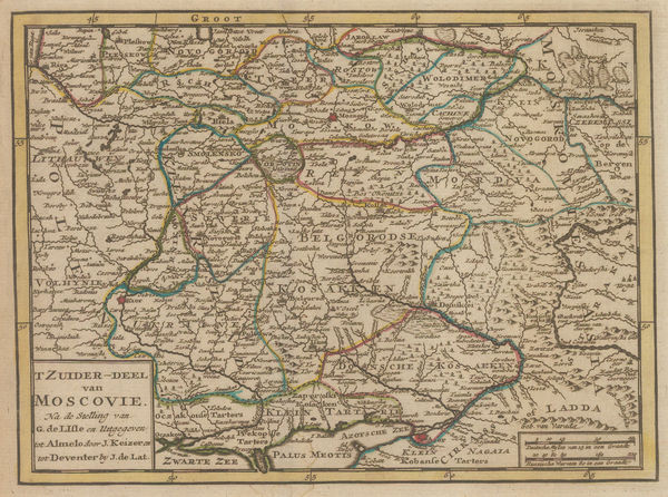
Jan de Lat, Southern Muscovy, 1777£ 125.00
-
Sayer & Bennett, Scotland, 1777£ 145.00
-
Sayer & Bennett, Environs of Edinburgh, 1777£ 125.00
-
-
Sayer & Bennett, Lanarkshire, 1777£ 85.00
-
Sayer & Bennett, Peebles, 1777£ 85.00
-
Sayer & Bennett, Fife and Kinross, 1777£ 145.00
-
Sayer & Bennett, Kirkcudbright, 1777£ 145.00
-
Sayer & Bennett, Dunbartonshire, 1777£ 95.00
-
Sayer & Bennett, Forfar, 1777£ 85.00
-
Sayer & Bennett, Murray and Nairn, 1777£ 95.00
-
Sayer & Bennett, Kincardineshire, 1777£ 95.00
-
Sayer & Bennett, Aberdeenshire and Banffshire, 1777£ 125.00
-
Sayer & Bennett, Sutherland, 1777£ 95.00
-
Sayer & Bennett, County of Edinburgh, 1777£ 125.00
-
Sayer & Bennett, Inverness, Skye & the Outer Hebrides, 1777£ 125.00
-
Sayer & Bennett, Wigtownshire, 1777£ 125.00


Page
42
of 130