-
 Antonio Zatta, Western Bohemia, 1780£ 120.00
 -
J.C. & J.A. Dezauche, Planisphere Physique, 1780£ 1,150.00
-
John Bew, West Indies with the Harbour and Fort of Omoa, 1780£ 875.00
-
Richard Benning, Bristol, 1780£ 825.00
-
Thomas Bowen, A New and Accurate Map of England, 1780 (c.)£ 245.00
-
Philippines with parts of part of Indonesia, New Guinea, Taiwan and southeast China, 1780 cRigobert BonneRigobert Bonne, Philippines with parts of part of Indonesia, New Guinea, Taiwan and southeast China, 1780 c£ 550.00
-
Rigobert Bonne, Africa, 1780 c£ 245.00
-
Rigobert Bonne, Great Lakes, 1780 c£ 495.00
-
Rigobert Bonne, Mauritius, Réunion & Rodrigues, 1780 c£ 375.00
-
Rigobert Bonne, Virgin Islands, Barbados, Antigua, etc., 1780 c£ 385.00
-
Rigobert Bonne, The Lesser Antilles, 1780 c£ 295.00
-
Rigobert Bonne, Ontario, the Great Lakes & the US Midwest, 1780 c£ 495.00
-
Thomas Bowen, Africa, 1780 c.£ 275.00
-
John Hamilton Moore, Scandinavia, 1780 c.£ 145.00
-
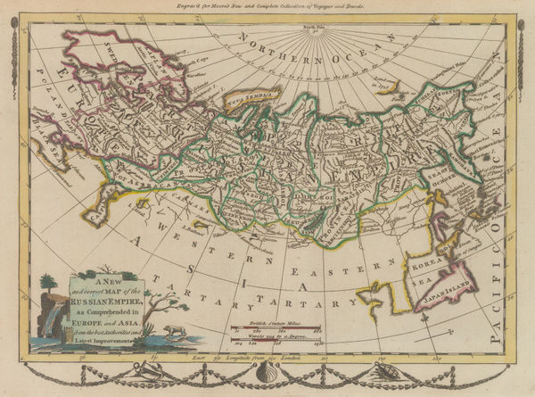
John Hamilton Moore, Russian Empire, 1780 c.£ 165.00
-
John Obadiah Justamond, Eastern United States, 1780 c.£ 1,750.00
-
Robert Sayer, Ancient Egypt, 1780 c.£ 195.00
-
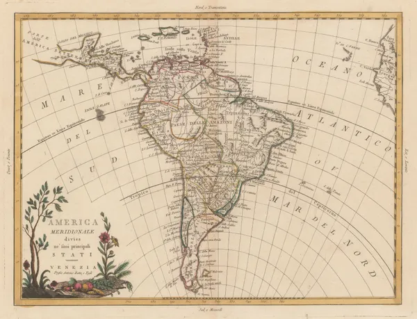
Antonio Zatta, South America, 1780 c.£ 295.00
-
Rigobert Bonne, North America, 1780 c.£ 345.00
-
Cesar-Francois Cassini, Antibes, 1780 c.£ 325.00
-
Rigobert Bonne, Arabia, 1780 c.£ 395.00
-
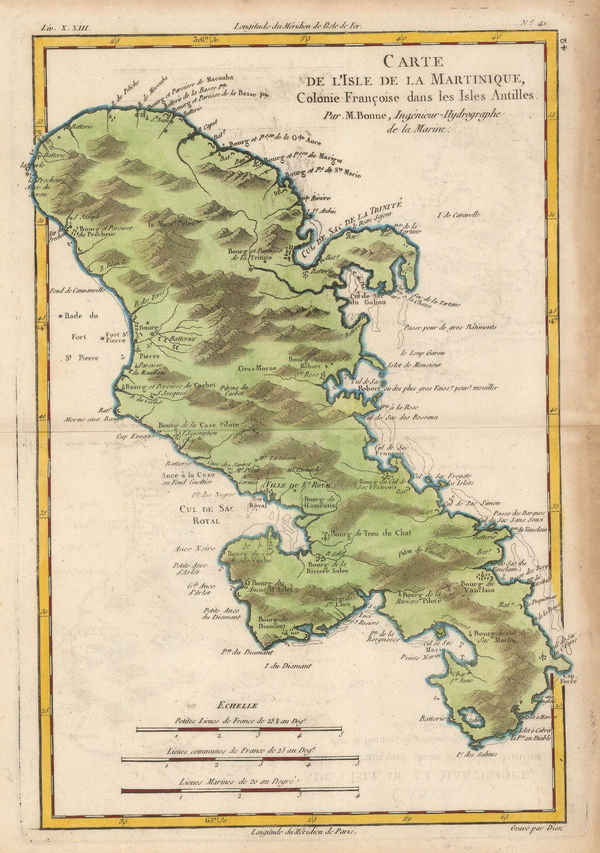
Rigobert Bonne, French map of Martinique, 1780 c.£ 185.00
-
Rigobert Bonne, North and South Carolina and Georgia, 1780 c.£ 285.00
-
Jacques Benard, Falkland Islands, 1780 c.£ 375.00
-
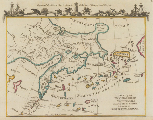
John Hamilton Moore, Kamchatka, Alaska & the Aleutian Islands, 1780 c.£ 74.00
-
John Rocque, England and Wales, 1780 c.£ 1,750.00
-
Rigobert Bonne, Etats Unis de L'Amerique, 1780 c.£ 375.00
-
Antonio Zatta, Early Italian map of Lake Superior, 1780 c.£ 395.00
-
Antonio Zatta, India and Southeast Asia, 1780 c.Reserved
-
Richard William Seale, Italy, 1780 c.£ 675.00
-
Rigobert Bonne, Chinese Empire, Korea, and Japan, 1780 c.£ 295.00
-
Rigobert Bonne, French Guyana, 1780 c.£ 78.00
-
Rigobert Bonne, Eastern United States, 1780 c.£ 375.00
-
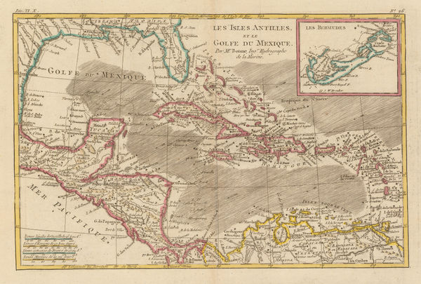
Rigobert Bonne, The West Indies and the Gulf of Mexico, 1780 c.£ 195.00
-
Francois Santini, Kingdoms of Spain and Portugal, 1780 c.£ 275.00
-
Antonio Zatta, Lorraine and Alsace, 1780 c.£ 88.00
-
Antonio Zatta, Scandinavia, 1780 c.£ 325.00
-
Rigobert Bonne, Northwest Africa coast, Tangier to Sierra Leone, 1780 c.£ 90.00
-
Francois Santini, Seven United Provinces of the Netherlands, 1780 c.£ 250.00
-
Plan of the Bay and Harbour of Trincomalay, on the Island of Ceylon, 1780 c.Jean-Baptiste d'Après de MannevilletteSeries: ParisJean-Baptiste d'Après de Mannevillette, Plan of the Bay and Harbour of Trincomalay, on the Island of Ceylon, 1780 c.£ 975.00
-
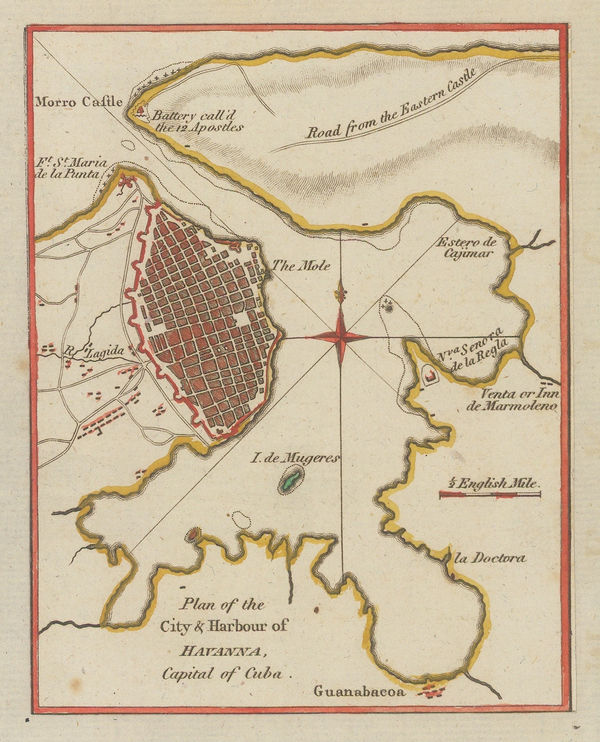
John Hamilton Moore, City & Harbour of Havana, Cuba, 1780 c.£ 64.00
-
Francois Santini, Turkey, Greece and the Balkans, 1780 c.£ 345.00
-
Jean Lattré, India, Sri Lanka & the Maldives, 1780 c.£ 785.00
-
Jean-Baptiste d'Après de Mannevillette, Sea Chart of Java, Indonesia, 1780 c.£ 925.00
-
Rigobert Bonne, Early map of Hawaii based on Capt. Cook, 1780 c.£ 745.00
-
William Faden, Chart of the Channel Islands, 1781£ 2,250.00
-
A Map and Chart of the Cape of Good Hope, with the Soundings in Table Bay, False Bay & Saldaniia Bay, 1781John BewSeries: LondonJohn Bew, A Map and Chart of the Cape of Good Hope, with the Soundings in Table Bay, False Bay & Saldaniia Bay, 1781£ 595.00
-
A Map of the English, French, Spanish, Dutch & Danish Islands in the West Indies, 1781John BewSeries: LondonJohn Bew, A Map of the English, French, Spanish, Dutch & Danish Islands in the West Indies, 1781£ 225.00
-
John Bew, Southern India, 1781£ 245.00
-
Tobias Conrad Lotter, James Cook's Voyage to the North Pacific & Bering Strait, 1781£ 2,750.00
-
Antonio Zatta, Denmark, 1781£ 325.00
-
Antonio Zatta, Hungary, 1781£ 115.00
-
Antonio Zatta, Northern Greece, 1781£ 225.00
-
Antonio Zatta, Sweden & Finland, 1781£ 395.00
-
Antonio Zatta, Provinces of Kraków, Łęczyca, Sieradz, Sandomierz, and Lublin, 1781£ 155.00
-
Antonio Zatta, Palatinates of Minsk, Mstsislaw, Vitebsk, and Połock, 1781£ 185.00
-
Antonio Zatta, Navahrudak and Brest, 1781£ 245.00
-
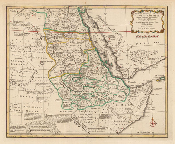
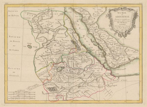
Willem Albert Bachiene, Southern Egypt, Sudan, Eritrea and Ethiopia, 1781£ 445.00
-
Antonio Zatta, Norway, 1781£ 795.00
-
Louis Brion de la Tour, West Indies or Caribbean, 1782£ 1,350.00
-
Rigobert Bonne, Paraguay, Uruguay and Southern Brazil, 1782£ 165.00
-
Antonio Zatta, Governi di Moscovia E Woronez, 1782£ 175.00
-
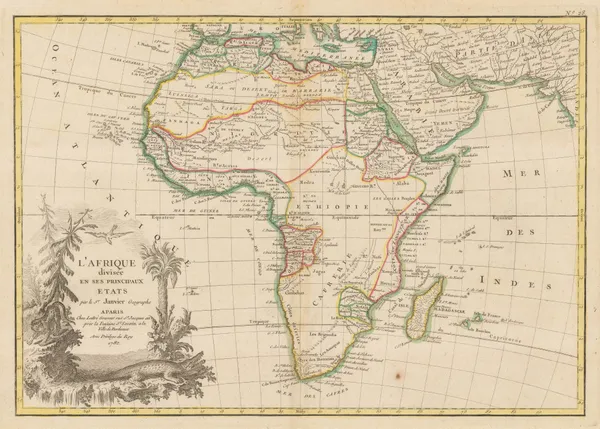
Jean Denis Janvier, Africa, 1782£ 495.00
-
Jean Denis Janvier, Europe, 1782£ 475.00
-
Antonio Zatta, Northern Russia and Southern Finland, 1782£ 175.00
-
Antonio Zatta, Moscow and Voronezh provinces, 1782£ 225.00
-
Jean Lattré, Egypt, Sudan and Ethiopia, 1782£ 75.00
-
Scarce and important Revolutionary War battle plan of the Battle of Monmouth, 1782Michel René Hilliard d' AuberteuilSeries: BrusselsMichel René Hilliard d' Auberteuil, Scarce and important Revolutionary War battle plan of the Battle of Monmouth, 1782£ 2,250.00
-
Robert Orme, Central India, 1782£ 225.00
-
Robert Orme, Southern India - Tamil Nadu & Kerala, 1782£ 225.00
-
Jean-Baptiste-Claude Delisle de Sales, Arabia, 1782£ 475.00
-
Michel-René Hilliard d'Auberteuil, Virginia, Maryland & Delaware, 1782£ 595.00
-
John Harrison, Italy, 1783£ 115.00
-
Willem Albert Bachiene, Coast of North Africa, 1783£ 485.00
-
Jean Lattré, Hudson Bay and Northeaster Canada, 1783£ 290.00
-
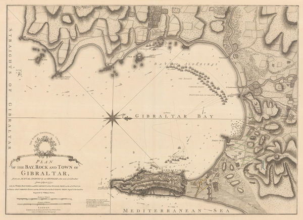
William Faden, Plan of the Bay, Rock, and Town of Gibraltar, 1783£ 1,750.00
-
William Faden, The Coast of Guyana from the Oroonoko to the River of Amazons, 1783£ 825.00
-
Edward Hasted, An Accurate Map of the County of Kent, 1783£ 850.00
-
Jean Denis Janvier, L'Amerique, 1783£ 295.00
-
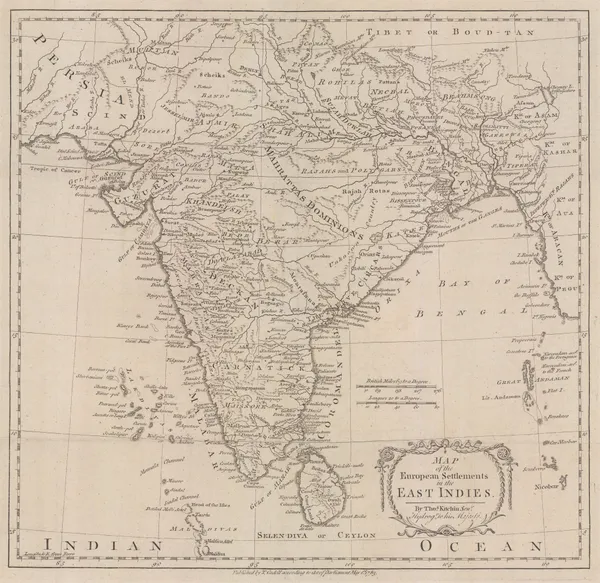
Thomas Kitchin, European Settlements in the East Indies, 1783£ 645.00


Page
44
of 130