-
 John Cary, Map of Worcestershire from the Best Authorities, 1805£ 175.00
 -
Joyce Gold, Miniature map of Martinique, 1805£ 48.00
-
Thomas and Andrews, Mississippi Territory, 1805£ 345.00
-
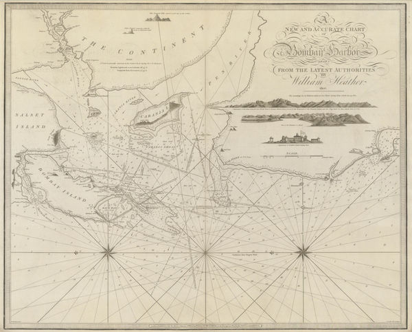
New Chart of the Coasts of England and Holland from the Latest Surveys, 1805William HeatherSeries: LondonWilliam Heather, New Chart of the Coasts of England and Holland from the Latest Surveys, 1805£ 1,750.00
-
Laurie & Whittle, New General Map of America, 1805£ 495.00
-
Morse and Andrews, New Hampshire, 1805£ 295.00
-
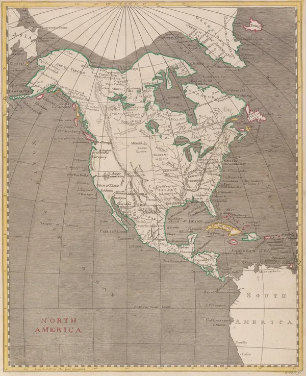
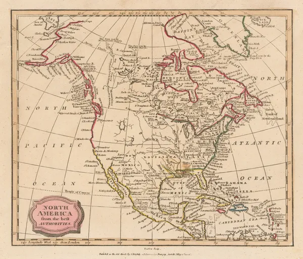
Morse and Andrews, North America, 1805£ 125.00
-
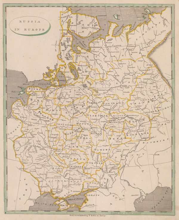
Thomas and Andrews, Russia in Europe, 1805£ 68.00
-
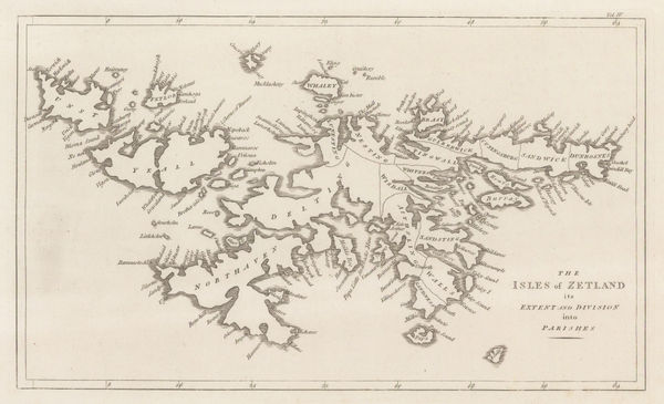
John Cary, The Isles of Zetland, 1805£ 125.00
-
Samuel Lewis, The State of New Hampshire, 1805£ 325.00
-
Morse and Andrews, Greece, Bosnia, Serbia and Bulgaria, 1805£ 68.00
-
C. & E. Brightly, Turkey in Europe and Hungary, 1805£ 62.00
-
Aaron Arrowsmith, United States, 1805£ 375.00
-
Morse and Andrews, Vermont, 1805£ 245.00
-
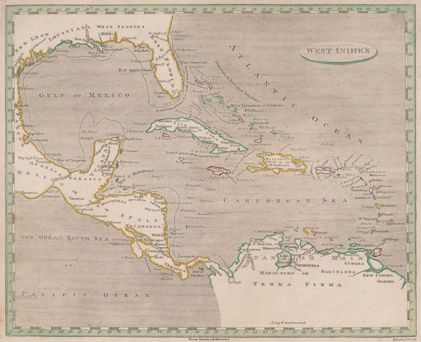
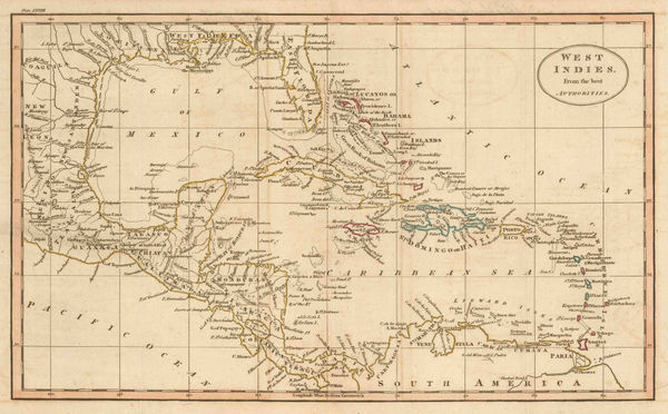
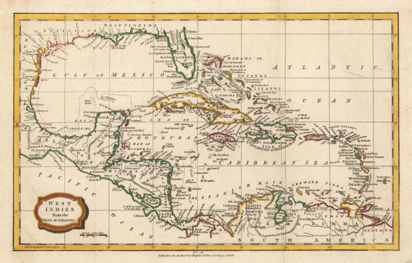
Morse and Andrews, West Indies, 1805£ 185.00
-
John Cary, Isle of Man, 1805£ 85.00
-
John Cary, Map of Dorsetshire from the Best Authorities, 1805£ 275.00
-
John Cary, A Map of Berkshire, 1805£ 375.00
-
Robert Wilkinson, Central Greece in Ancient Times, 1805£ 145.00
-
Thomas and Andrews, The World, 1805£ 295.00
-
Cole & Roper, Winchester, 1805£ 125.00
-
John Cary, Ireland, 1805£ 485.00
-
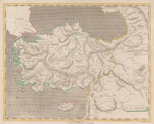
Thomas and Andrews, Asia Minor, 1805£ 145.00
-
Charles Smith, New Plan of London, Westminster and Southwark, 1805£ 1,350.00
-
Thomas and Andrews, The World, 1805£ 225.00
-
Robert Wilkinson, France Divided into Provinces, 1805£ 65.00
-
Matthew Carey, Maryland, 1805£ 445.00
-
John Russell, British Colonies in North America, 1805 c.£ 115.00
-
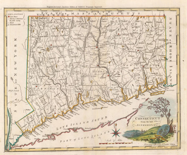
Matthew Carey, Connecticut from the Best Authorities, 1805 c.£ 1,350.00
-
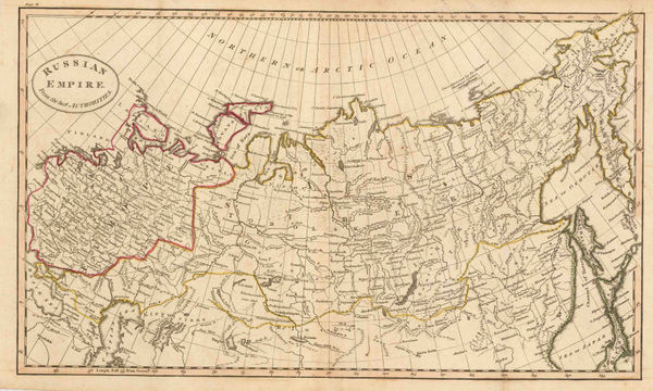
John Russell, Russian Empire, 1805 c.£ 82.00
-
John Russell, Eastern United States, 1805 c.£ 125.00
-
John Russell, West Indies, 1805 c.£ 125.00
-
Charles Francois Delamarche, Map of the World, 1805 c.£ 395.00
-
-
John Cary, Asia and Australia, 1806£ 450.00
-
John Cary, France prior to the French Revolution, 1806£ 245.00
-
John Cary, North-eastern United States, 1806£ 1,100.00
-
John Cary, A New Map of Staffordshire, 1806£ 295.00
-
John Cary, A New Map of Warwickshire, 1806£ 325.00
-
Cole & Roper, Hereford, 1806£ 55.00
-
John Wilkes, Hertfordshire, 1806£ 78.00
-
Eustache Herisson, North America, 1806£ 1,150.00
-
C. & E. Brightly, South America, 1806£ 72.00
-
Robert Wilkinson, Palaestina seu Terra Sancta, 1806£ 275.00
-
John Cary, A New Map of Lancashire, 1806£ 445.00
-
C. & E. Brightly, North America, 1806£ 145.00
-
James Stratford, London, 1806£ 895.00
-
William Heather, Chart of the Atlantic Ocean, 1807£ 4,500.00
-
A New Map of Devonshire divided into Hundreds exhibiting its Roads, Rivers, Parks &c., 1807John CarySeries: LondonJohn Cary, A New Map of Devonshire divided into Hundreds exhibiting its Roads, Rivers, Parks &c., 1807£ 495.00
-
John Cary, A New Map of Nova Scotia, Newfoundland &c., 1807£ 275.00
-
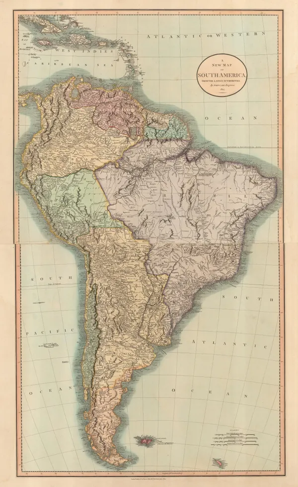
John Cary, South America, 1807£ 1,250.00
-
John Cary, A New Map of the British Isles, 1807£ 495.00
-
Cole & Roper, Anglesey, 1807£ 55.00
-
Samuel John Neele, Cheshire, 1807£ 80.00
-
Cole & Roper, Flintshire, 1807£ 55.00
-
William Guthrie, France divided into departments, 1807£ 58.00
-
Cole & Roper, Herefordshire, 1807£ 62.00
-
C. & E. Brightly, Italy, 1807£ 115.00
-
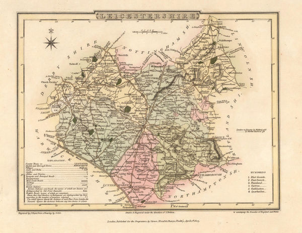
Cole & Roper, Leicestershire, 1807£ 70.00
-
-
Jean-Baptiste-Louis Clouet, Mappemonde ou Globe Terestre, 1807£ 2,500.00
-
Cole & Roper, Norwich, 1807£ 115.00
-
C. & E. Brightly, The Netherlands, 1807£ 66.00
-
Aaron Arrowsmith, The World on Mercators Projection, 1807£ 395.00
-
Cole & Roper, Warwickshire, 1807£ 55.00
-
C. & E. Brightly, West Indies, 1807£ 195.00
-
Cole & Roper, Westmoreland, 1807£ 62.00
-
India & the Middle East as it was known during the Classical Era, 1807Robert WilkinsonSeries: LondonRobert Wilkinson, India & the Middle East as it was known during the Classical Era, 1807£ 115.00
-
Jean-Baptiste Poirson, Texas, Louisiana, Alabama, Mississippi, Florida and Georgia, 1807£ 2,500.00
-
Robert Wilkinson, Kingdom of Jerusalem, 1807£ 125.00
-
John Albin, The Isle of Wight, 1807£ 1,150.00
-
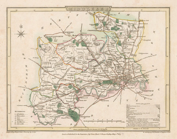
Cole & Roper, Middlesex, 1807£ 55.00
-
John Wilkes, Countries surrounding the South Pole, 1807£ 295.00
-
John Wilkes, Countries Surrounding the North Pole, 1807£ 225.00
-
William Guthrie, Carte D'Asie, 1807£ 88.00
-
Robert Wilkinson, The Empire of Alexander the Great, 1807£ 145.00
-
John Cary, A New Map of Cambridgeshire, 1808£ 245.00
-
Charles Smith, A New Map of the County of Durham Divided into Wards, 1808£ 145.00
-
Charles Smith, A New Map of the County of Gloucestershire, 1808£ 195.00
-
Charles Smith, A New Map of the County of Surrey, 1808£ 285.00


Page
52
of 130