-
 Edward Baines, Ashton-under-Lyne, 1824£ 55.00
 -
Edward Baines, Blackburn, 1824£ 85.00
-
Chart of Part of the North Eastern Coast of America, and its adjacent Islands, 1824Sir William Edward ParrySeries: LondonSir William Edward Parry, Chart of Part of the North Eastern Coast of America, and its adjacent Islands, 1824£ 545.00
-
George Frederick Cruchley, Environs of London, 1824£ 1,550.00
-
Edward Baines, Lancaster, 1824£ 95.00
-
Andrew Bryant, Map of the County of Gloucester from Actual Survey, 1824£ 3,500.00
-
Christopher & John Greenwood, Map of the County of Westmoreland, 1824£ 825.00
-
Map of the County Palatine of Lancashire with the Latest Improvements, 1824Edward BainesSeries: LeedsEdward Baines, Map of the County Palatine of Lancashire with the Latest Improvements, 1824£ 175.00
-
Felix Delamarche, Scandinavia, 1824£ 180.00
-
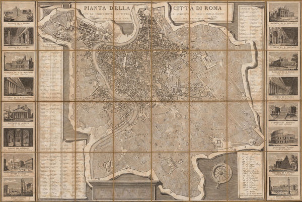
Venanzio Monaldini, Decorative plan of Rome, 1824£ 1,350.00
-
Anthony Finley, Prussia, 1824£ 60.00
-
Edward Baines, Rochdale, 1824£ 65.00
-
Felix Delamarche, The Netherlands, 1824£ 58.00
-
John Thomson, Selkirk Shire, 1824£ 345.00
-
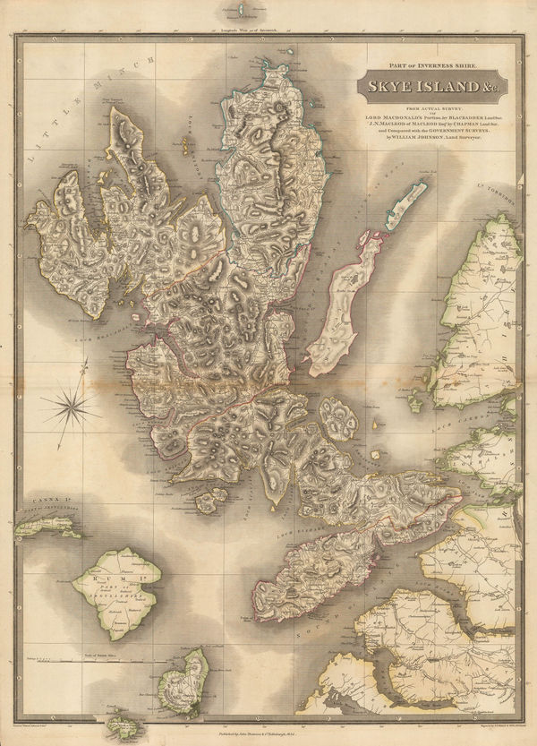
John Thomson, Skye Island &c., 1824£ 1,450.00
-
Edward Baines, Stockport, 1824£ 65.00
-
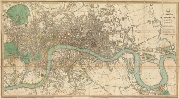
A Plan of the Cities of London & Westminster, the Borough of Southwark with the New Buildings, 1824James WyldJames Wyld, A Plan of the Cities of London & Westminster, the Borough of Southwark with the New Buildings, 1824£ 2,950.00
-
William Buckland, Geological Map of Oxfordshire & the Cotswolds, 1824£ 145.00
-
William Swire, Liverpool and its environs, 1824£ 495.00
-
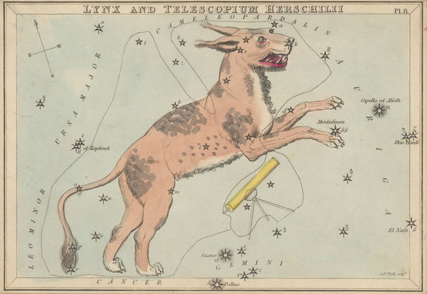
Samuel Leigh, Constellations - The Lynx and Hershel's Telescope, 1824 c£ 240.00
-
Constellations - The Glory of Frederic, Andromeda and the Triangle, 1824 cSamuel LeighSeries: LondonSamuel Leigh, Constellations - The Glory of Frederic, Andromeda and the Triangle, 1824 c£ 240.00
-
Samuel Leigh, Bootes Canes Venatici, Coma Berenices, and Quadrans Muralis, 1824 c.£ 240.00
-
Samuel Leigh, Camelopardalis, Tarandus and Custos Messium., 1824 c.£ 240.00
-
Samuel Leigh, Cassiopeia, 1824 c.£ 240.00
-
Samuel Leigh, Cepheus, 1824 c.£ 240.00
-
Samuel Leigh, Taurus,Poniatowski,Serpentariuus, 1824 c.£ 240.00
-
John Cary, South-eastern United States, 1825£ 1,675.00
-
John Cary, Southeast Asia, 1825£ 645.00
-
John Cary, Eastern United States, 1825£ 1,475.00
-
Adrien Brue, West Indies and Central America, 1825£ 295.00
-
Adrien Brue, Sweden, Norway & Denmark, 1825£ 95.00
-
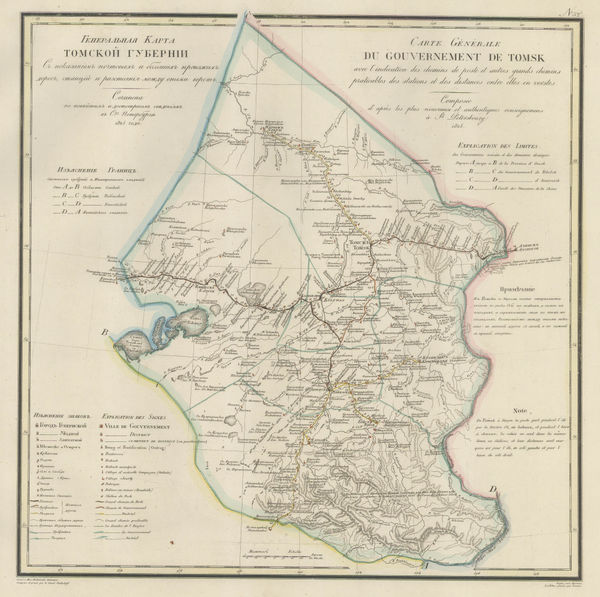
Vasilii Petrovich Piadischeff, Tomsk Oblast, 1825£ 325.00
-
Geographical, Statistical, and Historical map of North and South America, 1825Jean BuchonSeries: ParisJean Buchon, Geographical, Statistical, and Historical map of North and South America, 1825£ 125.00
-
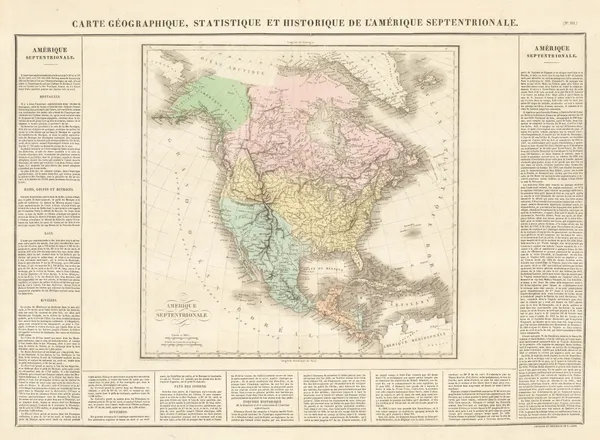
Jean Buchon, Geographical, Statistical, and Historical map of North America, 1825£ 250.00
-
Jean Buchon, Geographical, Statistical and Historical map of Indiana, 1825£ 125.00
-
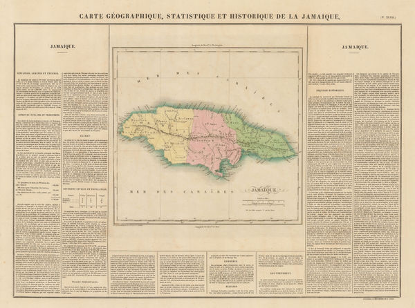
Jean Buchon, Geographical, Statistical and Historical map of Jamaica, 1825£ 275.00
-
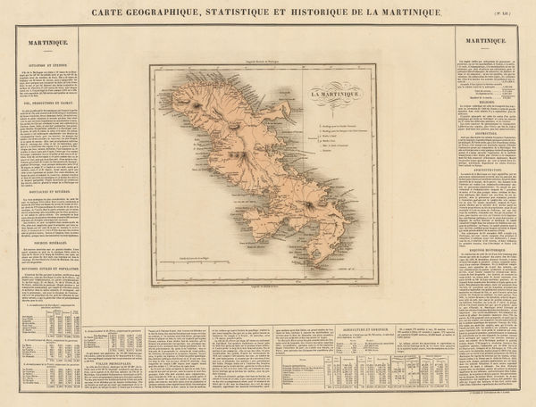
Jean Buchon, Geographical, Statistical and Historical map of Martinique, 1825£ 150.00
-
Jean Buchon, Geographical, Statistical, and Historical map of the West Indies, 1825£ 325.00
-
Jean Buchon, Geographical, Statistical and Historical map of Mississippi, 1825£ 175.00
-
Jean Buchon, Geographical, Statistical, and Historical map of Paraguay, 1825£ 225.00
-
Jean Buchon, Geographical, Statistical, and Historical map of French Guiana, 1825£ 150.00
-
William Kemp, Egham Race Course, 1825£ 88.00
-
-
Geographical, Statistical, and Historical Map of Connecticut, 1825Geographisches Institut WeimarSeries: WeimarGeographisches Institut Weimar, Geographical, Statistical, and Historical Map of Connecticut, 1825£ 200.00
-
Christopher & John Greenwood, Map of the County of Derby, 1825£ 1,550.00
-
Christopher & John Greenwood, Map of the County of Essex, From an Actual Survey, 1825£ 3,750.00
-
Philippe Vandermaelen, California coast, 1825£ 1,550.00
-
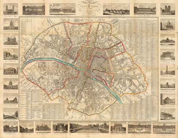
Seguin, Paris, 1825£ 895.00
-
Philippe Vandermaelen, Kodiak Island and the coast of Alaska, 1825£ 100.00
-
British Admiralty, Plan of the City, Harbours, & Environs of Alexandria, 1825£ 500.00
-
William Kemp, Pontefract Race Course, 1825£ 82.00
-
Philippe Vandermaelen, Alaska Peninsula, Unimak Isle, St. George and St. Paul, 1825£ 100.00
-
J. & G. Todd, York, 1825£ 245.00
-
Charles Smith, Map of the Country Twelve Miles around London, 1825£ 1,750.00
-
Andrew Bryant, Map of the County of Buckingham from actual Survey, 1825£ 3,500.00
-
William Darton, Kent divided into its Hundreds, 1825 c£ 175.00
-
Daniel & William Lizars, Chart of the World, 1825 c£ 1,850.00
-
Alexandre Blondeau, North America, 1825 c.£ 75.00
-
Alexandre Blondeau, Asia, 1825 c.£ 70.00
-
Charles Motte, Bay of Palma, Mallorca, 1825 c.£ 125.00
-
Alexandre Blondeau, North-eastern part of European Russia, Estonia & Latvia, 1825 c.£ 55.00
-
Alexandre Blondeau, Turquie D'Europe, 1825 c.£ 45.00
-
Christopher & John Greenwood, A Map of Northampton, 1826£ 1,250.00
-
Adrien Brue, European Russia, Finland, Baltic States, Poland and Ukraine, 1826£ 150.00
-
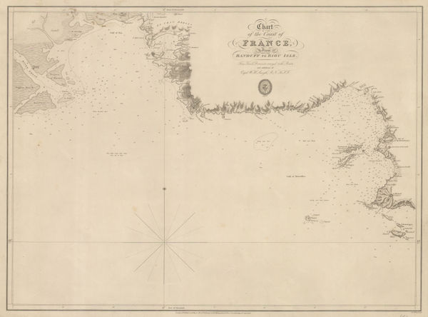
British Admiralty, Chart of the Coast of France, 1826£ 160.00
-
Geographical, Statistical, and Historical Map of Maryland, 1826Geographisches Institut WeimarSeries: WeimarGeographisches Institut Weimar, Geographical, Statistical, and Historical Map of Maryland, 1826£ 385.00
-
Vasilii Petrovich Piadischeff, Yakutsk & Okhotsk Districts, 1826£ 325.00
-
Christopher & John Greenwood, Map of County Dorset, 1826£ 3,500.00
-
Christopher & John Greenwood, Map of the County of Leicester, 1826£ 1,250.00
-
Andrew Bryant, Map of the County of Norfolk, from Actual Survey, 1826£ 3,500.00
-
Andrew Bryant, Map of the County of Suffolk from Actual Survey, 1826£ 4,750.00
-
Map of the Travels and Discoveries made in Northern and Central Africa, 1826Maj. Dixon DenhamSeries: LondonMaj. Dixon Denham, Map of the Travels and Discoveries made in Northern and Central Africa, 1826£ 395.00
-
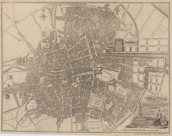
William Corbet, New Map of the City of Dublin for the Year 1820, 1826£ 975.00
-
John Thomson, Aberdeen and Banff-Shires, 1826£ 1,250.00
-
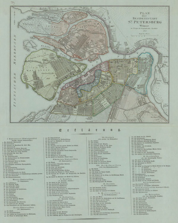
Geographisches Institut Weimar, German city plan of St. Petersburg, 1826£ 895.00
-
John Thomson, Renfrew-Shire, 1826£ 345.00
-
Maj. Dixon Denham, Sketch map of Lake Chad, 1826£ 145.00
-
Christopher & John Greenwood, Hampshire, 1826£ 3,500.00
-
Christopher & John Greenwood, A Map of the County of Devon, 1827£ 3,750.00
-
Hansard, St. James's Park Improvement Plan, 1827£ 1,450.00


Page
59
of 130