-
 Philippe Vandermaelen, Mexico - Chihuahua, Coahuila, Nuevo Leon & Sinaloa, 1827£ 650.00
 -
Philippe Vandermaelen, Central Baja, Sonora & Sinaloa, 1827£ 395.00
-
Philippe Vandermaelen, Southern California, Baja, Sonora & Arizona, 1827£ 750.00
-
Philippe Vandermaelen, Cabo San Lucas, Baja Peninsula, 1827£ 225.00
-
Philippe Vandermaelen, Mississippi and Alabama, 1827£ 650.00
-
Philippe Vandermaelen, Coast of Mexico and Guatemala, 1827£ 350.00
-
Philippe Vandermaelen, Iraq centring on Baghdad, 1827£ 1,150.00
-
Philippe Vandermaelen, Southern Arabia and Yemen, 1827£ 545.00
-
Philippe Vandermaelen, Sinai Peninsula, Jordan, Saudi Arabia and Egypt, 1827£ 750.00
-
Philippe Vandermaelen, Java, Bali and Lombok, 1827£ 645.00
-
Philippe Vandermaelen, Sulawesi, North Maluku, 1827£ 195.00
-
Philippe Vandermaelen, Central and South East Sulawesi, and the Gulf of Tomini, 1827£ 375.00
-
Philippe Vandermaelen, Western Cape, South Africa, 1827£ 1,100.00
-
Philippe Vandermaelen, Coronation Gulf and Bathurst Inlet, Nunavut, 1827£ 350.00
-
Philippe Vandermaelen, Hudson Strait and Baffin Island, 1827£ 250.00
-
George Thomson, George Thomson's Plan of Cape Town and Environs, 1827£ 750.00
-
Philippe Vandermaelen, Haiti & the Dominican Republic, 1827£ 450.00
-
Southern coast of Tasmania from Macquarie Harbour to Freycinet peninsula., 1827Philippe VandermaelenSeries: BrusselsPhilippe Vandermaelen, Southern coast of Tasmania from Macquarie Harbour to Freycinet peninsula., 1827£ 295.00
-
Felix Delamarche, Asia with political boundaries, 1827£ 110.00
-
Philippe Vandermaelen, British Columbia north of Port Essington, 1827£ 95.00
-
Andree Martin, Paris, prior to Hausmann's renovation, 1827£ 625.00
-
Philippe Vandermaelen, Tonga, 1827£ 325.00
-
Philippe Vandermaelen, Fiji, 1827£ 545.00
-
Western Australia coast from North west Cape to Roebuck Bay, 1827Philippe VandermaelenSeries: BrusselsPhilippe Vandermaelen, Western Australia coast from North west Cape to Roebuck Bay, 1827£ 495.00
-
Philippe Vandermaelen, The Great Barrier Reef & Queensland Coast, 1827£ 1,450.00
-
Western Australia coast from Mount Peron to Esperance Bay, 1827Philippe VandermaelenSeries: BrusselsPhilippe Vandermaelen, Western Australia coast from Mount Peron to Esperance Bay, 1827£ 625.00
-
Philippe Vandermaelen, Melville Island and Timor Sea, 1827£ 295.00
-
Philippe Vandermaelen, North-western Borneo, 1827£ 325.00
-
Philippe Vandermaelen, North-eastern Borneo, 1827£ 325.00
-
Philippe Vandermaelen, South-eastern Borneo, 1827£ 395.00
-
Philippe Vandermaelen, Western Java, 1827£ 285.00
-
Philippe Vandermaelen, North Sumatra and Aceh, 1827£ 285.00
-
Philippe Vandermaelen, West Sumatra and Riau, 1827£ 185.00
-
Philippe Vandermaelen, South-eastern Sumatra and south-western Borneo, 1827£ 395.00
-
Philippe Vandermaelen, French Polynesia, Tahiti & Bora Bora, 1827£ 245.00
-
Philippe Vandermaelen, South Island, New Zealand, 1827£ 1,475.00
-
Philippe Vandermaelen, Western Australia coast east of Recherche Archipelago, 1827£ 445.00
-
Philippe Vandermaelen, South Australia & Adelaide, 1827£ 645.00
-
Philippe Vandermaelen, Western New Guinea & Indonesia, 1827£ 295.00
-
Philippe Vandermaelen, West Papua and Papua, 1827£ 225.00
-
Philippe Vandermaelen, Eastern Papua New Guinea, 1827£ 225.00
-
Philippe Vandermaelen, North-western Solomon Islands, 1827£ 445.00
-
Western Australian coast from Cape Cuvier to Moresby Range, 1827Philippe VandermaelenSeries: BrusselsPhilippe Vandermaelen, Western Australian coast from Cape Cuvier to Moresby Range, 1827£ 445.00
-
Philippe Vandermaelen, North Western coast from Cape Boileau to Cambridge Gulf, 1827£ 345.00
-
Philippe Vandermaelen, Australia - Northern Territory inc. Darwin, 1827£ 425.00
-
Philippe Vandermaelen, The Gulf of Carpentaria, 1827£ 395.00
-
Philippe Vandermaelen, Torres Strait, 1827£ 525.00
-
Philippe Vandermaelen, Southern coast from Long Bay to Cape Otway, 1827£ 335.00
-
Philippe Vandermaelen, Coast of Oregon and Washington State, 1827£ 2,450.00
-
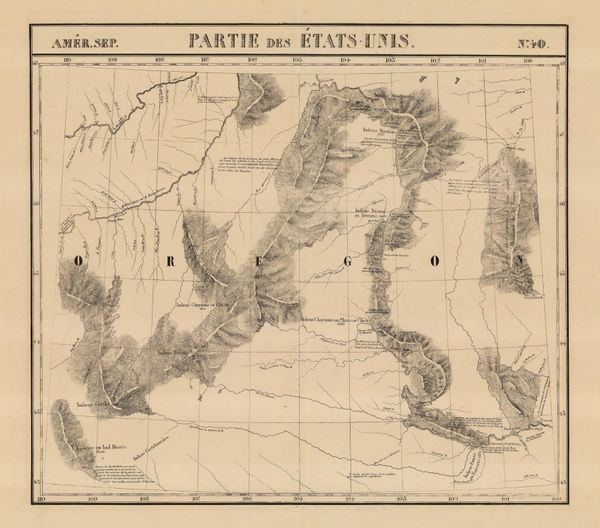
Philippe Vandermaelen, Oregon Territory or parts of Idaho, Montana and Wyoming, 1827£ 725.00
-
Philippe Vandermaelen, China - Beijing, Tiānjīn and Hebei, 1827£ 750.00
-
Philippe Vandermaelen, The colony of New South Wales, 1827£ 985.00
-
Philippe Vandermaelen, Coast of Queensland from Cape Melville to Cairns, 1827£ 425.00
-
Philippe Vandermaelen, Ontario between Lake Superior and James Bay, 1827£ 220.00
-
Northern Alberta and Saskatchewan south of Lake Athabasca, 1827Philippe VandermaelenSeries: BrusselsPhilippe Vandermaelen, Northern Alberta and Saskatchewan south of Lake Athabasca, 1827£ 195.00
-
Philippe Vandermaelen, Hudson Bay coast, Manitoba, 1827£ 295.00
-
Philippe Vandermaelen, Hudson Bay and entrance to James Bay, 1827£ 95.00
-
Philippe Vandermaelen, Lakes Winnipeg and Winnipegosis, Manitoba, 1827£ 350.00
-
Philippe Vandermaelen, Nunavut west of Chesterfield Inlet, 1827£ 90.00
-
Early map of Vancouver Island and southern British Columbia, 1827Philippe VandermaelenSeries: BrusselsPhilippe Vandermaelen, Early map of Vancouver Island and southern British Columbia, 1827£ 1,650.00
-
Bass Strait, southern New South Wales and northern Tasmania, 1827Philippe VandermaelenSeries: BrusselsPhilippe Vandermaelen, Bass Strait, southern New South Wales and northern Tasmania, 1827£ 595.00
-
Philippe Vandermaelen, Western Turkmenistan, 1827£ 450.00
-
Philippe Vandermaelen, Minnesota, 1827£ 625.00
-
Philippe Vandermaelen, Cape Cod to Chesapeake Bay, 1827£ 350.00
-
Philippe Vandermaelen, Northeastern United States, 1827£ 450.00
-
Philippe Vandermaelen, Indiana, Kentucky, Ohio and West Virginia, 1827£ 550.00
-
Philippe Vandermaelen, Missouri and Illinois, 1827£ 895.00
-
Philippe Vandermaelen, North and South Caroline and Georgia, 1827£ 725.00
-
Philippe Vandermaelen, Gulf of St. Lawrence, 1827£ 150.00
-
Philippe Vandermaelen, Early survey south of Utah Lake, 1827£ 450.00
-
Philippe Vandermaelen, Coast of Texas from Rio del Norte to Sabine River, 1827£ 1,450.00
-
Philippe Vandermaelen, Mexico - Veracruz, Puebla & Tamaulipas, 1827£ 825.00
-
Philippe Vandermaelen, Montana and the Dakotas, 1827£ 600.00
-
Philippe Vandermaelen, The Lesser Antilles, 1827£ 350.00
-
Edmond Francois Paris, Tongatapu Island, Tonga, 1827£ 275.00
-
John Wilkes, Somersetshire, 1827£ 75.00
-
John Wilkes, Staffordshire, 1827£ 72.00
-
John Wilkes, Sussex, 1827£ 125.00
-
British Admiralty, The Coast of Italy from Naples to Cape Vaticano, 1827£ 200.00
-
Uzbekistan, Turkmenistan, Afghanistan, and Tajikistan border region, 1827Philippe VandermaelenSeries: BrusselsPhilippe Vandermaelen, Uzbekistan, Turkmenistan, Afghanistan, and Tajikistan border region, 1827£ 475.00


Page
60
of 130