-
 Frederick Jackson, Nottingham, 1861£ 750.00
 -
James Cowles Prichard, Ethnographic Map of South America, 1861£ 450.00
-
George Woolworth Colton, The Environs of London, 1861£ 385.00
-
Roswell C. Smith, Civil War-Era Map of the Western US, 1861£ 745.00
-
Joseph Hutchins Colton, West Indies, 1861£ 185.00
-
Patagonia, South Orkney, Falkland Islands & South Georgia, 1861Joseph Hutchins ColtonSeries: New YorkJoseph Hutchins Colton, Patagonia, South Orkney, Falkland Islands & South Georgia, 1861£ 225.00
-
Joseph Hutchins Colton, Brazil & the Guianas, 1861£ 225.00
-
Justus Perthes, The Yangtze and Pearl Rivers, 1861Sold
-
Joseph Hutchins Colton, Northern Regions, 1861£ 115.00
-
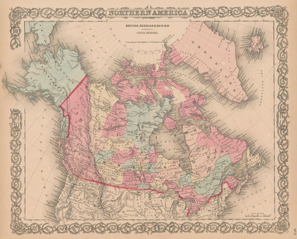
Joseph Hutchins Colton, Canada, Alaska & Greenland, 1861£ 195.00
-
Joseph Hutchins Colton, Australia, 1861£ 145.00
-
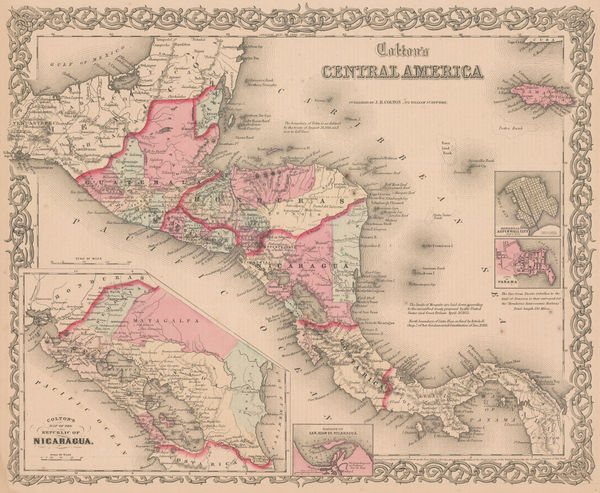
Joseph Hutchins Colton, Central America, 1861£ 195.00
-
Justus Perthes, Queensland Colony, 1861£ 85.00
-
Joseph Hutchins Colton, North America, 1861£ 175.00
-
Joseph Hutchins Colton, Argentina, Chile, Uruguay & Paraguay, 1861£ 125.00
-
Joseph Hutchins Colton, Hawaii, New Zealand & Pacific Islands, 1861£ 295.00
-
James Cowles Prichard, Ethnographic Map of North America, 1861£ 550.00
-
-
Royal Geographical Society (RGS), China - The Yang-Tsze Kiang, 1862£ 375.00
-
Benjamin Rees Davies, Davies's New Map of London and its Environs, 1862£ 1,750.00
-
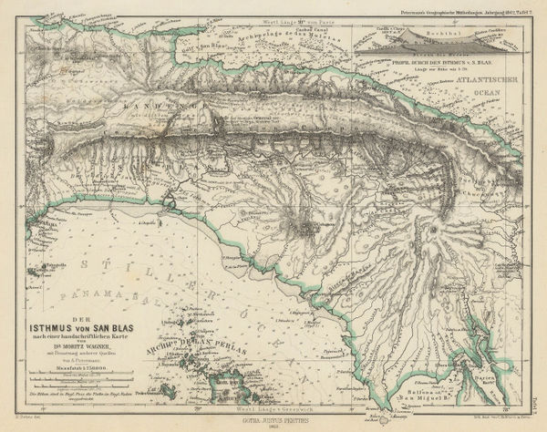
Justus Perthes, Isthmus of Panama, 1862£ 66.00
-
Northern Territory from Gulf of Carpentaria to South Australia border, 1862Justus PerthesSeries: GothaJustus Perthes, Northern Territory from Gulf of Carpentaria to South Australia border, 1862£ 68.00
-
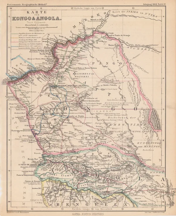
Justus Perthes, Exploration of Congo & Angola, 1862£ 125.00
-
Royal Geographical Society (RGS), Thailand, Cambodia and Laos, 1862£ 695.00
-
North Western Australia from North West Cape to Ripon Island, 1862Royal Geographical Society (RGS)Series: LondonRoyal Geographical Society (RGS), North Western Australia from North West Cape to Ripon Island, 1862£ 285.00
-
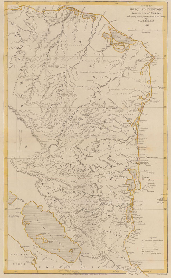
Royal Geographical Society (RGS), Mosquito (Miskito) Coast, Honduras & Nicaragua, 1862£ 185.00
-
-
Justus Perthes, The Doomed Burke & Wills Expedition, 1862£ 68.00
-
Justus Perthes, Routes of explorer Frank Gregory through northwest Australia, 1862£ 78.00
-
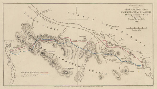
Southern Vancouver Island from Alberni Inlet to Nanaimo, 1862Royal Geographical Society (RGS)Series: LondonRoyal Geographical Society (RGS), Southern Vancouver Island from Alberni Inlet to Nanaimo, 1862£ 60.00
-
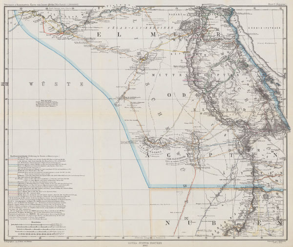
Justus Perthes, Sudan & Egypt, 1862£ 115.00
-
A. Fullarton & Co., Japan, Korea, Manchuria, and the coast of Siberia, 1862£ 525.00
-
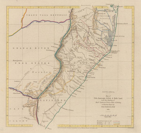
South Africa - Map of Zulu, Amatonga, Natal & Kafir Land, 1862Royal Geographical Society (RGS)Series: LondonRoyal Geographical Society (RGS), South Africa - Map of Zulu, Amatonga, Natal & Kafir Land, 1862£ 115.00
-
Joseph Hutchins Colton, Georgia, 1862£ 325.00
-
Joseph Hutchins Colton, Minnesota and Dakota, 1862£ 345.00
-
Joseph Hutchins Colton, Massachusettes and Rhode Island , 1862£ 325.00
-
Joseph Hutchins Colton, Ohio, 1862£ 195.00
-
Archibald Fullarton, Java & Borneo, 1862£ 325.00
-
Joseph Hutchins Colton, Louisiana, 1862£ 245.00
-
Joseph Hutchins Colton, Canada West, 1862£ 195.00
-
Joseph Hutchins Colton, Virginia, 1862£ 375.00
-
Justus Perthes, Ancient Babylon, 1862£ 95.00
-
J. & C. Walker, The Early Caliphates, 1862£ 275.00
-
Samuel Augustus Mitchell, County Map of Minnesota, 1862£ 245.00
-
F.A. Garnier, Civil War map of the United States, 1862 c£ 595.00
-
Royal Geographical Society (RGS), Japan, reduced from a Japanese map., 1862 c.£ 275.00
-
Edward Weller, Victoria Park, Hackney, Dalston & London Fields, 1863£ 395.00
-
Edward Weller, Asia, 1863£ 75.00
-
Edward Weller, Berkshire, 1863£ 35.00
-
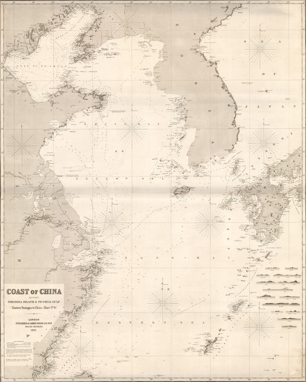
Edward Weller, Coast of China, 1863£ 125.00
-
James Imray, Coast of China, Korea, and southern Japan, 1863£ 4,500.00
-
James Imray, Torres Strait and New Guinea, 1863£ 1,750.00
-
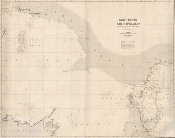
James Imray, East Indian Archipelago. (Eastern passages to China. Chart No. 5), 1863£ 885.00
-
James Imray, East Indian Archipelago. (Eastern Passages to China. Chart No.1), 1863£ 895.00
-
James Imray, East Indian Archipelago. (Eastern Passages to China. Chart No.2), 1863£ 975.00
-
James Imray, Taiwan and the North Pacific, 1863£ 2,200.00
-
James Imray, Coast of Vietnam, China, and Hong Kong, 1863£ 4,950.00
-
James Imray, East Indian Archipelago. (Western Route to China. Chart No.1), 1863£ 1,250.00
-
James Imray, Coasts of Thailand, Cambodia and Vietnam, 1863£ 1,875.00
-
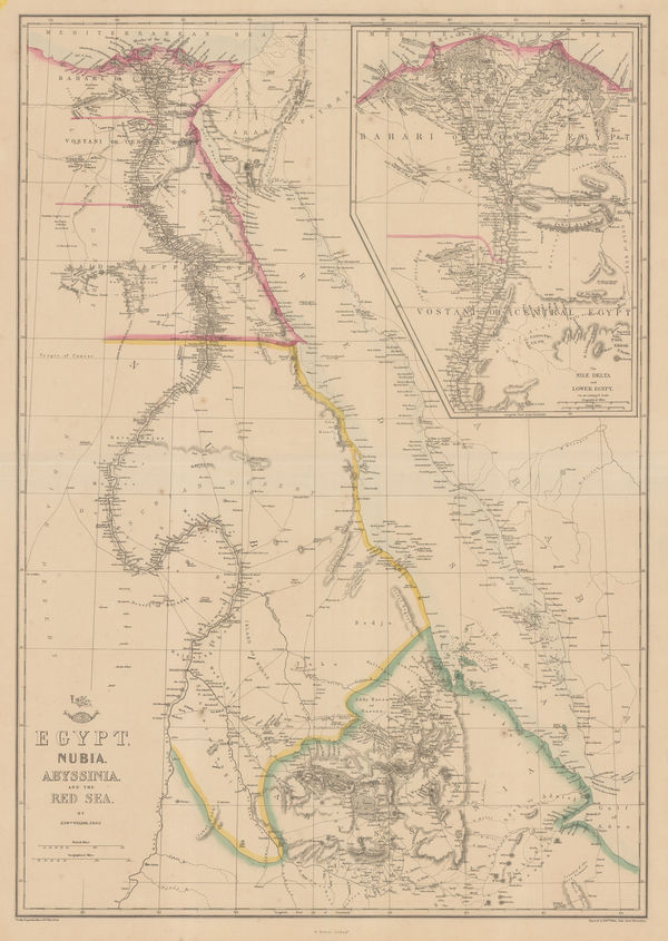
Edward Weller, Egypt, Nubia, Abyssinia and the Red Sea, 1863£ 125.00
-
Royal Geographical Society (RGS), Expeditions in Search of Burke and Wills, 1863£ 1,250.00
-
Johnson & Ward, Italy during the Italian Unification, 1863£ 145.00
-
Johnson & Ward, Johnson's Asia, 1863£ 60.00
-
Johnson & Ward, Johnson's Australia, 1863£ 325.00
-
Johnson & Ward, Johnson's Georgia and Alabama, 1863£ 275.00
-
Johnson & Ward, Johnson's Iowa and Nebraska, 1863£ 150.00
-
Johnson's New Brunswick, Nova Scotia, Newfoundland, and Prince Edward Id., 1863Johnson & WardSeries: New YorkJohnson & Ward, Johnson's New Brunswick, Nova Scotia, Newfoundland, and Prince Edward Id., 1863£ 65.00
-
Justus Perthes, Algeria, Tunisia & Libya, 1863£ 65.00
-
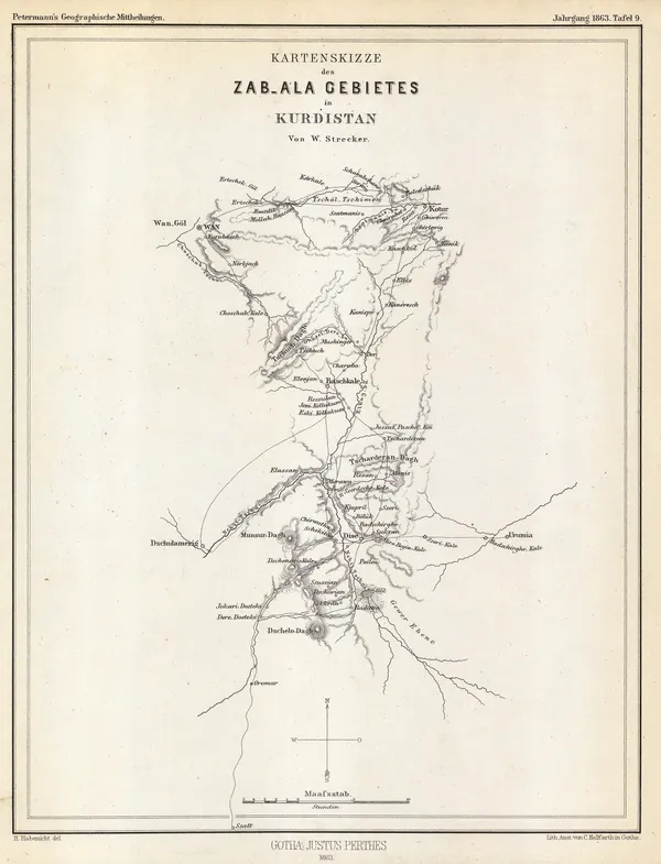
Justus Perthes, Sketch map of Zabala, Kurdistan, 1863£ 68.00
-
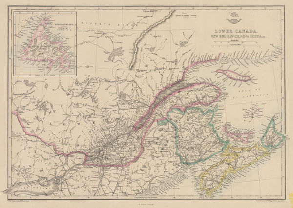
Edward Weller, Lower Canada, New Brunswick, Nova Scotia, 1863£ 45.00
-
Royal Geographical Society (RGS), The Discovery of Lake Malawi (Nyasa), 1863£ 175.00
-
Royal Geographical Society (RGS), Map of Syria &c., 1863£ 150.00
-
Royal Geographical Society (RGS), Map of the Coast from Kurrachee to Gwadur, 1863£ 335.00
-
Map Showing Recent Acquisitions to the Geography of the Districts Bordering the British Trans-Indus Frontier between Peshawur and DeraIshmael Khan, 1863Royal Geographical Society (RGS)Series: LondonRoyal Geographical Society (RGS), Map Showing Recent Acquisitions to the Geography of the Districts Bordering the British Trans-Indus Frontier between Peshawur and DeraIshmael Khan, 1863£ 295.00
-
Royal Geographical Society (RGS), Sketch map of Northern China, 1863£ 165.00
-
Society for the Diffusion of Useful Knowledge (SDUK), North America, 1863£ 125.00
-
Edward Weller, North America, 1863£ 175.00
-
Edward Weller, Russia in Europe, 1863£ 125.00
-
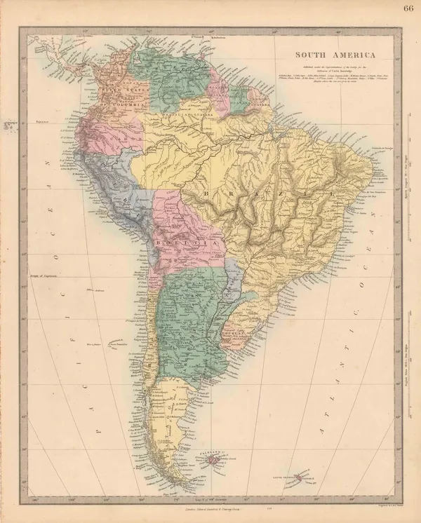
Society for the Diffusion of Useful Knowledge (SDUK), South America, 1863£ 175.00
-
Edward Weller, Spain and Portugal, 1863£ 52.00


Page
81
of 131