-
 Archibald Fullarton, Kamtchatka, 1860 c.£ 58.00
 -
Archibald Fullarton, Kincardineshire, 1860 c.£ 42.00
-
Braun & Nitzschke, La Grande Ourse, The Great Bear, Der Grosse Bär, 1860 c.£ 950.00
-
J. Lavars, Bristol, 1860 c.£ 645.00
-
Braun & Nitzschke, Le Capricorne, The Capricorne, Der Steinbock, 1860 c.£ 950.00
-
Archibald Fullarton, Lower Egypt, 1860 c.£ 40.00
-
John Dower, Madrid, 1860 c.£ 225.00
-
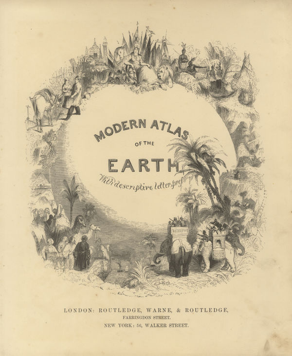
Routledge, Modern Atlas of the Earth, 1860 c.£ 48.00
-
Society for the Diffusion of Useful Knowledge (SDUK), New York, 1860 c.£ 595.00
-
Archibald Fullarton, New York Harbour and Vicinity, 1860 c.£ 85.00
-
Newfoundland, New Brunswick, Nova Scotia, Prince Edward Island, 1860 c.Archibald FullartonSeries: LondonArchibald Fullarton, Newfoundland, New Brunswick, Nova Scotia, Prince Edward Island, 1860 c.£ 85.00
-
John Rapkin, North America, 1860 c.£ 135.00
-
Archibald Fullarton, North America, 1860 c.£ 195.00
-
Victor Levasseur, Oceania, 1860 c.£ 275.00
-
Archibald Fullarton, Oregon and California, 1860 c.£ 265.00
-
Archibald Fullarton, The Altiplano, 1860 c.£ 44.00
-
Archibald Fullarton, Providence, 1860 c.£ 36.00
-
Archibald Fullarton, Railway Map of the British Isles, 1860 c.£ 325.00
-
Archibald Fullarton, Roxburgh Shire, 1860 c.£ 48.00
-
John Dower, Russian in Europe, 1860 c.£ 112.00
-
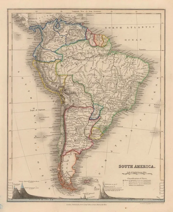
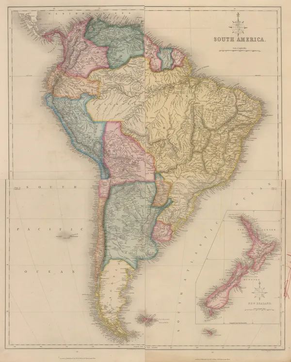
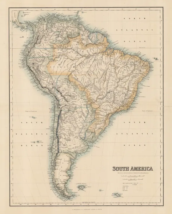
John Dower, South America, 1860 c.£ 145.00
-
Joshua Archer, South America, 1860 c.£ 145.00
-
Archibald Fullarton, South America, 1860 c.£ 85.00
-
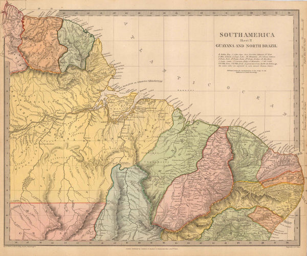
Northern Brazil, Guyana, Suriname & French Guiana, 1860 c.Society for the Diffusion of Useful Knowledge (SDUK)Series: LondonSociety for the Diffusion of Useful Knowledge (SDUK), Northern Brazil, Guyana, Suriname & French Guiana, 1860 c.£ 70.00
-
Archibald Fullarton, Spain & Portugal, 1860 c.£ 85.00
-
Justus Perthes, Switzerland, 1860 c.£ 62.00
-
Victor Levasseur, Switzerland and North Italy, 1860 c.£ 175.00
-
W. & A.K. Johnston, Switzerland, 1860 c.£ 125.00
-
Archibald Fullarton, Turkish Empire, 1860 c.£ 285.00
-
John Dower, Eastern United States, 1860 c.£ 120.00
-
Daniel & William Lizars, Eastern USA and the Caribbean, 1860 c.£ 350.00
-
Archibald Fullarton, United States - North America, 1860 c.£ 245.00
-
John Dower, West Indies, 1860 c.£ 98.00
-
Archibald Fullarton, The Aral Sea, 1860 c.£ 95.00
-
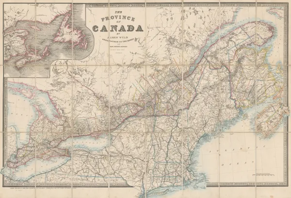
James Wyld, The Province of Canada, 1860 c.£ 1,450.00
-
Archibald Fullarton, Rome with its Environs, 1860 c.£ 68.00
-
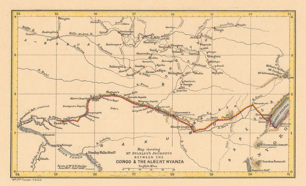
Royal Geographical Society (RGS), The Congo, 1860 c.£ 145.00
-
Archibald Fullarton, Plan of Portsmouth, 1860 c.£ 78.00
-
Archibald Fullarton, British Possessions in the Indian Seas, 1860 c.£ 475.00
-
John Dower, Turkey in Asia, 1860 c.£ 115.00
-
John Dower, Sweden and Norway, 1860 c.£ 78.00
-
John Dower, Iran or Persia, 1860 c.£ 175.00
-
Archibald Fullarton, The East Indies, 1860 c.£ 445.00
-
US Government, Ceded Part of Dakota Territory, 1861£ 195.00
-
Royal Geographical Society (RGS), Courses of the Zambezi and Shire rivers, 1861£ 125.00
-
James T. Lloyd, American Railroad Map, 1861£ 2,750.00
-
Royal Geographical Society (RGS), Tokyo to Mount Fuji route map, 1861£ 245.00
-
Johnson & Browning, Johnson's Kentucky and Tennessee, 1861£ 160.00
-
Johnson & Browning, Johnson's Ohio and Indiana, 1861£ 195.00
-
Justus Perthes, Sikkim and the Nepalese frontier, 1861£ 66.00
-
Map Illustrating the plan of the defences of the Western & North Western Frontier, 1861Washington HoodSeries: PhiladelphiaWashington Hood, Map Illustrating the plan of the defences of the Western & North Western Frontier, 1861£ 525.00
-
Royal Geographical Society (RGS), Patagonia from Buenos Aires to Trelew, 1861£ 95.00
-
Royal Geographical Society (RGS), Map of the Russian & Chinese Frontier, 1861£ 345.00
-
Justus Perthes, Northern Borneo, 1861£ 68.00
-
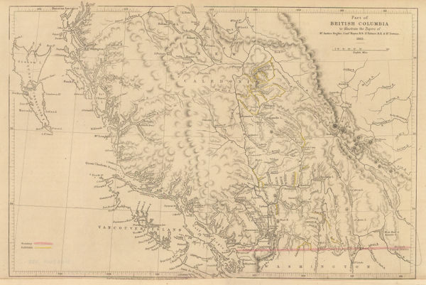
Royal Geographical Society (RGS), Southern British Columbia and Vancouver Island, 1861£ 445.00
-
Route map from the Persian Gulf to Tehran and Herat, 1861Royal Geographical Society (RGS)Series: LondonRoyal Geographical Society (RGS), Route map from the Persian Gulf to Tehran and Herat, 1861£ 84.00
-
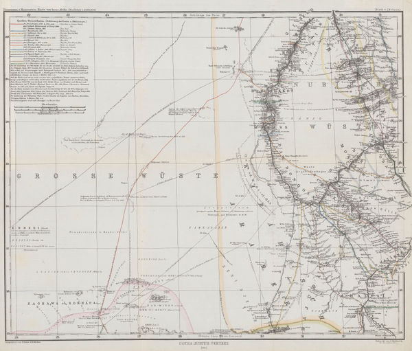
Justus Perthes, Sahara, 1861£ 62.00
-
General Land Office (GLO), Sketch of Public Surveys in New Mexico, 1861£ 895.00
-
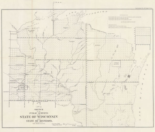
Sketch of the Public Surveys in the State of Wisconsin and State of Minnesota, 1861US GovernmentSeries: Washington, D.C.US Government, Sketch of the Public Surveys in the State of Wisconsin and State of Minnesota, 1861£ 325.00
-
US Government, Sketch of the Public Surveys of Iowa and Dakota, 1861£ 295.00
-
Edward Stanford, Civil War Map of the Eastern United States, 1861£ 2,850.00
-
W. & A.K. Johnston, Civil War Map of the United States, 1861£ 595.00
-
Justus Perthes, Sudan & the Sahara, 1861£ 155.00
-
Justus Perthes, The Coast of Labrador, 1861£ 88.00
-
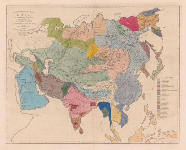
James Cowles Prichard, Ethnographic Map of Asia, 1861£ 550.00
-
Joseph Hutchins Colton, Southern Italy, 1861£ 145.00
-
Royal Geographical Society (RGS), Map of the Valley of Kashmir, 1861£ 245.00
-
William Figg, Map of the County of Sussex, 1861£ 3,500.00
-
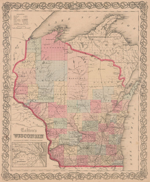
Joseph Hutchins Colton, Wisconsin, 1861£ 325.00
-
Joseph Hutchins Colton, Illinois, 1861£ 195.00
-
Joseph Hutchins Colton, Philadelphia, 1861£ 275.00
-
Joseph Hutchins Colton, Florida, 1861£ 495.00
-
Joseph Hutchins Colton, South Carolina, 1861£ 345.00
-
Joseph Hutchins Colton, Savannah and Charleston, 1861£ 375.00
-
Joseph Hutchins Colton, Connecticut, 1861£ 295.00
-
Joseph Hutchins Colton, North Carolina, 1861£ 325.00
-
Joseph Hutchins Colton, Michigan, 1861£ 295.00
-
Joseph Hutchins Colton, Indiana, 1861£ 225.00
-
Joseph Hutchins Colton, Louisville and New Orleans, 1861£ 295.00
-
James Cowles Prichard, Ethnographic Map of Europe, 1861£ 550.00


Page
80
of 131