-
 Henry Cuthbert Tunison, North Dakota, 1882£ 95.00
 -
Justus Perthes, Geological Map of West Africa, 1882£ 425.00
-
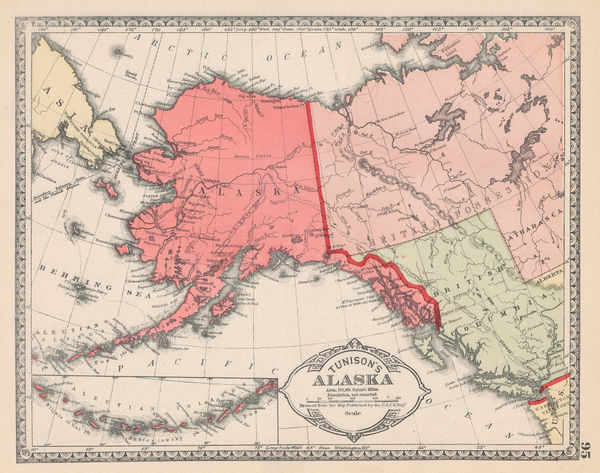
Henry Cuthbert Tunison, Alaska, 1882£ 95.00
-
Henry Cuthbert Tunison, Maine, 1882£ 95.00
-
Letts & Son, The City of Vienna, 1882£ 225.00
-
Letts & Son, Arabia, Egypt, Nubia & Abyssina, 1882£ 395.00
-
Letts & Son, Plan of Edinburgh, 1882£ 285.00
-
Henry Cuthbert Tunison, Minnesota, 1882£ 95.00
-
Edward K. Godfrey, Historical Map Nantucket, 1882 c.£ 1,250.00
-
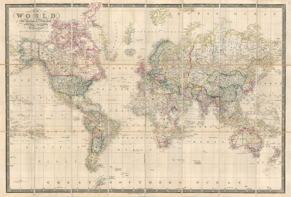
James Wyld, The World on Mercator's Projection, 1882 c.£ 1,950.00
-
A Map of a Route Along the Alburz Mountains Between Tehran, Astrabad and Shahrud, 1883Royal Geographical Society (RGS)Series: LondonRoyal Geographical Society (RGS), A Map of a Route Along the Alburz Mountains Between Tehran, Astrabad and Shahrud, 1883£ 495.00
-
A. Simon, Chart of the port of Barcelona, 1883£ 125.00
-
Royal Geographical Society (RGS), Athabasca District, Saskatchewan, 1883£ 395.00
-
Chart Showing Mr. Leigh Smith's Track to Franz Josef Land and Boat Journey to Novaya Zemlya in 1881-1882, 1883Royal Geographical Society (RGS)Series: LondonRoyal Geographical Society (RGS), Chart Showing Mr. Leigh Smith's Track to Franz Josef Land and Boat Journey to Novaya Zemlya in 1881-1882, 1883£ 75.00
-
A. Simon, Southampton, 1883£ 125.00
-
Letts & Son, Eastern United States, 1883£ 68.00
-
A. Simon, Chart of the port of Rijeka, 1883£ 125.00
-
Ordnance Survey, Geological Survey of England and Wales, 1883£ 120.00
-
Letts & Son, Northwest India - Lahore, Kashmir & Himachal Pradesh, 1883£ 78.00
-
Service géographique de l'armée, Folding wall map of Egypt , 1883£ 2,450.00
-
Wright & Polter, Map of Railroads of the State of Massachusetts, 1883£ 675.00
-
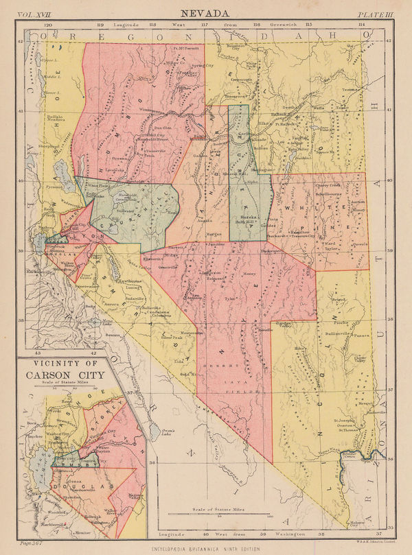
W. & A.K. Johnston, Nevada, 1883£ 65.00
-
Ole Theodor Olsen, North Sea Fishing Grounds, 1883£ 185.00
-
Ole Theodor Olsen, North Sea Soundings, 1883£ 185.00
-
Letts & Son, Western Russia from St. Petersburg to Moscow, 1883£ 74.00
-
Letts & Son, Patagonia, Chile, Tierra del Fuego and The Falklands, 1883£ 78.00
-
Letts & Son, Southern Peru & Bolivia, 1883£ 74.00
-
Letts & Son, Southern India and Sri Lanka (Ceylon), 1883£ 295.00
-
Letts & Son, Southern Québec and New Brunswick, 1883£ 48.00
-
Letts & Son, Brussels (Bruxelles), 1883£ 195.00
-
Ole Theodor Olsen, The Piscatorial Atlas - Anchovy, 1883£ 95.00
-
Ole Theodor Olsen, Sole Fishing in the North Sea, 1883£ 95.00
-
Justus Perthes, European Exploration of the Congo, 1883£ 195.00
-
Arabia and the Surrounding Countries to illustrate the life of Mahomet and the Annals of the early Caliphate, 1883Edward StanfordSeries: LondonEdward Stanford, Arabia and the Surrounding Countries to illustrate the life of Mahomet and the Annals of the early Caliphate, 1883£ 3,850.00
-
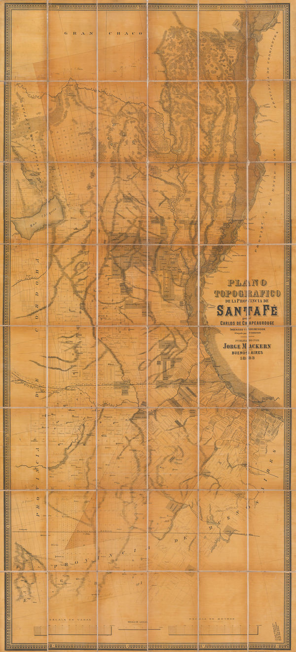
Jorge Mackern, Santa Fe Province, Argentina, 1883£ 375.00
-
Justus Perthes, Sierra Leone, 1883£ 175.00
-
Justus Perthes, Korea, 1883£ 750.00
-
Royal Geographical Society (RGS), The Central and Western Provinces of Colombia, 1883£ 375.00
-
W. & A.K. Johnston, The Islamic Empire, 1883£ 115.00
-
Josiah Whitbread, Whitbread's Reduced Ordnance Map of London, 1883£ 775.00
-
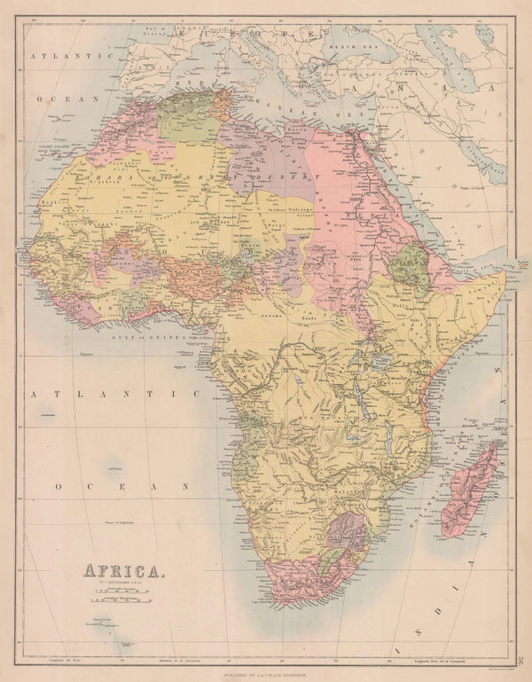
A. & C. Black, Africa, 1884£ 195.00
-
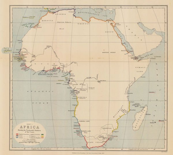
Royal Geographical Society (RGS), Africa showing colonial possessions, 1884£ 145.00
-
Eugène Andriveau-Goujon, Wall map of South America, 1884£ 1,250.00
-
A. Simon, Boston, 1884£ 495.00
-
A. Simon, Port of Kolkata (Calcutta), 1884£ 285.00
-
A. Simon, Port and city of Cartagena, 1884£ 72.00
-
Samuel Augustus Mitchell, County and Township Map of Dakota, 1884£ 58.00
-
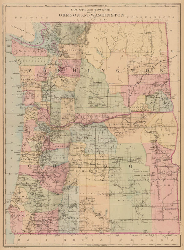
Samuel Augustus Mitchell, County and Township Map of Oregon and Washington, 1884£ 225.00
-
Samuel Augustus Mitchell, County Map of the State of New York, 1884£ 145.00
-
Justus Perthes, European Russia, 1884£ 38.00
-
A. Simon, French Ministry of Works import and export map of Europe, 1884£ 98.00
-
Reginald A.F. Murray, Geological Survey of Gipps Land, 1884£ 125.00
-
Ordnance Survey, Geological Survey of Great Britain, 1884£ 375.00
-
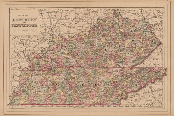
Samuel Augustus Mitchell, Kentucky and Tennessee, 1884£ 125.00
-
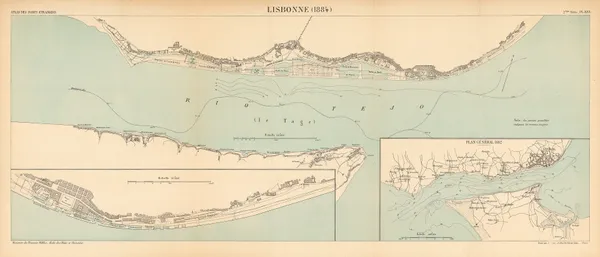
A. Simon, Chart of Lisbon harbour, 1884£ 145.00
-
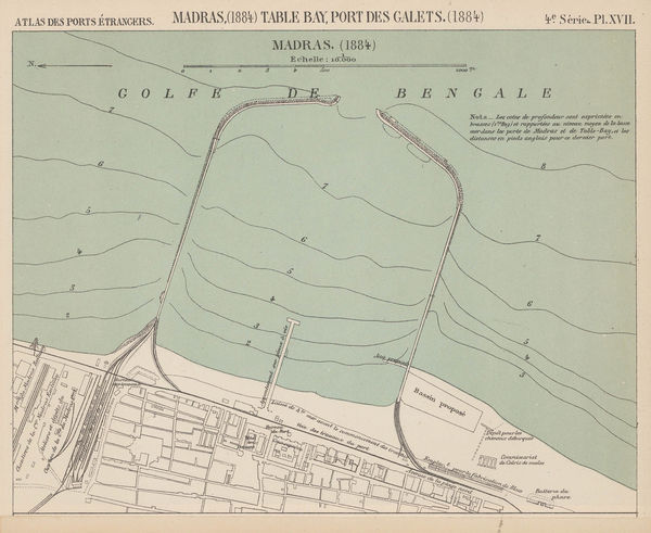
A. Simon, Port of Chennai (Madras), 1884£ 98.00
-
Samuel Augustus Mitchell, Map of Mexico, Central America and the West Indies, 1884£ 145.00
-
Richard Anthony Proctor, Stars for May - Map V, 1884£ 250.00
-
Louis Thuillier, Monaco, 1884£ 38.00
-
New Zealand - Outline Map of Southern Part of South Island, 1884Royal Geographical Society (RGS)Series: LondonRoyal Geographical Society (RGS), New Zealand - Outline Map of Southern Part of South Island, 1884£ 165.00
-
Bukhara between the Zarafshan and Amu Darya (Oxus) Rivers, 1884Royal Geographical Society (RGS)Series: LondonRoyal Geographical Society (RGS), Bukhara between the Zarafshan and Amu Darya (Oxus) Rivers, 1884£ 285.00
-
Royal Geographical Society (RGS), Central Australia north of Lake Eyre, 1884£ 115.00
-
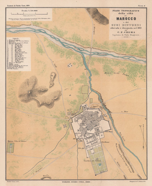
Guido Cora, Italian city plan of Marrakech, 1884£ 325.00
-
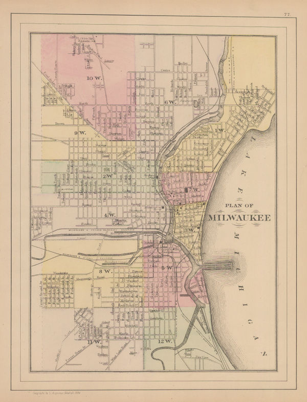
Samuel Augustus Mitchell, Plan of Milwaukee, 1884£ 62.00
-
Samuel Augustus Mitchell, Plan of the City of Philadelphia and Camden, 1884£ 165.00
-
A. Simon, Docks of Rio de Janeiro, 1884£ 395.00
-
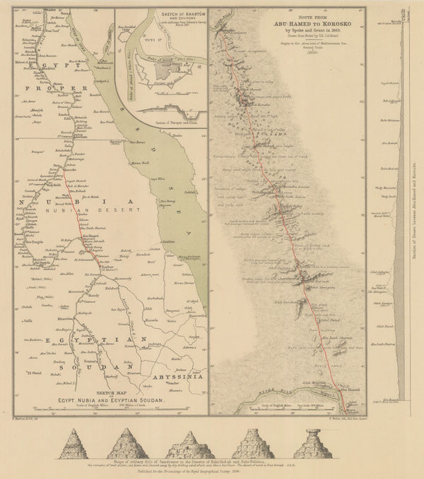
Royal Geographical Society (RGS), Sketch Map of Egypt, Nubia and Egyptian Sudan, 1884£ 145.00
-
A. Simon, Southampton, 1884£ 82.00
-
General Land Office (GLO), State of Oregon, 1884£ 1,350.00
-
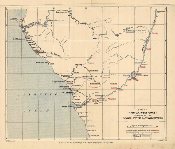
Royal Geographical Society (RGS), European Trading Posts in Congo, Angola & Gabon, 1884£ 245.00
-
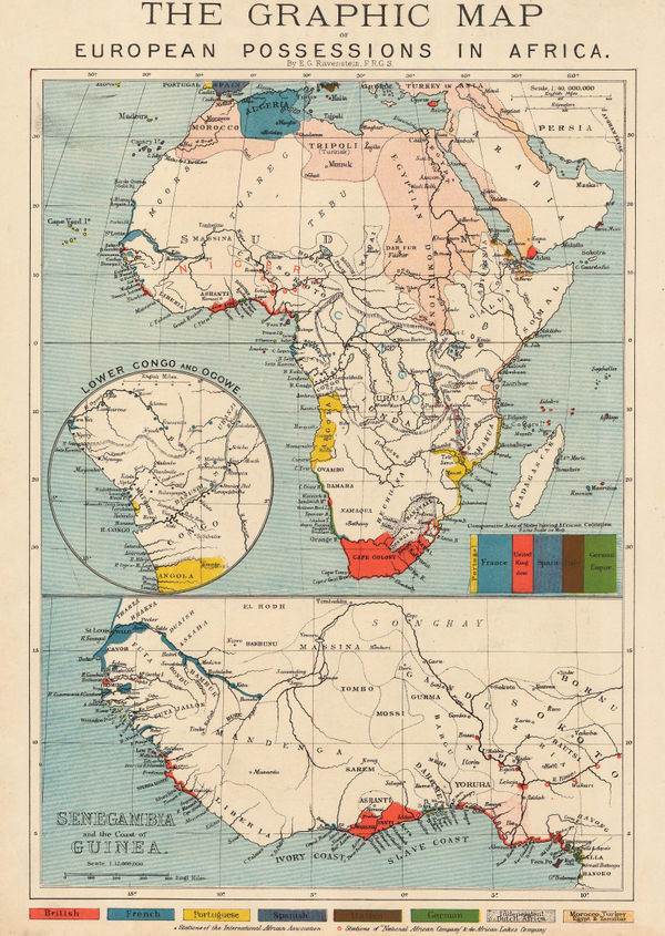
The Graphic Magazine, The Graphic Map of European Possessions in Africa, 1884£ 325.00
-
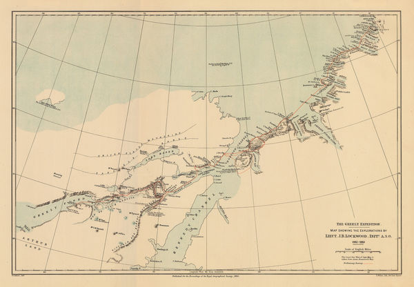
Royal Geographical Society (RGS), The Greely Expedition, 1884£ 320.00
-
Royal Geographical Society (RGS), The Interior of South Africa, 1884£ 795.00
-
Royal Geographical Society (RGS), The Pamir, Tajikistan, 1884£ 165.00
-
A. Simon, Venice, 1884£ 125.00
-
E. Whitehead, Whitehead's New Map of Victoria, 1884£ 625.00
-
Royal Geographical Society (RGS), New Guinea, 1884£ 225.00
-
Royal Geographical Society (RGS), Himalayas, 1884£ 485.00
-
Justus Perthes, John Forrest's travels in Northwest Australia, 1884£ 68.00
-
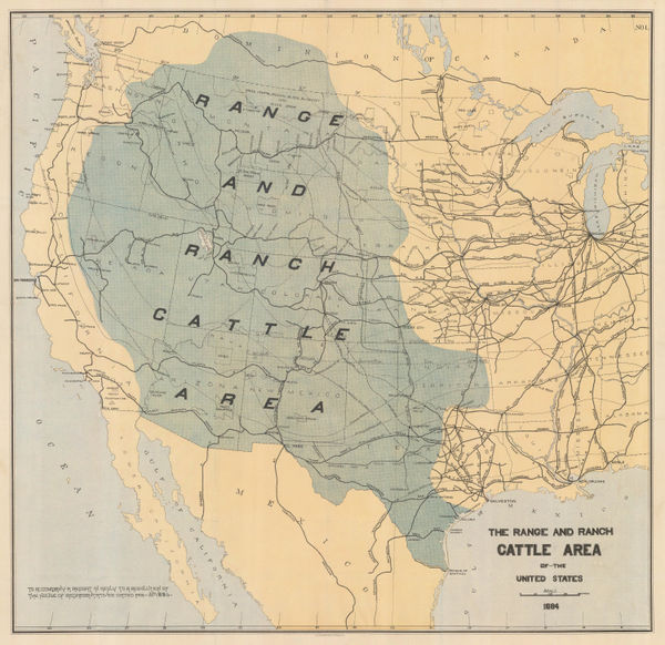
Julius Bien, The Range and Ranch Cattle Area of the United-States, 1884£ 1,650.00


Page
91
of 130