-
 Joseph Meyer, Macao, 1912£ 125.00
 -
Walter Boldero Paton, Map of the Province of Ontario Canada, 1912£ 68.00
-
Walter Boldero Paton, Map of the Union of South Africa, 1912£ 295.00
-
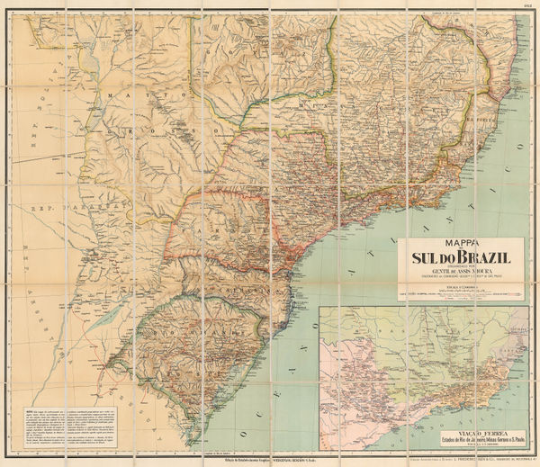
Gentil De Assis Moura, Wall map of Southern Brazil, 1912£ 925.00
-
-
-
Lilian Tennant, Caricature map of Russia, 1912£ 365.00
-
Joseph Meyer, Saint-Louis, 1912£ 44.00
-
Lilian Tennant, Sweden & Norway, 1912£ 345.00
-
Sketch map Showing the Route from Kashgar to Kowlun, 1912Royal Geographical Society (RGS)Series: LondonRoyal Geographical Society (RGS), Sketch map Showing the Route from Kashgar to Kowlun, 1912£ 115.00
-
D.G. Hatchell, South Canara District Map for the use of Touring Officers, 1912£ 495.00
-
Royal Geographical Society (RGS), The Troad / Biga Peninsula, 1912£ 135.00
-
United States and Mexico - Sketch Map of part of Sonora and Arizona, 1912Royal Geographical Society (RGS)Series: LondonRoyal Geographical Society (RGS), United States and Mexico - Sketch Map of part of Sonora and Arizona, 1912£ 185.00
-
T.N. Hibben & Co., Vancouver Island and southern British Columbia, 1912£ 885.00
-
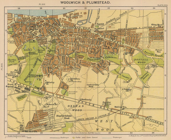
George Philip & Son Ltd., Woolwich & Plumstead, 1912£ 50.00
-
Edward Stanford, Killarney and its Lakes, 1912£ 78.00
-
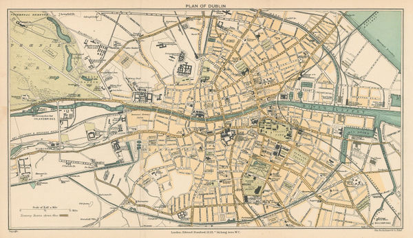
Edward Stanford, Dublin, 1912£ 78.00
-
Royal Geographical Society (RGS), Lower Mesopotamia, 1912£ 1,250.00
-
Rand, McNally & Co., City and County of San Francisco, 1912£ 550.00
-
John Bartholomew, Giants Causeway, 1912£ 78.00
-
Edward Stanford, Cork and environs, 1912£ 75.00
-
Survey of India, Railway, Canal, and Road Map of India, 1912£ 3,600.00
-
Edward Stanford, Geological Map of Ireland, 1912£ 55.00
-
Edward Stanford, Zurich, 1912£ 65.00
-
Rand, McNally & Co., Arizona, 1912£ 475.00
-
Edward Stanford, Cork, 1912£ 95.00
-
Edward Stanford, Londonderry, 1912£ 95.00
-
London Underground, London Underground Railways, 1912£ 950 (framed)
-
W. & A.K. Johnston, North Polar Chart, 1912 c£ 225.00
-
George W. Bacon, Large Scale Map of Australia, 1912 c.£ 3,450.00
-
Ordnance Survey, Watford and High Wycombe, 1912 c.£ 115.00
-
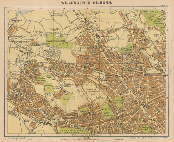
George Philip & Son Ltd., Willesden & Kilburn, 1912 c.£ 64.00
-
George W. Bacon, Bacon's Gem Map of London and its Suburbs, 1912 c.£ 425.00
-
C.S. Hammond & Co., A Guide to Jewish New York, 1912 c.£ 1,950.00
-
George Philip & Son Ltd., The Near East: Industries and Communications, 1912 c.£ 275.00
-
Adolf Hartleben, Opatija, Croatia, 1913£ 32.00
-
Adolf Hartleben, Rab, Croatia, 1913£ 28.00
-
-
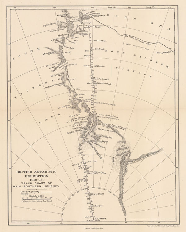
British Antarctic Expedition 1910-13. Track chart of the main southern journey, 1913Edward StanfordSeries: LondonEdward Stanford, British Antarctic Expedition 1910-13. Track chart of the main southern journey, 1913£ 450.00
-
Adolf Hartleben, Adriatic Coast from Pula to Zadar, Croatia, 1913£ 36.00
-
Adolf Hartleben, Map of the train route from Sarajevo to Ragusa (Dubrovnik), 1913£ 32.00
-
Adolf Hartleben, Port and city of Pula, Croatia, 1913£ 34.00
-
Adolf Hartleben, Hvar, Croatia, 1913£ 48.00
-
Adolf Hartleben, Lošinj, Croatia, 1913£ 32.00
-
Karl Baedeker, Pisa, 1913£ 54.00
-
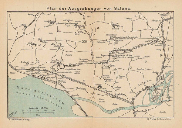
Adolf Hartleben, Solin, Croatia, 1913£ 28.00
-
Adolf Hartleben, Rijeka, Croatia, 1913£ 32.00
-
Adolf Hartleben, Lovran and Ika, Croatia, 1913£ 36.00
-
Adolf Hartleben, Pula, Croatia, 1913£ 68.00
-
Adolf Hartleben, Split, Croatia, 1913£ 24.00
-
Adolf Hartleben, Zadar, Croatia, 1913£ 32.00
-
Preliminary Chart showing the Deep Sea Soundings taken on board the 'Aurora' during the 1st and 2nd years work of the Australasian Antarctic Expedition, 1913Royal Geographical Society (RGS)Series: LondonRoyal Geographical Society (RGS), Preliminary Chart showing the Deep Sea Soundings taken on board the 'Aurora' during the 1st and 2nd years work of the Australasian Antarctic Expedition, 1913£ 600.00
-
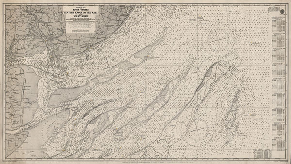
British Admiralty, River Thames, Kentish Knock and the Naze, 1913£ 175.00
-
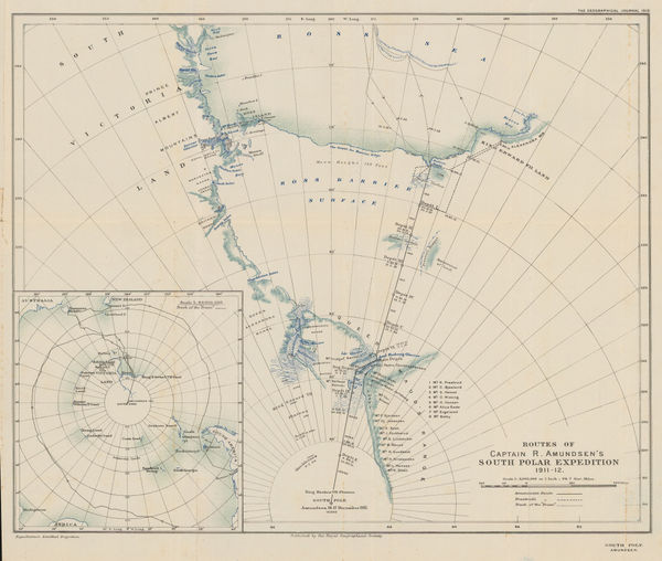
Routes of Captain R. Amundsen's South Polar Expedition 1911-1912, 1913Royal Geographical Society (RGS)Series: LondonRoyal Geographical Society (RGS), Routes of Captain R. Amundsen's South Polar Expedition 1911-1912, 1913£ 4,950.00
-
Edward Stanford, Sketch Map of Mount Erebus, 1913£ 150.00
-
Sketch Map to Illustrate Einar Mikkelsen's Expedition to North East Greenland 1909-12, 1913Royal Geographical Society (RGS)Series: LondonRoyal Geographical Society (RGS), Sketch Map to Illustrate Einar Mikkelsen's Expedition to North East Greenland 1909-12, 1913£ 88.00
-
Royal Geographical Society (RGS), The Basin of the Upper Yenisei, 1913£ 245.00
-
Karl Baedeker, Turin / Torino, 1913£ 68.00
-
Vasco Nunez de Balboa's Discovery of the Pacific Ocean, 1913Royal Geographical Society (RGS)Series: LondonRoyal Geographical Society (RGS), Vasco Nunez de Balboa's Discovery of the Pacific Ocean, 1913£ 78.00
-
Drainage Map of the Island of Hawaii, 1913United States Geological Survey (USGS)Series: Washington, D.C.United States Geological Survey (USGS), Drainage Map of the Island of Hawaii, 1913£ 375.00
-
Edward Stanford, Edinburgh, 1913£ 115.00
-
Edward Stanford, St Andrews, 1913£ 125.00
-
Southern Nigeria to Illustrate the Paper by A.E. Kitson, 1913Royal Geographical Society (RGS)Series: LondonRoyal Geographical Society (RGS), Southern Nigeria to Illustrate the Paper by A.E. Kitson, 1913£ 345.00
-
Royal Geographical Society (RGS), The Canadian Arctic Expedition, 1913£ 245.00
-
Edward Stanford, Railway Map of the US & Canada, 1913£ 1,450.00
-
John Murray, Agra and Environs, 1913 c.£ 55.00
-
George Philip & Son Ltd., The Polar Regions, 1913 c.£ 395.00
-
British Admiralty, Heroic Age map of the Ross Sea & Ross Ice Shelf, 1914£ 4,500.00
-
Australasian Antarctic Expedition - King George V Land, 1914Royal Geographical Society (RGS)Series: LondonRoyal Geographical Society (RGS), Australasian Antarctic Expedition - King George V Land, 1914£ 2,450.00
-
Australasian Antarctic Expedition, 1911 - 14. Queen Mary Land, Showing the tracking of the Sledging Parties from the Main Base, 1914Royal Geographical Society (RGS)Series: LondonRoyal Geographical Society (RGS), Australasian Antarctic Expedition, 1911 - 14. Queen Mary Land, Showing the tracking of the Sledging Parties from the Main Base, 1914£ 1,600.00
-
J. Nystrom, Eastern and Western Hemispheres, 1914£ 3,500.00
-
Edward Fisher Pittman, Geological Map of New South Wales, 1914£ 1,450.00
-
British Admiralty, Karachi Harbour, 1914£ 2,500.00
-
Pharus, Berlin, 1914£ 225.00
-
Royal Geographical Society (RGS), Lake System of Western Australia, 1914£ 225.00
-
Royal Geographical Society (RGS), Turgun Mountains, northwest Mongolia, 1914£ 195.00
-
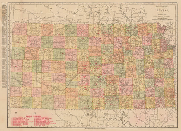
Rand, McNally & Co., New Commercial Atlas Map of Kansas, 1914£ 295.00
-
Rand, McNally & Co., New Commercial Atlas Map of Nevada, 1914£ 395.00
-
British Admiralty, Fiji - Nukulau Island to Namuka Island, 1914£ 475.00
-
Panama Canal to illustrate a paper by Vaughan Cornish, 1914Royal Geographical Society (RGS)Series: LondonRoyal Geographical Society (RGS), Panama Canal to illustrate a paper by Vaughan Cornish, 1914£ 345.00


Page
111
of 131