-
 Martin Waldseemüller & Laurent Fries, West Africa, 1541£ 2,550.00
 -
Claudius Ptolemy & Laurent Fries, Algeria, Tunisia & Libya, 1541£ 695.00
-
Early woodcut map of West Africa and the Gulf of Guinea, 1556Giovanni Battista RamusioSeries: VeniceGiovanni Battista Ramusio, Early woodcut map of West Africa and the Gulf of Guinea, 1556£ 3,650.00
-
Antoine Du Pinet, Very early woodcut view of Algiers, 1564£ 425.00
-
Giulio & Livio Sanuto, Rare Ptolemaic Map of North Africa, 1588£ 985.00
-
Abraham Ortelius, Northern Africa or Barbary Coast, 1601£ 1,850.00
-
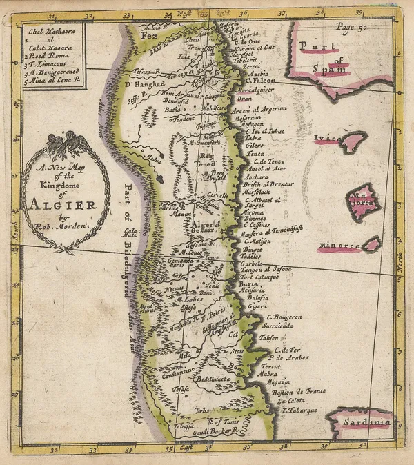
Robert Morden, A New Map of the Kingdome of Algier, 1688£ 225.00
-
Johann Ulrich Muller, Northern Africa, 1692£ 145.00
-
Nicolas Sanson, West and Northwest Africa, 1692£ 375.00
-
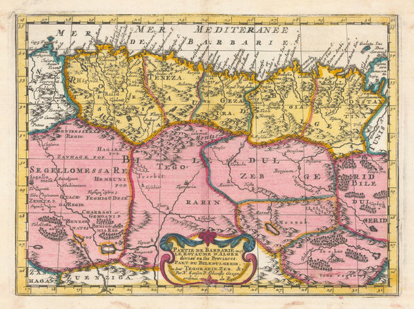
Nicolas & Guillaume Sanson, Partie de Barbarie en est le Royaume d'Alger., 1700£ 350.00
-
Robert Morden, North & West Africa, 1702£ 175.00
-
Guillaume De L'Isle, North & West Africa, 1707£ 445.00
-
Pierre Mortier, Chart of the southern Mediterranean and coast of North Africa, 1708£ 3,000.00
-
Western Mediterranean, Coast of Spain and Algeria, 1723Henri Michelot and Laurent BrémondSeries: MarseillesHenri Michelot and Laurent Brémond, Western Mediterranean, Coast of Spain and Algeria, 1723£ 1,550.00
-
Jacques-Nicolas Bellin, Chart of Mers El Kébir harbour and castle, 1764£ 65.00
-
Jacques-Nicolas Bellin, Algiers, 1764£ 145.00
-
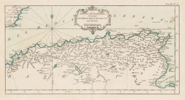
Jacques-Nicolas Bellin, Algeria & Tunisia, 1764£ 175.00
-
Emanuel Bowen, West Africa, 1766£ 645.00
-
Rigobert Bonne, Northwest Africa coast, Tangier to Sierra Leone, 1780 c.£ 90.00
-
Algerian coast from Bonah to Magrowah, 1834Society for the Diffusion of Useful Knowledge (SDUK)Series: LondonSociety for the Diffusion of Useful Knowledge (SDUK), Algerian coast from Bonah to Magrowah, 1834£ 86.00
-
Route of Sir Grenville Temple from Bonah to Kostantinah, 1838Royal Geographical Society (RGS)Series: LondonRoyal Geographical Society (RGS), Route of Sir Grenville Temple from Bonah to Kostantinah, 1838£ 58.00
-
John Tallis, Northern Africa, 1851£ 275.00
-
Victor Levasseur, Algérie (Northern Algeria), 1860 c.£ 195.00
-
Justus Perthes, Sahara, 1861£ 62.00
-
Justus Perthes, Algeria, Tunisia & Libya, 1863£ 65.00
-
Alexandre Vuillemin, Folding map of Algeria, 1871£ 295.00
-
Carl Muller, North Africa coast during the Classical period, 1873£ 50.00
-
A. Simon, Algier. (1886), 1886£ 175.00
-
A. Simon, Mostaganem. (1886), 1886£ 62.00
-
J. Migeon, Algeria, 1890 c.£ 48.00
-
Letts & Son, Algeria, 1892£ 52.00
-
Sketch Maps Illustrating the Physical and Political Geography of Algeria, 1894Scottish Geographical Society (SGS)Series: EdinburghScottish Geographical Society (SGS), Sketch Maps Illustrating the Physical and Political Geography of Algeria, 1894£ 58.00
-
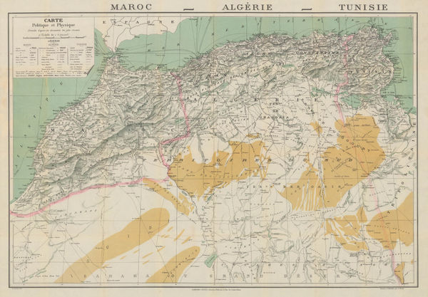
Garnier Frères, Morocco, Algeria & Tunisia, 1900 c.£ 195.00
-
Karl Baedeker, Algiers, 1911£ 38.00
-
Karl Baedeker, Algeria, Tunisia & Libya, 1911£ 38.00
-
Karl Baedeker, Miniature plan of Algiers, 1934£ 48.00
Algeria
Our entire inventory of over 10,000 antique and vintage maps is now available to browse by region, date, cartographer, and subject