-
 Antonio Zatta, Early Italian map of Lake Superior, 1780 c.£ 395.00
 -
Matthew Carey, The Northwestern Territories of the United States, 1812£ 850.00
-
Philippe Vandermaelen, Minnesota, 1827£ 625.00
-
Capt. John B. Pope, Map of the Territory of Minnesota, 1849£ 2,750.00
-
Joseph Hutchins Colton, Minnesota and Dakota, 1862£ 345.00
-
Samuel Augustus Mitchell, County Map of Minnesota, 1862£ 245.00
-
General Land Office (GLO), Minnesota, 1866£ 850.00
-
Archibald Fullarton, United States - The North Central Section, 1870 c.£ 75.00
-
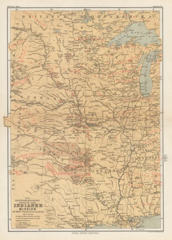
Justus Perthes, Indigenous Map of Central and Midwest USA, 1871£ 125.00
-
W. & A.K. Johnston, Minnesota, 1880 (c.)£ 85.00
-
O.W. Gray & Son, Minnesota, 1881£ 545.00
-
Henry Cuthbert Tunison, Minnesota, 1882£ 95.00
-
Justus Perthes, Dakotas, Minnesota, Iowa, Nebraska and part of Wisconsin., 1885£ 85.00
-
Arbuckle Brothers Company, Minnesota, 1889£ 115.00
-
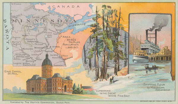
Perry Mason & Co., Minnesota, 1891£ 130.00
-
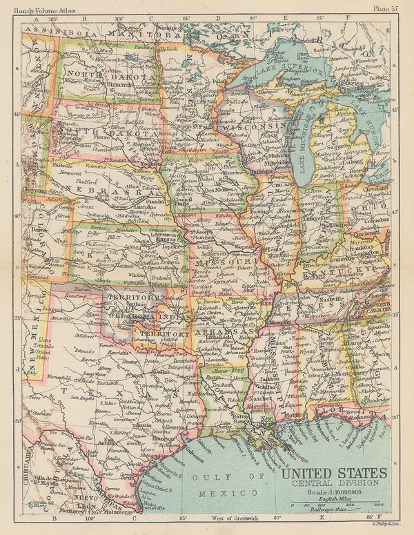
George Philip & Son Ltd., United States - Central Division, 1896£ 36.00
-
Karl Baedeker, Minneapolis, 1909£ 52.00
-
Karl Baedeker, St. Paul, 1909£ 38.00
-
Rand, McNally & Co., New Commercial Atlas Map of Minnesota, 1920 c.£ 345.00
-
Dore Ogrizek, Minnesota, 1946£ 75.00
Minnesota
Our entire inventory of over 10,000 antique and vintage maps is now available to browse by region, date, cartographer, and subject