-
 Claudius Ptolemy & Laurent Fries, Rare and early map of the Malay Peninsula, 1541£ 2,450.00
 -
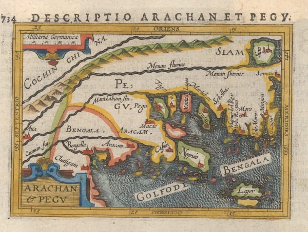
Petrus Bertius, Miniature map of Myanmar (Burma) and Thailand, 1616£ 325.00
-
Petrus Bertius, Description de Malacca, 1618£ 495.00
-
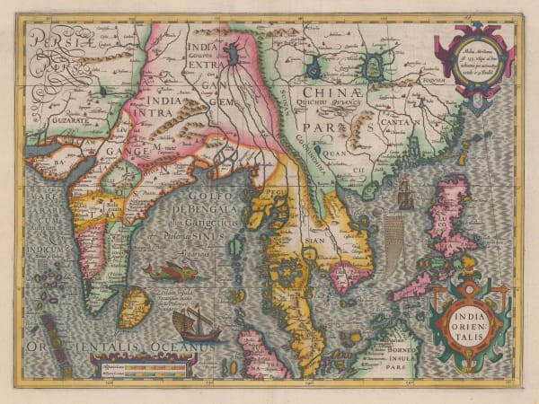
Mercator Hondius, Important early map of India, Sri Lanka, Southeast Asia, and the Philippines, 1636 c.Reserved
-
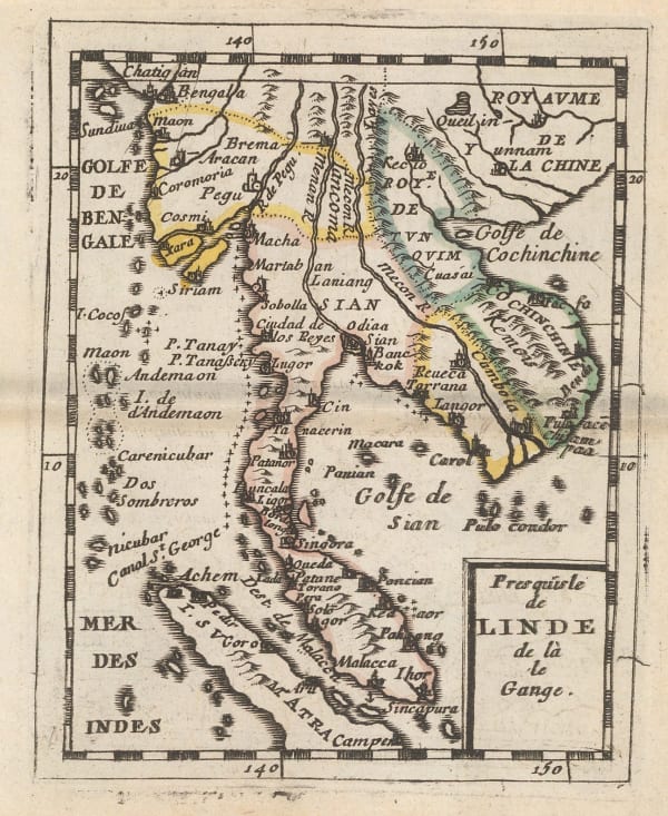
Pierre Duval, Malaysia, Thailand, Myanmar, Cambodia, Laos and Vietnam, 1680 c.£ 375.00
-
-
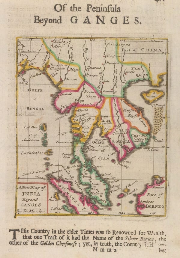
Robert Morden, Miniature map of mainland Southeast Asia, 1688£ 325.00
-
Nicolas & Guillaume Sanson, Myanmar, Laos, Thailand, Cambodia, Vietnam and Malay Peninsula, 1700£ 595.00
-
Herman Moll, Myanmar, Thailand, Cambodia, Vietnam, Laos and Malaysia, 1725£ 795.00
-
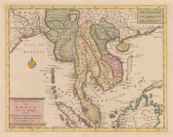
Isaac Tirion, Nieuwe Kaart van India over de Ganges, 1730 c£ 1,150.00
-
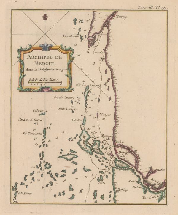
Jacques-Nicolas Bellin, Mergui (Myeik) Archipelago, 1750 c.£ 42.00
-
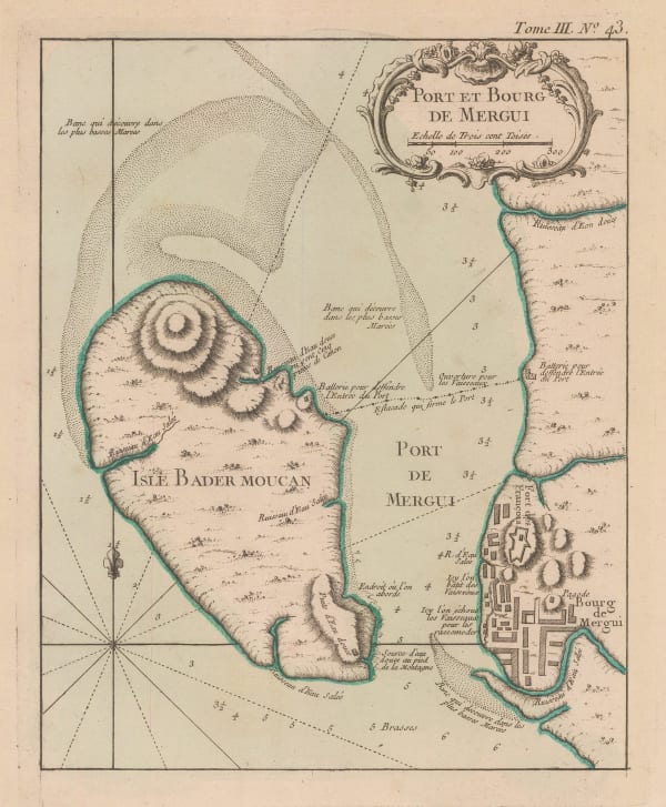
Jacques-Nicolas Bellin, Port of Mergui and Island of Bader Moucan, 1764£ 195.00
-
Giovanni Maria Cassini, Peninsular Southeast Asia, 1797£ 1,850.00
-
Michael Symes, Myanmar (Burmese Empire) and Indo-China, 1800£ 245.00
-
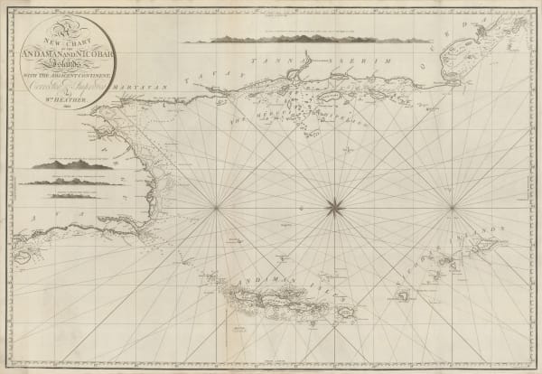
William Heather, Chart of the Andaman and Nicobar Islands, 1803£ 3,200.00
-
John Walker, Thailand, Malaysia, Singapore, Vietnam, Laos and Cambodia., 1828£ 1,150.00
-
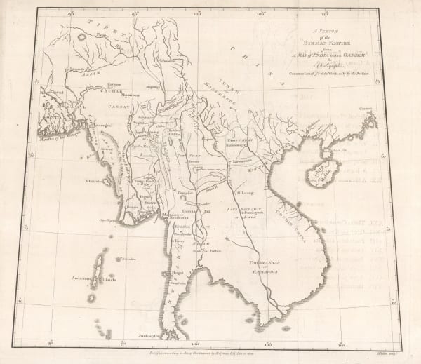
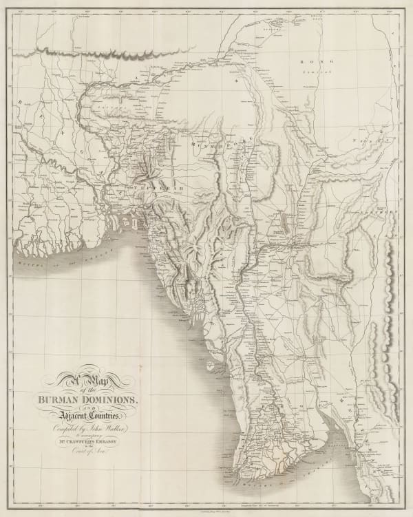
John Crawfurd, Myanmar, John Crawfurd's journey to the Court of the King of Burma, 1829£ 785.00
-
Adrien Brue, Indian and Southeast Asia showing European colonial possessions, 1836£ 245.00
-
John Arrowsmith, Folding map of Myanmar (Burma), 1853£ 675.00
-
Sidney Hall, Myanmar (Burma), northeast India and western Thailand, 1855 c.£ 395.00
-
Royal Geographical Society (RGS), Myanmar (Burma), 1857£ 495.00
-
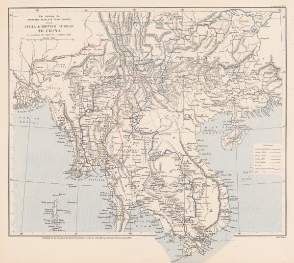
Royal Geographical Society (RGS), Map Showing the Proposed Trade Routes from India & British Burmah to China, 1875£ 395.00
-
Royal Geographical Society (RGS), Map of Southern China, 1882£ 165.00
-
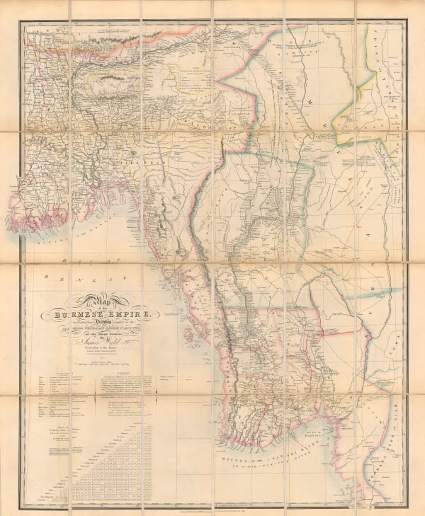
James Wyld, Myanmar (Burma) after the Third Anglo-Burmese war, 1886£ 1,250.00
-
Myanmar (Burma) with parts of India and Thailand, 1886Royal Geographical Society (RGS)Series: LondonRoyal Geographical Society (RGS), Myanmar (Burma) with parts of India and Thailand, 1886£ 545.00
-
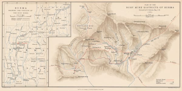
Royal Geographical Society (RGS), Plan of the Ruby Mine Districts of Myanmar (Burma), 1888£ 695.00
-
G. & J. Bartholomew, Orographical map of Malaysia, Laos, Cambodia, Thailand and Myanmar, 1890 c.£ 44.00
-
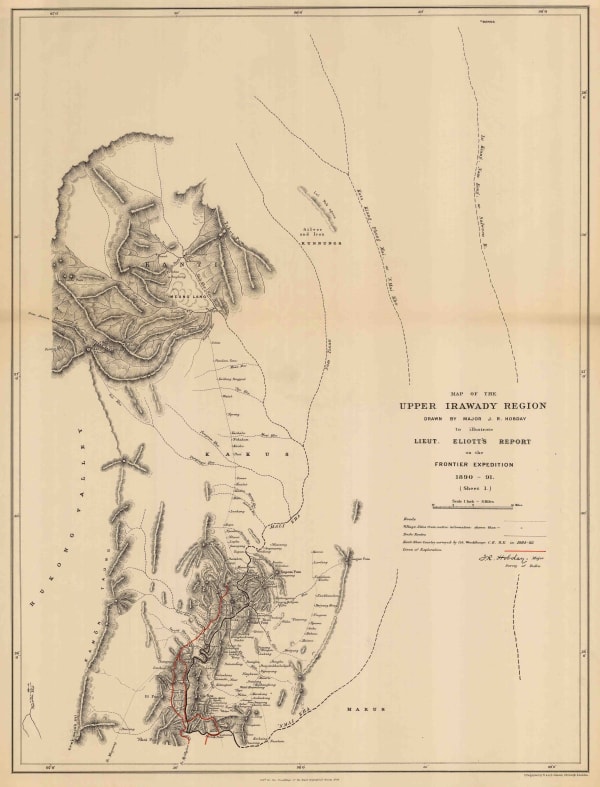
Royal Geographical Society (RGS), Map of the Upper Irawady Region, 1892£ 140.00
-
G. & J. Bartholomew, Lower Myanmar (Burma) and the Andaman and Nicobar Islands, 1893£ 38.00
-
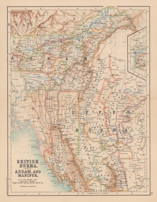
W. & A.K. Johnston, Myanmar (British Burma), Assam, and Manipur, 1894£ 115.00
-
Edward Stanford, Large scale map of Myanmar (Burma) , 1912£ 295.00
-
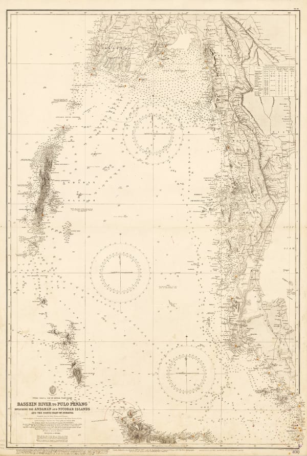
British Admiralty, Bassein River to Pulo Penang, 1932£ 1,550.00
-
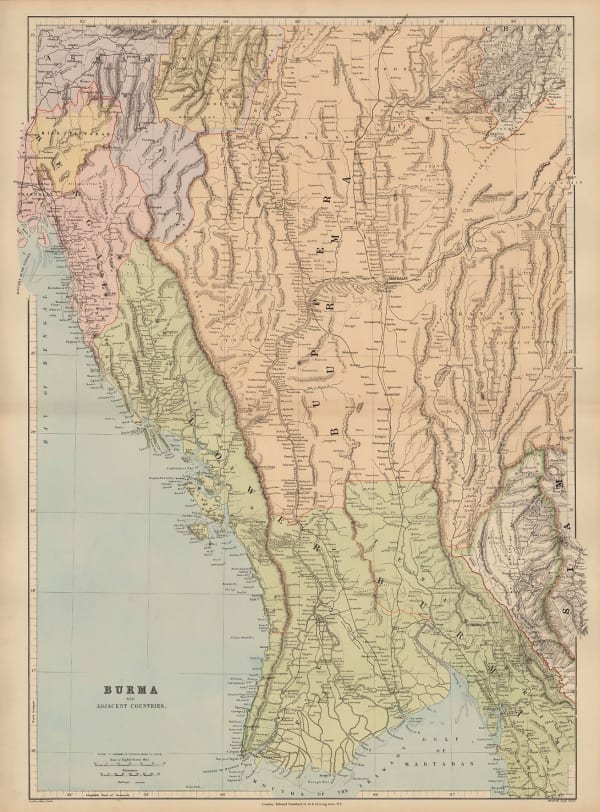
War Office, Myanmar (Burma) and western Thailand, 1944£ 450.00
Close
Search Inventory
Our entire inventory of over 10,000 antique and vintage maps is now available to browse by region, date, cartographer, and subject


Join our mailing list
* denotes required fields
We will process the personal data you have supplied to communicate with you in accordance with our Privacy Policy. You can unsubscribe or change your preferences at any time by clicking the link in our emails.
![]()
Join our mailing list
* denotes required fields
We will process the personal data you have supplied to communicate with you in accordance with our Privacy Policy. You can unsubscribe or change your preferences at any time by clicking the link in our emails.