-
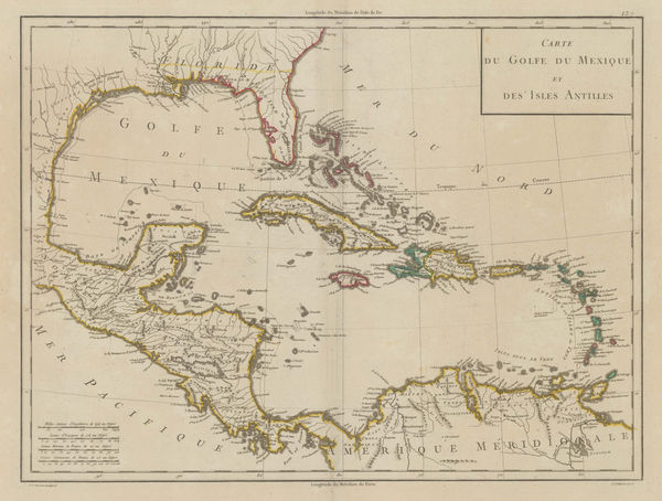
 Louis Brion de la Tour, West Indies or Caribbean, 1782£ 1,350.00
 -
William Faden, The Coast of Guyana from the Oroonoko to the River of Amazons, 1783£ 825.00
-
William Faden, Leeward and Windward Islands, 1784£ 3,650.00
-
Jacques-Nicolas Bellin, Chart of Turks and Caicos, 1787£ 1,275.00
-
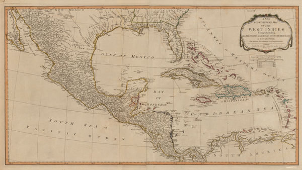
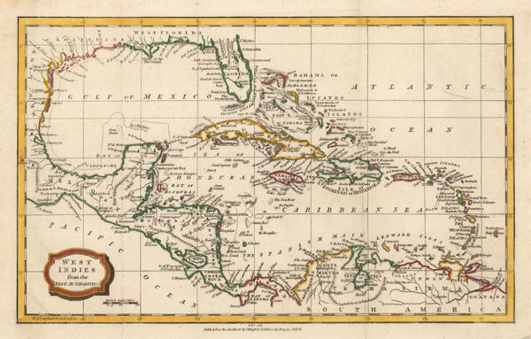
Laurie & Whittle, Central America and the West Indies, 1794£ 985.00
-
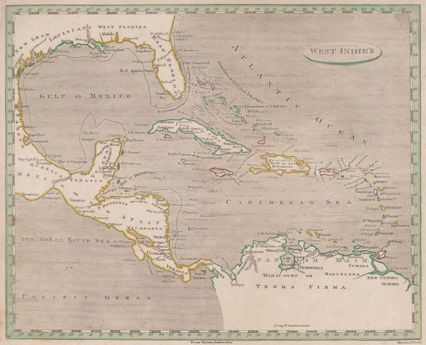
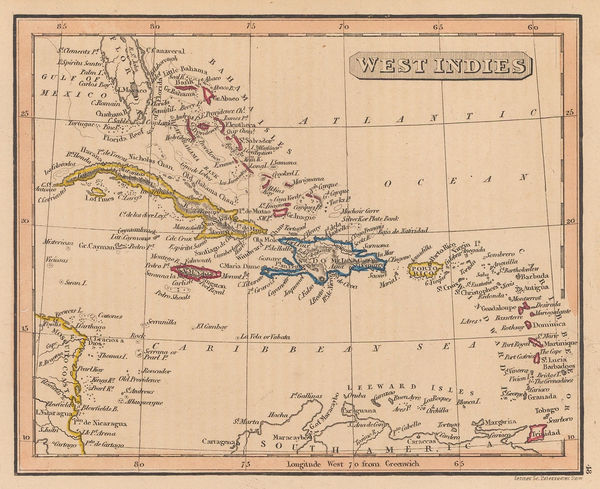
Robert Wilkinson, The West Indies, 1794£ 195.00
-
Bryan Edwards, Dominica, 1794£ 225.00
-
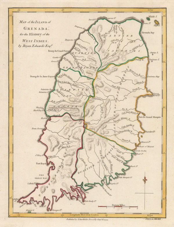
Bryan Edwards, Grenada divided into quartiers, 1794£ 195.00
-
Bryan Edwards, Map of the Island of St. Vincent, 1794£ 225.00
-
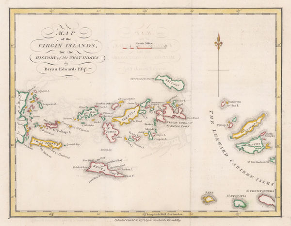
Bryan Edwards, Map of the Virgin Islands for The History of the West Indies, 1794£ 895.00
-
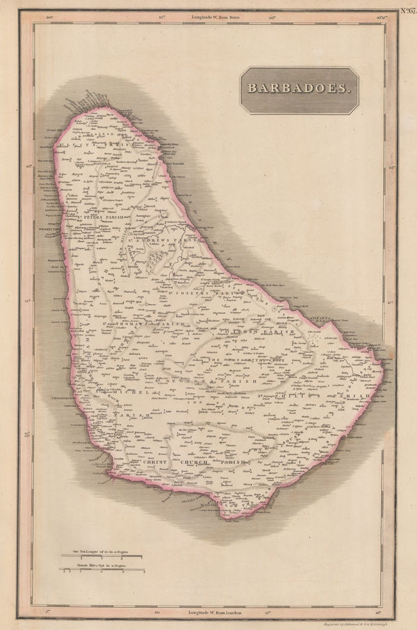
Bryan Edwards, Barbados, 1794£ 465.00
-
William Heather, Caribbean Islands from the Virgin Islands to Trinidad and Tobago, 1795£ 1,950.00
-
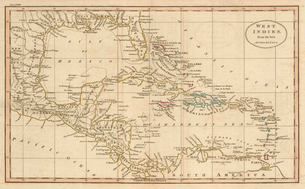
Franz Ludwig Gussefeld, The West Indies, 1795£ 1,175.00
-
Antonio Zatta, Greater and Lesser Antilles, 1795£ 875.00
-
William Faden, Chart of the West Indies, 1796£ 2,950.00
-
John Reid, The West Indies or Caribbean, 1796£ 495.00
-
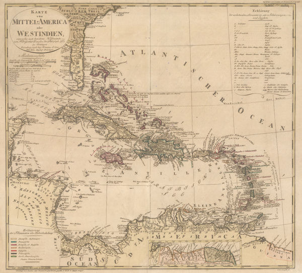
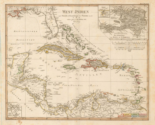
Homann Heirs, West Indies and Florida, 1796£ 1,350.00
-
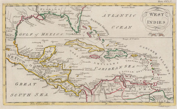
Andrew Bell, West Indies, 1797£ 195.00
-
John Stockdale, The West Indies or Caribbean, 1799£ 225.00
-
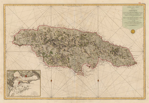
Depot de la Marine, Jamaica, 1799£ 725.00
-
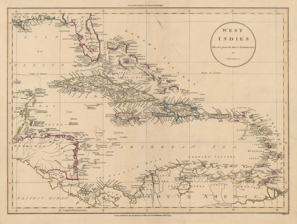
John Russell, West Indies, 1799£ 395.00
-
Pierre Tardieu, The West Indies and Central America, 1800£ 525.00
-
Laurie & Whittle, Plan of the Isle of Trinidad, 1800£ 2,850.00
-
-
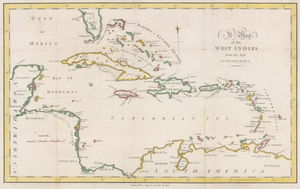
William Guthrie, The West Indies or Caribbean, 1801£ 145.00
-
Depot de la Marine, San Juan, Puerto Rico, 1802£ 2,450.00
-
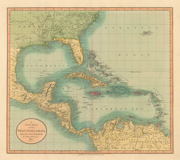
John Cary, West Indies and Southern United States, 1803£ 645.00
-
-
Joyce Gold, Miniature map of Martinique, 1805£ 48.00
-
Morse and Andrews, West Indies, 1805£ 185.00
-
John Russell, West Indies, 1805 c.£ 125.00
-
C. & E. Brightly, West Indies, 1807£ 195.00
-
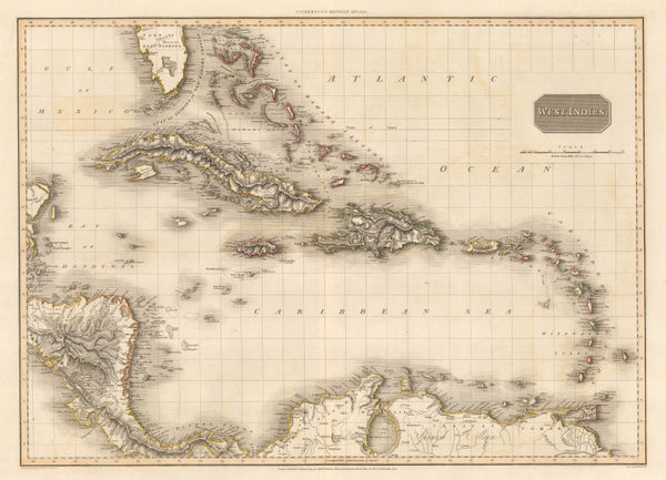
John Pinkerton, West Indies, 1809£ 795.00
-
George Cooke, The West Indies, 1810 c.£ 185.00
-
Rev'd. James Barclay, The West Indies, 1811£ 125.00
-
-
John Thomson, West Indies, 18120 c.£ 425.00
-
John Thomson, St. Vincent, 1814 c.£ 325.00
-
John Thomson, Jamaica, 1814 c.£ 425.00
-
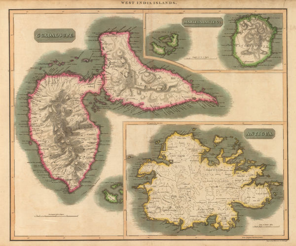
John Thomson, Guadeloupe, Antigua & Marie-Galante, 1815 c.£ 225.00
-
British Admiralty, A Survey of the Island of Trinidad, 1816£ 1,450.00
-
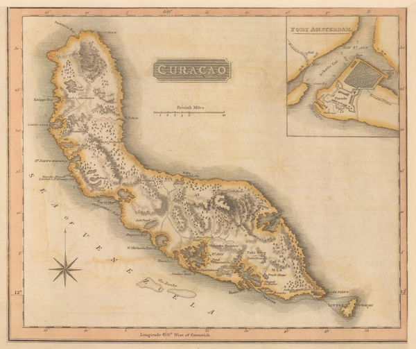
John Thomson, Curacao, 1816£ 295.00
-
John Thomson, Tobago, 1816£ 165.00
-
John Thomson, Grenada, 1816 c.£ 195.00
-
John Thomson, Island of Cuba, 1816 c.£ 345.00
-
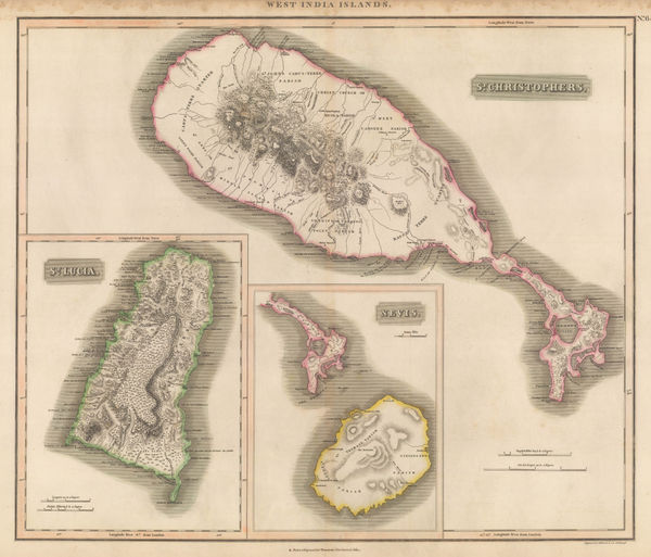
John Thomson, St. Lucia, St. Kitts, and Nevis, 1817£ 395.00
-
Adolf Stieler, The West Indies, 1818£ 295.00
-
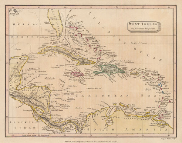
Thomas Myers, West Indies: On Mercator's Projection, 1820£ 92.00
-
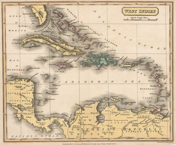
Richard Phillips, West Indies, 1820£ 95.00
-
John Thomson, Barbados with plantations and sugar mills, 1820 (c.)£ 425.00
-
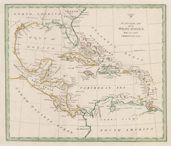
William Darton, The West Indies, 1820 c.£ 150.00
-
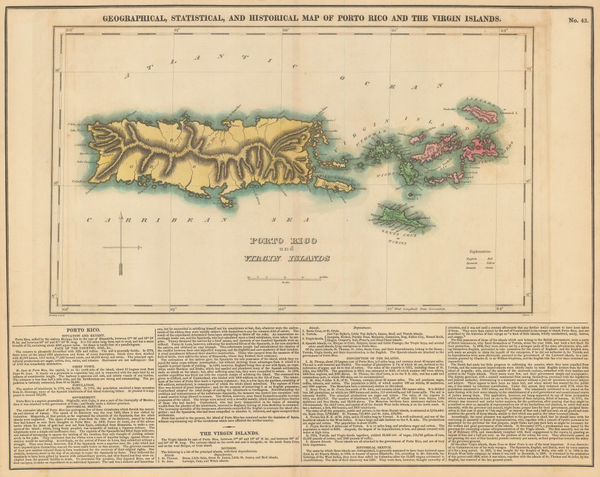
Geographical, Statistical and Historical map of Porto Rico and the Virgin Islands, 1822Carey & LeaSeries: PhiladelphiaCarey & Lea, Geographical, Statistical and Historical map of Porto Rico and the Virgin Islands, 1822£ 2,450.00
-
Geographical, Statistical and Historical map of The Windward Islands, 1822Carey & LeaSeries: PhiladelphiaCarey & Lea, Geographical, Statistical and Historical map of The Windward Islands, 1822£ 985.00
-
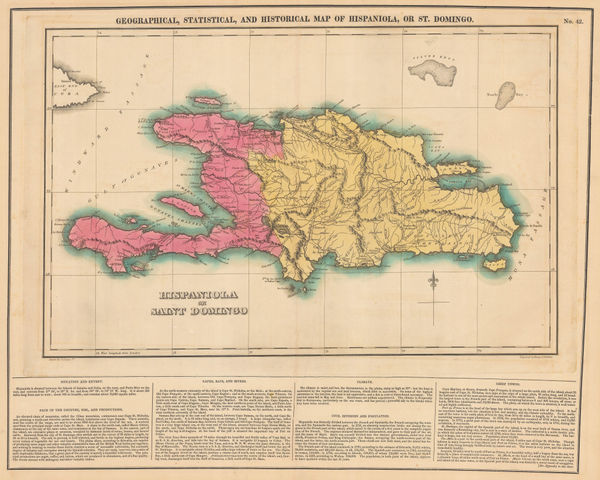
Geographical, Statistical and Historical map of Haiti & the Dominican Republic, 1822Carey & LeaSeries: PhiladelphiaCarey & Lea, Geographical, Statistical and Historical map of Haiti & the Dominican Republic, 1822£ 585.00
-
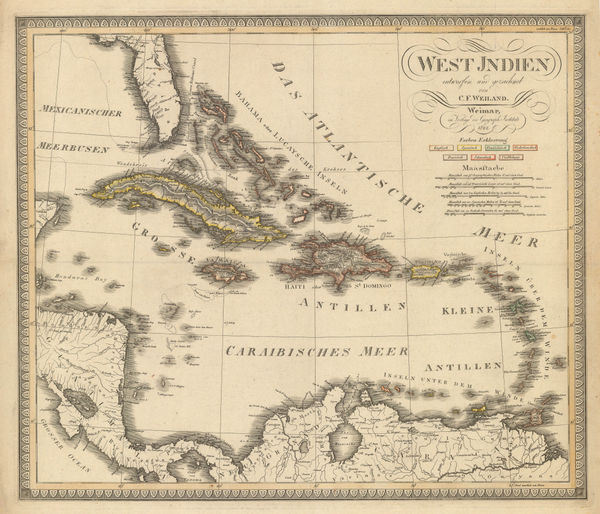
Carl Weiland, West Indies, 1822£ 885.00
-
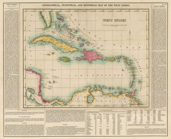
Carey & Lea, Geographical, Statistical, and Historical map of the West Indies, 1823£ 550.00
-
Fielding Lucas Jr, Barbados, 1823£ 275.00
-
Adrien Brue, West Indies and Central America, 1825£ 295.00
-
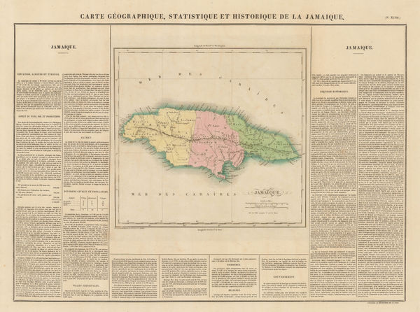
Jean Buchon, Geographical, Statistical and Historical map of Jamaica, 1825£ 275.00
-
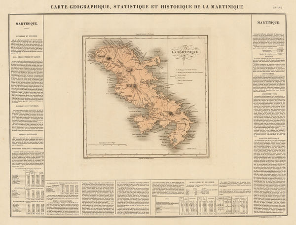
Jean Buchon, Geographical, Statistical and Historical map of Martinique, 1825£ 150.00
-
Jean Buchon, Geographical, Statistical, and Historical map of the West Indies, 1825£ 325.00
-
Philippe Vandermaelen, Haiti & the Dominican Republic, 1827£ 450.00
-
Philippe Vandermaelen, The Lesser Antilles, 1827£ 350.00
-
John Thomson, Haiti & the Dominican Republic, 1828£ 215.00
-
John Thomson, Martinique and Dominica, 1828£ 195.00
-
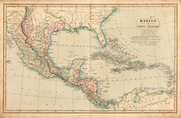
Charles Smith, Mexico and West Indies, 1828£ 345.00
-
John Thomson, Porto Rico and Virgin Islands & Haiti, Hispaniola or St.Domingo, 1828£ 345.00
-
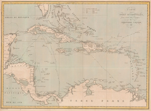
Pierre Tardieu, The Voyages of Christopher Columbus, 1828£ 950.00
-
Thomas Starling, West Indies, 1830£ 85.00
-
John Arrowsmith, West Indies, 1832£ 675.00
-
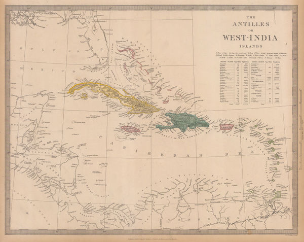
Society for the Diffusion of Useful Knowledge (SDUK), The West Indies, 1835£ 160.00
-
Rest Fenner, West Indies, 1836£ 78.00
-
W. & A.K. Johnston, West Indies, 1840 c.£ 395.00
-
John Dower, West Indies, 1840 c.£ 72.00
-
James Wyld, The West Indies, 1841£ 1,375.00
-
Carl Christian Franz Radefeld, West Indies, 1841£ 45.00
-
John Arrowsmith, Windward Isles, 1842£ 495.00
-
John Arrowsmith, West Indies, 1842£ 60.00
-
French Admiralty, Chart of the Gulf of Mexico, 1843£ 885.00
-
Joseph Meyer, West Indies and Central America, 1843£ 165.00


Page
3
of 4