-
 Royal Geographical Society (RGS), Himalayas, 1884£ 485.00
 -
Letts & Son, Delhi, Agra & Jaipur, 1889£ 85.00
-
J.G. Bartholomew, Southern India, 1890 c.£ 38.00
-
General Map of Pamir and Surrounding Countries, 1892Scottish Geographical Society (SGS)Series: EdinburghScottish Geographical Society (SGS), General Map of Pamir and Surrounding Countries, 1892£ 325.00
-
Letts & Son, India, 1892£ 82.00
-
Letts & Son, Eastern Gujarat , 1892£ 68.00
-
Letts & Son, Telangana and Odisha states, 1892£ 72.00
-
George Philip, India (South Sheet), 1893£ 65.00
-
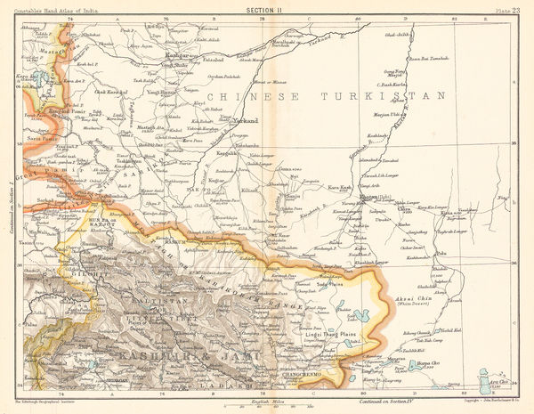
J.G. Bartholomew, Kashmir, the Himalayas, and Western China, 1893£ 44.00
-
J.G. Bartholomew, Uttar Pradesh, Bihar and Jharkhand, 1893£ 38.00
-
J.G. Bartholomew, Section X. Bombay, Berar, 1893£ 48.00
-
J.G. Bartholomew, Odisha and Chhattisgarh, 1893£ 38.00
-
J.G. Bartholomew, Maharasthtra, Goa, Telagana, Karnataka and Andhra Pradesh, 1893£ 38.00
-
Rajastan, Madhya Pradesh, Uttar Pradesh and Jharkhand, 1894W. & A.K. JohnstonSeries: Edinburgh & LondonW. & A.K. Johnston, Rajastan, Madhya Pradesh, Uttar Pradesh and Jharkhand, 1894£ 92.00
-
Survey of India, North Western Provinces and Oudh Survey, 1898£ 495.00
-
George Philip, Map of the Eastern Indian Railway, 1900 c.£ 385.00
-
Emil Reich, Campaigns in India, 1903£ 55.00
-
Emil Reich, Anglo-Mysore Wars, 1903£ 58.00
-
Emil Reich, Campaigns in India 1802-1852, 1903£ 62.00
-
The Territories of the Maharaja of Jummoo and Kashmir, 1905 (c.)Thacker, Spink & Co.Series: CalcuttaThacker, Spink & Co., The Territories of the Maharaja of Jummoo and Kashmir, 1905 (c.)£ 375.00
-
Cutch and the Ran showing the Mount of the Indus, 1907Royal Geographical Society (RGS)Series: LondonRoyal Geographical Society (RGS), Cutch and the Ran showing the Mount of the Indus, 1907£ 295.00
-
Royal Geographical Society (RGS), Nanda Devi National Park, Himalayas, 1908£ 295.00
-
J.G. Bartholomew, Bangladesh (East Bengal), Assam and Bhutan , 1909£ 88.00
-
J.G. Bartholomew, Rajasthan (Rajputana with Ajmer-Merwara), 1909£ 85.00
-
J.G. Bartholomew, Southern India - Andhra Pradesh., 1909£ 65.00
-
J.G. Bartholomew, Central India, 1909£ 65.00
-
J.G. Bartholomew, West Bengal and Sikkim, 1909£ 75.00
-
Uttar Pradesh and Uttarakhand (The United Provinces of Agra and Oudh), 1909J.G. BartholomewSeries: EdinburghJ.G. Bartholomew, Uttar Pradesh and Uttarakhand (The United Provinces of Agra and Oudh), 1909£ 68.00
-
John Bartholomew & Co., Railways of Northeast India & Bengal, 1909£ 125.00
-
John Bartholomew & Co., Railways of South India & Sri Lanka, 1909£ 95.00
-
John Bartholomew & Co., Northwest Pakistan & Kashmir, 1909£ 78.00
-
John Bartholomew & Co., Gujarat & Sindh , 1909£ 68.00
-
John Bartholomew & Co., Western India & Maharashtra, 1909£ 74.00
-
John Bartholomew & Co., Environs of Bombay (Mumbai), 1909£ 95.00
-
D.G. Hatchell, Kurnool District map for the use of Touring Officers, 1912£ 495.00
-
D.G. Hatchell, Malabar District Map for the use of Touring Officers, 1916£ 495.00
-
Survey of India, India and Adjacent Countries - Baroda, 1917£ 795.00
-
Alexander Gross, North West India, Pakistan & Afghanistan, 1920 c£ 425.00
-
Map Showing the Position of the Rubber Estates in South India and Ceylon, 1920 c.The Financial TimesSeries: LondonThe Financial Times, Map Showing the Position of the Rubber Estates in South India and Ceylon, 1920 c.£ 495.00
-
Madras Survey, Map of the Madras Presidency Showing the Roads & Distances, 1926£ 950.00
-
Survey of India, Lahore and environs, 1931£ 585.00
-
Survey of India, Sikkim, 1941£ 425.00
-
T.S. Duraiswami Ayyar, Map of the Madras Presidency, 1943£ 495.00
-
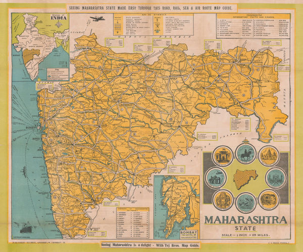
Tej Bros, Maharashtra State, 1960 c.£ 395.00
-
Anonymous, Hindi Map of Rajasthan, 1970 c.£ 295.00
-
Survey of India, Uttar Pradesh, India, 1975£ 325.00


Page
2
of 2