-
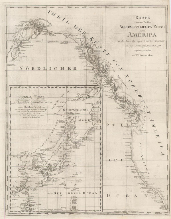
 Daniel Friedrich Sotzmann, North West Pacific coast of America, 1800£ 795.00
 -
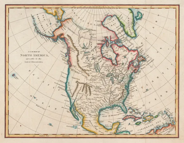
Thomas Kelly, North America, 1802£ 185.00
-
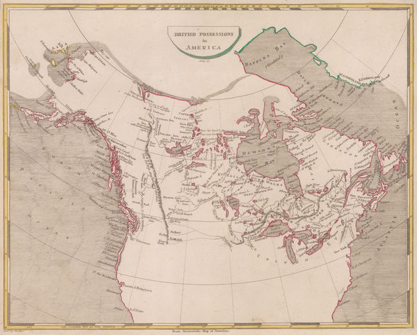
Thomas and Andrews, British Possessions in America, 1805£ 295.00
-
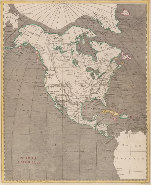
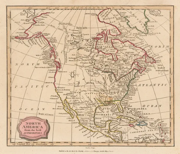
Morse and Andrews, North America, 1805£ 125.00
-
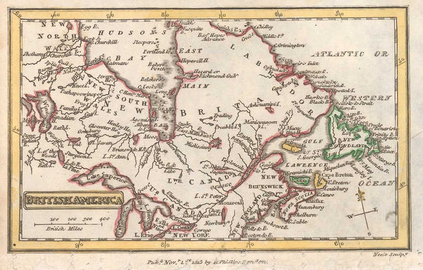
John Russell, British Colonies in North America, 1805 c.£ 115.00
-
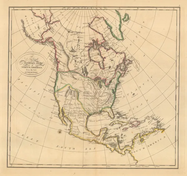
Eustache Herisson, North America, 1806£ 1,150.00
-
C. & E. Brightly, North America, 1806£ 145.00
-
John Cary, A New Map of Nova Scotia, Newfoundland &c., 1807£ 275.00
-
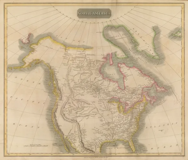
Aaron Arrowsmith, British Possessions in North America, 1809£ 345.00
-
Aaron Arrowsmith, North America, 1809£ 345.00
-
Neele, Map of Canada, 1809£ 485.00
-
Tardieu, North-eastern United States, 1810 c.£ 495.00
-
Tardieu, Coast of British Columbia & Graham Island, 1810 c.£ 425.00
-
Rev'd. James Barclay, North America during the Napoleonic Wars, 1811£ 115.00
-
John Pinkerton, Southwestern Unites States, 1811£ 3,500.00
-
John Pinkerton, Central America, 1811£ 650.00
-
William Guthrie, North America at the height of the Napoleonic Wars, 1812£ 115.00
-
Richard Phillips, Eastern Canada, 1813£ 58.00
-
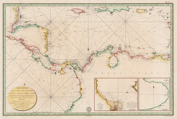
Depot de la Marine, Central America and Northern South America, 1813£ 775.00
-
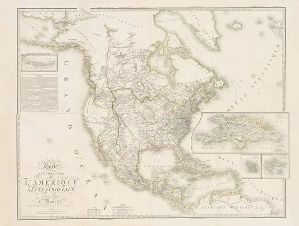
John Thomson, North America, 1814£ 985.00
-
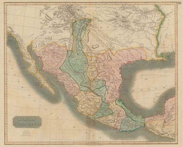
John Thomson, Texas, New Mexico, Arizona and Mexico, 1814£ 2,250.00
-
Adrien Brue, North America, 1815£ 825.00
-
-
John Thomson, Central America, 1816£ 495.00
-
John Thomson, Canada and Nova Scotia, 1816£ 985.00
-
Matthew Carey, North America, 1818£ 625.00
-
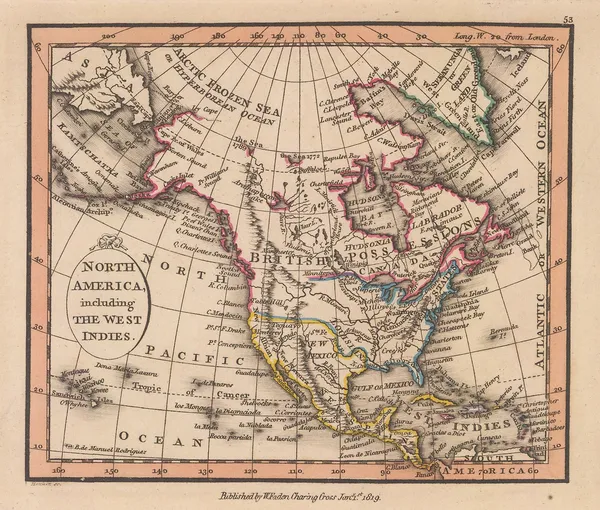
William Faden, North America including the West Indies, 1819£ 385.00
-
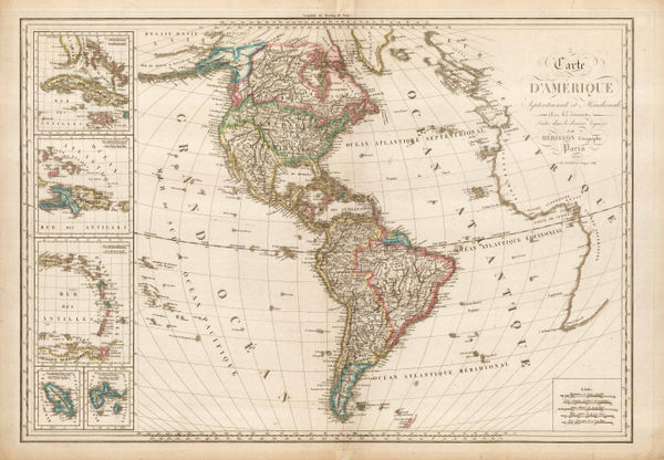
Eustache Herisson, Carte D'Amerique Septentrionale et Meridionale, 1820£ 595.00
-
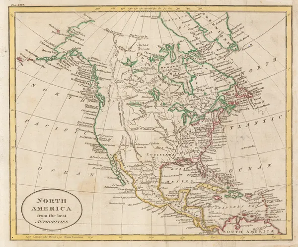
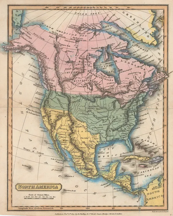
Richard Phillips, North America, 1820£ 145.00
-
John Thomson, Atlantic Ocean with the suspected course of the Gulf Stream, 1820 c.£ 525.00
-
Thomas Myers, Alexander Mackenzie's journeys to the Arctic and Pacific coasts, 1821£ 145.00
-
Geographical, Statistical and Historical map of Upper and Lower Canada, 1822Carey & LeaSeries: PhiladelphiaCarey & Lea, Geographical, Statistical and Historical map of Upper and Lower Canada, 1822£ 925.00
-
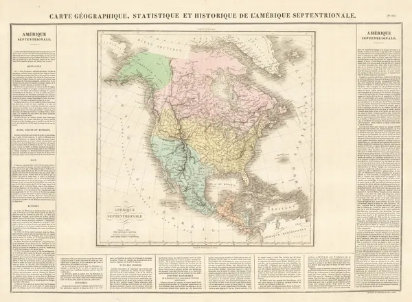
Jean Buchon, Geographical, Statistical, and Historical map of North America, 1825£ 250.00
-
Alexandre Blondeau, North America, 1825 c.£ 75.00
-
Philippe Vandermaelen, Mexico - Chihuahua, Coahuila, Nuevo Leon & Sinaloa, 1827£ 650.00
-
Philippe Vandermaelen, Central Baja, Sonora & Sinaloa, 1827£ 395.00
-
Philippe Vandermaelen, Southern California, Baja, Sonora & Arizona, 1827£ 750.00
-
Philippe Vandermaelen, Cabo San Lucas, Baja Peninsula, 1827£ 225.00
-
Philippe Vandermaelen, Coast of Mexico and Guatemala, 1827£ 350.00
-
Philippe Vandermaelen, Coronation Gulf and Bathurst Inlet, Nunavut, 1827£ 350.00
-
Philippe Vandermaelen, Hudson Strait and Baffin Island, 1827£ 250.00
-
Philippe Vandermaelen, British Columbia north of Port Essington, 1827£ 95.00
-
Philippe Vandermaelen, Ontario between Lake Superior and James Bay, 1827£ 220.00
-
Northern Alberta and Saskatchewan south of Lake Athabasca, 1827Philippe VandermaelenSeries: BrusselsPhilippe Vandermaelen, Northern Alberta and Saskatchewan south of Lake Athabasca, 1827£ 195.00
-
Philippe Vandermaelen, Hudson Bay coast, Manitoba, 1827£ 295.00
-
Philippe Vandermaelen, Hudson Bay and entrance to James Bay, 1827£ 95.00
-
Philippe Vandermaelen, Lakes Winnipeg and Winnipegosis, Manitoba, 1827£ 350.00
-
Philippe Vandermaelen, Nunavut west of Chesterfield Inlet, 1827£ 90.00
-
Early map of Vancouver Island and southern British Columbia, 1827Philippe VandermaelenSeries: BrusselsPhilippe Vandermaelen, Early map of Vancouver Island and southern British Columbia, 1827£ 1,650.00
-
Philippe Vandermaelen, Gulf of St. Lawrence, 1827£ 150.00
-
Philippe Vandermaelen, Mexico - Veracruz, Puebla & Tamaulipas, 1827£ 825.00
-
Philippe Vandermaelen, Costa Rica & Nicaragua, 1827£ 445.00
-
Eustache Herisson, North America, 1830 c.£ 85.00
-
Thomas Starling, Miniature map of Canada, 1830 c.£ 88.00
-
Thomas Starling, Canada, 1830 c.£ 48.00
-
Sidney Hall, Canada, New Brunswick and Nova Scotia, 1830 c.£ 525.00
-
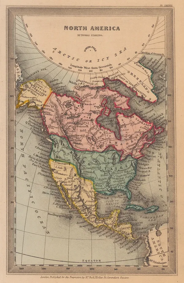
Thomas Starling, North America, 1830 c.£ 195.00
-
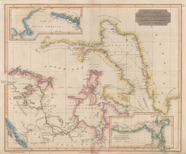
John Thomson, Discoveries of Ross, Parry & Franklin in the Arctic , 1830 c.£ 2,950.00
-
Lt. Col. Joseph Bouchette, City of Montreal, 1832£ 195.00
-
Nova-Scotia with Part of New Brunswick and East Canada, 1832Society for the Diffusion of Useful Knowledge (SDUK)Series: EdinburghSociety for the Diffusion of Useful Knowledge (SDUK), Nova-Scotia with Part of New Brunswick and East Canada, 1832£ 125.00
-
Lt. Col. Joseph Bouchette, Plan of the Town of Goderich, Upper Canada, 1832£ 125.00
-
Lt. Col. Joseph Bouchette, Plan of the Town of Guelf, Upper Canada, 1832£ 125.00
-
Lt. Col. Joseph Bouchette, City plan of Ottawa, Ontario, 1832£ 325.00
-
North America Sheet IV - Lake Superior, 1832Society for the Diffusion of Useful Knowledge (SDUK)Series: LondonSociety for the Diffusion of Useful Knowledge (SDUK), North America Sheet IV - Lake Superior, 1832£ 98.00
-
Royal Geographical Society (RGS), Captain Black's proposed route through Canada, 1833£ 145.00
-
Charles Smith, New Brunswick, Nova Scotia, &c., 1834£ 165.00
-
Charles Smith, Upper and Lower Canada, 1834£ 225.00
-
Thomas Bradford, Upper & Lower Canada, 1835£ 55.00
-
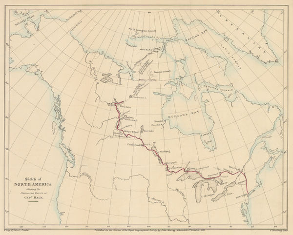
Map of the Discoveries and Route of the Arctic Land Expedition, 1836Royal Geographical Society (RGS)Series: LondonRoyal Geographical Society (RGS), Map of the Discoveries and Route of the Arctic Land Expedition, 1836£ 425.00
-
Hansard, Montreal Island, 1837£ 525.00
-
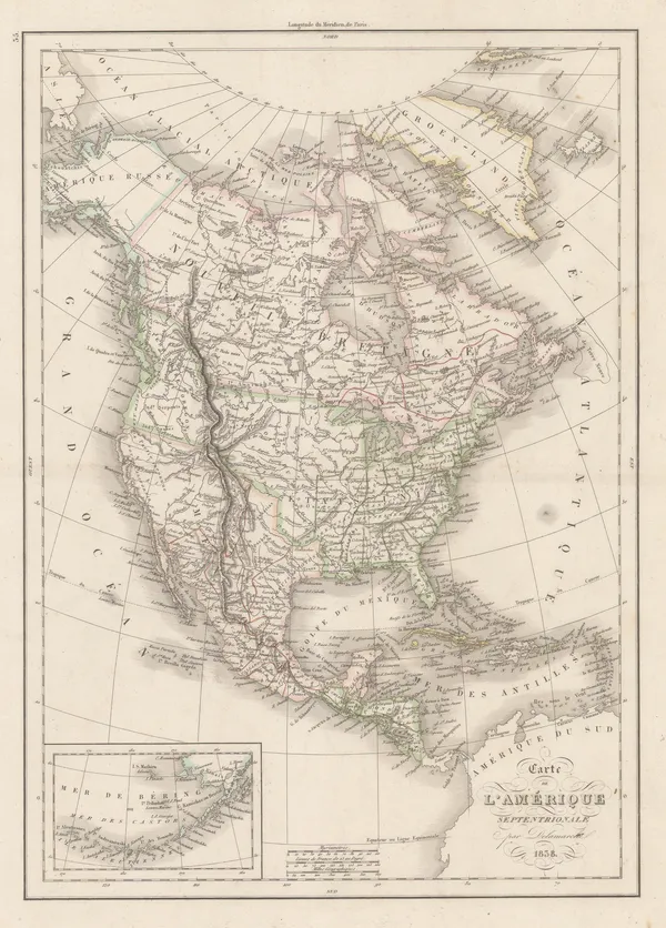
Felix Delamarche, North America, 1838£ 120.00
-
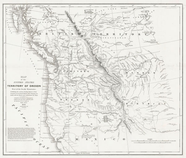
Washington Hood, Territory of Oregon West of the Rocky Mountains, 1838£ 2,450.00
-
James Wyld, Province of Quebec, 1840£ 775.00
-
James Wyld, Mexico and Central America showing the Position of the Mines, 1840£ 675.00
-
James Wyld, A Map of the Province of Upper Canada, 1840 c.£ 925.00
-
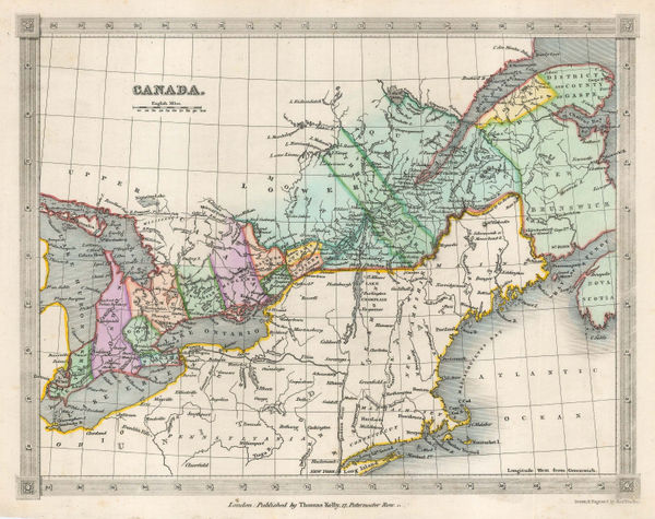
Thomas Kelly, Canada, 1840 c.£ 85.00
-
Royal Geographical Society (RGS), Central America, 1841£ 385.00
-
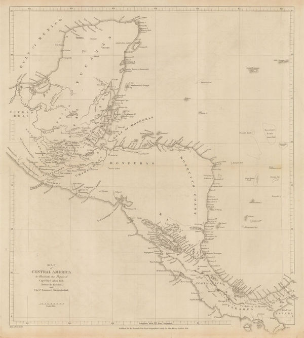
Thomas Kelly, Mexico & Central America, 1842£ 150.00
-
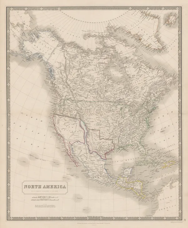
W. & A.K. Johnston, North America, 1843£ 925.00
-
Joseph Meyer, Quebec Province, 1844£ 88.00


Page
3
of 6