-
 James White, Northern Quebec, Labrador, and Hudson Bay, 1908£ 295.00
 -
James White, Wheat growing areas of Canada, 1908£ 325.00
-
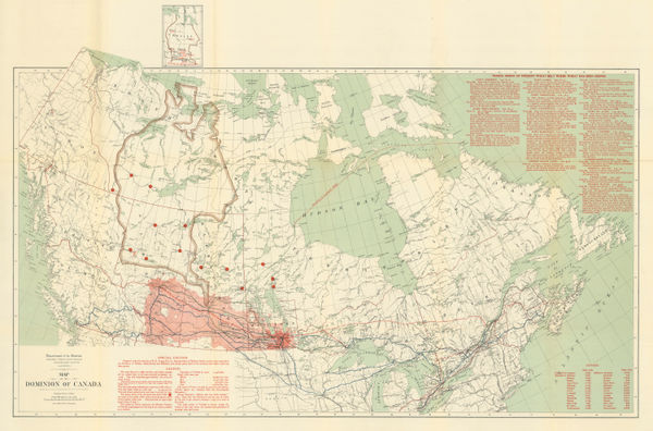
Royal Geographical Society (RGS), Mackenzie Delta, Northwest Territories, 1908£ 425.00
-
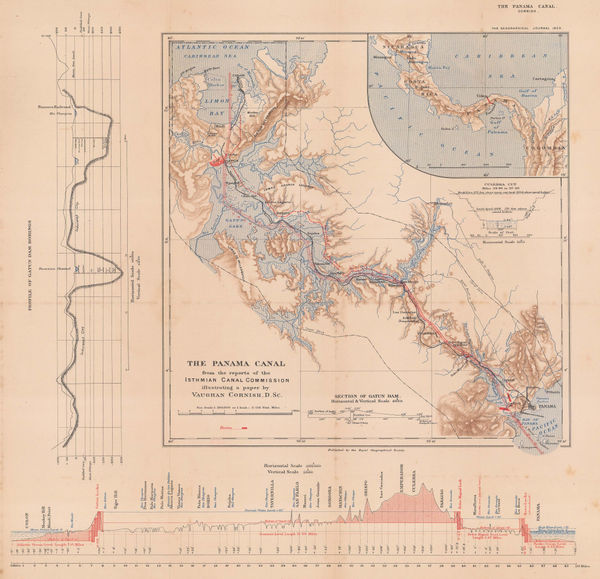
Royal Geographical Society (RGS), The Panama Canal, 1909£ 295.00
-
Karl Baedeker, Niagara Falls, 1909£ 55.00
-
Karl Baedeker, Mexico City, 1909£ 68.00
-
Karl Baedeker, [British Columbia and Vancouver Island], 1909£ 68.00
-
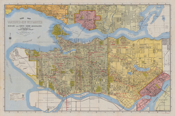
R.C. McPhillips, Map of the City of Winnipeg, 1910£ 895.00
-
Enciclopedia Segui, Costa Rica, 1910 c.£ 68.00
-
George Griffith Aitken, British Columbia, 1912£ 3,250.00
-
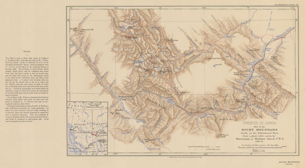
Canadian Rocky Mountains North of the Yellowhead Pass, 1912Royal Geographical Society (RGS)Series: LondonRoyal Geographical Society (RGS), Canadian Rocky Mountains North of the Yellowhead Pass, 1912£ 235.00
-
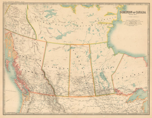
W. & A.K. Johnston, Western Canada, 1912£ 125.00
-
Walter Boldero Paton, Map of the Province of Ontario Canada, 1912£ 68.00
-
-
T.N. Hibben & Co., Vancouver Island and southern British Columbia, 1912£ 885.00
-
Vasco Nunez de Balboa's Discovery of the Pacific Ocean, 1913Royal Geographical Society (RGS)Series: LondonRoyal Geographical Society (RGS), Vasco Nunez de Balboa's Discovery of the Pacific Ocean, 1913£ 78.00
-
Edward Stanford, Railway Map of the US & Canada, 1913£ 1,450.00
-
Panama Canal to illustrate a paper by Vaughan Cornish, 1914Royal Geographical Society (RGS)Series: LondonRoyal Geographical Society (RGS), Panama Canal to illustrate a paper by Vaughan Cornish, 1914£ 345.00
-
George Philip & Son Ltd., Chart of the Panama Canal, 1914 c.£ 495.00
-
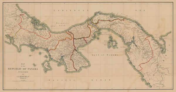
I.L. Maduro Jr., Map of the Republic of Panama, 1915 c.£ 775.00
-
Canadian Pacific Railway, Railway map of the Canadian Rocky Mountains, 1920 c£ 485.00
-
John Bartholomew & Son, British Columbia, 1922£ 95.00
-
John Bartholomew & Son, Alberta & Saskatchewan, 1922£ 95.00
-
John Bartholomew & Son, Manitoba & Northwest Ontario, 1922£ 95.00
-
John Bartholomew & Son, Western Canada, 1922£ 95.00
-
J.G. Bartholomew, Ontario & Quebec, 1922£ 95.00
-
John Bartholomew & Son, Mexico & Central America, 1922£ 125.00
-
John Bartholomew & Son, Dominion of Canada - Political, 1922£ 95.00
-
John Bartholomew & Son, North-Eastern Canada, 1922£ 95.00
-
J.G. Bartholomew, Maritime Provinces and Newfoundland, 1922£ 95.00
-
William Collins, Arctic Coast of Canada, 1923£ 595.00
-
Rand, McNally & Co., Plan of Mexico City, 1924£ 975.00
-
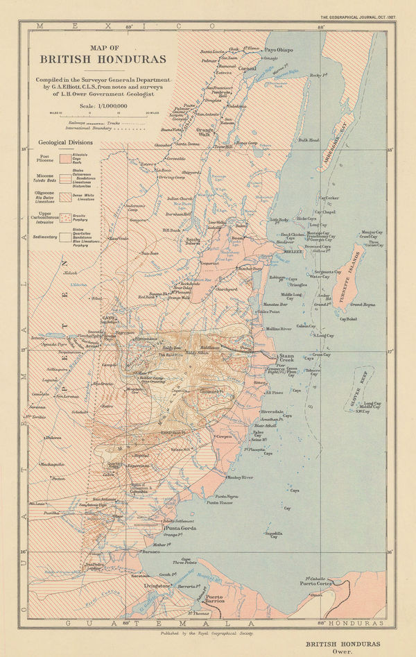
Royal Geographical Society (RGS), Belize (British Honduras), 1927£ 225.00
-
Terry's Guide, Plan of Mazatlán, 1934£ 46.00
-
Terry's Guide, Plan of Victoria de Durango, 1935£ 42.00
-
Terry's Guide, Plan of Guadalajara, 1935£ 48.00
-
Terry's Guide, Plan of Zacatecas, 1935£ 38.00
-
Grant & Sons, City of Vancouver, 1935£ 675.00
-
Ernest Dudley Chase, A Pictorial Map of North America, 1945£ 1,800.00
-
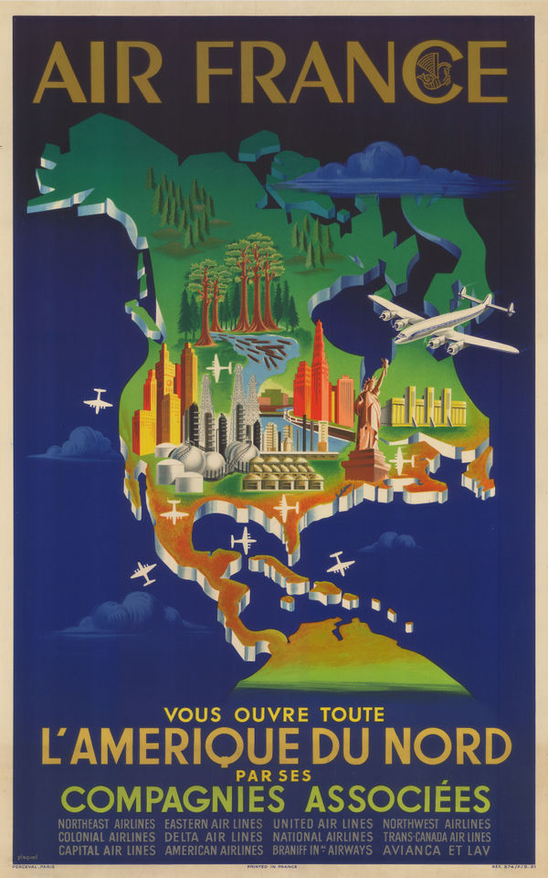
Air France, Air France Postcard - 'Amerique du Nord', 1946 c.Reserved
-
Arthur Oligny, City of Montreal, 1947£ 295.00
-
Anonymous, Vancouver, 1950 c.£ 125.00
-
Air France, Air France - L'Amerique du Nord, 1951£ 3,500.00
-
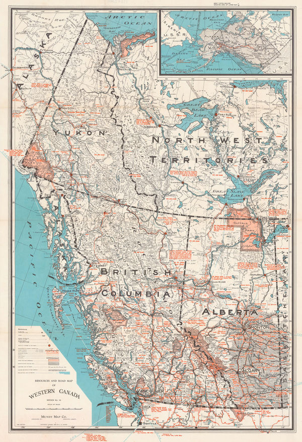
Mundy Map Co., Resources and Road Map of Western Canada, 1957£ 485.00
-
General Drafting Co., Vintage motoring map of Costa Rica, 1965 (c.)£ 185.00
-
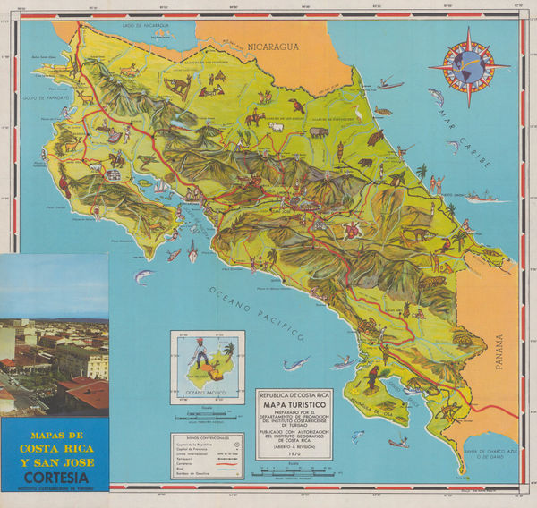
Jose Andres Masis, Vintage pictorial map of Costa Rica, 1970£ 275.00
-
Jack H. Moffett, Baja California Map and Log, 1974£ 150.00


![Karl Baedeker, [British Columbia and Vancouver Island], 1909](https://static-assets.artlogic.net/w_600,c_limit,f_auto,fl_lossy,q_auto/artlogicstorage/themaphouse/images/view/99a3db3157adb371c8d7608b0b8487ccj/themaphouse-karl-baedeker-british-columbia-and-vancouver-island-1909.jpg)


Page
6
of 6