-

-
Cornelis Wytfliet, American south west and Texas, 1597£ 1,675.00
-
-
Abraham Ortelius, La Florida, 1598£ 2,950.00
-
Cornelis Wytfliet, Pacific Northwest, the Kingdom of Anian, 1607£ 3,250.00
-
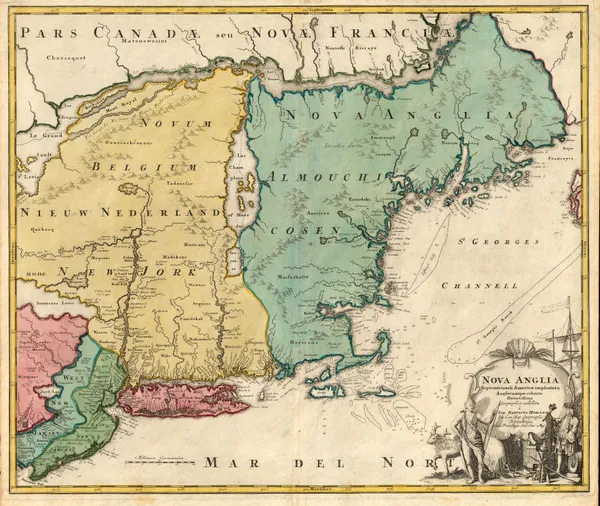
Petrus Bertius, Early miniature map of north eastern United States, 1616£ 445.00
-
Jodocus Hondius, Southeast coast of the United States, 1619£ 2,250.00
-
Mercator Hondius, North and South Carolina, Virginia and Georgia, 1621£ 925.00
-
Mercator Hondius, Chesapeake Bay, Virginia and Maryland,, 1630£ 925.00
-
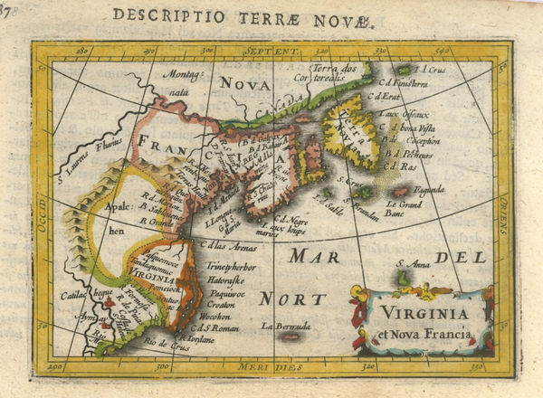
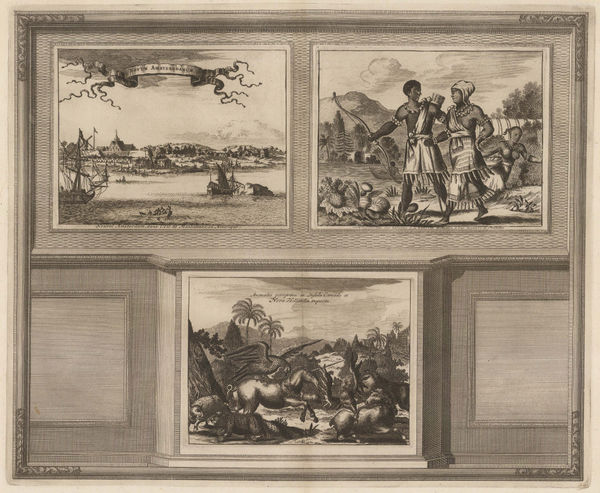
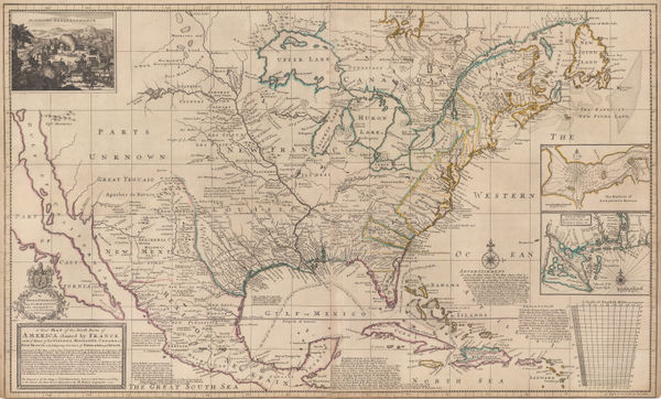
Johannes [Jan] de Laet, Florida and the Southeast, 1630£ 3,500.00
-
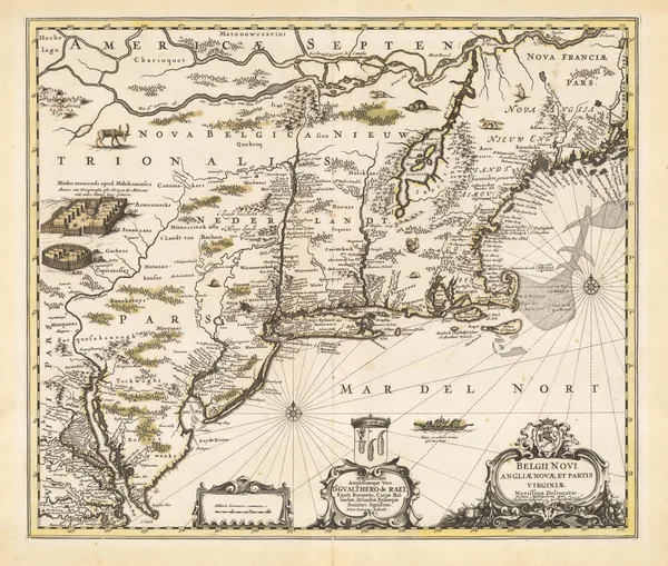
Willem & Jan Blaeu, Nova Virginiae Tabvla, 1635£ 4,950.00
-
Henricus Hondius, Nova Virginiae Tabula, 1636£ 4,500.00
-
Jan Blaeu, New England, 1650 c.£ 4,250.00
-
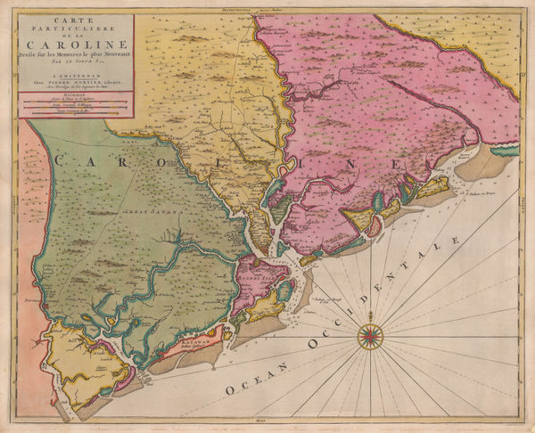
Willem & Jan Blaeu, Southern Virginia, North and South Carolina and Georgia, 1650 c.£ 1,950.00
-
Jan Jansson, South-eastern coast of USA , 1666£ 1,950.00
-
John Ogilby, Chesapeake Bay, Virginia and Maryland, 1670 c.£ 3,250.00
-
John Ogilby, New England, 1670 c.£ 2,850.00
-
John Ogilby, Georgia & the Carolinas, 1670 c.£ 1,750.00
-
Henri Justel, Important map of the East coast of the United States , 1674£ 1,950.00
-
-
John Speed, North and South Carolina, 1676£ 3,950.00
-
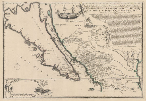
Nicolas Sanson, The First Map to focus on the Island of California, 1679£ 2,750.00
-
Alain Manesson Mallet, Miniature map of the Island of California, 1683£ 1,350.00
-
Alain Manesson Mallet, Floride, 1683£ 695.00
-
Alain Manesson Mallet, Virginie, 1683£ 345.00
-
-
-
Robert Morden, North and South Carolina, 1688£ 875.00
-
Robert Morden, New Jersey and Pennsylvania, 1688£ 885.00
-
Robert Morden, Rare map of the Chesapeake Bay, 1688£ 1,150.00
-
Robert Morden, California as an Island, 1688£ 1,650.00
-
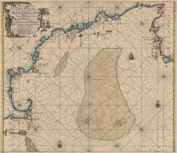
Johannes van Keulen, Early Dutch sea chart of the New England, 1690 c.£ 3,650.00
-
Johann Ulrich Muller, Virginia, 1692£ 525.00
-
Robert Morden, Rare miniature map of eastern North America, 1693£ 985.00
-
Pierre Duval, Florida, 1694£ 775.00
-
Valk & Schenk, New England, 1694 c.£ 4,750.00
-
Pierre Mortier, Uncommon map of North and South Carolina, 1700£ 3,200.00
-
-
Nicolas de Fer, Important map of California as an island, 1700£ 2,350.00
-
Nicolas & Guillaume Sanson, Spanish Florida, 1700£ 1,500.00
-
Heinrich Scherer, Baja California and Mexico, 1700 c.£ 985.00
-
Nicolas & Guillaume Sanson, Amerique Septentrionale, 1700 c.£ 1,150.00
-
Nicolas de Fer, Mississippi River, Florida and the Gulf of Mexico, 1705£ 2,650.00
-
Nicolas de Fer, Eastern Coast of North America, 1705£ 1,950.00
-
-
Pieter van der Aa, Southern USA from Virginia to Florida, 1707£ 895.00
-
-
Valk & Schenk, New England and Virginia, 1710 c.£ 2,300.00
-
-
Pieter van der Aa, Southern USA, Florida and the Gulf of Mexico, 1713£ 1,650.00
-
Pieter van der Aa, Florida and Mississippi, 1714£ 1,450.00
-
Pieter van der Aa, Virginia, North and South Carolina and northern Florida, 1714£ 1,950.00
-
Pieter van der Aa, Virginia and Chesapeake Bay, 1714£ 2,250.00
-
Johann Baptist Homann, Virginia, Maryland and Carolina, 1714 c.£ 3,250.00
-
-
-
-
Henri Chatelain, Carte Contenant le Royaume du Mexique et la Floride, 1719£ 1,650.00
-
-
Johann Georg Schreiber, Eastern United States and Louisiana, 1720 c.£ 565.00
-
Johann Baptist Homann, New England, 1720 c.£ 3,350.00
-
Southern United States, Mexico, Central America and the Caribbean, 1720 c.Johann Baptist HomannSeries: NurembergJohann Baptist Homann, Southern United States, Mexico, Central America and the Caribbean, 1720 c.£ 2,250.00
-
Herman Moll, The English Empire in America, Newfound-land, Canada, Hudson's Bay, 1723£ 945.00
-
Larger and rarer version of Kino's landmark map of California, 1726Eusebio Francisco KinoSeries: AugsburgEusebio Francisco Kino, Larger and rarer version of Kino's landmark map of California, 1726£ 3,750.00
-
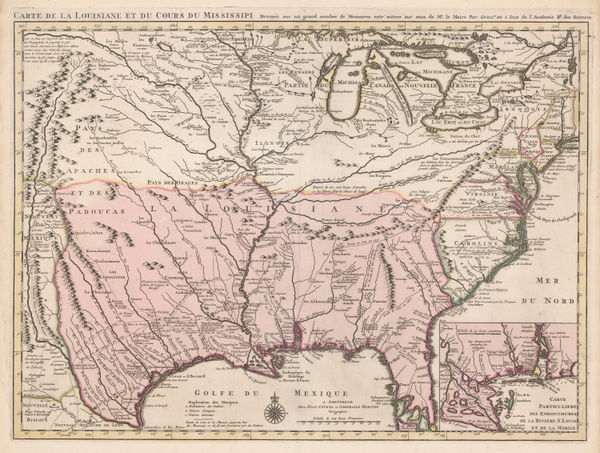
Covens (Jean) & Mortier (Cornelius), Louisiana and the Mississippi River, 1730 (c.)£ 3,450.00
-
-
Jacques Benard, Le Cours du Fleuve Missisipi, 1730 c.£ 2,750.00
-
Tabula Geographica Mexicae et Floridae &c., 1730 c.Covens (Jean) & Mortier (Cornelius)Series: AmsterdamCovens (Jean) & Mortier (Cornelius), Tabula Geographica Mexicae et Floridae &c., 1730 c.£ 2,750.00
-
-
Louisiana, Florida and the Gulf of Mexico, 1735 c.Covens (Jean) & Mortier (Cornelius)Series: AmsterdamCovens (Jean) & Mortier (Cornelius), Louisiana, Florida and the Gulf of Mexico, 1735 c.£ 1,200.00
-
Herman Moll, Chesapeake Bay, Virginia and Maryland, 1739£ 1,850.00
-
North Eastern United States, Nova Scotia, Newfoundland and Labrador, 1740Henry PoppleSeries: AmsterdamHenry Popple, North Eastern United States, Nova Scotia, Newfoundland and Labrador, 1740£ 2,750.00
-
Homann Heirs, Florida, Georgia, North Carolina, and South Carolina, 1740 c.£ 495.00
-
Jacques-Nicolas Bellin, Carte de La Louisiane Cours Du Mississipi et Pais Voisins, 1744£ 2,200.00
-
Jacques-Nicolas Bellin, Lake Champlain, the Richelieu and the St Lawrence Rivers, 1744£ 275.00
-
Herman Moll, Southern America, Mexico and Central America, 1745£ 395.00
-
Matthaus Seutter, Early map of Pennsylvania, New York and New Jersey, 1745 c.£ 3,450.00
-
A New and Accurate Map of New Jersey, Pennsylvania, New York and New England, 1747Emanuel BowenSeries: LondonEmanuel Bowen, A New and Accurate Map of New Jersey, Pennsylvania, New York and New England, 1747£ 1,550.00
-
-
Robert de Vaugondy, French Louisiana and the course of the Mississippi River, 1749£ 295.00


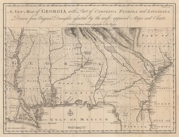
![Johannes [Jan] de Laet, Florida and the Southeast, 1630](https://static-assets.artlogic.net/w_600,c_limit,f_auto,fl_lossy,q_auto/artlogicstorage/themaphouse/images/view/57ce486c201061945f9c5ea3c94828faj/themaphouse-johannes-jan-de-laet-florida-and-the-southeast-1630.jpg)


Page
1
of 16