Maps of the whole of London
-
 Benjamin Rees Davies, Davies's New Map of London and its Environs, 1862£ 1,750.00
 -
Edward Weller, Victoria Park, Hackney, Dalston & London Fields, 1863£ 395.00
-
Edward Weller, East London, 1863£ 595.00
-
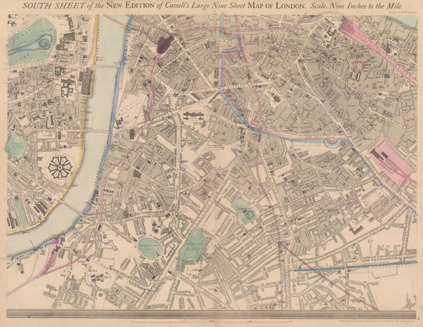
Edward Weller, London (South West Sheet), 1863£ 2,550.00
-
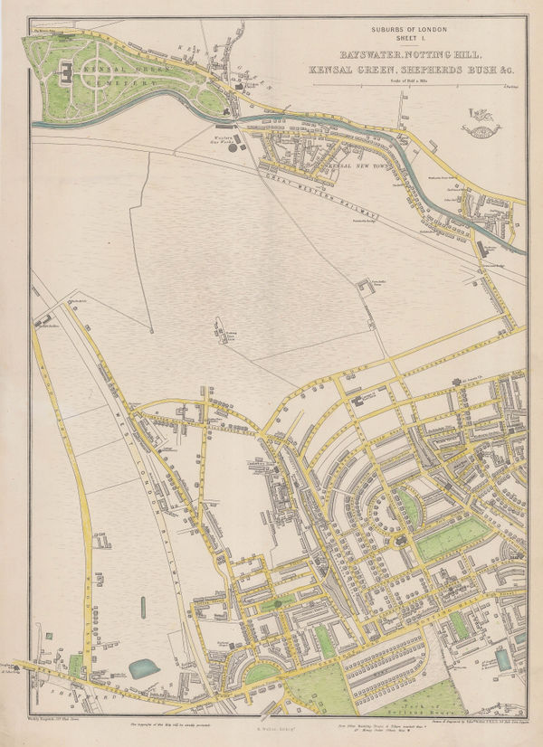
Edward Weller, Bayswater, Notting Hill, Kensal Green, Shepherds Bush &c., 1863£ 495.00
-
Edward Weller, Suburbs of London - Stockwell Clapham &c., 1863£ 285.00
-
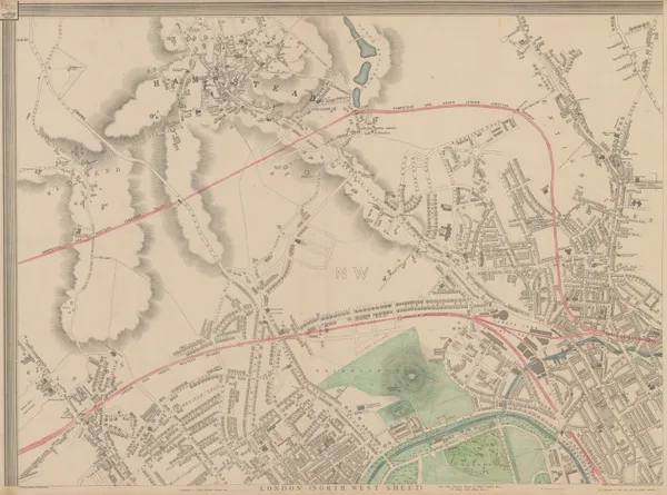
Edward Weller, Primrose Hill, St. John's Wood & Hampstead, 1863£ 895.00
-
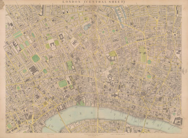
Edward Weller, Map of London (Central Sheet), 1863£ 595.00
-
Edward Weller, The 'Landmarks' of London, 1863 c.£ 695.00
-
Edward Stanford, A New Map of Metropolitan Railways Sanctioned in 1864, 1864£ 875.00
-
Benjamin Rees Davies, Davies's New Map of the British Metropolis, 1865£ 1,850.00
-
-
Ordnance Survey, Knightsbridge & Kensington Gore, 1867£ 2,500.00
-
Ordnance Survey, Kensington Palace to Kensington Gore, 1867£ 1,850.00
-
John Cassell, Hammersmith, Shepherd's Bush & Holland Park, 1868£ 495.00
-
John Cassell, Lambeth, Vauxhall, Borough, Southwark & Kennington, 1868£ 345.00
-
John Cassell, Paddington, Bayswater, Marylebone & Regent's Park, 1868£ 775.00
-
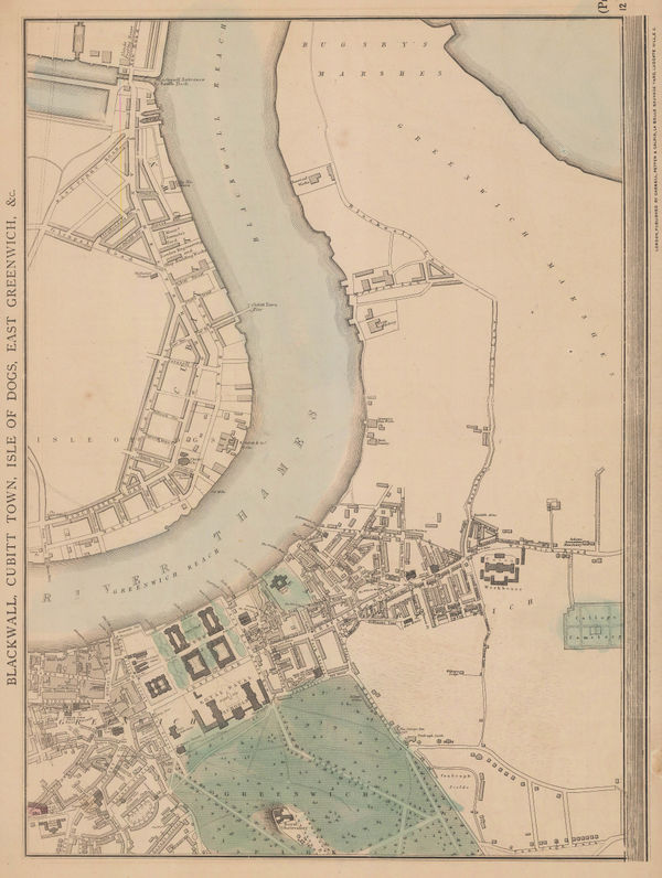
John Cassell, Greenwich, Isle of Dogs & Greenwich Peninsula, 1868£ 325.00
-
John Cassell, Kensal Green, Kilburn & Notting Hill, 1868£ 575.00
-
John Cassell, North London, 1868 (c.)£ 565.00
-
Ordnance Survey, Knightsbridge, Kensington & Brompton, 1869£ 3,500.00
-
James Wyld, Wyld's New Plan of London & Its Vicinity, 1869£ 3,750.00
-
Ordnance Survey, Knightsbridge & Belgravia, 1870£ 1,850.00
-
Benjamin Rees Davies, Davies's New Map of London, 1870£ 2,250.00
-
W.H. Smith & Son, Environs of London, 1870 c£ 295.00
-
James Wyld, A New Map of the Country Twenty-Five Miles Round London, 1870 c.£ 2,250.00
-
Edward Stanford, Victoria Park, Hackney, Stratford & Homerton, 1874£ 325.00
-
Society for the Diffusion of Useful Knowledge (SDUK), London, 1875£ 1,350.00
-
Alfred W. Oborne, Wimbledon Park Estate, 1875£ 885.00
-
George W. Bacon, Greenwich, 1875 c.£ 395.00
-
Edward Stanford, Lewisham, Ladywell & Hither Green, 1877£ 225.00
-
Edward Stanford, West Central London, 1877£ 1,850.00
-
Edward Stanford, Fulham, Parson's Green & West Brompton, 1877£ 1,350.00
-
Edward Stanford, Chelsea, Battersea, Pimlico & Nine Elms, 1877£ 1,450.00
-
Edward Stanford, Kensington, Notting Hill, Bayswater & Holland Park, 1877£ 1,750.00
-
Edward Stanford, Greenwich, Deptford & New Cross, 1877£ 695.00
-
Edward Stanford, Wimbledon & Merton, 1877£ 675.00
-
Edward Stanford, Clapham, Balham, Upper Tooting & Streatham Hill, 1877£ 985.00
-
Edward Stanford, Peckham, Walworth & Camberwell, 1877£ 345.00
-
Edward Stanford, Crystal Palace, Sydenham, Norwood & Penge, 1877£ 395.00
-
Edward Stanford, Dulwich, Herne Hill, Forest Hill & Peckham Rye, 1877£ 695.00
-
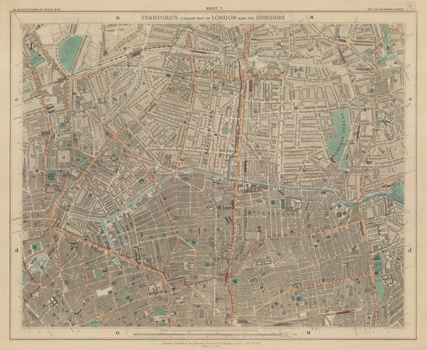
Edward Stanford, The City, Southwark, Wapping & Whitechapel, 1877£ 1,150.00
-
Edward Stanford, Hoxton, Islington, Canonbury & Dalston, 1877£ 795.00
-
Edward Stanford, Highgate, Kentish Town & Holloway, 1877£ 645.00
-
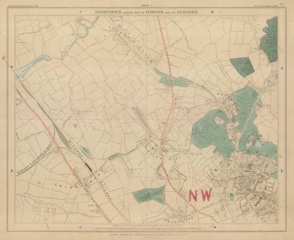
Edward Stanford, Hampstead, Golders Green & Cricklewood, 1877£ 495.00
-
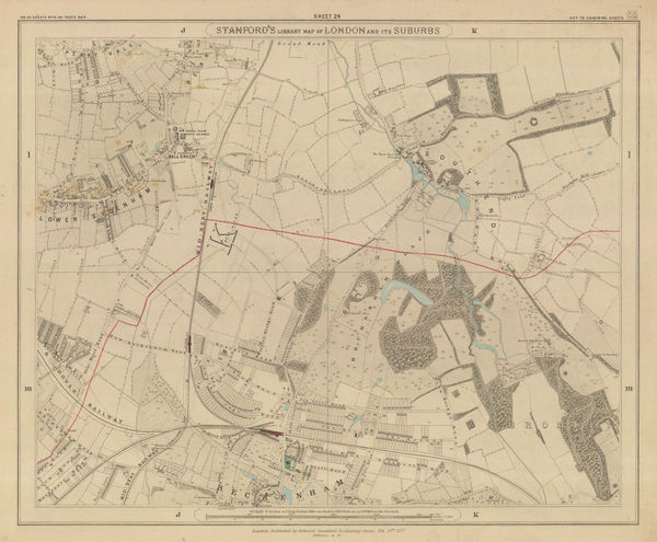
Edward Stanford, Beckenham, Perivale & Sydenham, 1877£ 295.00
-
Edward Stanford, Putney, Wandsworth & Wimbledon, 1877£ 495.00
-
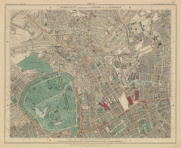
Edward Stanford, Regent's Park, Camden, Primrose Hill & King's Cross, 1877£ 950.00
-
Edward Stanford, Tooting, Streatham & Mitcham, 1877£ 395.00
-
Edward Stanford, Limehouse, Canary Wharf & Poplar, 1877 c£ 445.00
-
James Wyld, Map of the Superficial Geology of London and its Environs, 1878 c.£ 825.00
-
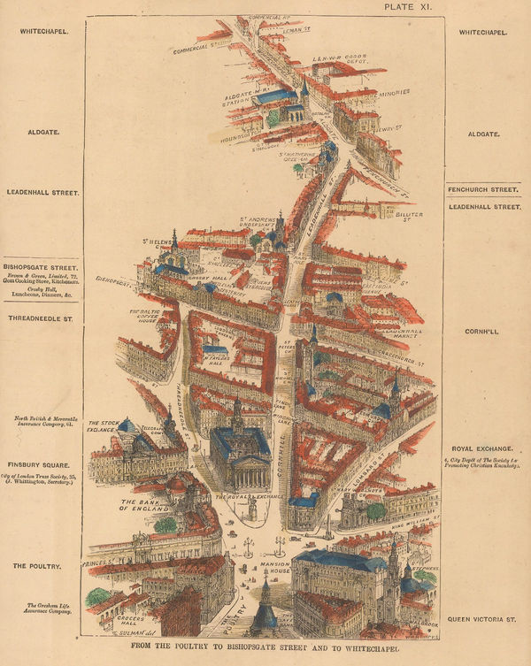
Thomas Sulman, From the Poultry to Bishopsgate Street and to Whitechapel, 1880£ 135.00
-
Thomas Sulman, Regent Street from Waterloo Place to Portland Place, 1880£ 185.00
-
George W. Bacon, Greenwich & Blackheath, 1880 (c.)£ 475.00
-
Gall & Inglis, Cruchley's Handy Map of London, 1880 c£ 545.00
-
George W. Bacon, Woolwich, Plumstead, Charlton, Eltham, 1880 c£ 175.00
-
A Map of the Environs of London Extending Twenty Five Miles fr. the Metropolis, 1880 c.Edward StanfordSeries: LondonEdward Stanford, A Map of the Environs of London Extending Twenty Five Miles fr. the Metropolis, 1880 c.£ 825.00
-
Henry George Collins, Collins' Standard Map of London, 1880 c.£ 785.00
-
-
Gall & Inglis, Reduced Ordnance Map of London, 1880 c.£ 945.00
-
Pettitt & Cox, The Wimbledon House Estate, 1880 c.£ 545.00
-
George W. Bacon, Clapham, Wandsworth & Battersea, 1880 c.£ 750.00
-
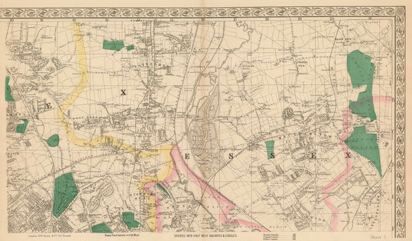
George W. Bacon, [Cricklewood & Willesden Green], 1880 c.£ 160.00
-
George W. Bacon, Finsbury Park, Crouch End, Tottenham, Leyton & Walthamstow, 1880 c.£ 365.00
-
George W. Bacon, Fulham & Putney, 1880 c.£ 795.00
-
George W. Bacon, Peckham, New Cross, Nunhead & Deptford, 1880 c.£ 295.00
-
George W. Bacon, Stockwell, Brixton & Camberwell, 1880 c.£ 295.00
-
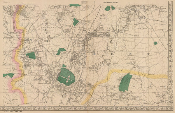
George W. Bacon, Stratford, West Ham & Leytonstone, 1880 c.£ 325.00
-
George W. Bacon, London (North Sheet), 1880 c.£ 825.00
-
George W. Bacon, Bacon's Map of the Environs of London, 1880 c.£ 445.00
-
George W. Bacon, Wimbledon, Merton, Balham, Tooting & Streatham, 1880 c.£ 895.00
-
George W. Bacon, Dulwich, Norwood, Crystal Palace, Penge & Hither Green, 1880 c.£ 325.00
-
George W. Bacon, Bromley, Poplar, Blackwall, Canning Town & North Greenwich, 1880 c.£ 225.00
-
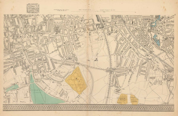
George W. Bacon, East London, 1880 c.£ 545.00
-
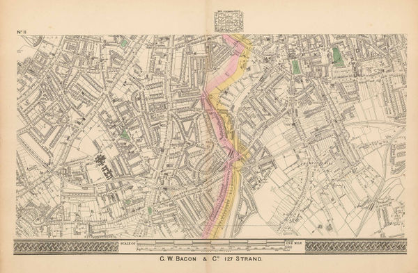
George W. Bacon, Victoria Park, Hackney, Dalston & London Fields, 1880 c.£ 675.00
-
Edward Stanford, Leyton, Walthamstow & Hackney Marshes, 1882£ 295.00
-
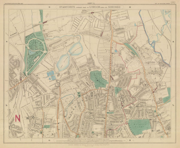
Edward Stanford, Finsbury Park, Stoke Newington & Tottenham, 1882£ 575.00
-
Josiah Whitbread, Whitbread's Reduced Ordnance Map of London, 1883£ 775.00
-
George W. Bacon, Primrose Hill, St. John's Wood, Camden & Hampstead, 1885 (c.)£ 1,150.00
-
George W. Bacon, London, 1885 c£ 1,250.00


![George W. Bacon, [Cricklewood & Willesden Green], 1880 c.](https://static-assets.artlogic.net/w_600,c_limit,f_auto,fl_lossy,q_auto/artlogicstorage/themaphouse/images/view/cf53116b3099c7da6fc4c3e03a263439j/themaphouse-george-w.-bacon-cricklewood-willesden-green-1880-c..jpg)


Page
3
of 8