Maps of the whole of London
-
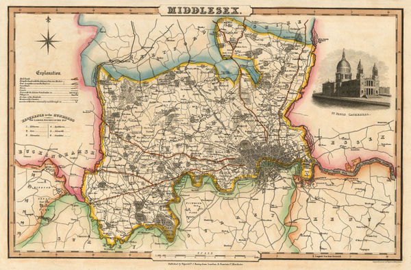
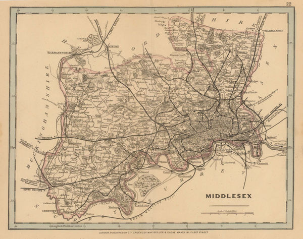
 John Cary, A New Map of Middlesex, 1801£ 525.00
 -
John Wallis, Wallis's Plan of the Cities of London and Westminster, 1801£ 1,950.00
-
Richard Phillips, London, 1802£ 795.00
-
Plan des Villes de Londres et Westminster et du Bourg de Southwark, 1802Bureau d'IndustrieSeries: WeimarBureau d'Industrie, Plan des Villes de Londres et Westminster et du Bourg de Southwark, 1802£ 795.00
-
Depot de la Guerre, Napoleonic Invasion Map of London, 1804£ 3,500.00
-
Charles Smith, New Plan of London, Westminster and Southwark, 1805£ 1,350.00
-
James Stratford, London, 1806£ 895.00
-
Cole & Roper, Middlesex, 1807£ 55.00
-
James Stratford, London and Environs, 1808£ 295.00
-
Edward Mogg, An Entire New Plan of the Cities of London and Westminster, 1809£ 1,650.00
-
Daniel Paterson, Paterson's Twenty-Four Miles Round London, 1809£ 1,850.00
-
Thomas Faulkner, Chelsea, 1810£ 1,150.00
-
-
Laurie & Whittle, New Map of London with its Environs, 1817£ 1,950.00
-
John Britton, London, 1817£ 445.00
-
William Faden, A New Topographical Map of the Country in the Vicinity of London, 1818£ 2,650.00
-
Longman & Co., London and its Environs, 1818£ 825.00
-
Ambroise Tardieu, Plan de Londres avec le Bourg de Southwark, 1820 c.£ 775.00
-
Edward Mogg, Forty Five Miles Around London, 1821£ 750.00
-
William Faden, A Plan of London and Westminster with the Borough of Southwark, 1822£ 985.00
-
Edward Wallis, Guide for Strangers through London, 1822£ 1,550.00
-
John Luffman, The Metropolis Displayed or Langley's Faithful Guide through London, 1822£ 2,450.00
-
William Faden, Plan of London and Westminster and the Borough of Southwark, 1823£ 2,450.00
-
Stephen William Cooke, A New Plan of London and its Environs, 1823£ 1,700.00
-
Charles Smith, Map of the Country Fifteen Miles around London, 1823£ 1,250.00
-
Sholto and Reuben Percy, A New Map of London, Westminster and Southwark, 1823£ 395.00
-
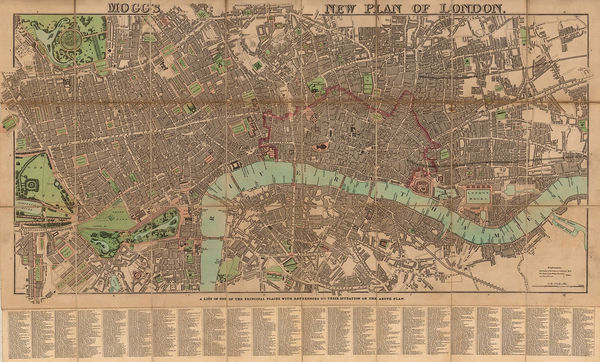
James Pigot, Pigot & Co.'s New Plan of London, 1823 (c.)£ 2,450.00
-
George Frederick Cruchley, Environs of London, 1824£ 1,550.00
-
A Plan of the Cities of London & Westminster, the Borough of Southwark with the New Buildings, 1824James WyldJames Wyld, A Plan of the Cities of London & Westminster, the Borough of Southwark with the New Buildings, 1824£ 2,950.00
-
Charles Smith, Map of the Country Twelve Miles around London, 1825£ 1,750.00
-
Hansard, St. James's Park Improvement Plan, 1827£ 1,450.00
-
George Frederick Cruchley, Cruchley's New Plan of London, 1828£ 800.00
-
Christopher & John Greenwood, Map of the County of Middlesex, 1829£ 475.00
-
Frederick Trench, Westminster, the Strand, and the Southbank, 1829£ 275.00
-
Joshua Archer, Middlesex, 1830 c.£ 44.00
-
Isaac Slater, Middlesex, 1830 c.£ 180.00
-
Charles Smith, Smith's London, 1830 c.£ 695.00
-
Thomas Tegg, New Plan of London &c. with 360 References to the Principal Streets, 1831£ 875.00
-
Pigot & Co's New Map of the Environs of London, Extending 14 Miles Round St. Paul's in Every Direction, 1832James PigotSeries: ManchesterJames Pigot, Pigot & Co's New Map of the Environs of London, Extending 14 Miles Round St. Paul's in Every Direction, 1832£ 1,650.00
-
Society for the Diffusion of Useful Knowledge (SDUK), The Environs of London, 1832£ 445.00
-
New Plan of London &c. with 360 references to the Principal Streets, 1832 c.Thomas TeggSeries: LondonThomas Tegg, New Plan of London &c. with 360 references to the Principal Streets, 1832 c.£ 950.00
-
George Frederick Cruchley, New Map of London, 1833£ 1,295.00
-
John Walter Froggett, Froggett's Survey of the Country Thirty Miles Round London, 1833£ 3,950.00
-
-
-
George & John Cary, Cary's New Plan of London and its Vicinity, 1836£ 2,250.00
-
James Wyld, Environs of London, 1838£ 1,550.00
-
John Tallis, [Blackfriars Rd], 1840 c.£ 80.00
-
Samuel Lewis, A Plan of London and its Environs, 1840 c.£ 750.00
-
-
James Wyld, Plan of London and Westminster, 1841£ 2,000.00
-
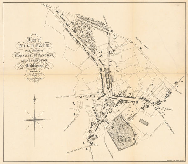
George Prickett, Plan of Highgate, 1842£ 595.00
-
George Prickett, Highgate and Hornsey Park, 1842£ 395.00
-
Edward Wallis, Wallis's Guide for Strangers through London, 1843£ 1,350.00
-
James Wyld, A New Topographical Map of the Country in the vicinity of London, 1843£ 2,650.00
-
Richard Holmes Laurie, Laurie's Plan of London, Westminster, and Southwark, 1843£ 3,450.00
-
Edward Mogg, London in Miniature with Surrounding Villages, 1844£ 1,850.00
-
-
Edward Mogg, Mogg's New Plan of London, 1845 c.£ 1,650.00
-
William Tombleson, Panoramic Map of the Thames and Medway, 1845 c.£ 2,200.00
-
Laurie's New Plan of London and its Environs, with an improved Scale for Ascertaining Distances, the Fares of Hackney Coaches, Porterage of Parcels, &c., 1846Richard Holmes LaurieSeries: LondonRichard Holmes Laurie, Laurie's New Plan of London and its Environs, with an improved Scale for Ascertaining Distances, the Fares of Hackney Coaches, Porterage of Parcels, &c., 1846£ 3,450.00
-
-
Benjamin Rees Davies, London and its Environs, 1847£ 1,450.00
-
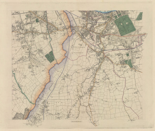
James Wyld, Greenwich, Deptford, Lewisham, Brockley, Peckham & East Dulwich, 1849£ 395.00
-
Willesden Green, Cricklewood, Childs Hill, Golders Green, Neasden & Wembley Park, 1849James WyldSeries: LondonJames Wyld, Willesden Green, Cricklewood, Childs Hill, Golders Green, Neasden & Wembley Park, 1849£ 295.00
-
James Wyld, Hampstead, Kentish Town, Highgate, Holloway, Islington & Crouch End, 1849£ 795.00
-
James Wyld, Hackney, Clapton, Leyton, Homerton, Dalston & Stratford, 1849£ 495.00
-
James Wyld, Clapham, Battersea, Brixton, Streatham, Tooting & Camberwell, 1849£ 1,250.00
-
Joseph Cross, London Guide, 1850 c.£ 1,500.00
-
George Frederick Cruchley, Middlesex, 1850 c.£ 48.00
-
Johann Georg Heck, Neuester Plan von London, 1851£ 1,850.00
-
Henry George Collins, Plan of London, 1851£ 795.00
-
James Wyld, New Plan of London, 1851£ 1,850.00
-
James Wyld, Wyld's New Plan of London, 1851 c£ 1,250.00
-
George Frederick Cruchley, New Plan of London Improved, 1851 c.£ 3,250.00
-
Society for the Diffusion of Useful Knowledge (SDUK), London, 1855 c£ 1,250.00
-
William Mogg, Twenty Four Miles Round London, 1855 c.£ 1,200.00
-
Letts & Son, London and its Environs, 1857£ 925.00
-
Robert William Mylne, Geological and Topographical Map of London & its Environs, 1858£ 2,500.00
-
George Woolworth Colton, The Environs of London, 1861£ 385.00


![John Tallis, [Blackfriars Rd], 1840 c.](https://static-assets.artlogic.net/w_600,c_limit,f_auto,fl_lossy,q_auto/artlogicstorage/themaphouse/images/view/3b1bd440ddfe2ce5d75946d0c0776cbcj/themaphouse-john-tallis-blackfriars-rd-1840-c..jpg)


Page
2
of 8