Maps of the whole of London
-
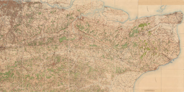
 J.G. Bartholomew, The Environs of London, 1910 c£ 195.00
 -
George W. Bacon, West and Southwest London, 1910 c£ 695.00
-
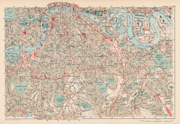
George W. Bacon, North and Northwest London, 1910 c£ 495.00
-
George W. Bacon, South London, 1910 c£ 325.00
-
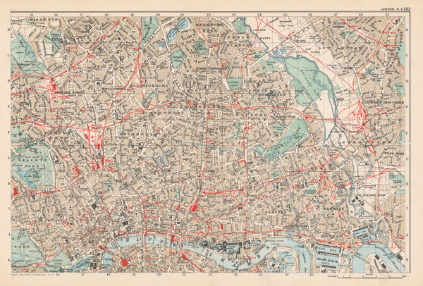
George W. Bacon, East and Northeast London, 1910 c£ 425.00
-
J. E. May, Landmarks and Parks of London, 1910 c£ 495.00
-
George W. Bacon, Large Scale Plan of Wimbledon, 1910 c.£ 795.00
-
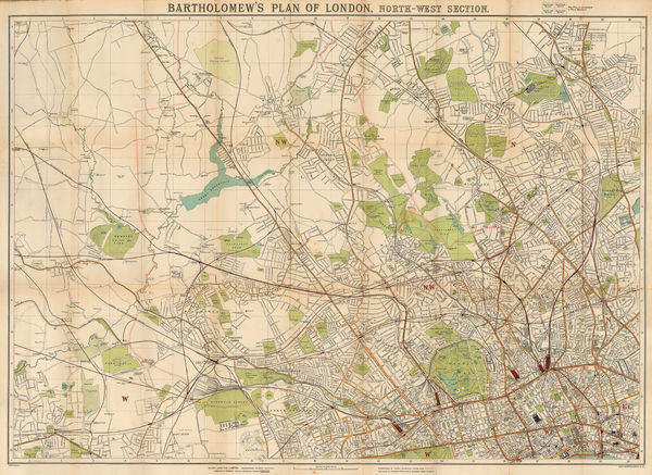
J.G. Bartholomew, Plan of London, North-West Section, 1910 c.£ 395.00
-
George Philip & Son Ltd., Beckton, Royal Docks & Silvertown, 1910 c.£ 36.00
-
George W. Bacon, Hampstead, Willesden, Finchley and Paddington, 1910 c.£ 46.00
-
J.F. Bennet, Bennet's Map of the River Thames from Oxford to Gravesend, 1910 c.£ 1,350.00
-
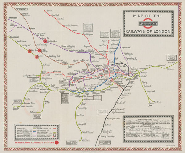
London Underground, The Underground Map of London, 1911£ 950.00
-
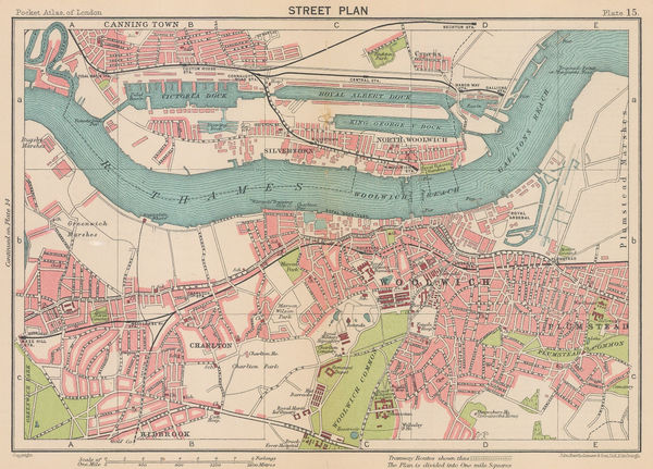
George Philip & Son Ltd., Canning Town & North Woolwich, 1912£ 52.00
-
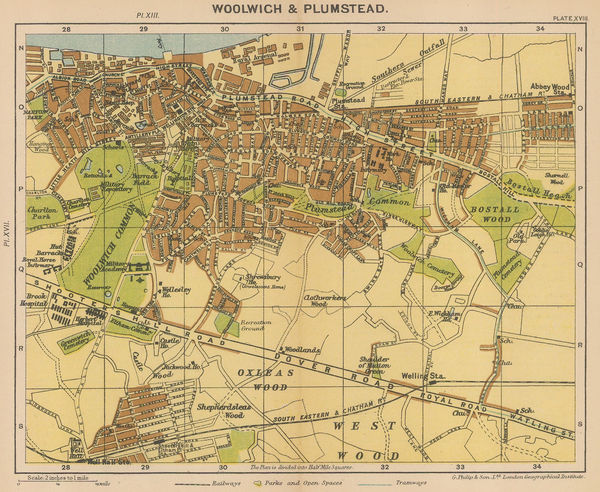
George Philip & Son Ltd., Woolwich & Plumstead, 1912£ 50.00
-
London Underground, London Underground Railways, 1912£ 950 (framed)
-
Ordnance Survey, Watford and High Wycombe, 1912 c.£ 115.00
-
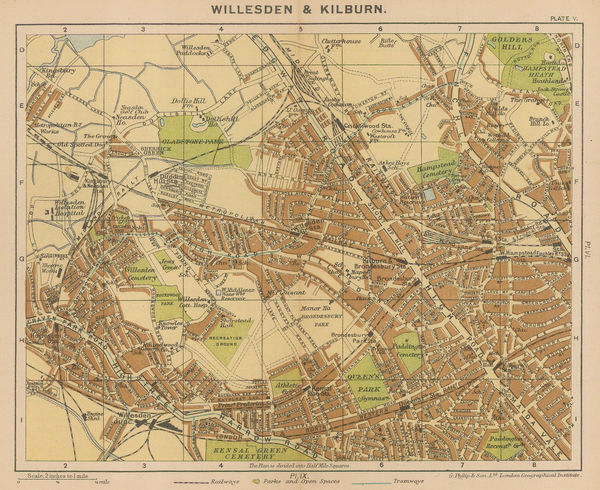
George Philip & Son Ltd., Willesden & Kilburn, 1912 c.£ 64.00
-
George W. Bacon, Bacon's Gem Map of London and its Suburbs, 1912 c.£ 425.00
-
London Underground, Underground Map of London, 1913£ 1,450.00
-
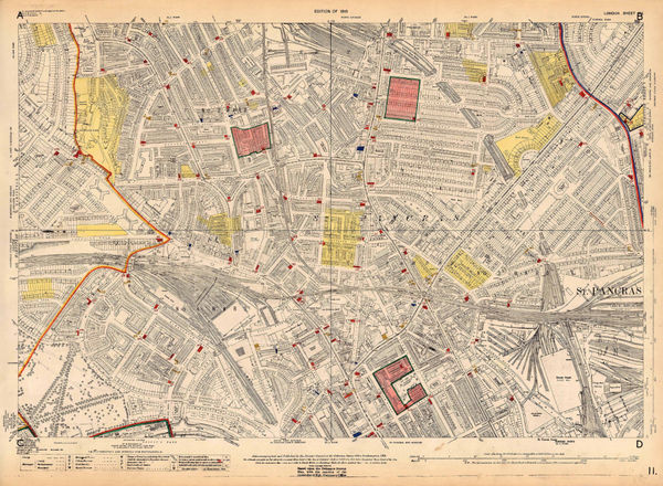
Thomas Kelly, London, 1915£ 545.00
-
London Underground, Underground Map of London with some Motor Bus Extensions, 1916£ 625 (framed)
-
Ordnance Survey, Nine Elms, 1918 c.£ 850.00
-
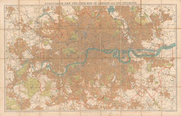
Edward Stanford, Stanford's New Two Inch Map of London and Its Environs, 1919£ 975.00
-
Ordnance Survey, Blackheath, 1919 c.£ 775.00
-
Ordnance Survey, Holland Park to Shepherds Bush, 1919 c.£ 1,350.00
-
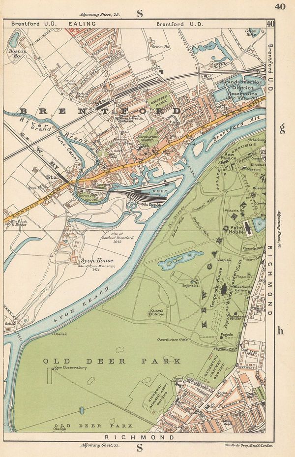
Edward Stanford, Brentford & Kew Gardens, 1920£ 42.00
-
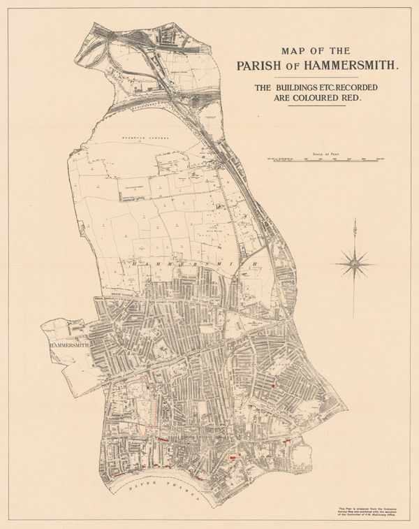
Ordnance Survey, Map of the Parish of Hammersmith, 1920 c£ 325.00
-
George W. Bacon, Manor House, Abney Park, Stoke Newington & Clapton, 1920 c.£ 88.00
-
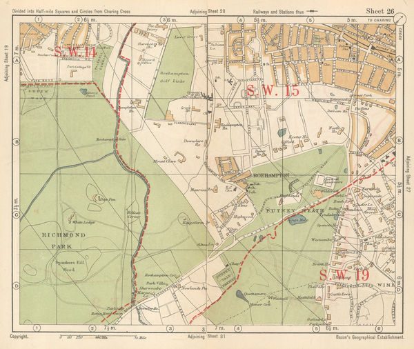
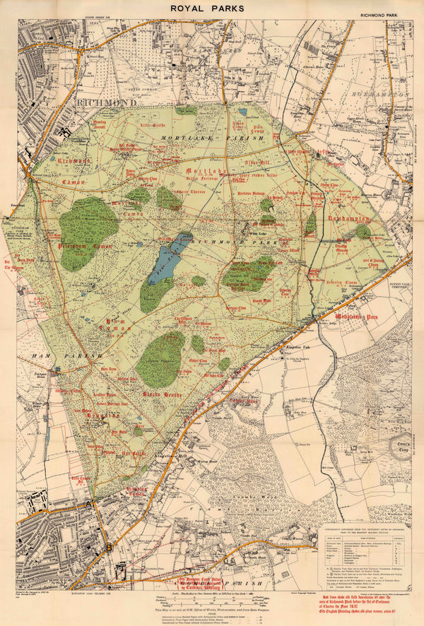
George W. Bacon, Richmond Park & Putney Heath, 1920 c.£ 36.00
-
George W. Bacon, South London, 1920 c.£ 425.00
-
Ordnance Survey, South London, Kent & East Sussex, 1920 c.£ 450.00
-
Macdonald Gill, Map of Electric Railways of London, 1921£ 1,350.00
-
Ordnance Survey, Highgate Village, 1921 c.£ 1,250.00
-
Kennedy North, British Empire Exhibition 1924, 1923£ 650.00
-
Macdonald Gill, Map of the Underground Railways of London, 1923£ 1,650 (framed)
-
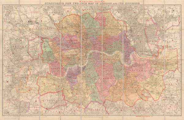
Edward Stanford, Stanford's New Two Inch Map of London and its Environs - Municipal Edition, 1924£ 845.00
-
Waterlow & Sons, Underground Map of London, 1924£ 750.00
-
Ordnance Survey, Dulwich, 1924 c.£ 425.00
-
Macdonald Gill, The Wonderground Map of London, 1924 c.£ 4,800 (framed)
-
J.C. Betts, Underground Railways of London, 1925£ 825.00
-
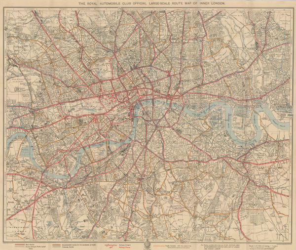
The Royal Automobile Club Official Large Scale Route Map of Inner London, 1925George Philip & Son Ltd.George Philip & Son Ltd., The Royal Automobile Club Official Large Scale Route Map of Inner London, 1925£ 575.00
-
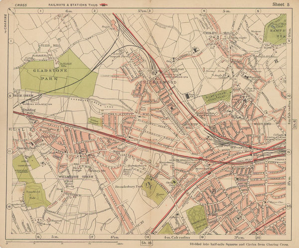
Bacon's New Map of London, Divided into Half-Mile Squares and Circles from Charing Cross, 1925 c.George W. BaconSeries: LondonGeorge W. Bacon, Bacon's New Map of London, Divided into Half-Mile Squares and Circles from Charing Cross, 1925 c.£ 775.00
-
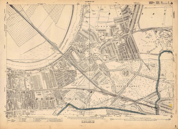
Ordnance Survey, Barnes, 1925 c.£ 1,450.00
-
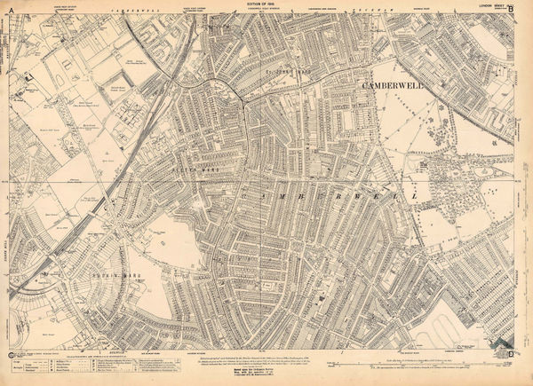
Ordnance Survey, East Dulwich and Camberwell, 1925 c.£ 425.00
-
Ordnance Survey, Shoreditch, 1925 c.£ 525.00
-
Ordnance Survey, Richmond Park, 1926£ 495.00
-
J.G. Bartholomew, Woolwich, Charlton & the Royal Docks, 1926£ 44.00
-
E.G. Perman, Underground Railways of London, 1928£ 1,250.00
-
J.G. Bartholomew, Southwark, Waterloo, Lambeth & Kennington, 1928£ 58.00
-
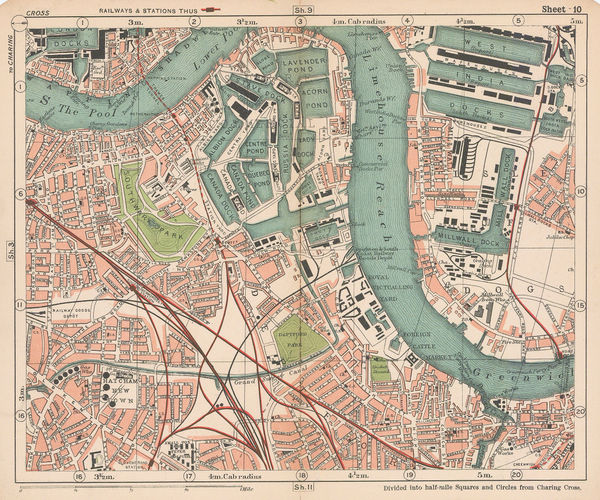
George W. Bacon, Rotherhithe, Deptford & Bermondsey, 1928£ 55.00
-
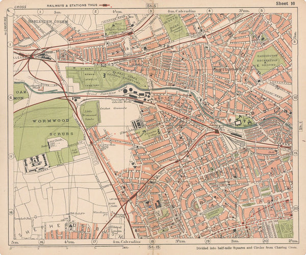
George W. Bacon, Bayswater, Notting Hill, Kensal Green & Paddington, 1928£ 78.00
-
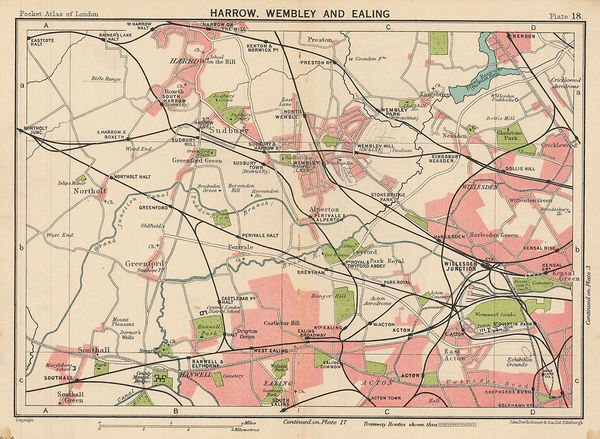
J.G. Bartholomew, Harrow, Wembley and Ealing, 1929£ 42.00
-
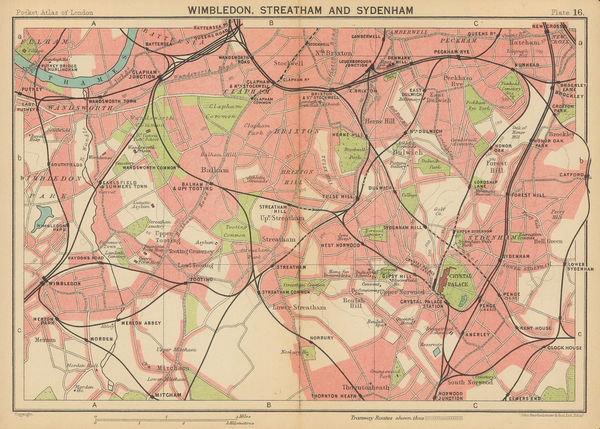
J.G. Bartholomew, Wimbledon, Streatham and Sydenham, 1929£ 44.00
-
J.G. Bartholomew, Kew, Richmond and Hampton Court, 1929£ 75.00
-
Chelsea, Fulham, Earl's Court, Battersea, and Hammersmith, 1929John Bartholomew & SonSeries: EdinburghJohn Bartholomew & Son, Chelsea, Fulham, Earl's Court, Battersea, and Hammersmith, 1929£ 125.00
-
Thomas Kelly, Richmond, Teddington, Kew, Chiswick, Twickenham & Isleworth, 1929£ 795.00
-
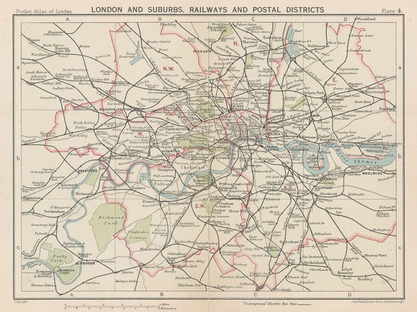
John Bartholomew & Son, London and Suburbs, Railways and Postal Districts, 1929£ 68.00
-
John Bartholomew & Son, Hampstead, Camden, Kentish Town & Holloway, 1929£ 78.00
-
The City, Wapping, Aldgate, Whitechapel, Liverpool St & Barbican, 1929John Bartholomew & SonSeries: EdinburghJohn Bartholomew & Son, The City, Wapping, Aldgate, Whitechapel, Liverpool St & Barbican, 1929£ 68.00
-
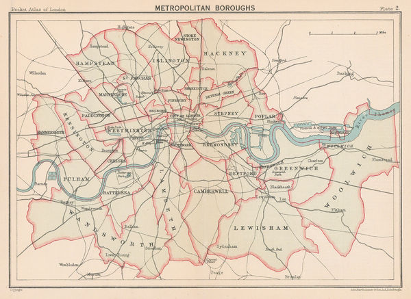
John Bartholomew & Son, Metropolitan Boroughs, 1929£ 65.00
-
John Bartholomew & Son, The Thames to Windsor, 1929£ 55.00
-
Ordnance Survey, Pimlico, 1929 c.£ 1,350.00
-
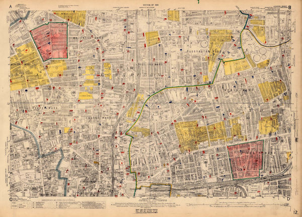
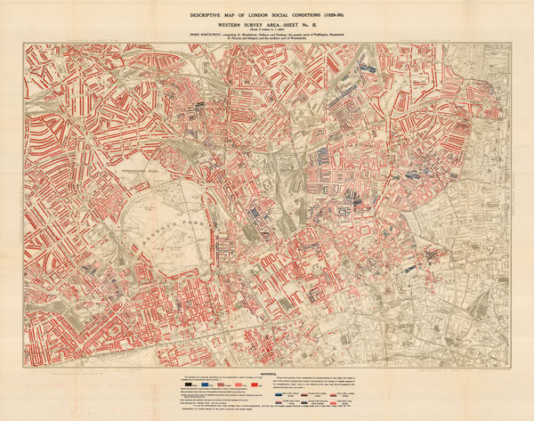
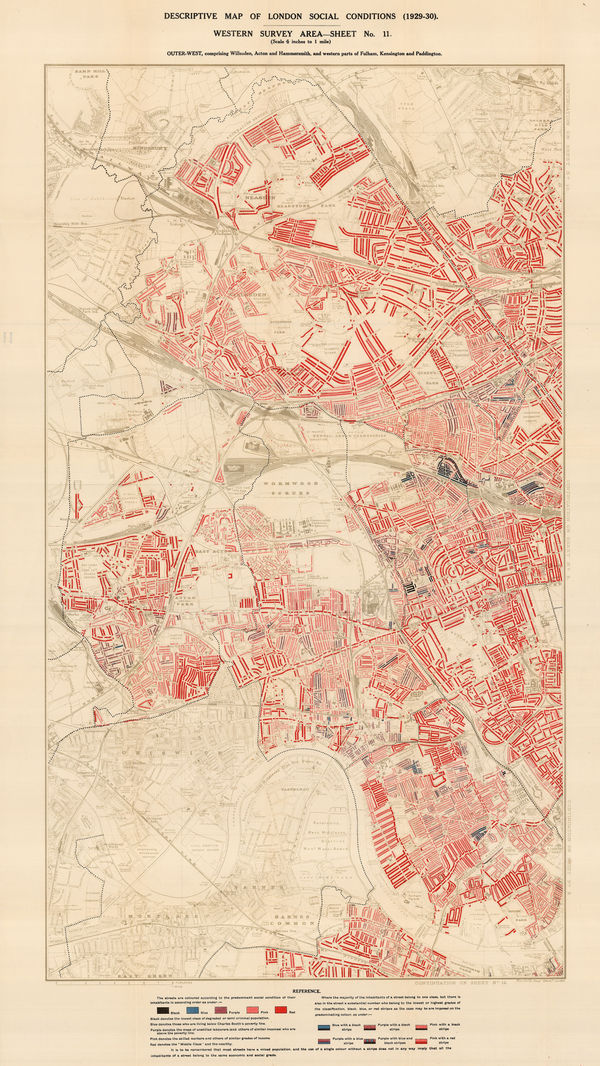
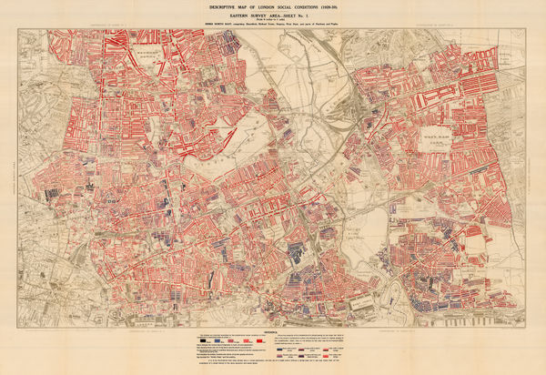
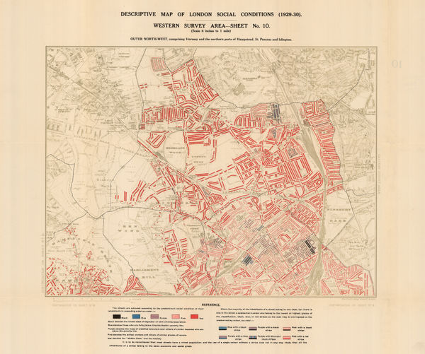
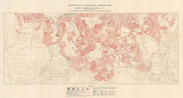
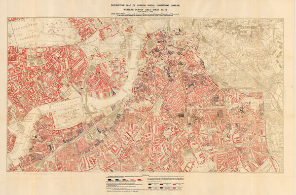
Charles Booth, Descriptive Map of London Social Conditions (1929-1930), 1930£ 1,950.00
-
Charles Booth, Descriptive Map of London Social Conditions (1929-1930), 1930£ 1,550.00
-
Charles Booth, Poverty Map of Whitechapel, Hackney, Shoreditch & Stratford, 1930£ 1,350.00
-
Charles Booth, Descriptive Map of London Social Conditions (1929-1930), 1930£ 950.00
-
Charles Booth, Poverty Map of Wandsworth, Streatham, Tooting, Clapham & Dulwich, 1930£ 1,450.00
-
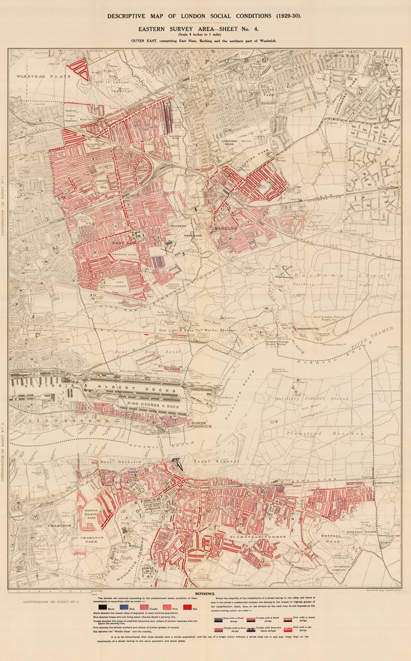
Charles Booth, Poverty Map of Royal Docks, Barking & Woolwich, 1930£ 650.00
-
Charles Booth, Descriptive Map of London Social Conditions (1929-1930), 1930£ 2,500.00
-
Fred H. Stingemore, Map of London's Underground Railways, 1930£ 795.00
-
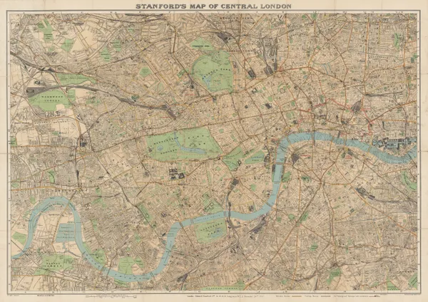
Edward Stanford, Stanford's Map of Central London, 1930£ 850.00
-
-
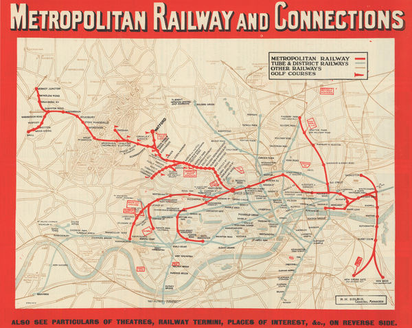
London Underground, Metropolitan Railway and Connections, 1930 (c.)£ 550.00
-
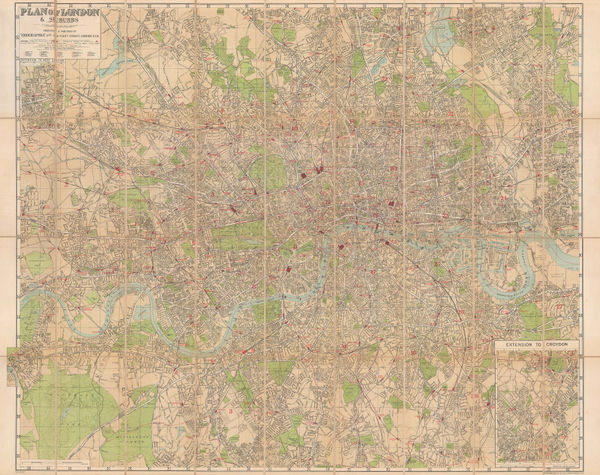
Geographia Ltd., Plan of London & Suburbs, 1930 c.£ 495.00
-
Geographers' Map Co., London, 1930 c.£ 145.00
-
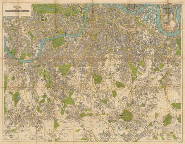
George W. Bacon, South London & Suburbs, 1930 c.£ 650.00
-
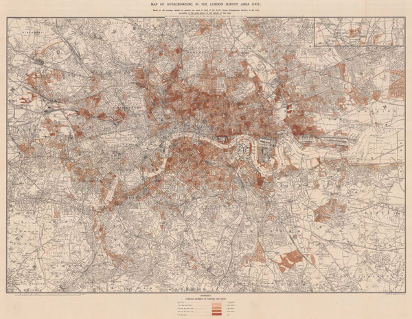
Charles Booth, Map of Overcrowding in the London Survey Area (1931), 1931£ 1,950.00
-
Fred H. Stingemore, Map of London's Underground Railways, 1931£ 795.00
-
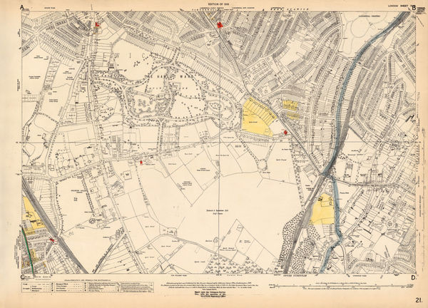
Ordnance Survey, Primrose Hill and St. Pancras, 1931 c.£ 825.00
-
Edward Stanford, Hyde Park Corner Tube Station and 1/4 Miles Around, 1932£ 1,250.00


Page
6
of 8