Maps of the whole of London
-
 London Transport, London Tramways, 1932£ 150.00
 -
-
Harry Beck, September/October Edition, 1933£ 1,450.00
-
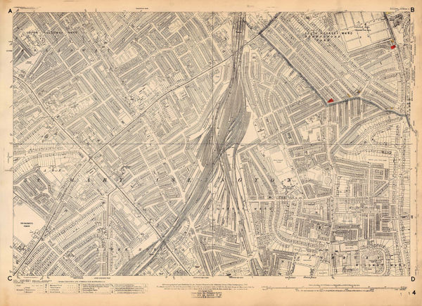
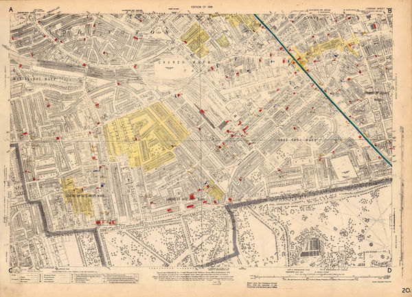
Ordnance Survey, Kings Cross and Angel, 1933 c.£ 1,150.00
-
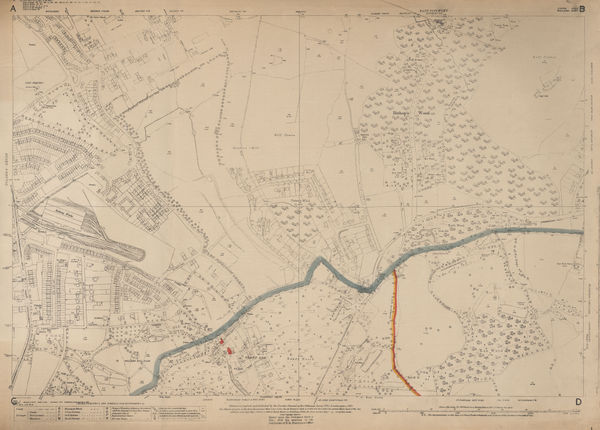
Ordnance Survey, Southfields & Wimbledon, 1933 c.£ 745.00
-
Harry Beck, No. 1, 1934£ 750.00
-
Rex Whistler, Prospect of the City of London, 1934£ 3,250.00
-
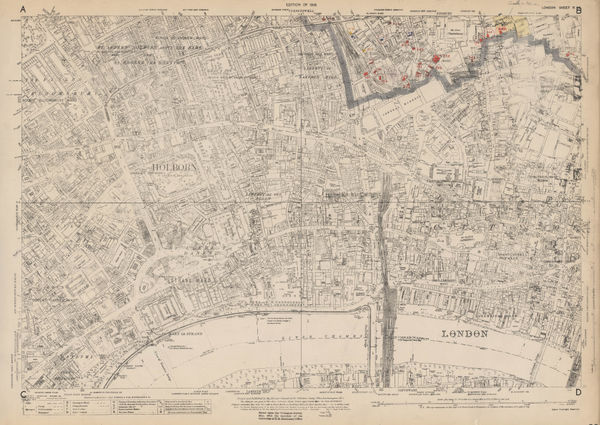
Ordnance Survey, East Central London, 1934 c.£ 1,150.00
-
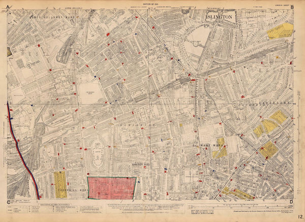
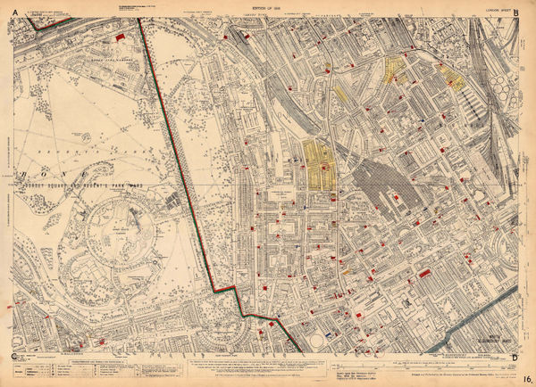
Ordnance Survey, Islington and Barnsbury, 1934 c.£ 925.00
-
Clifford & Rosemary Ellis, Christmas Shopping by Underground Poster, 1935£ 4,000.00
-
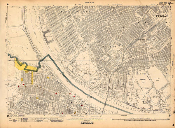
Ordnance Survey, Fulham, 1935 c.£ 1,250.00
-
Ordnance Survey, Highbury, 1935 c.£ 795.00
-
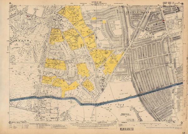
Ordnance Survey, North Hampstead, 1935 c.£ 425.00
-
Ordnance Survey, Queens Park and Kensal Town, 1935 c.£ 625.00
-
Ordnance Survey, Regents Park, 1935 c.£ 845.00
-
Ordnance Survey, Regents Park to Kings Cross, 1935 c.£ 845.00
-
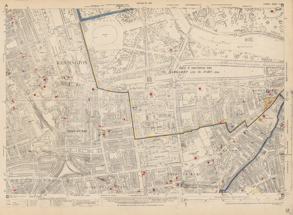
Ordnance Survey, Knightsbridge and Kensington, 1936£ 1,550.00
-
Port of London Authority, Royal Docks Development Plan, 1936£ 1,650.00
-
-
-
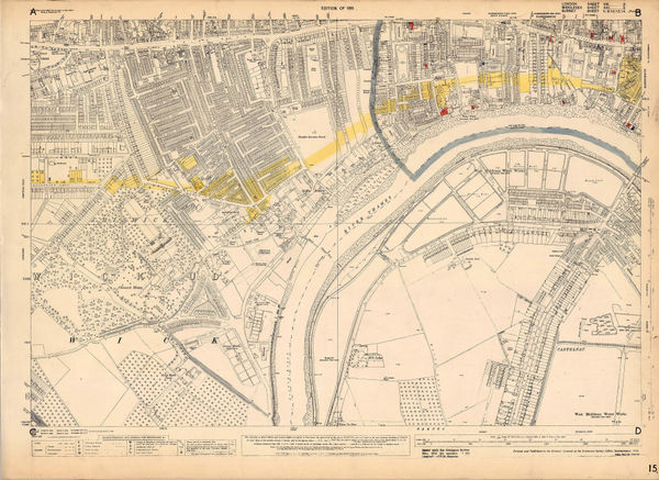
Ordnance Survey, Battersea, 1936 c.£ 1,450.00
-
Ordnance Survey, Bayswater, 1936 c.£ 1,450.00
-
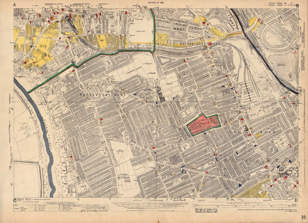
Ordnance Survey, Belsize Park and Swiss Cottage, 1936 c.£ 925.00
-
Ordnance Survey, Chiswick, 1936 c.£ 695.00
-
Ordnance Survey, Fulham, 1936 c.£ 1,350.00
-
Ordnance Survey, Parliament Hill Fields and Tufnell Park, 1936 c.£ 950.00
-
Ordnance Survey, The City of London, Aldgate & Bishopsgate, 1936 c.£ 1,250.00
-
Harry Beck, London Underground Map, 1937£ 550 (framed)
-
London Transport, Underground Railway Map, 1937£ 450.00
-
RHS Calendar of Shows & Application for Fellowship, 1937Royal Horticultural Society (RHS)Series: LondonRoyal Horticultural Society (RHS), RHS Calendar of Shows & Application for Fellowship, 1937£ 200.00
-
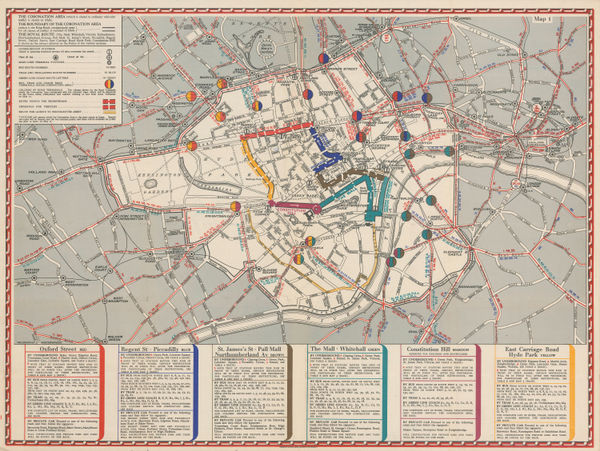
Geographia Ltd., The Coronation Area, 1937£ 450 (framed)
-
Harry Beck, London Underground Map, 1938£ 450.00
-
London Underground, Bakerloo Line Extension, 1939£ 225.00
-
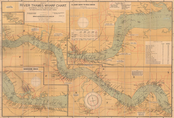
Imray & Co., River Thames Wharf Chart from Barking Creek to Hole Haven, 1939 c.£ 295.00
-
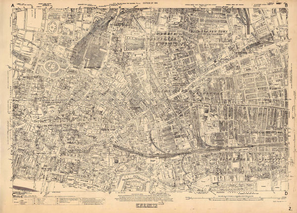
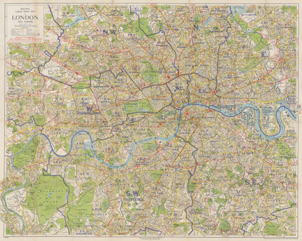
George W. Bacon, Bacon's Large-Print Map of London and Suburbs, 1940 c£ 395.00
-
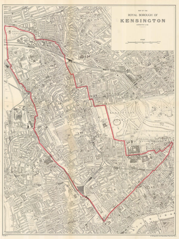
George W. Bacon, Map of the Royal Borough of Kensington, 1941£ 645.00
-
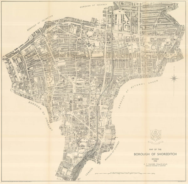
Ordnance Survey, The Borough of Shoreditch, 1942£ 625.00
-
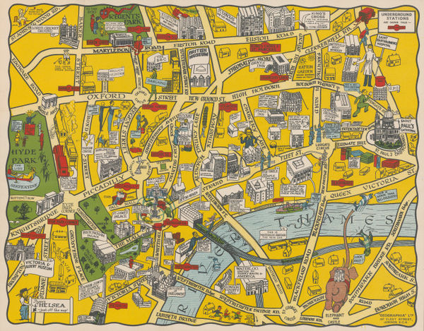
George Philip & Son Ltd., The New Pictorial Map of London, 1942 c£ 295.00
-
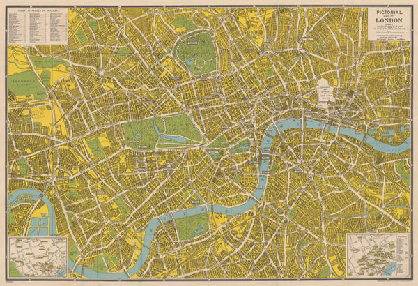
Geographers' Map Co., Pictorial Map of London, 1945 c.£ 375.00
-
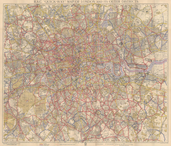
R. A. C. "Quick-Way" Motoring Map of London and its Outer Districts , 1945 c.George Philip & Son Ltd.Series: LondonGeorge Philip & Son Ltd., R. A. C. "Quick-Way" Motoring Map of London and its Outer Districts , 1945 c.£ 300.00
-
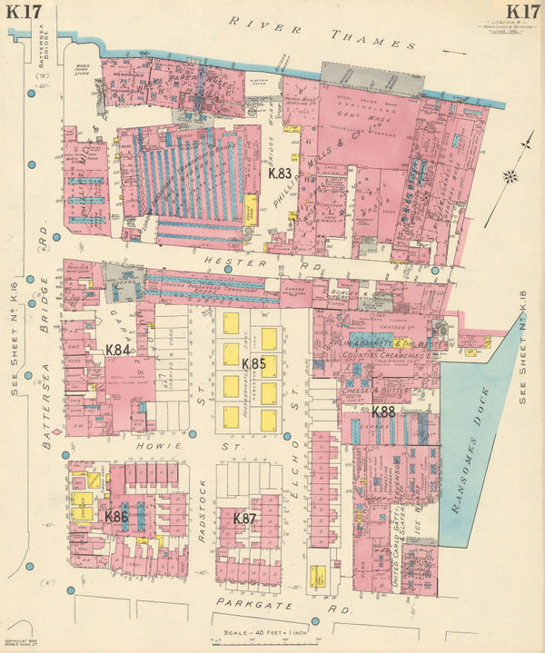
Charles Edward Goad, Battersea Bridge, Hester & Parkgate Roads, 1946£ 250.00
-
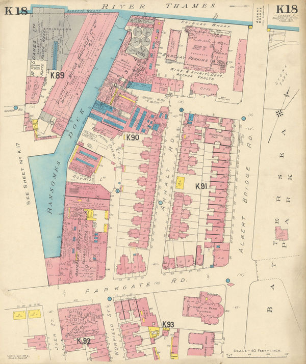
Charles Edward Goad, Battersea - Albert Bridge Rd, 1946£ 250.00
-
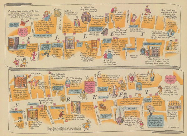
J.P. Sayer, Fleet Street, 1946£ 65.00
-
J.P. Sayer, The City of London, 1946Sold
-
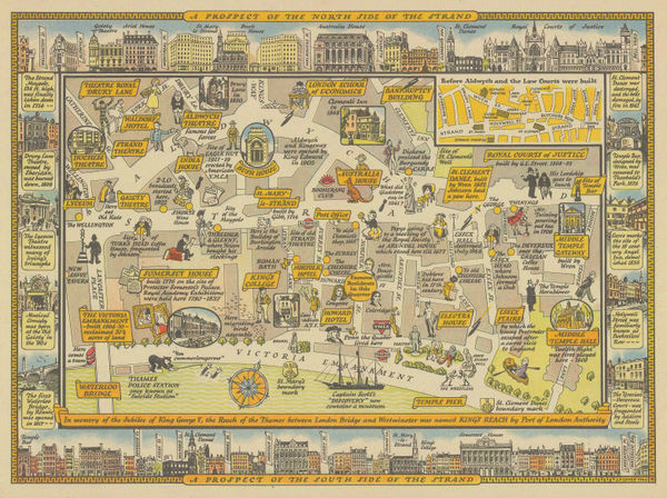
J.P. Sayer, The Strand - Waterloo Bridge to Temple Bar, 1946£ 95.00
-
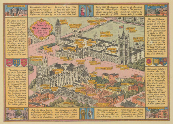
J.P. Sayer, Westminster, 1946£ 115.00
-
J.P. Sayer, Trafalgar Square - Before & After, 1946£ 88.00
-
J.P. Sayer, Kensington Gardens & Hyde Park, 1946£ 115.00
-
Kerry Lee, London, the Bastion of Liberty, 1947£ 2,800.00
-
J.P. Sayer, Mayfair, 1947£ 85.00
-
J.P. Sayer, Blackfriars Bridge and Ludgate Circus , 1947£ 75.00
-
J.P. Sayer, The Strand , 1947£ 85.00
-
J.P. Sayer, A Bird's-Eye View of Hyde Park Corner, 1947£ 95.00
-
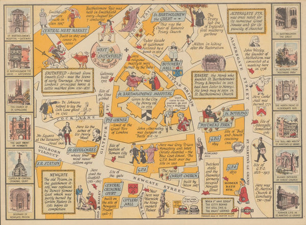
An Historical Description and Map of the District surrounding St. Bartholomew's Hospital, 1948J.P. SayerSeries: LondonJ.P. Sayer, An Historical Description and Map of the District surrounding St. Bartholomew's Hospital, 1948£ 42.00
-
Ordnance Survey, Holland Park and Notting Hill, 1948 c.£ 1,450.00
-
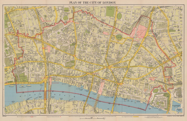
Geographia Ltd., Plan of the City of London, 1948 c.£ 365.00
-
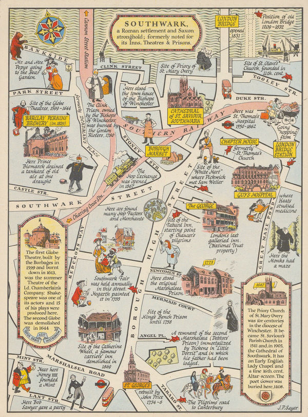
J.P. Sayer, Southwark, 1948 c.£ 75.00
-
M.R. Sherley, A Decorative Map of Tower Hill & District, 1949£ 495.00
-
Harry Beck, London Underground Map, 1950£ 400 (framed)
-
John Bartholomew, Children's Map of London, 1950£ 445.00
-
-
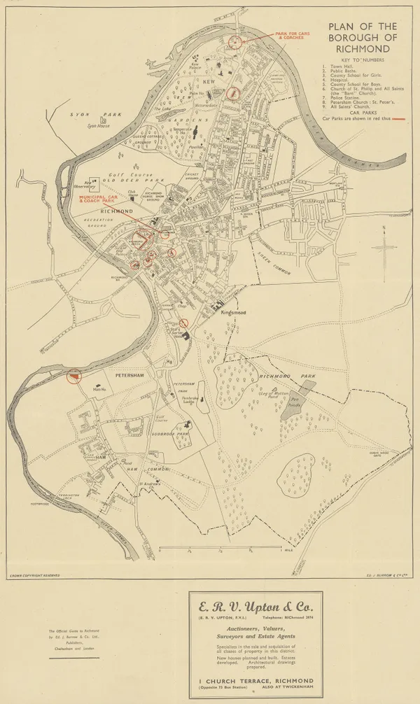
Ed. J. Burrow & Co., Ltd., Plan of the Borough of Richmond, 1950 c£ 175.00
-
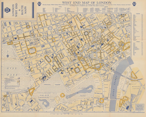
Automobile Association (AA), West End Map of London, 1950 c.£ 325.00
-
Harry Beck, London Underground Map, 1951£ 400 (framed)
-
West London Road Safety Committee, The Highway Code Map of Chelsea, 1951£ 445.00
-
H.G. Ward & Co. Ltd, London Places of Interest, 1951 c.£ 295.00
-
Harry Beck, London Underground Map, 1953£ 400 (framed)
-
Geographia Ltd., Queen Elizabeth II's Coronation Route, 1953£ 495.00
-
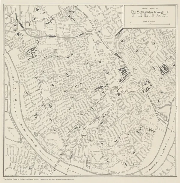
Ed. J. Burrow & Co., Ltd., Fulham, 1953£ 195.00
-
Ed. J. Burrow & Co., Ltd., Street Plan of Chelsea, 1954£ 225.00
-
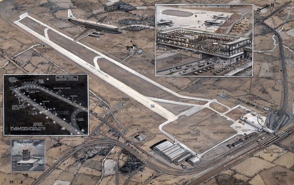
As It Will Be - London's New Airport at Gatwick, which was to be opened by the Queen on June 9, 1958George Horace DavisSeries: LondonGeorge Horace Davis, As It Will Be - London's New Airport at Gatwick, which was to be opened by the Queen on June 9, 1958£ 2,500.00
-
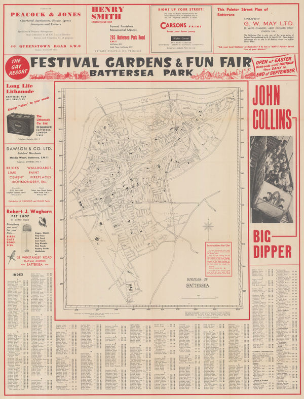
G. W. May Ltd., Borough of Battersea, 1958 c.£ 245.00
-
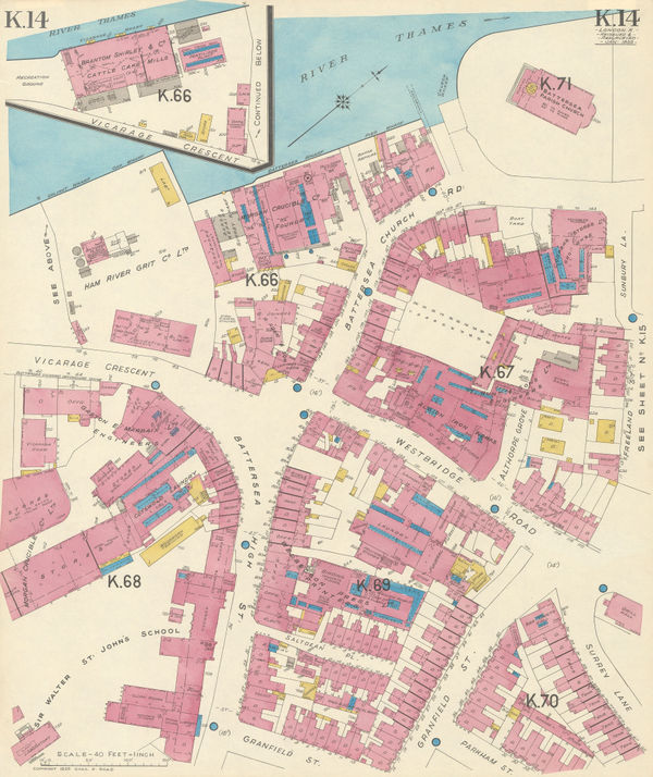
Charles Edward Goad, Battersea Square, 1959£ 250.00
-
-
Ordnance Survey, Royal Botanic Gardens Kew, 1963£ 150.00
-
Harold Hutchison, Hutchison's Final Tube Map, 1963£ 300 (framed)
-
London Transport, Visitor's London Quad Royal Tube Map, 1963£ 1,850.00
-
Paul E. Garbutt, London Underground Map, 1965£ 275.00
-
London Transport, Visitor's London, 1966£ 350 (framed)
-
David Schiller, London in the Swinging Sixties, 1968£ 2,750.00


Page
7
of 8