-
 Harmsworth, Western Front - Cambrai and Bourlon Wood, 1920 c.£ 58.00
 -
Harmsworth, Western Front : Loos and Hohenzollern Redoubt, 1920 c.£ 68.00
-
Harmsworth, Battle of the Somme, 1920 c.£ 86.00
-
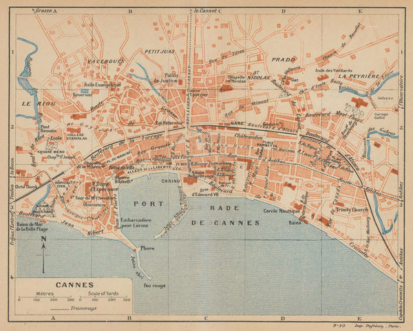
Eugène Dufrenoy, Cannes, 1921£ 58.00
-
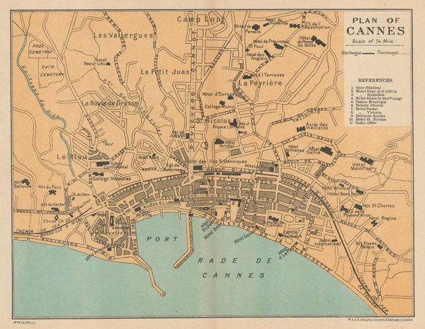
W. & A.K. Johnston, Plan of Cannes, 1923£ 52.00
-
W. & A.K. Johnston, Plan of Monaco, 1923£ 145.00
-
British Admiralty, Mediterranean France - South Coast - Approaches to Toulon, 1927£ 225.00
-
British Admiralty, Chart of the Port and Harbour of Toulon, 1927£ 295.00
-
Féret & Fils, Carte Vinicole du Departement de la Gironde, 1929£ 650.00
-
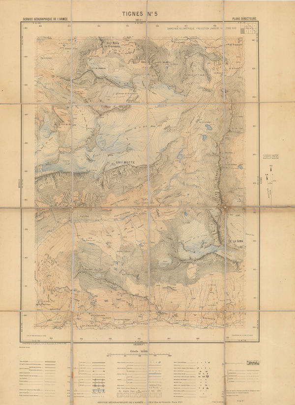
Service géographique de l'armée, Tignes/Glaciers de la Motte, 1930£ 450.00
-
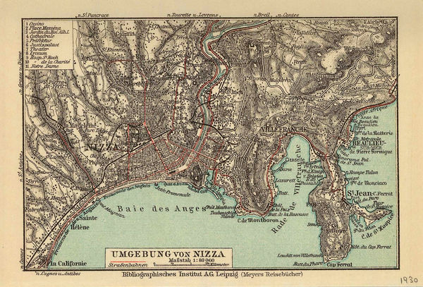
Joseph Meyer, Nice and environs, 1930£ 28.00
-
Jean Dollfus, Rhone Valley, 1930£ 950.00
-
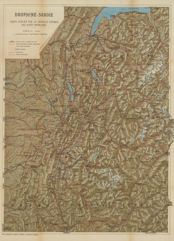
Orell Füssli, Dauphine-Savoie, 1930 c£ 650.00
-
Jean Dollfus, Burgundy Nievres, 1930 c.£ 950.00
-
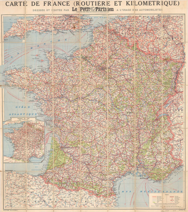
R. Bolze, Vintage road map of France, 1930 c.£ 175.00
-
André Galland, French Anti-Disarmament Propaganda, 1932£ 1,800.00
-
M. Munier, Vintage city plan of Dijon, 1932£ 250.00
-
Institut géographique national (IGN), Aix, Provence, 1935£ 88.00
-
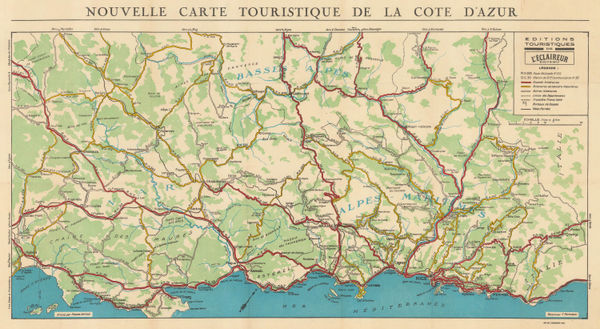
L'Eclaireur, Tourist Map of the Cote d'Azur, 1935 (c.)£ 175.00
-
Malmö Kartografiska Anstalt, French Riviera from Nice to Menton, 1935 c£ 55.00
-
French State Railway, Paris Welcomes You, 1937£ 2,000.00
-
Camille Rodier, Wine map of Cote de Beaune and Cote de Nuits, Burgundy, 1937£ 125.00
-
Camille Rodier, Wine map of Cote de Beaune and Cotes de Nuits, Burgundy, 1937£ 750.00
-
J.G. Bartholomew, Environs of Paris: Rail and Automobile Routes, 1938£ 28.00
-
J.G. Bartholomew, The Western Front at the Outbreak of WW2, 1939£ 175.00
-
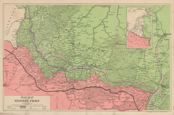
Alexander Gross, War Map of the Western Front, 1940 c.£ 225.00
-
Louis Larmat, Les Vins de Bordeaux - Loupiac - Sainte-Croix-du-Monte, 1941£ 625.00
-
Louis Larmat, Les Vins de Bordeaux - Médoc - Haut Médoc, 1941£ 595.00
-
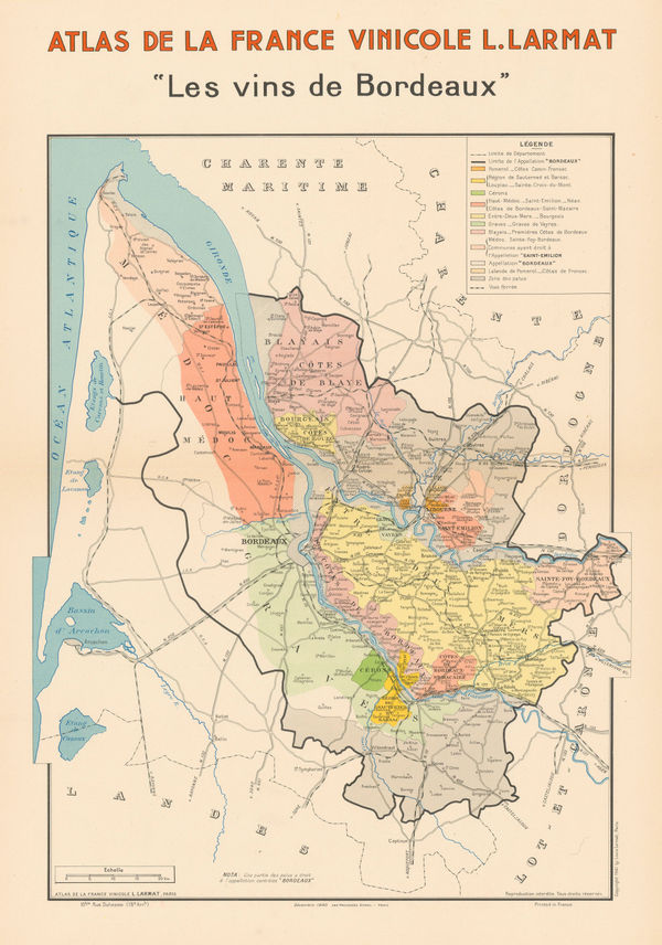
Louis Larmat, Bordeaux Wine Region, 1941£ 1,650.00
-
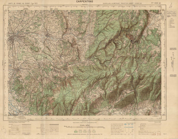
Institut géographique national (IGN), Carpentras, Provence, 1942£ 75.00
-
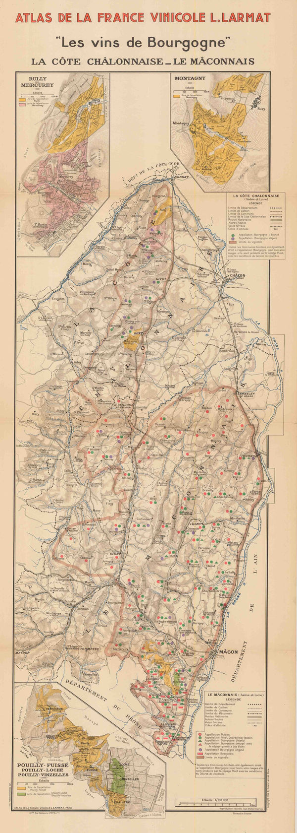
Louis Larmat, Wine map of Chalon and Macon, Burgundy, 1942£ 445.00
-
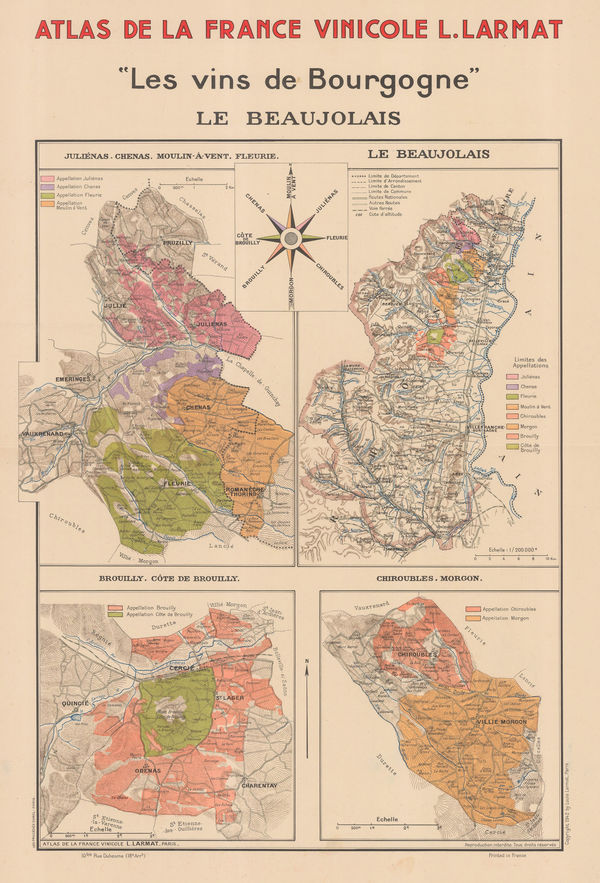
Larmat, Vineyards of Burgundy, 1942£ 645.00
-
Louis Larmat, Burgundy Wine Map - La Côte de Nuits, 1942£ 1,500.00
-
Louis Larmat, "Les vins de Bourgogne" - La Côte de Beaune, 1942£ 1,650.00
-
Louis Larmat, Les Vins de Bourgogne - Chablis Grand Cru - Chablis, 1942£ 795.00
-
Louis Larmat, Wine map of Tavel and Châteauneuf-du-Pape, Côtes du Rhône, 1943£ 550.00
-
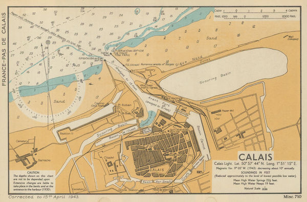
War Office, Calais, 1943£ 32.00
-
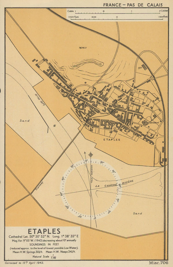
War Office, Etaples, 1943£ 32.00
-
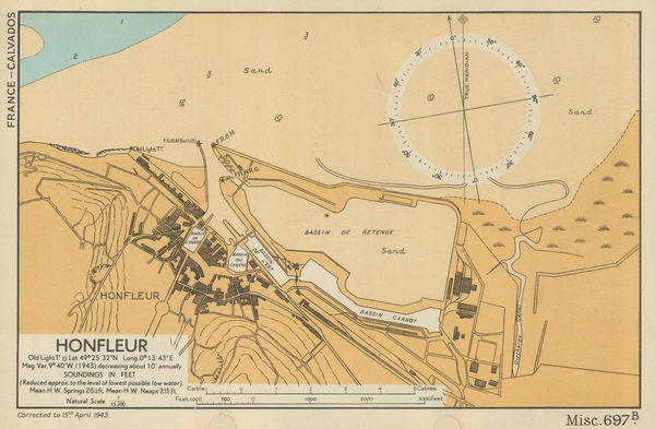
War Office, Honfleur, 1943£ 76.00
-
War Office, Mouth of the River Canche, Pas-de-Calais, 1943£ 22.00
-
Louis Larmat, Wine map of Cotes de Blaye and Cotes de Bourg, Bordeaux, 1943£ 325.00
-
Louis Larmat, Wine map of Entre-Deux-Mers, Grave de Vayres- Sainte-Foy-Bordeaux, 1943£ 425.00
-
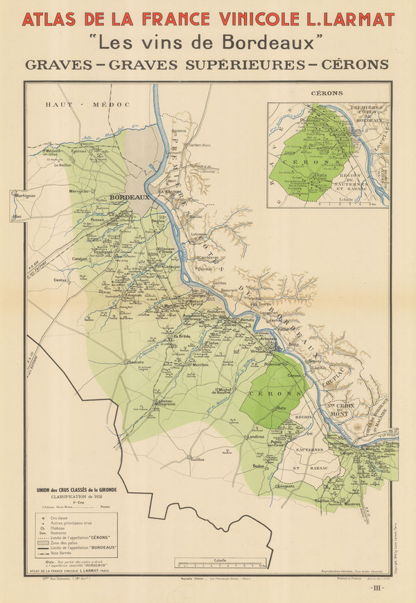
Louis Larmat, Wine map of Graves, Graves Superieures, and Cerons, Bordeaux, 1943£ 365.00
-
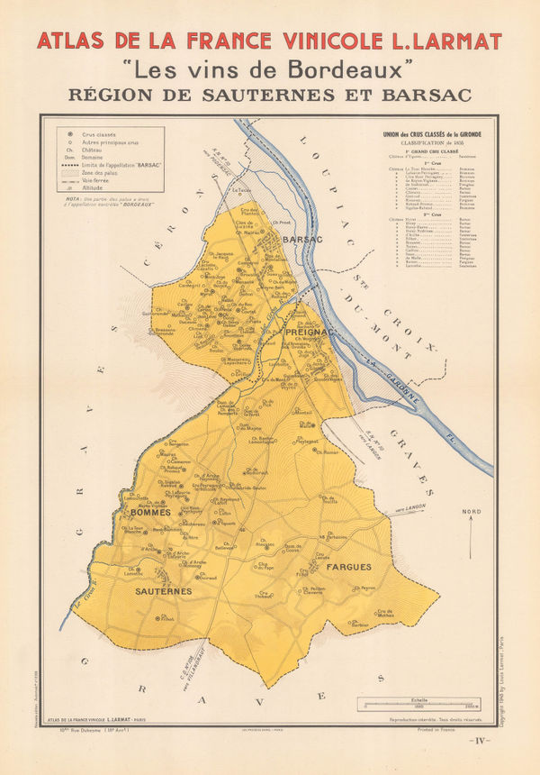
Louis Larmat, Wine map of Sauternes, Barsac, Preignac, and Bommes, Bordeaux, 1943£ 325.00
-
Louis Larmat, Wine map of Châteauneuf-du-Pape and Tavel, Côtes du Rhône, 1943£ 545.00
-
War Office, River Seine: Le Havre to Rouen, 1943£ 36.00
-
War Office, Le Tréport, Normandy, 1943£ 32.00
-
War Office, Trouville, 1943£ 72.00
-
Jean Dratz, Bordeaux et ses Vins, 1943£ 850.00
-
Monaco Tourism Office, Principality of Monaco, 1943£ 1,450.00
-
Louis Larmat, Champagne - Vallée de la Marne et L'Aisne, 1944£ 450.00
-
Louis Larmat, Champagne - La Cote des Blancs, 1944£ 450.00
-
Louis Larmat, Infographic Chart of Champagne Production & Quality from 1844-1943, 1944£ 450.00
-
Louis Larmat, Champagne - Côte des Bar, 1944£ 545.00
-
Louis Larmat, Champagne - Montagne de Reims & Vallée de l'Ardre, 1944£ 545.00
-
Louis Larmat, Champagne - Montagne de Reims & Éperon de Bouzy, 1944£ 450.00
-
Louis Larmat, Wine map of Vouvray, Loire Valley, 1946£ 495.00
-
Louis Larmat, Wine map of Coteaux de Touraine, Loire Valley, 1946£ 550.00
-
Wine map of Quincy & Reuilly and Sancerre & Pouilly-sur-Loire, Loire Valley, 1946Louis LarmatSeries: ParisLouis Larmat, Wine map of Quincy & Reuilly and Sancerre & Pouilly-sur-Loire, Loire Valley, 1946£ 550.00
-
Louis Larmat, Wine map of Burgundy, 1946£ 450.00
-
Louis Larmat, Geological map of the Bordeaux wine region, 1947£ 95.00
-
Louis Larmat, Cognac producing regions of France, 1947£ 380.00
-
Walter Crotch, Wine map of Mâconnais, 1947£ 75.00
-
Walter Crotch, Wine Map of Mercurey, 1947£ 65.00
-
Walter Crotch, Wine map of Anjou, Loire Valley, 1947£ 72.00
-
Walter Crotch, Wine map of Saint-Émilion, Bordeaux, 1947£ 195.00
-
Walter Crotch, Chateauneuf-du-Pape, 1947£ 85.00
-
Air France, Paris, 1947£ 2,950.00
-
Walter Crotch, Bordeaux Wine Map, 1947£ 55.00
-
Walter Crotch, Bordeaux Wine Regions, 1947£ 55.00
-
Walter Crotch, Franche-Comte, 1947£ 62.00
-
Walter Crotch, Region du Centre, 1947£ 55.00
-
Walter Crotch, Vins Doux Naturels, 1947£ 65.00
-
Walter Crotch, Vignoble de Chablis, 1947£ 65.00
-
Walter Crotch, Medoc and Haut-Medoc, 1947£ 75.00
-
Walter Crotch, South-East France, 1947£ 65.00
-
Walter Crotch, South-West France, 1947£ 68.00
-
Walter Crotch, Muscadet, 1947£ 68.00
-
Walter Crotch, Sancerrois Vineyards, 1947£ 55.00
-
Walter Crotch, Medoc, 1947£ 78.00


Page
6
of 7