-
 Victor Levasseur, Meurthe-et-Moselle, 1847£ 60.00
 -
Victor Levasseur, Lozère, 1847£ 60.00
-
Victor Levasseur, Maine-et-Loire, 1847£ 65.00
-
Victor Levasseur, Mayenne, 1847£ 60.00
-
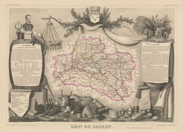
Victor Levasseur, Loiret, 1847£ 60.00
-
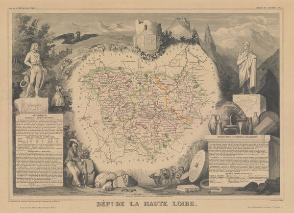
Victor Levasseur, Haute-Loire, 1847£ 60.00
-
Victor Levasseur, Loir-et-Cher, 1847£ 85.00
-
Victor Levasseur, Jura, 1847£ 60.00
-
Victor Levasseur, Indre-et-Loire, 1847£ 70.00
-
Victor Levasseur, Indre, 1847£ 60.00
-
Victor Levasseur, Gard, 1847£ 95.00
-
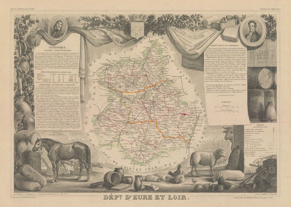
Victor Levasseur, Eure-et-Loir, 1847£ 60.00
-
Victor Levasseur, Drôme, 1847£ 60.00
-
Victor Levasseur, Cantal, 1847£ 60.00
-
Victor Levasseur, Allier, 1847£ 60.00
-
Victor Levasseur, Aube, 1847£ 80.00
-
Victor Levasseur, Alpes-de-Haute-Provence (Basses-Alpes), 1847£ 80.00
-
Victor Levasseur, Ardennes, 1847£ 60.00
-
Victor Levasseur, Paris and Environs, 1847£ 85.00
-
Victor Levasseur, Calvados, 1847£ 85.00
-
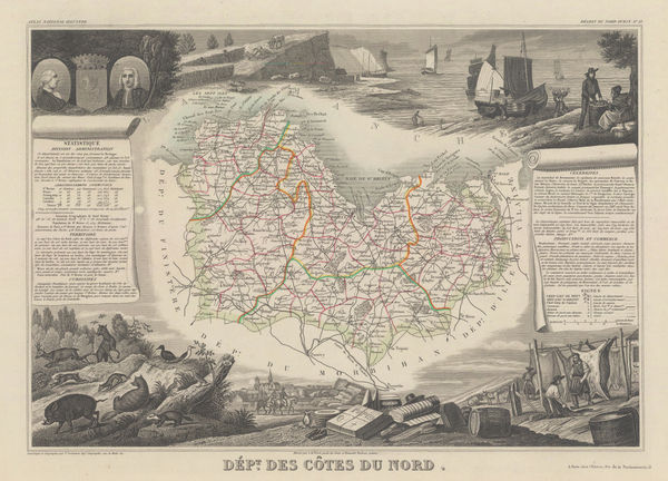
Victor Levasseur, Côtes-d'Armor (Côtes-du-Nord), 1847£ 140.00
-
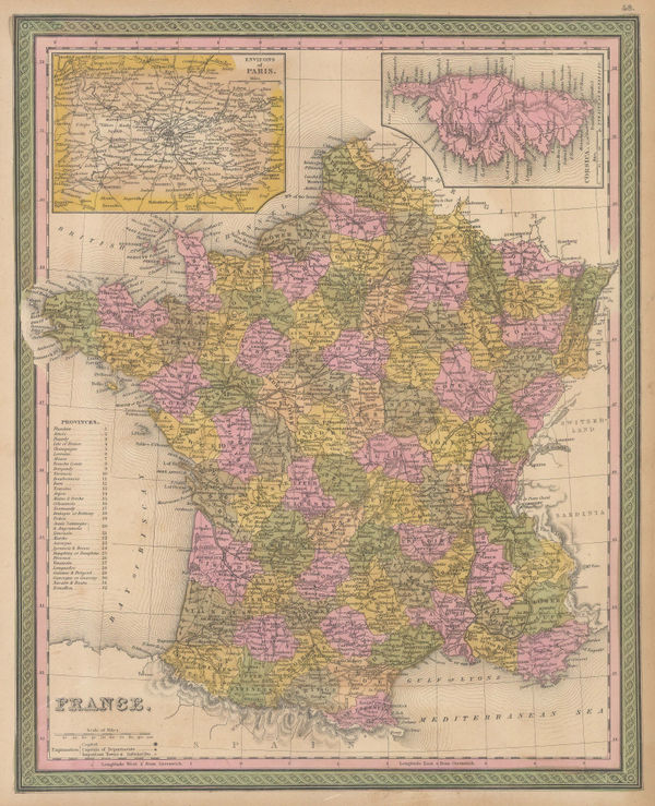
Samuel Augustus Mitchell, France, 1847 c.£ 95.00
-
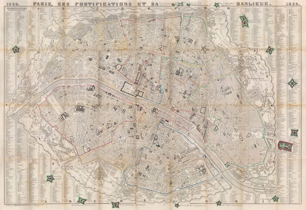
Danlos, Paris, 1850£ 675.00
-
A. Perret, The Pyrenees, 1850£ 395.00
-
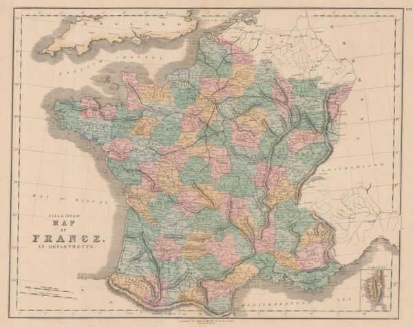
Gall & Inglis, France in Departments, 1850 c.£ 65.00
-
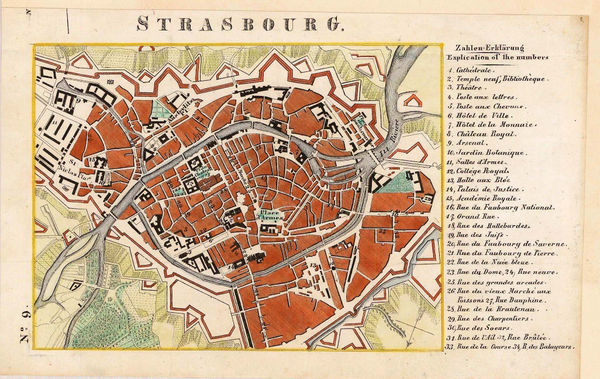
J. Lehnhardt, Strasbourg, 1850 c.£ 45.00
-
Society for the Diffusion of Useful Knowledge (SDUK), Toulon, 1853£ 40.00
-
Society for the Diffusion of Useful Knowledge (SDUK), Paris, 1854 c.£ 475.00
-
Pierre Tardieu, Paris showing Districts & Quarters, 1855£ 595.00
-
Lallemand, Tourist map of Paris, 1856£ 445.00
-
Jean Andriveau-Goujon, Plan of Paris, 1856£ 695.00
-
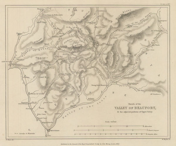
Royal Geographical Society (RGS), Valley of Beaufort and parts of Upper Savoy, 1856£ 175.00
-
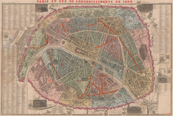
A. Bernard, Paris divided into 20 Arrondissements, 1860£ 950.00
-
G. C. Castellini, Monaco, 1860£ 1,450.00
-
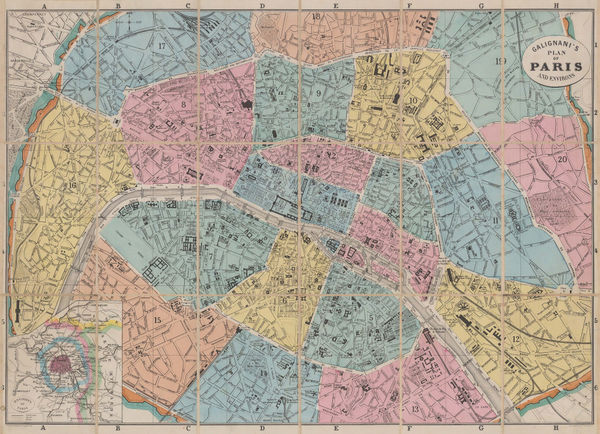
A. & W. Galignani & Co., Paris divided into Arrondissements, 1860 c.£ 345.00
-
Jean Joseph Mieulet, Controversial survey map of the Mont Blanc peaks., 1865£ 1,750.00
-
Aleph, Scarce caricature map of France, 1869£ 1,350.00
-
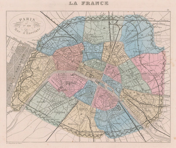
Alexandre Vuillemin, Paris showing the Thiers Wall, 1869£ 250.00
-
E. Coutaut, Wine map of Gironde, 1873£ 4,250.00
-
F. Robaudy, Ligurian coast or Italian Riviera, 1880£ 495.00
-
W. & A.K. Johnston, Paris, 1880 c.£ 115.00
-
British Admiralty, Bay of Biscay, 1881£ 950.00
-
Adolphe Joanne, Haute Savoie & Mont Blanc, 1882£ 165.00
-
Louis Thuillier, Monaco, 1884£ 38.00
-
Louis Thuillier, Environs de Nice, 1884£ 58.00
-
A. Simon, Plan of the port of Dieppe, 1886£ 64.00
-
Royal Geographical Society (RGS), The Western Alps, 1886£ 95.00
-
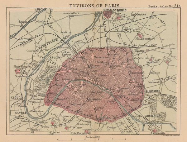
J.G. Bartholomew, Environs of Paris, 1887£ 38.00
-
Arbuckle Brothers Company, France, 1889£ 125.00
-
J. Migeon, France divided into Departments, 1891£ 50.00
-
Letts & Son, Lett's Map of the City of Paris, 1892£ 345.00
-
J.G. Bartholomew, Plan of Paris, 1893£ 115.00
-
J.G. Bartholomew, South-Eastern France, 1893£ 64.00
-
J.G. Bartholomew, Environs of Nice and Monaco, 1893£ 88.00
-
J.G. Bartholomew, Plan of Central Paris, 1893£ 95.00
-
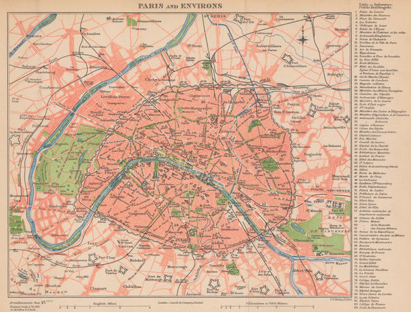
Cassell & Co., Paris and Environs, 1895 (c.)£ 78.00
-
Larousse, Paris , 1900 c£ 125.00
-
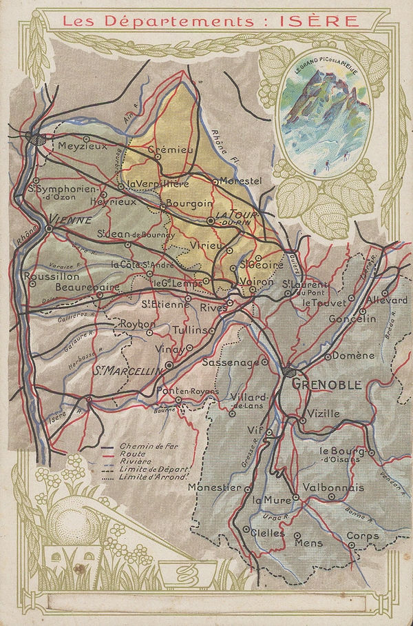
Chocolat d'Aiguebelle, Isère, 1900 c.£ 48.00
-
C. Legresle, La Cote d'Azur, 1902£ 895.00
-
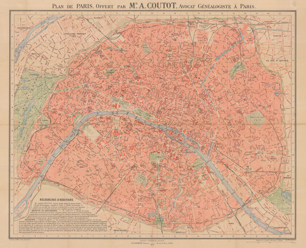
A. Simon, Plan of Paris, 1902£ 325.00
-
Emil Reich, The Hundred Years' War I (1338-1396), 1903£ 60.00
-
Emil Reich, The Hundred Years' War II (1396-1453), 1903£ 60.00
-
De Dion-Bouton, Automobile Racing through the Pyrenees, 1905£ 395.00
-
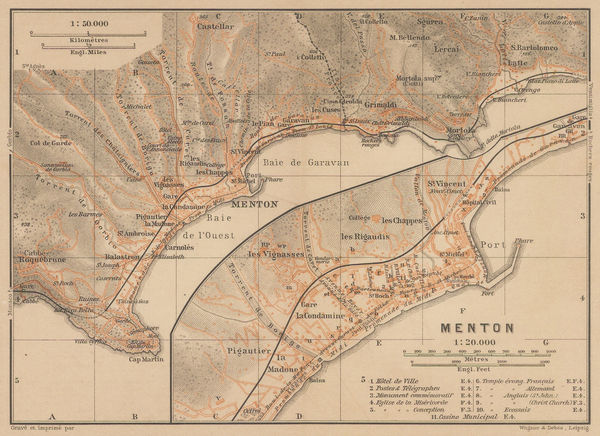
Karl Baedeker, Menton, 1906£ 36.00
-
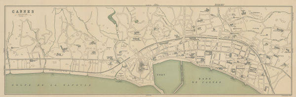
Karl Baedeker, Cannes, 1907£ 44.00
-
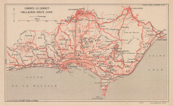
Eugène Dufrenoy, Cannes and environs, 1907£ 68.00
-
Eugène Dufrenoy, Provence & the Côte d'Azur, 1910 (c.)£ 150.00
-
A. Cretin-Pellion, Beaune, Burgundy, 1910 (c.)£ 120.00
-
John Bartholomew, Cannes, 1910 c.£ 185.00
-
Eugène Dufrenoy, Les Maures, 1910c.£ 68.00
-
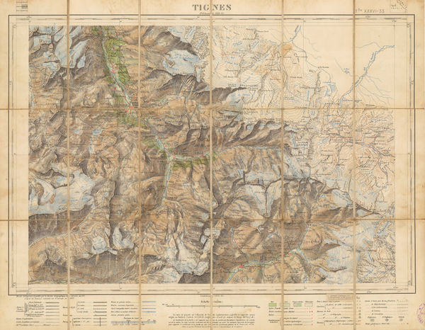
Service Géographique de l'Armée, Tignes/Val d'Isere, 1911£ 2,450.00
-
Lilian Tennant, France, 1912£ 220.00
-
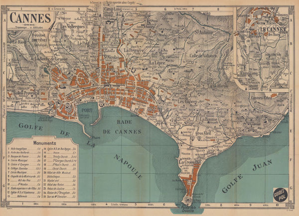
E. Fonne, Cannes, 1914£ 250.00
-
E. Fonné, Menton, 1914£ 68.00
-
The Graphic Magazine, WWI - the Battle of Verdun, 1916£ 125.00
-
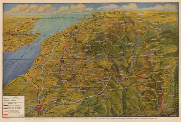
Otto Kurth, WWI - Western Front in September, 1918, 1918£ 250.00
-
Harmsworth, Dixmude to Arras, 1920 c.£ 44.00
-
Harmsworth, Lens and Arras, 1920 c.£ 42.00
-
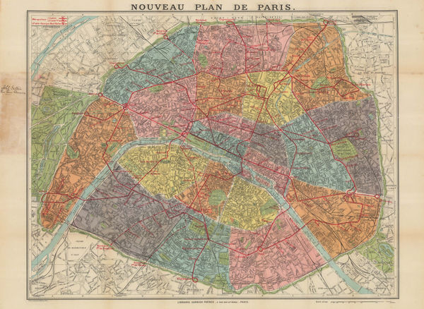
Garnier Frères, Railway map of Paris, 1920 c.£ 195.00
-
Harmsworth, Western Front (British and German Attacks), 1920 c.£ 75.00


Page
5
of 7