-
 John Cary, Herefordshire, 1809£ 65.00
 -
John Cary, Lancashire, 1809£ 85.00
-
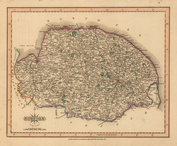
John Cary, Norfolk, 1809£ 78.00
-
John Cary, Northamptonshire, 1809£ 54.00
-
John Cary, Rutlandshire, 1809£ 45.00
-
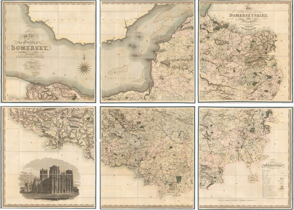
John Cary, Somersetshire, 1809£ 98.00
-
John Cary, Sussex, 1809£ 165.00
-
John Cary, Wiltshire, 1809£ 82.00
-
John Cary, Yorkshire - Northern part of the West Riding, 1809£ 82.00
-
John Cary, Yorkshire - Southern part of the West Riding, 1809£ 82.00
-
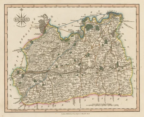
John Cary, Surrey, 1809£ 245.00
-
John Cary, Lincolnshire , 1809£ 98.00
-
John Cary, Shropshire, 1809£ 78.00
-
John Cary, Durham, 1809£ 75.00
-
John Cary, Cambridgeshire, 1809£ 55.00
-
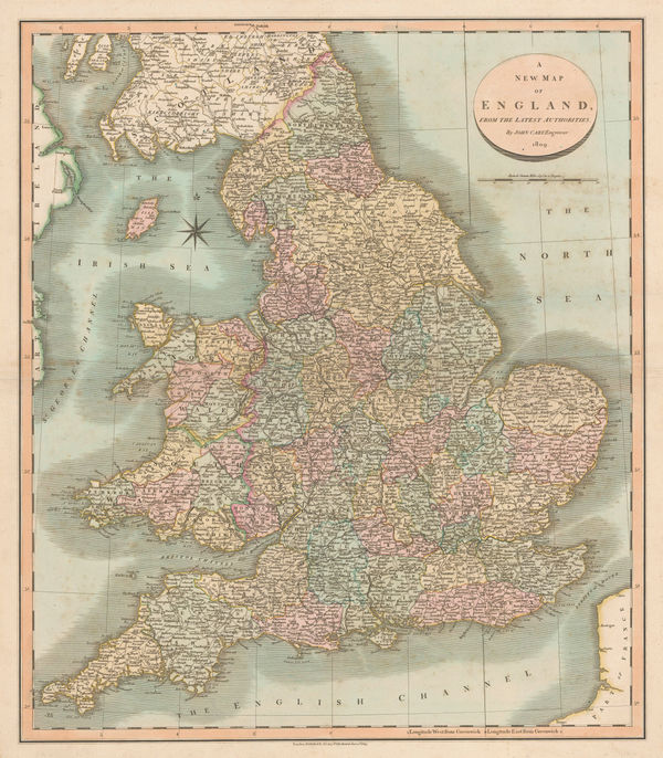
John Cary, A New Map of England, 1809£ 345.00
-
John Cary, Leicestershire, 1810£ 25.00
-
Daniel Paterson, New Four Sheet Map of England and Wales, 1810£ 1,850.00
-
John Cary, Berkshire, 1810£ 55.00
-
William Faden, A Map of Wiltshire, 1810£ 850.00
-
Cole & Roper, St Albans, 1810£ 95.00
-
John Wallis, Durham, 1810 c.£ 26.00
-
John Wallis, Middlesex, 1810 c.£ 52.00
-
John Wilkes, Lincolnshire, 1811£ 82.00
-
James Clarke, Isle of Wight, 1812£ 950.00
-
John Pinkerton, Scilly Isles, Shetland and Channel Islands, 1814£ 225.00
-
Samuel John Neele, Reading, 1814£ 125.00
-
John Thomson, Isles of Scilly, 1815 c.£ 64.00
-
Ordnance Survey, East Sussex, 1816£ 495.00
-
Langley & Belch, England and Wales, 1817£ 445.00
-
John Cary, Hertfordshire, 1817£ 62.00
-
Langley & Belch, Langley's New Map of Berkshire, 1817£ 125.00
-
Langley & Belch, Langley's New Map of Cambridgeshire, 1817£ 88.00
-
Langley & Belch, Langley's New Map of Cheshire, 1817£ 115.00
-
Langley & Belch, Langley's New Map of Cumberland, 1817£ 98.00
-
Langley & Belch, Langley's New Map of Derbyshire, 1817£ 80.00
-
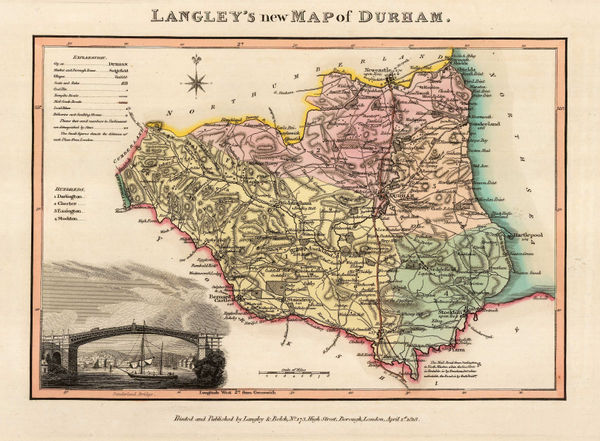
Langley & Belch, Langley's New Map of Durham, 1817£ 82.00
-
Langley & Belch, Langley's New Map of Essex, 1817£ 145.00
-
Langley & Belch, Langley's New Map of Herefordshire, 1817£ 72.00
-
Langley & Belch, Langley's New Map of Huntingdonshire, 1817£ 85.00
-
Langley & Belch, Langley's New Map of Lincolnshire, 1817£ 92.00
-
Langley & Belch, Langley's New Map of Northamptonshire, 1817£ 85.00
-
Langley & Belch, Langley's New Map of Northumberland, 1817£ 95.00
-
Langley & Belch, Langley's New Map of Oxfordshire, 1817£ 165.00
-
Langley & Belch, Langley's New Map of Rutlandshire, 1817£ 58.00
-
Langley & Belch, Langley's New Map of Staffordshire, 1817£ 115.00
-
Langley & Belch, Langley's New Map of Surrey, 1817£ 175.00
-
Langley & Belch, Langley's New Map of Warkwickshire, 1817£ 98.00
-
Langley & Belch, New Map of Surrey, 1817 c.£ 155.00
-
Sidney Hall, Northamptonshire, 1818£ 40.00
-
John Wilkes, Northamptonshire, 1819£ 85.00
-
John Wilkes, Northumberland, 1819£ 75.00
-
William Darton, Travelling Companion through England and Wales, 1819£ 395.00
-
Ordnance Survey, Kent, 1819£ 495.00
-
William Darton, Bedfordshire, 1820£ 35.00
-
Sidney Hall, Leicestershire, 1820£ 20.00
-
Map of the County of Wilts, from Actual Survey in the Years 1819 & 1820, 1820Christopher & John GreenwoodSeries: LondonChristopher & John Greenwood, Map of the County of Wilts, from Actual Survey in the Years 1819 & 1820, 1820£ 3,750.00
-
William Darton, Northumberland, 1820£ 25.00
-
Sidney Hall, Somersetshire, 1820£ 18.00
-
William Darton, Westmoreland, 1820£ 30.00
-
William Darton, Worcestershire, 1820£ 30.00
-
Sidney Hall, Suffolk, 1820 c.£ 45.00
-
Christopher & John Greenwood, Map of the County of Kent, 1821£ 3,850.00
-
Jonathan Hebner, The Grand Southern Tour of England, 1821£ 1,250.00
-
Christopher & John Greenwood, Map of the County of Somerset, 1822£ 2,950.00
-
James Bingley, Canterbury, 1822£ 125.00
-
Christopher & John Greenwood, Map of the County of Surrey, 1823£ 3,250.00
-
Andrew Bryant, Map of the County of Surrey from Actual Survey, 1823£ 4,950.00
-
Aristide Michel Perrot, Middlesex, 1823£ 45.00
-
Edward Baines, Ashton-under-Lyne, 1824£ 55.00
-
Edward Baines, Blackburn, 1824£ 85.00
-
Edward Baines, Lancaster, 1824£ 95.00
-
Andrew Bryant, Map of the County of Gloucester from Actual Survey, 1824£ 3,500.00
-
Christopher & John Greenwood, Map of the County of Westmoreland, 1824£ 825.00
-
Map of the County Palatine of Lancashire with the Latest Improvements, 1824Edward BainesSeries: LeedsEdward Baines, Map of the County Palatine of Lancashire with the Latest Improvements, 1824£ 175.00
-
Edward Baines, Rochdale, 1824£ 65.00
-
Edward Baines, Stockport, 1824£ 65.00
-
William Buckland, Geological Map of Oxfordshire & the Cotswolds, 1824£ 145.00
-
William Swire, Liverpool and its environs, 1824£ 495.00
-
William Kemp, Egham Race Course, 1825£ 88.00


Page
8
of 15