-
 Archibald Fullarton, Roxburgh Shire, 1860 c.£ 48.00
 -
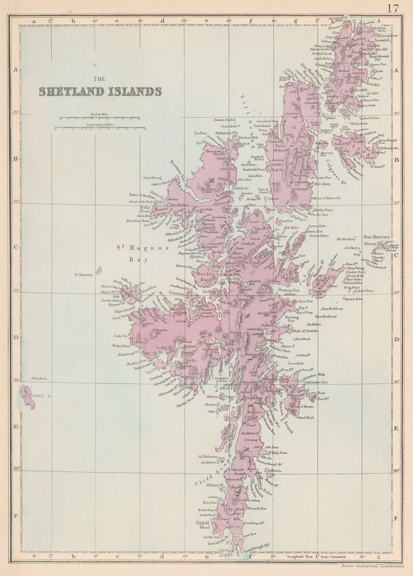
Edward Weller, The Shetland Islands, 1863 (c.)£ 115.00
-
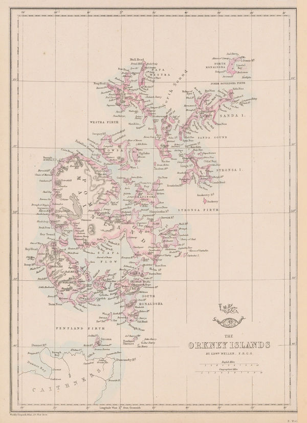
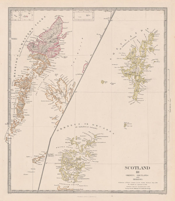
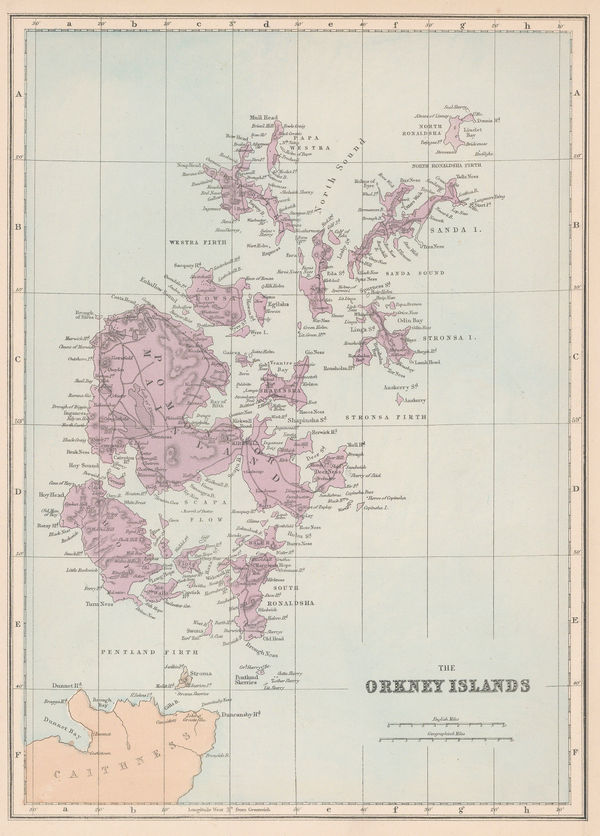
Edward Weller, The Orkney Islands, 1863 (c.)£ 115.00
-
Ordnance Survey, Glasgow, 1865£ 625.00
-
British Admiralty, Kyles of Bute, 1867£ 225.00
-
Aleph, Scotland, 1869£ 1,850.00
-
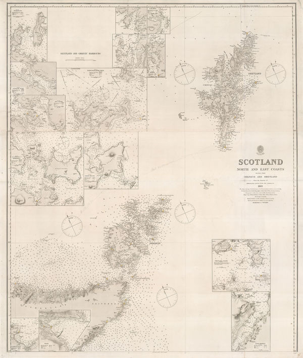
British Admiralty, Orkneys and Shetland Isles, 1872£ 325.00
-
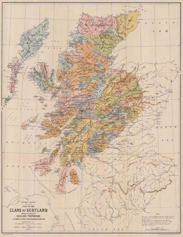
W. & A.K. Johnston, Map of the Clans of Scotland, 1873£ 950.00
-
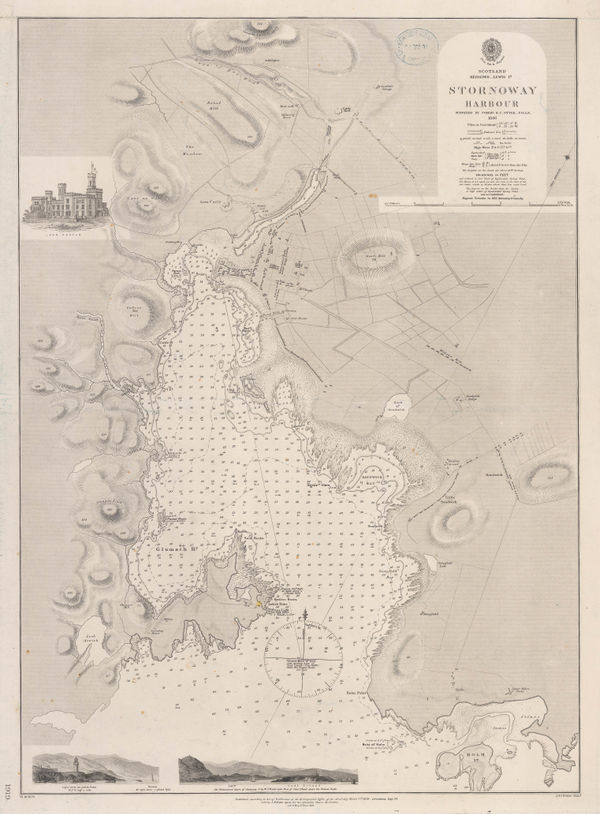
British Admiralty, Stornoway Harbour, 1874£ 150.00
-
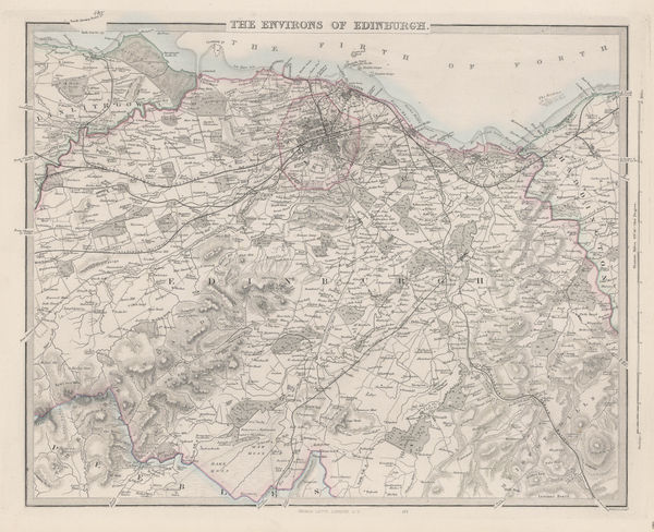
The Environs of Edinburgh, 1875 c.Society for the Diffusion of Useful Knowledge (SDUK)Series: LondonSociety for the Diffusion of Useful Knowledge (SDUK), The Environs of Edinburgh, 1875 c.£ 175.00
-
British Admiralty, Isle of Skye, 1878£ 695.00
-
British Admiralty, Kyle Akin Harbour, 1879£ 175.00
-
Letts & Son, Orkney, Shetland & Hebrides, 1880 (c.)£ 185.00
-
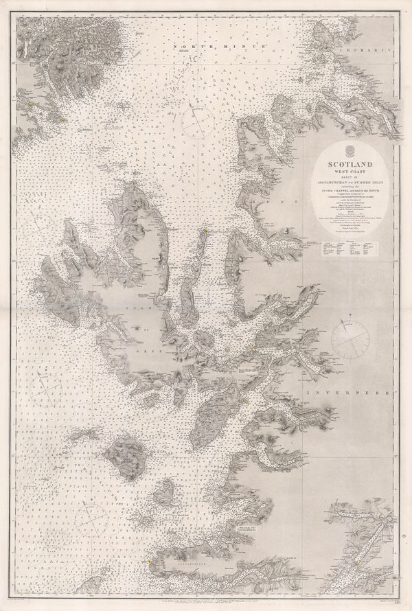
British Admiralty, Western Scotland, 1882£ 885.00
-
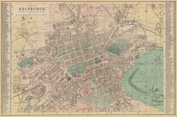
Letts & Son, Plan of Edinburgh, 1882£ 285.00
-
J.G. Bartholomew, Ayr and Land of Burns, 1885£ 26.00
-
J.G. Bartholomew, Inverness, 1885£ 36.00
-
George W. Bacon, Shetland Islands, 1885 (c.)£ 125.00
-
George W. Bacon, Orkney Islands, 1885 (c.)£ 125.00
-
Henry Cuthbert Tunison, Scotland, 1885 (c.)£ 95.00
-
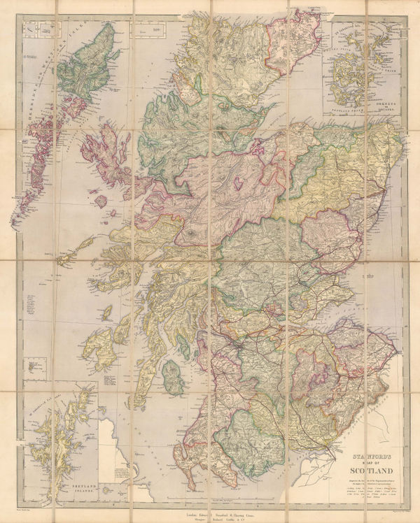
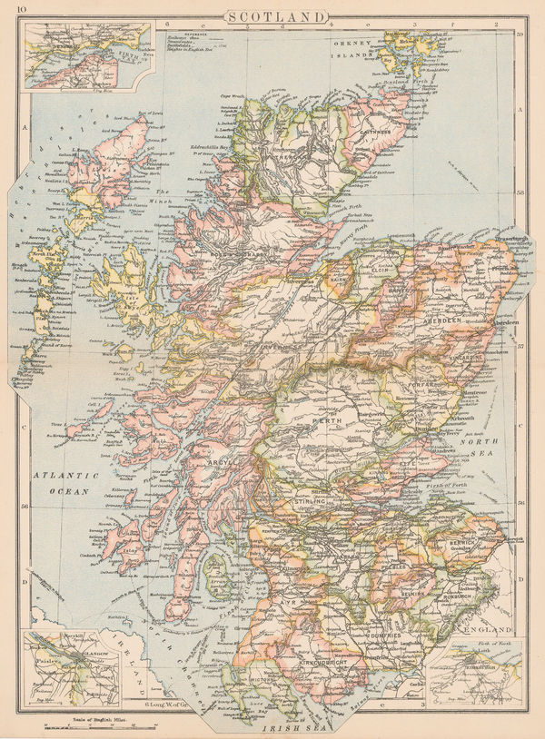
Edward Stanford, Map of Scotland, 1885 c.£ 325.00
-
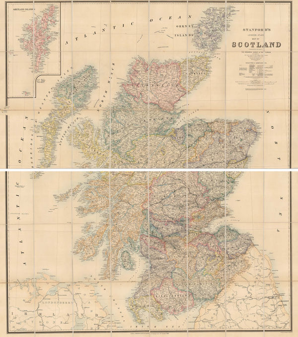
Edward Stanford, Map of Scotland, 1886£ 675.00
-
Arbuckle Brothers Company, Scotland, 1889£ 165.00
-
George W. Bacon, The Environs of Dundee, 1895 (c.)£ 65.00
-
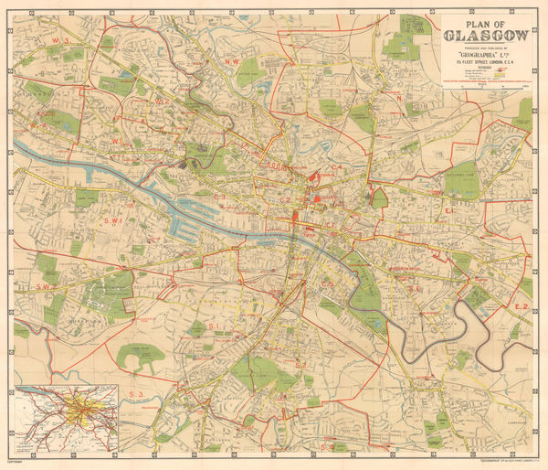
George W. Bacon, Plan of Glasgow, 1895 c.£ 295.00
-
George W. Bacon, Plan of Edinburgh, 1895 c.£ 285.00
-
George W. Bacon, Scotland, 1898£ 75.00
-
John Bartholomew & Co., Geological Map of Scotland, 1900 (c.)£ 550.00
-
J.G. Bartholomew, Plan of Aberdeen, 1900 c.£ 125.00
-
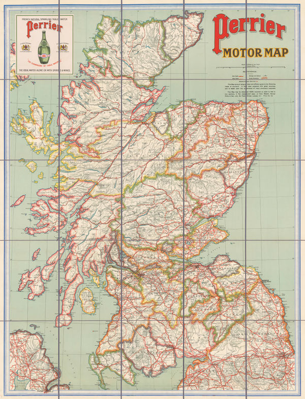
George Philip & Son Ltd., Perrier Motor Map of Scotland, 1906£ 400.00
-
John Bartholomew, Edinburgh, 1908£ 95.00
-
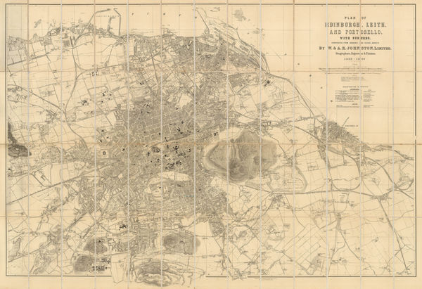
W. & A.K. Johnston, Plan of Edinburgh, Leith and Portobello with Suburbs, 1909£ 845.00
-
Edward Stanford, Edinburgh, 1913£ 115.00
-
Edward Stanford, St Andrews, 1913£ 125.00
-
George Philip & Son Ltd., Glasgow, 1915 c.£ 68.00
-
John Bartholomew & Co., Skye, 1920 (c.)£ 375.00
-
Iliffe & Sons Ltd., The Autocar Folding Map of Scotland, 1930 (c.)£ 450.00
-
J.G. Bartholomew, Edinburgh, 1930 c£ 450.00
-
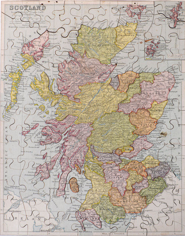
George Philip & Son Ltd., Scotland Jigsaw Puzzle, 1930 c.£ 325.00
-
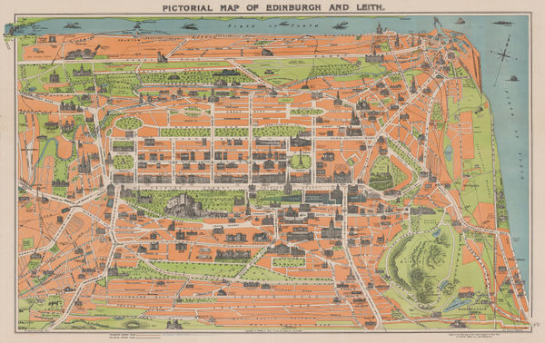
George Reid, Pictorial Map of Edinburgh and Leith, 1935£ 325.00
-
Geographia Ltd., Plan of Glasgow, 1938£ 225.00
-
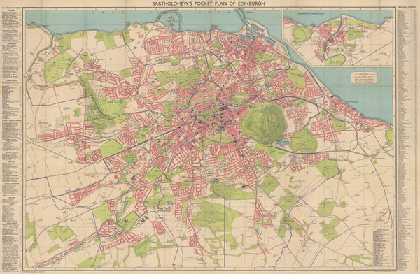
John Bartholomew, Pocket Plan of Edinburgh and Suburbs, 1941 c.£ 385.00
-
W. & A.K. Johnston, Clan Map of the Scottish Highlands, 1950 c£ 450.00
-
Sifton Praed & Co., Fisherman's Map of Salmon Pools on the River Dee, 1975 c.£ 95.00
-
Sifton Praed & Co., Fisherman's Map of Salmon Pools on the River Tay, 1975 c.£ 75.00


Page
3
of 3