-
 Capt. Greenvile Collins, Sea Chart of the Harbours of Dundee, Aberdeen & Montrose, 1785£ 495.00
 -
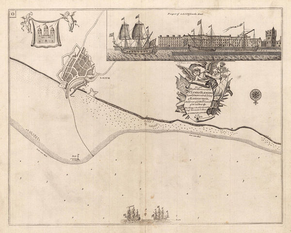
Capt. Greenvile Collins, Sea Chart of Leith, Edinburgh, 1785£ 575.00
-
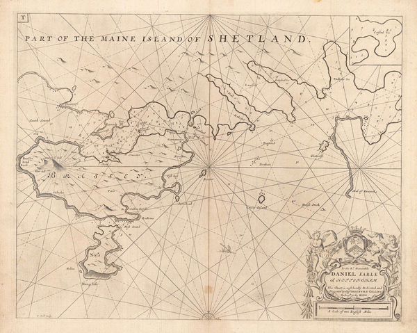
Capt. Greenvile Collins, Shetland - Lerwick, Bressay & Noss, 1785£ 345.00
-
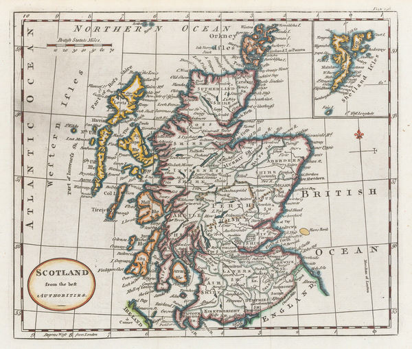
William Guthrie, Scotland from the best Authorities, 1792£ 115.00
-
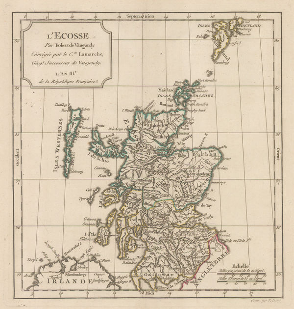
Charles Francois Delamarche, L'Ecosse, 1795£ 275.00
-
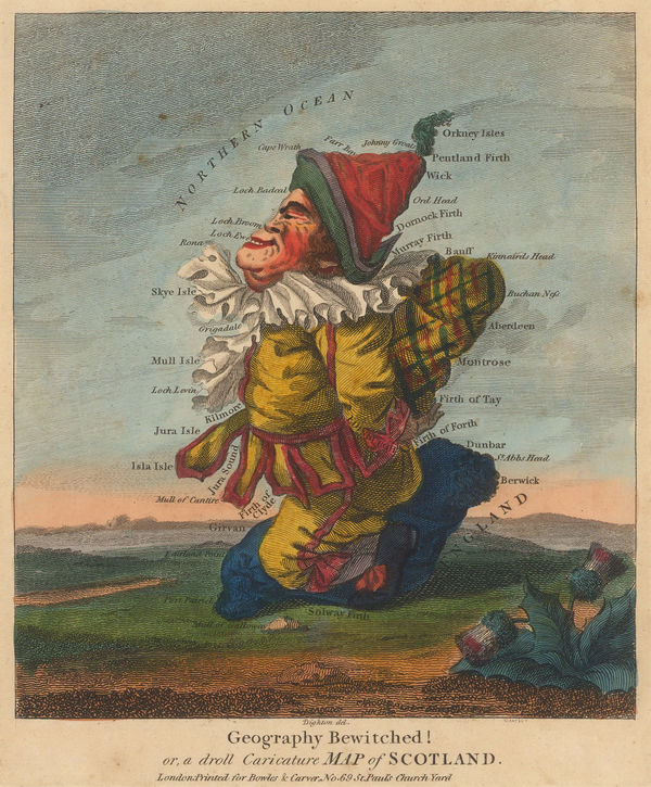
Robert Dighton, Geography Bewitched! or, a droll Caricature Map of Scotland, 1797£ 4,000.00
-
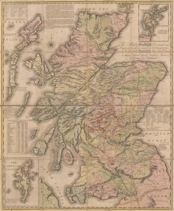
Scotland drawn and engraved from a series of Angles and Astronomical Observations, 1800John AinslieSeries: EdinburghJohn Ainslie, Scotland drawn and engraved from a series of Angles and Astronomical Observations, 1800£ 4,500.00
-
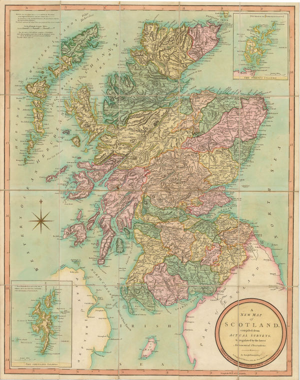
John Cary, A New Map of Scotland, 1801£ 1,550.00
-
Heather's New and Improved Chart of the Orkney Isles. Drawn from the Most Accurate Surveys., 1804William HeatherSeries: LondonWilliam Heather, Heather's New and Improved Chart of the Orkney Isles. Drawn from the Most Accurate Surveys., 1804£ 1,650.00
-
Kirkwood & Sons' Travelling Map of Scotland, 1804James Kirkwood & SonsSeries: Edinburgh, Perth & LondonJames Kirkwood & Sons, Kirkwood & Sons' Travelling Map of Scotland, 1804£ 975.00
-
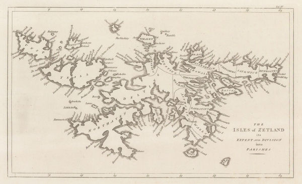
John Cary, The Isles of Zetland, 1805£ 125.00
-
John Pass, A New and Correct Map of Scotland, 1808£ 195.00
-
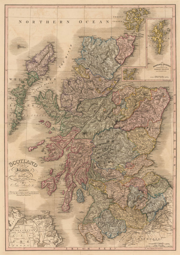
William Faden, Scotland with its Islands, 1813£ 950.00
-
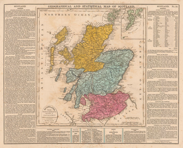
C.V. Lavoisne, Geographical and Statistical Map of Scotland, 1813£ 225.00
-
John Pinkerton, Scilly Isles, Shetland and Channel Islands, 1814£ 225.00
-
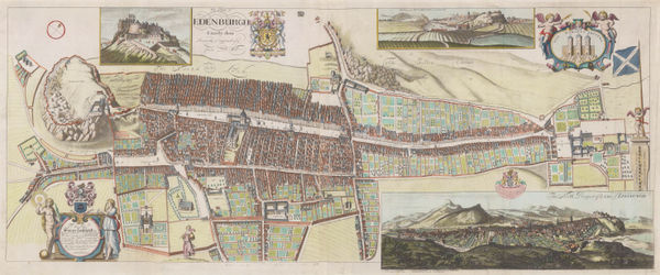
John Bowles, Rare view of 17th century Edinburgh, 1814 (c.)£ 3,500.00
-
Richard Holmes Laurie, A New Map of Scotland, 1821£ 575.00
-
John Thomson, Berwickshire, 1821£ 375.00
-
John Thomson, Kircudbright-shire (North Sheet), 1821£ 325.00
-
John Thomson, Kirkcudbright-Shire, 1821£ 595.00
-
John Thomson, Edinburghshire (Southeast Sheet), 1821£ 295.00
-
John Thomson, Edinburghshire (Southwest Sheet), 1821£ 275.00
-
John Thomson, Caithness Shire, 1822£ 485.00
-
John Thomson, Kincardine Shire, 1822£ 375.00
-
John Thomson, Lanarkshire (South Sheet), 1822£ 525.00
-
John Thomson, Roxburgh Shire (South Sheet), 1822£ 395.00
-
John Thomson, Western Isles (North Sheet), 1822£ 495.00
-
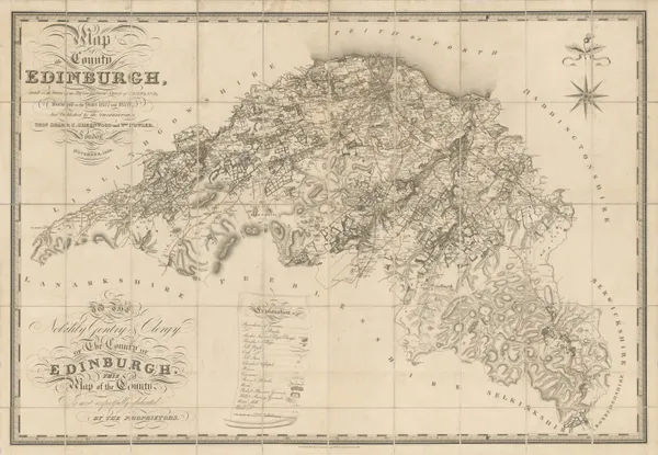
John Thomson, Northern Part of Edinburghshire [Two Sheets], 1822£ 475.00
-
John Thomson, Haddington, 1822£ 495.00
-
John Thomson, Lanarkshire (North Sheet), 1822 c.£ 325.00
-
Aristide Michel Perrot, Aberdeen - Kincardine, 1823£ 82.00
-
Aristide Michel Perrot, Haddington - Edinburgh - Berwick, 1823£ 68.00
-
Aristide Michel Perrot, Inverness, 1823£ 78.00
-
Aristide Michel Perrot, Nairn - Elgin - Banff, 1823£ 74.00
-
Aristide Michel Perrot, Peebles - Selkirk - Roxburgh, 1823£ 82.00
-
Aristide Michel Perrot, Perth - Kinross, 1823£ 68.00
-
Aristide Michel Perrot, Ross, 1823£ 74.00
-
Aristide Michel Perrot, Wigtown & Kirkcudbrightshire, 1823£ 74.00
-
John Thomson, Western Isles [Southern Section], 1823£ 425.00
-
John Thomson, Selkirk Shire, 1824£ 345.00
-
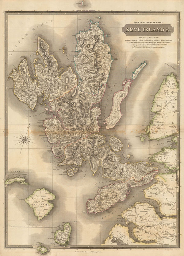
John Thomson, Skye Island &c., 1824£ 1,450.00
-
John Thomson, Aberdeen and Banff-Shires, 1826£ 1,250.00
-
John Thomson, Renfrew-Shire, 1826£ 345.00
-
John Thomson, Fife & Kinross-Shire (West Sheet), 1827£ 325.00
-
John Cary, New Sheet Map of Scotland from the Latest Authorities, 1828£ 425.00
-
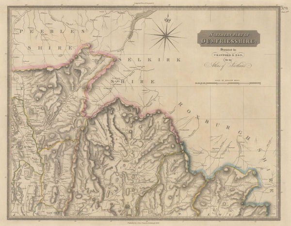
John Thomson, Dumfriesshire (Northeast Sheet), 1828£ 325.00
-
John Thomson, Dumfriesshire (Northwest Sheet), 1828£ 295.00
-
John Thomson, Ayrshire (Southeast & Southwest Sheet), 1828£ 625.00
-
John Thomson, Dumfriesshire (Southwest Sheet), 1828£ 325.00
-
John Thomson, Ayrshire (Northeast & Northwest Sheet), 1828£ 625.00
-
Christopher & John Greenwood, Edinburgh, 1828£ 2,250.00
-
John Thomson, Inverness-shire, 1830£ 1,200.00
-
Henry Teesdale, Scotland, 1830 c.£ 375.00
-
John Lothian, Dumfries, 1835£ 145.00
-
John Lothian, Kirkudbrightshire, 1835£ 145.00
-
John Lothian, Selkirk, 1835£ 145.00
-
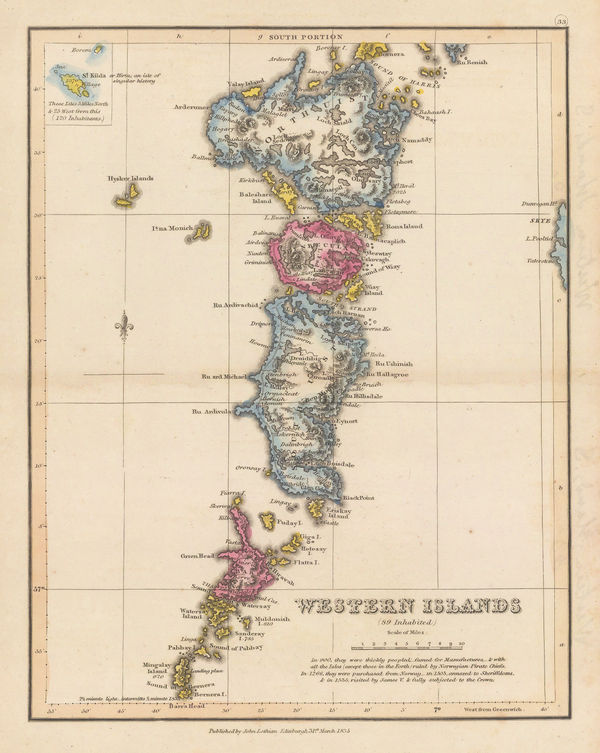
John Lothian, Western Isles (South Portion), 1835£ 145.00
-
John Lothian, Aberdeen & Banff, 1838£ 145.00
-
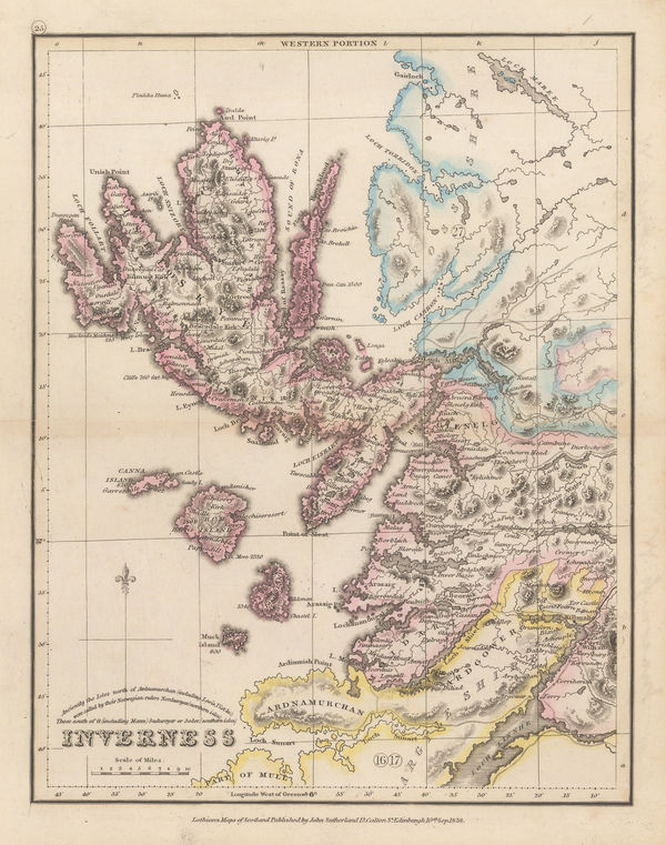
John Lothian, Inverness - Western Portion, 1838£ 175.00
-
John Lothian, Kincardine, 1838£ 125.00
-
John Lothian, Peebles, 1838£ 145.00
-
John Lothian, Perth - North Portion, 1838£ 145.00
-
John Lothian, Renfrew, 1838£ 145.00
-
John Lothian, Roxburgh, 1838£ 145.00
-
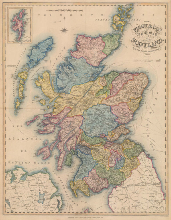
James Pigot, New Map of Scotland with the latest Improvements, 1840£ 750.00
-
W. & A.K. Johnston, Johnston's County Map of Lanarkshire, 1841£ 850.00
-
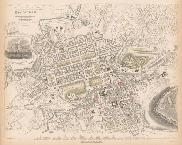
Society for the Diffusion of Useful Knowledge (SDUK), Edinburgh, 1844£ 445.00
-
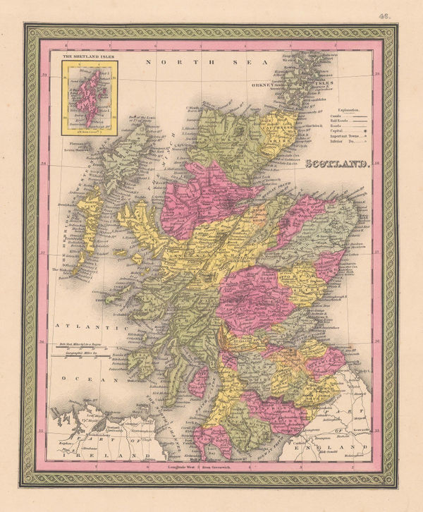
Samuel Augustus Mitchell, Scotland, 1849£ 195.00
-
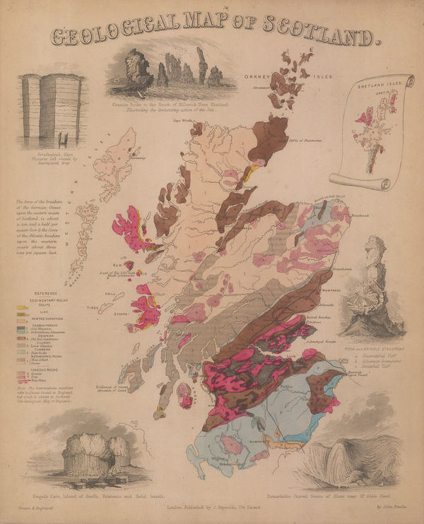
James Reynolds, Geological map of Scotland, 1850 c£ 545.00
-
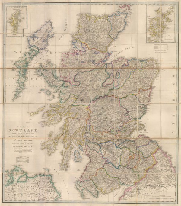
James Wyld, A Map of Scotland, 1850 c.£ 1,350.00
-
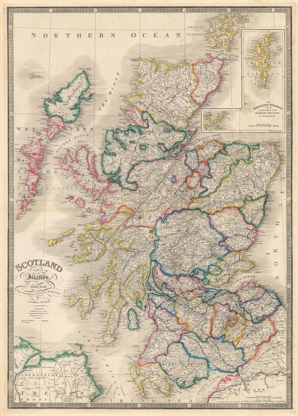
James Wyld, Scotland with its Islands, 1850 c.£ 725.00
-
John Tallis, Glasgow, 1851£ 645.00
-
John Tallis, Perth, 1851£ 345.00
-
John Tallis, Scotland, 1851£ 475.00
-
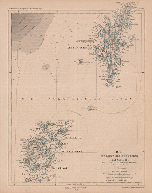
Justus Perthes, Orkney & Shetland Islands, 1855£ 75.00
-
Archibald Fullarton, Aberdeen, 1860£ 54.00
-
Archibald Fullarton, Buteshire, 1860 c.£ 38.00
-
Archibald Fullarton, Caithness Shire, 1860 c.£ 48.00
-
Archibald Fullarton, Dumfries shire, 1860 c.£ 44.00
-
Archibald Fullarton, Kincardineshire, 1860 c.£ 42.00


![John Thomson, Northern Part of Edinburghshire [Two Sheets], 1822](https://static-assets.artlogic.net/w_600,c_limit,f_auto,fl_lossy,q_auto/artlogicstorage/themaphouse/images/view/fdd8d9f33a144ae0de4ce1cf589dad73j/themaphouse-john-thomson-northern-part-of-edinburghshire-two-sheets-1822.jpg)


![John Thomson, Western Isles [Southern Section], 1823](https://static-assets.artlogic.net/w_600,c_limit,f_auto,fl_lossy,q_auto/artlogicstorage/themaphouse/images/view/bbdfddc34eefb201bcd8a736788ff46cj/themaphouse-john-thomson-western-isles-southern-section-1823.jpg)


Page
2
of 3