-
 Rand, McNally & Co., Rand McNally & Co's Map of the World, 1901£ 985.00
 -
Edward Stanford, A Chart of the World on Mercator's Projection, 1903£ 1,450.00
-
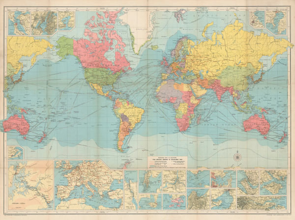
Emil Reich, The British Empire about 1800, 1903£ 70.00
-
Emil Reich, English Voyages of Discovery during the Tudor Period, 1903£ 68.00
-
W. & A.K. Johnston, The World on Mercator's Projection, 1906 (c.)£ 2,200.00
-
George W. Bacon, New Chart of the World, 1907 c.£ 2,950.00
-
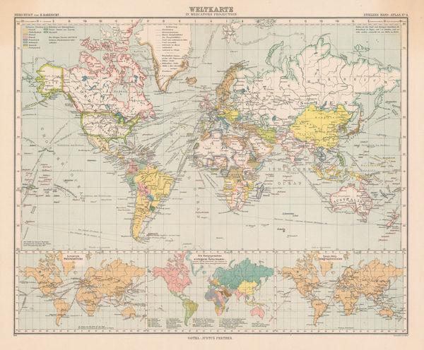
Justus Perthes, The World on Mercator's Projection, 1909£ 175.00
-
George W. Bacon, Bacon's Chart of Useful Knowledge, 1910 c.£ 3,600.00
-
Enciclopedia Segui, Climate Zones & Ocean Currents, 1910 c.£ 85.00
-
J. Dosseray, Nuevo Mapa-Mundi Planisferio, 1911£ 3,500.00
-
Cottreau & Le Chartier, M & H., Planisphère, 1911£ 85.00
-
J. Nystrom, Eastern and Western Hemispheres, 1914£ 3,500.00
-
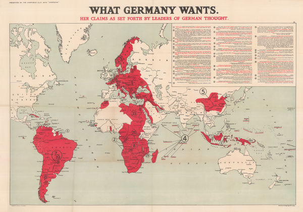
Edward Stanford, What Germany Wants, 1916£ 1,650.00
-
Alexander Gross, Commercial & Political Map of the World, 1920£ 4,950.00
-
George W. Bacon, Nightingale's New Library & Route Chart of the World, 1920 (c.)£ 1,450.00
-
John Bartholomew & Son, World Map of Vegetation and Ocean Currents, 1922£ 175.00
-
John Bartholomew & Son, World Maps throughout History, 1922£ 145.00
-
George W. Bacon, Nightingale's New Chart of the World, 1922 c.£ 2,250.00
-
W. & A.K. Johnston, Cook's Map of the World, 1928£ 88.00
-
James Daugherty, This World of Ours, 1929 c.£ 2,500.00
-
J.G. Bartholomew, Route Chart of the World, 1930 c£ 750.00
-
-
-
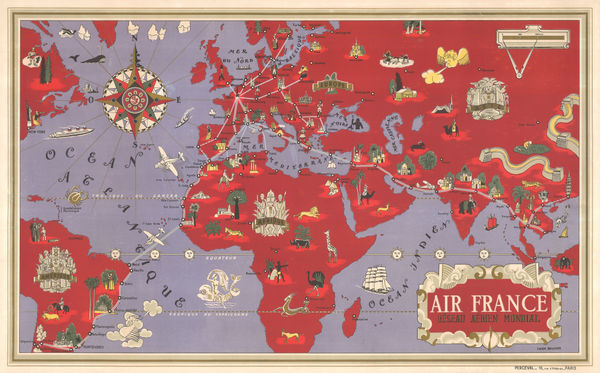
Air France, Air France - 'Reseau Aerien Mondial', 1934£ 3,500.00
-
Kingu Magazine (キング), Pre-WW2 Japanese Map of Europe, 1936£ 950.00
-
Imperial Airways, Map of the Empire and European Air Routes, 1936£ 3,000 (framed)
-
Air France, Air France 'Reseau Aerien Mondial', 1937 c.£ 4,500.00
-
Thomas Skinner, Air Routes of the World, 1938£ 900.00
-
Flying Magazine, The Empire Air Mail Scheme, 1938 c.£ 265.00
-
George Philip & Son Ltd., The World on Mercator's Projection, 1939£ 650.00
-
Richard Edes Harrison, Atlantic Arena, 1942£ 350.00
-
Richard Edes Harrison, One World One War, 1942£ 1,800.00
-
Stanley Turner, Dated Events War Map - 20th Edition, 1944£ 550.00
-
R. Merigeau, Planisphere, 1945£ 1,450.00
-
Stanley Turner, Dated Events War Map - 26th Edition, 1945£ 550.00
-
Stanley Turner, Dated Events War Map - 25th Edition, 1945£ 550.00
-
TWA (Trans World Airline), TWA Route Map, 1948£ 495.00
-
John Bartholomew & Son, United Nations Map of the World, 1948£ 395.00
-
Koen van Os, Amsterdam Travel Poster, 1950 c.£ 1,650.00
-
Guy Georget, Nautarum Gallia Salus, 1950 c.£ 245.00
-
Pan Am Airways, Routes of Pan American World Airways System, 1951£ 1,200.00
-
Pan Am Airways, Pan-American Airways - The Rainbow Service, 1954 c.£ 1,200.00
-
Carrington Birch, P&O Passenger Services Cover Half the World, 1955 c.£ 2,200.00
-
Atlantic and Indian Oceans with the Western Portion of the Pacific Ocean, 1957British AdmiraltySeries: LondonBritish Admiralty, Atlantic and Indian Oceans with the Western Portion of the Pacific Ocean, 1957£ 2,850.00
-
-
McCormick & Company, Inc, McCormick's Map of the World, 1960£ 385.00
-
Air France, Pictorial World Map, 1962£ 3,500.00
-
Air France, "Nova et Vetera" sur la vieille terre, chemins nouveaux, 1962 c.£ 3,950.00
-
J.G. Fox, Where our Cannabis Comes From, 2024£ 995 (framed)
-
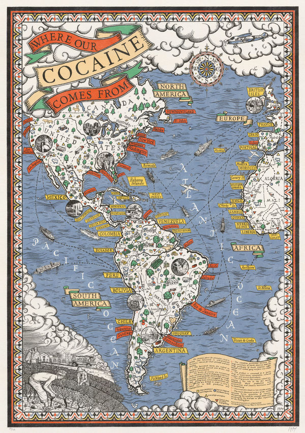
J.G. Fox, Where our Cocaine Comes From, 2024£ 495


Page
3
of 3