-
 John Blair, A Map of the World, 1779 c.£ 1,575.00
 -
J.C. & J.A. Dezauche, Planisphere Physique, 1780£ 1,150.00
-
Jacques-Nicolas Bellin, Carte Reduites des parties connues du Globe Terrestre, 1784£ 3,750.00
-
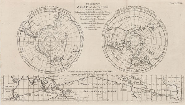
A Map of the World in Three Sections describing the Polar Regions to the Tropics, 1784Andrew BellSeries: LondonAndrew Bell, A Map of the World in Three Sections describing the Polar Regions to the Tropics, 1784£ 445.00
-
William Guthrie, Chart of the World, 1785 c£ 275.00
-
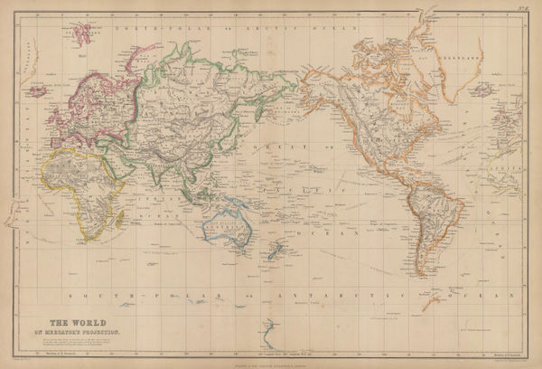
Rigobert Bonne, The World on Mercator's Projection, 1785 c.£ 295.00
-
-
Charles Cooke, The World including the Discoveries made by Captain Cook, 1790 c.£ 895.00
-
William Guthrie, Double Hemisphere World Map, 1792£ 295.00
-
Sir George Staunton, A General Chart on Mercator's Projection, 1796£ 1,450.00
-
Robert Wilkinson, Terra Veteribus Nota, 1796£ 145.00
-
William Faden, The New World and the Old World, 1798£ 525.00
-
The Division of the World between the Sons of Noah after the Great Flood, 1798Robert WilkinsonSeries: LondonRobert Wilkinson, The Division of the World between the Sons of Noah after the Great Flood, 1798£ 195.00
-
-
-
Aaron Arrowsmith, The World from the Latest Voyages & Travels, 1802£ 185.00
-
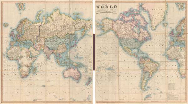
William Faden, Western Hemisphere & Eastern Hemisphere, 1802£ 2,750.00
-
-
Robert Wilkinson, The Ancient World According to Herodotus, 1802£ 175.00
-
-
-
Thomas and Andrews, The World, 1805£ 295.00
-
Thomas and Andrews, The World, 1805£ 225.00
-
Charles Francois Delamarche, Map of the World, 1805 c.£ 395.00
-
Jean-Baptiste-Louis Clouet, Mappemonde ou Globe Terestre, 1807£ 2,500.00
-
Aaron Arrowsmith, The World on Mercators Projection, 1807£ 395.00
-
John Pinkerton, [Western Hemisphere - Eastern Hemisphere], 1812£ 1,250.00
-
Conrad Malte-Brun, Mappe-Monde sur la Projection Reduite de Mercator, 1812£ 195.00
-
-
John Thomson, Chart of the World on Mercators Projection, 1820 c.£ 1,250.00
-
John Thomson, Northern and Southern Hemispheres, 1820 c.£ 1,250.00
-
John Thomson, Northern and Southern Hemispheres, 1820 c.£ 2,500.00
-
Daniel & William Lizars, Chart of the World, 1825 c£ 1,850.00
-
Thomas Starling, The World, 1830£ 295.00
-
Anonymous, Chart of the World, 1830 c£ 185.00
-
Edward Quin, A.D. 1100. Period of the First Crusade, 1830 c.£ 245.00
-
Edward Quin, A.D. 1294. The Empire of Kublai Khan, 1830 c.£ 545.00
-
Edward Quin, A.D. 1551. At the Death of Charles V., 1830 c.£ 495.00
-
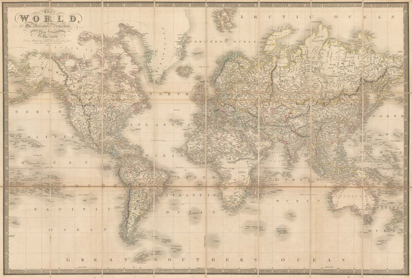
John Arrowsmith, The World, 1835£ 1,150.00
-
James Wyld, The World on Mercator's Projection, 1837£ 1,950.00
-
Geographical Diagram of the Earth Adapted for Illustrating its Movements &c., 1840 c.James ReynoldsSeries: LondonJames Reynolds, Geographical Diagram of the Earth Adapted for Illustrating its Movements &c., 1840 c.£ 275.00
-
-
W. & A.K. Johnston, Chart of the World on Mercator's Projection, 1844£ 575.00
-
James Gilbert, Map of the World on Mercator's Projection, 1844£ 4,850.00
-
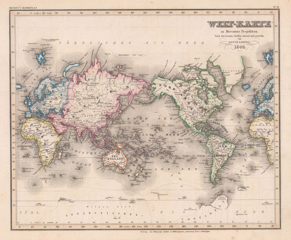
Joseph Meyer, Welt-Karte in Mercators Projektion, 1844£ 275.00
-
Victor Levasseur, Planisphere, 1847£ 650.00
-
The World, the World on a Polar Projection & recent Antarctic Discoveries, 1847 (c.)Samuel Augustus MitchellSeries: PhiladelphiaSamuel Augustus Mitchell, The World, the World on a Polar Projection & recent Antarctic Discoveries, 1847 (c.)£ 175.00
-
W. & A.K. Johnston, Zoological Geography - Carnivores, 1848£ 595.00
-
Richard Holmes Laurie, The World on Mercator's Projection, 1850£ 2,750.00
-
James Reynolds, Geological Map of the World, 1850 c£ 545.00
-
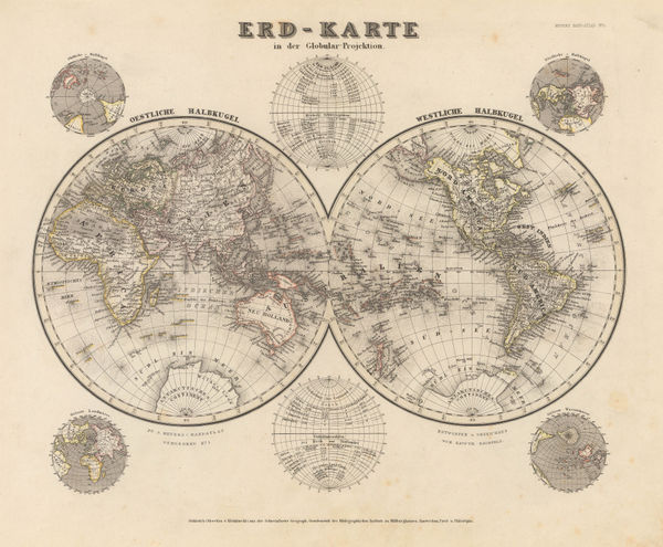
Joseph Meyer, Erd-Karte, 1850 c.£ 185.00
-
John Dower, The World, 1850 c.£ 275.00
-
John Tallis, Western and Eastern Hemisphere, 1851£ 1,150.00
-
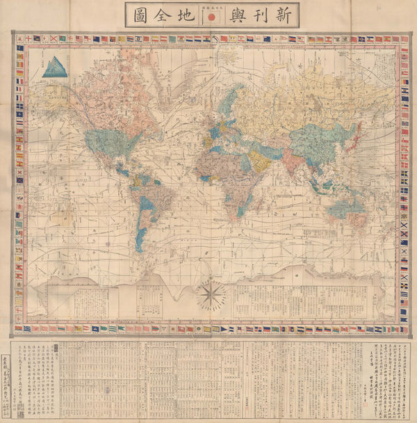
Abe Yasuyuki, Japanese Map of the World, 1853£ 845.00
-
-
W. & A.K. Johnston, Commercial Chart of the World, 1855£ 4,500.00
-
Blackie & Son, The World on Mercator's Projection, 1855 c.£ 325.00
-
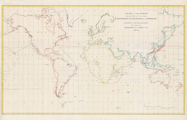
Matthew Perry, Chart of the World, 1856£ 950.00
-
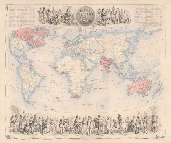
British Empire Throughout the World Exhibited in One View, 1860 c.Archibald FullartonSeries: Edinburgh, London & DublinArchibald Fullarton, British Empire Throughout the World Exhibited in One View, 1860 c.£ 2,250.00
-
-
-
George W. Bacon, The World, 1866 c£ 1,500.00
-
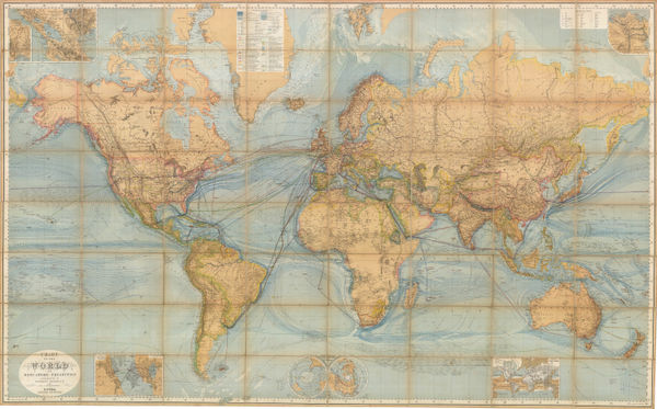
Justus Perthes, Chart of the World on Mercator's Projection, 1867 c.£ 2,250.00
-
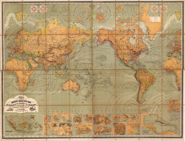
Julius Maier, Neueste Karte der Erde, 1870 c.£ 2,650.00
-
Justus Perthes, Chart of the World on Mercators Projection, 1871£ 3,250.00
-
Jules Marcou, Geological Map of the World, 1875£ 4,250.00
-
Victor Clerot, Mappemonde Orographique et Hydrographique, 1875 c.£ 4,500.00
-
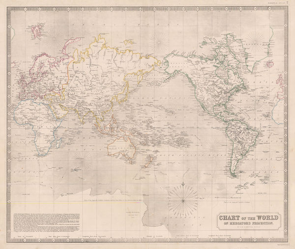
James Wyld, The World on Mercator's Projection, 1877£ 395.00
-
Eugène Andriveau-Goujon, Planisphere, 1878£ 1,450.00
-
Justus Perthes, Bubonic Plague Outbreaks from 1346 to 1879, 1879£ 325.00
-
-
A. & C. Black, The World on Mercator's Projection, 1880 c£ 395.00
-
Letts & Son, The World on Mercator's Projection, 1882£ 375.00
-
James Wyld, The World on Mercator's Projection, 1882 c.£ 1,950.00
-
The World showing the British Possessions and Chief Ports, 1885Illustrated London News (ILN)Series: LondonIllustrated London News (ILN), The World showing the British Possessions and Chief Ports, 1885£ 595.00
-
Edward Stanford, The World in Hemispheres, 1885£ 245.00
-
-
W. & A.K. Johnston, The World in Hemispheres, 1889£ 195.00
-
Scottish Geographical Society (SGS), Evolution of the Continents, 1890£ 245.00
-
Justus Perthes, Annual Temperatures of the World's Oceans, 1893£ 145.00


![John Pinkerton, [Western Hemisphere - Eastern Hemisphere], 1812](https://static-assets.artlogic.net/w_600,c_limit,f_auto,fl_lossy,q_auto/artlogicstorage/themaphouse/images/view/be9fc1bd6701b9daa2e5b0a91c28b129j/themaphouse-john-pinkerton-western-hemisphere-eastern-hemisphere-1812.jpg)


Page
2
of 3