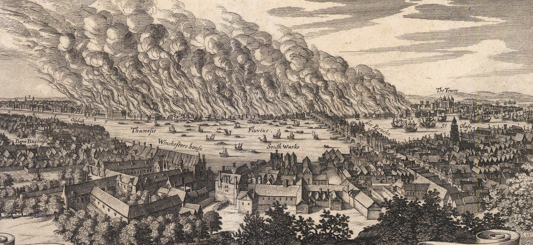
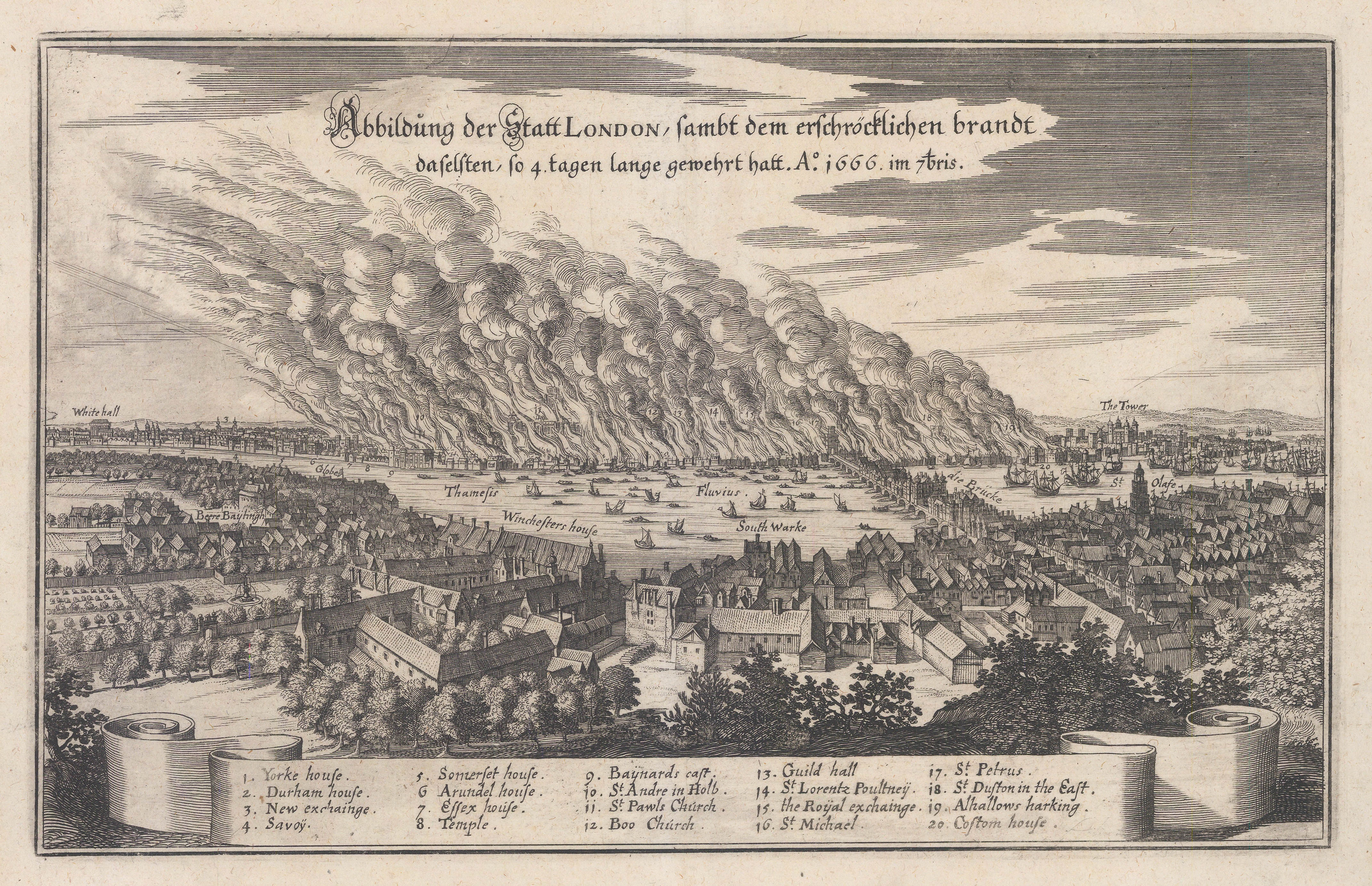
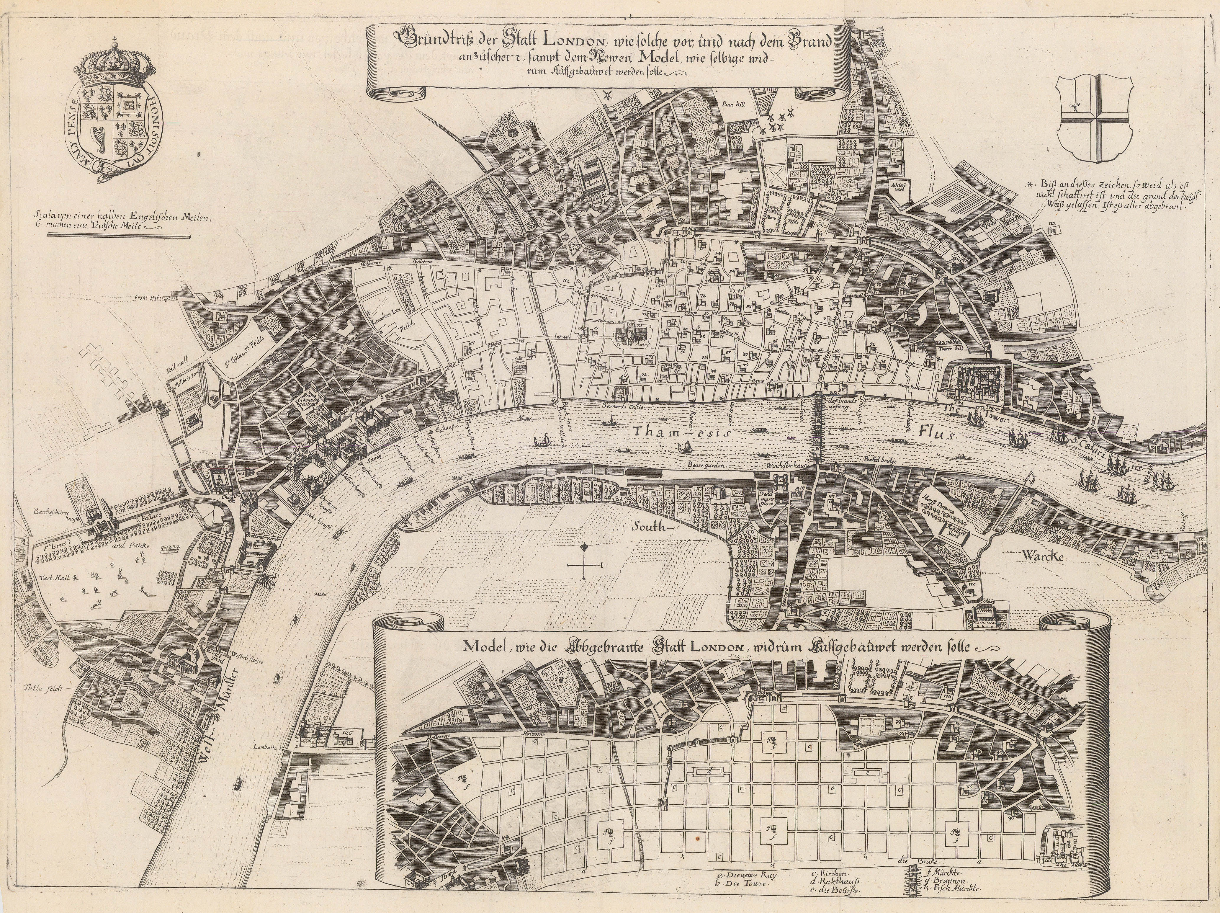
This is the view engraver and publisher Matthäus Merian encountered, which was brought to life in "Abbildung der Statt London..." (published circa 1670) - his eye-witness account of London engulfed in flames.
The damage caused by the fire is estimated to have cost approximately an excruciating £1.7 billion in today's money.
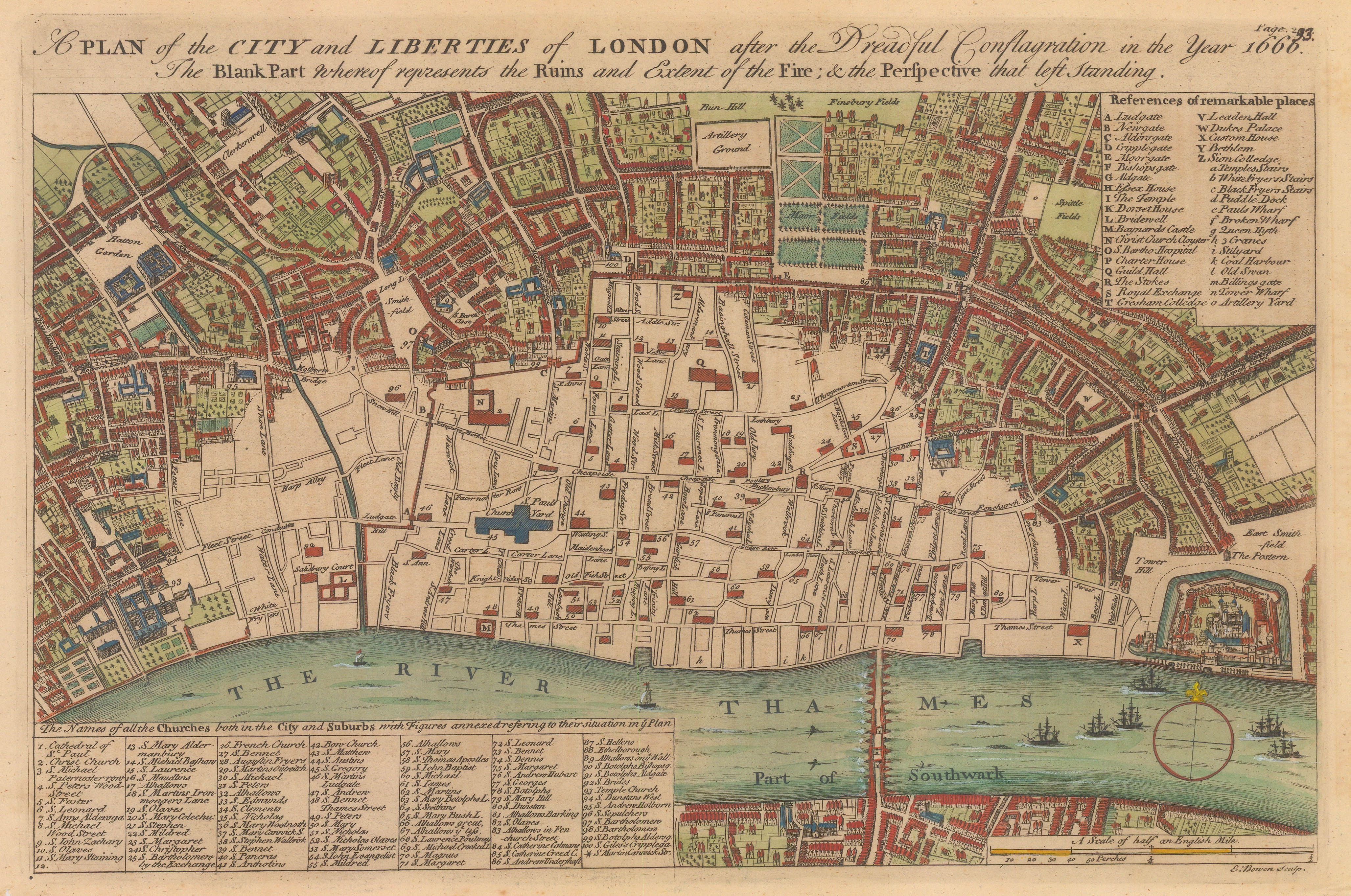
This 1740 map by Emanuel Bowen shows the extent of the devastation of the Great Fire of London from the Tower west to Fetter Lane. As a result, laws were passed for future construction to be made in stone, thus enormously reducing fire risk.
After the embers of the fire had finally burnt out, and plans were being drawn up, it was paramount that things were put in place that would protect citizens from this scale of loss happening again. In 1681, Londoners were offered Fire Insurance for the first time.
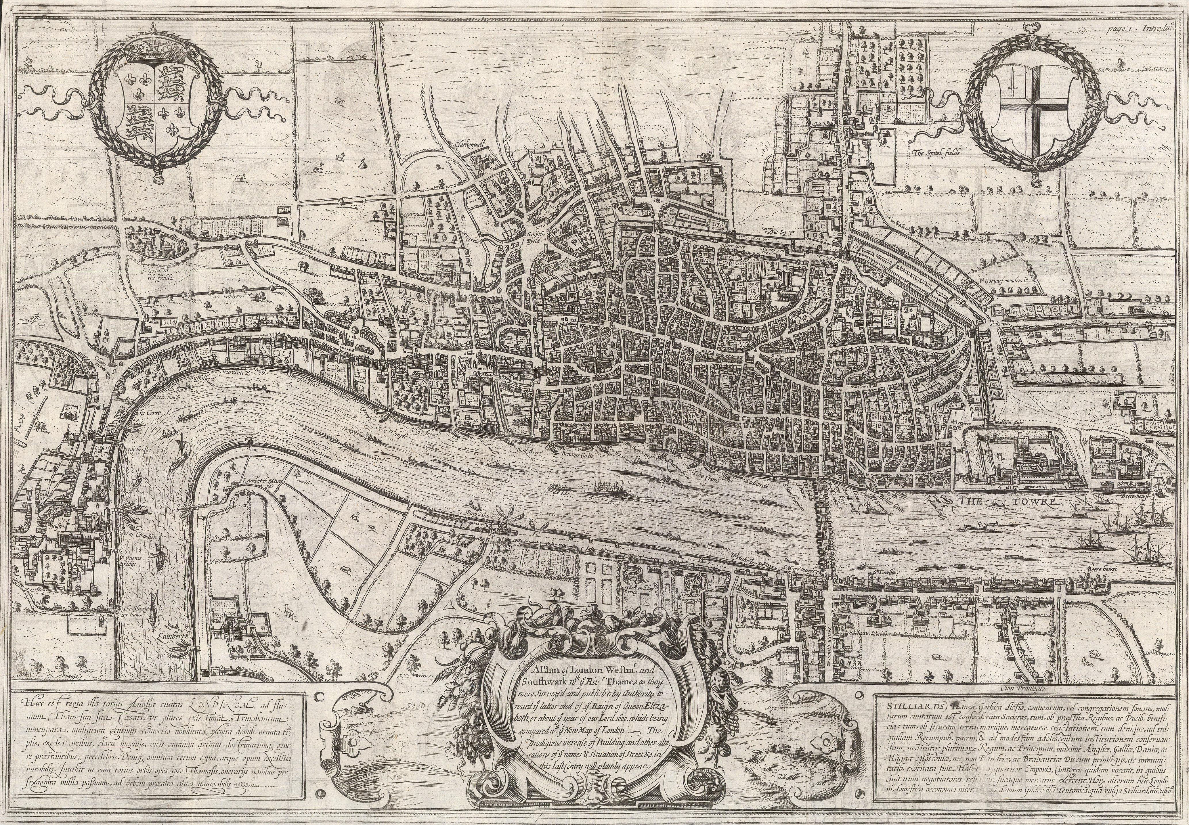
This is Edward Hatton's 1708 map of London, describing the city before The Great Fire.
Hatton was a surveyor for a fire insurance company. In 1708, the company anonymously published A New View of London: or, an Ample Account of that City, in Two Volumes, or Eight Sections. &c., featuring the aforementioned map . The cartographic source for the map was Georg Braun & Franz Hogenberg's map of London, which was first published in 1572, making it the very first map of the city available to the collector.
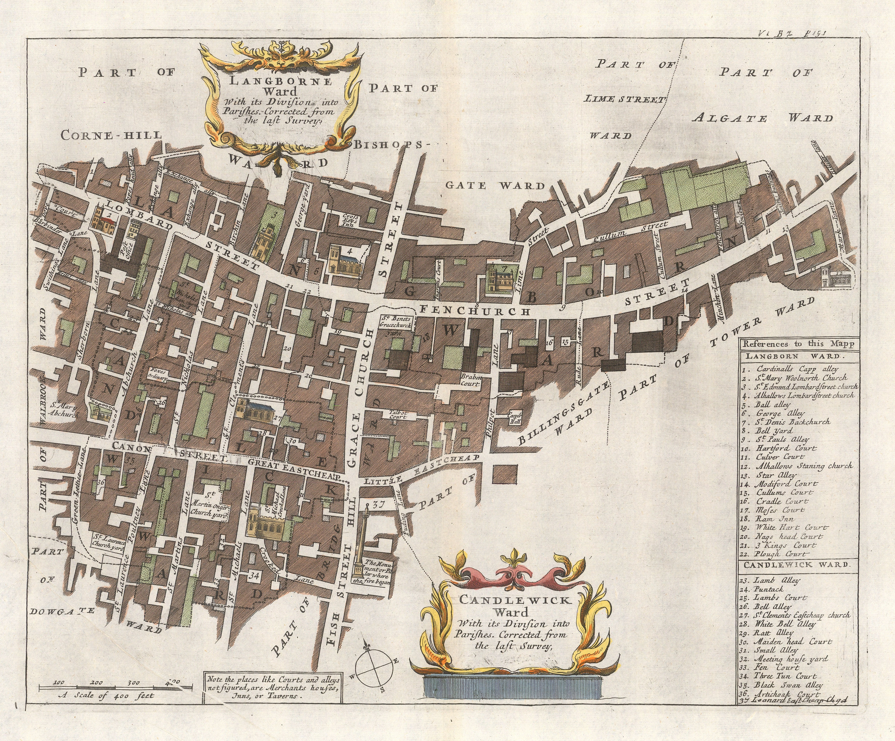
To commemorate the Great Fire, a monument designed by Sir Christopher Wren was constructed between 1671 and 1677, and erected on the very spot the fire started. This is John Stow's sectional map of the Candelwick Ward, showing Pudding Lane and The Monument, published within the first illustrated edition of Stow's seminal Survey of London, 1720.
The rebuilding of the city began with the likes of intellectual and diarist John Evelyn and esteemed architect Sir Christopher Wren, who both took centre stage with their designs. These two maps show their conflicting plans for the rebuilding of London; the upper plan by Evelyn, and the lower by Wren.
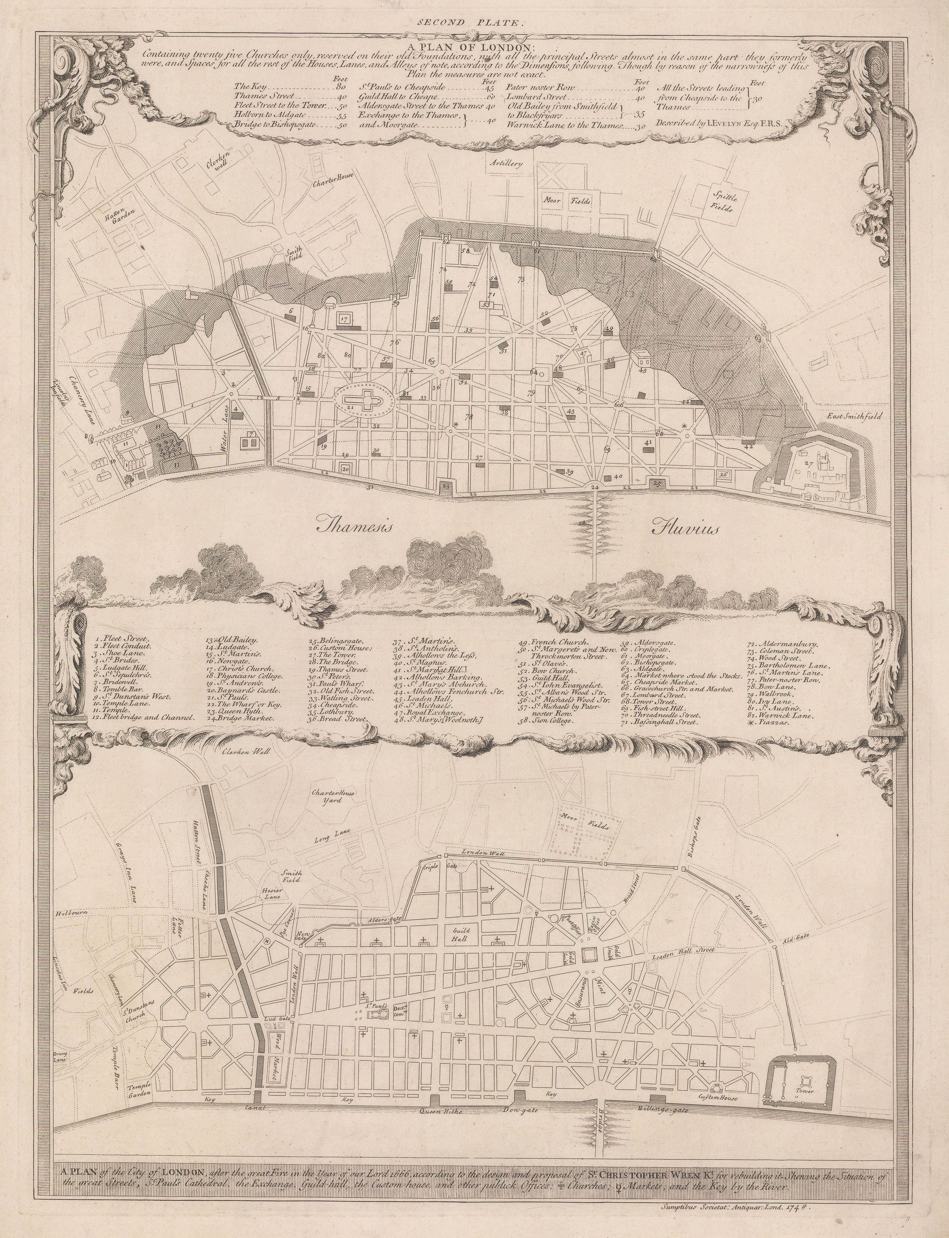
Evelyn's plan focused on retaining and restoring where possible twenty five of the most historically important churches in the City, and connecting them with straight roads. This would present a more regimented layout of the City, while not completely erasing it's charm and character.
Sir Christopher Wren's plan, on the other hand, was grand and elegant, completely changing the structure of the City. The narrow alleys and ancient roads would have been replaced by grand avenues, radial crossroads and crescents similar to the design of modern-day Paris. Wren's proposed financial circle around the Bank of England is particularly interesting as it would have brought all of the great economic institutions (i.e. the Royal Mint, the Excise Office, and the Post Office) together in one location.
The residents and businessmen of the City began rebuilding on their original plots almost from the moment the fire burnt out. Despite publicly favouring Wren's plan, King Charles II was politically and financially unable to coerce the residents of London into following a civic plan. Eventually, the only compromises made were the widening of major thoroughfares and a strict prohibition on wooden structures within the City walls.
These comparative maps were published in 1748 by the Society of Antiquaries to record the plans which had been submitted almost a century earlier. Coincidentally, during this year another major fire broke out in the City of London.
Find out more about the mapping of London by emailing maps@themaphouse.com, or peruse our entire collection of London maps visit www.themaphouse.com.