-
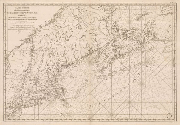
 Georges-Louis Le Rouge, Eastern coast of North America and the Mississippi river, 1787£ 1,500.00
 -
Tardieu, Carte de L'Ile de Nantucket, 1787£ 2,250.00
-
Jacques-Nicolas Bellin, Chart of Turks and Caicos, 1787£ 1,275.00
-
John Seller, Devon, 1787£ 125.00
-
John Seller, Essex, 1787£ 62.00
-
John Seller, Hertfordshire, 1787£ 55.00
-
John Seller, Lancashire, 1787£ 85.00
-
Jean Francois de La Perouse, San Diego and San Blas, 1787£ 885.00
-
Jeremiah Seller, Somersetshire, 1787£ 82.00
-
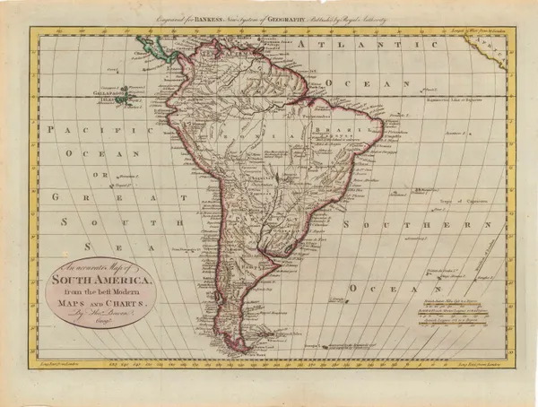
John Harrison, South America, 1787£ 225.00
-
John Seller, Staffordshire, 1787£ 58.00
-
Henry Gregory, Sea Chart of the Gulf of Thailand (Siam), 1787£ 895.00
-
Francois Soules, Siege of Yorktown, 1787£ 1,450.00
-
John Cary, Worcestershire, 1787£ 85.00
-
-
David Ramsay, South Carolina during the American Revolution, 1787£ 1,950.00
-
John Seller, Dorsetshire, 1787£ 95.00
-
David Ramsay, Siege of Yorktown, 1787£ 1,450.00
-
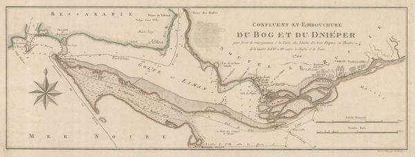
Hieronymus Benedicti, Chart of the Dniprovs'ka Gulf, 1788£ 545.00
-
John Harrison, Egypt and the course of the Nile, 1788£ 145.00
-
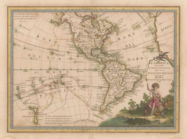
Giovanni Maria Cassini, L'America secondo le ultime osservazioni, 1788£ 875.00
-
Giovanni Maria Cassini, Asian continent, 1788£ 575.00
-
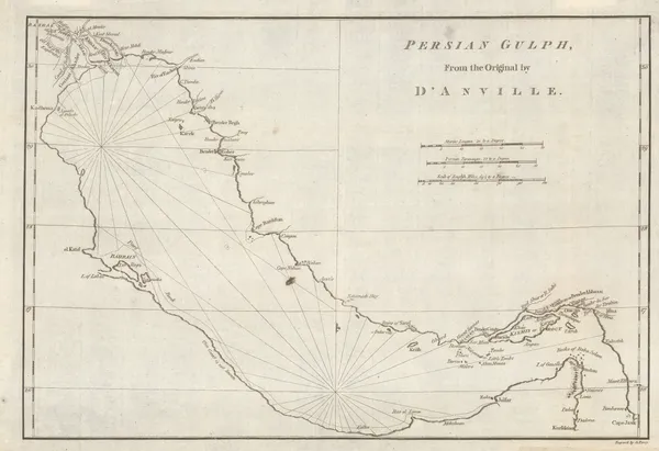
John Harrison, Chart of the Persian Gulf, 1788£ 775.00
-
Jean-Dominique Cassini, Réduction de la grande Carte de la Lune de J. Dom. Cassini, 1788£ 4,500.00
-
Antonio Zatta, The Black Sea coast, 1788£ 4,750.00
-
William Gordon, Revolutionary War map of New Jersey, 1788£ 645.00
-
William Faden, Germany and the Holy Roman Empire, 1788£ 195.00
-
John Stockdale, Store ship Alexander's voyage from Port Jackson to Batavia, 1789£ 195.00
-
John Stockdale, Chart of the Track of the Scarborough from Port Jackson to Guam, 1789£ 245.00
-
John Harrison, A Map of Derbyshire, 1789£ 125.00
-
William Faden, Belgium, 1789£ 275.00
-
Franz Von Reilly, Das Furstenthum Wales, 1789£ 185.00
-
David Ramsay, Plan of the Siege of Charleston, 1789£ 695.00
-
John Stockdale, Plan of Port Jackson, New South Wales, 1789£ 1,250.00
-
Louis Capitaine du Chesne, Northeastern USA, 1789 (c.)£ 475.00
-
John Harrison, A Map of Oxfordshire, 1790£ 175.00
-
Robert Sayer, Italy, Sicily, Sardinia & Corsica, 1790£ 295.00
-
Robert Sayer, Kingdoms of Spain and Portugal, 1790£ 195.00
-
Robert Sayer, Scandinavia, 1790£ 385.00
-
John Harrison, Eastern North America, 1790£ 1,750.00
-
John Cary, Cambridgeshire, 1790£ 35.00
-
John Cary, Rutlandshire, 1790£ 30.00
-
John Cary, Somersetshire, 1790£ 25.00
-
Robert Sayer, Russian Empire, 1790£ 495.00
-
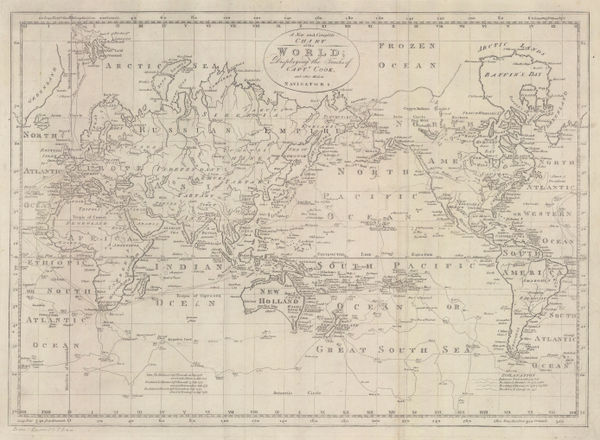
Thomas Bowen, A New and Complete Chart of the World, 1790£ 750.00
-
Rigobert Bonne, Indonesia, Malaysia and New Guinea, 1790 c£ 395.00
-
Emanuel Bowen, Chart of the Pacific Ocean with voyages of Captain James Cook, 1790 c.£ 895.00
-
Rigobert Bonne, South America, 1790 c.£ 80.00
-
Thomas Bowen, South America, 1790 c.£ 225.00
-
Charles Theodore Middleton, India and the East Indies, 1790 c.£ 325.00
-
Rigobert Bonne, Asia, 1790 c.£ 85.00
-
Carte de L'Hemisphere Austral Montrant les Routes des Navigateurs les plus Célebres Par le Captaine Jacques Cook, 1790 c.Capt. James CookSeries: ParisCapt. James Cook, Carte de L'Hemisphere Austral Montrant les Routes des Navigateurs les plus Célebres Par le Captaine Jacques Cook, 1790 c.£ 2,500.00
-
Capt. James Cook, Cook's survey of Tahiti, 1790 c.£ 575.00
-
Franz Von Reilly, Guernsey, 1790 c.£ 345.00
-
Franz Von Reilly, Koenigreiche Kroatien, 1790 c.£ 395.00
-
Robert de Vaugondy, Chinese Empire, 1790 c.£ 425.00
-
Rigobert Bonne, Southern Africa, 1790 c.£ 150.00
-
T. & E. Bowen, Staffordshire Divided into Hundreds, 1790 c.£ 185.00
-
Charles Cooke, The World including the Discoveries made by Captain Cook, 1790 c.£ 895.00
-
Robert Wilkinson, A Map of Spain & Portugal, 1791£ 125.00
-
William Faden, Greece and part of Anatolia, 1791£ 1,185.00
-
William Faden, Sea Chart of Funchal, Madeira, 1791£ 785.00
-
William Faden, The Southern Countries of India from Madrass to Cape Comorin, 1791£ 3,950.00
-
William Faden, Hampshire, or the County of Southampton, 1791£ 4,500.00
-
William Guthrie, Africa from the best Authorities, 1792£ 155.00
-
William Guthrie, Poland, 1792£ 125.00
-
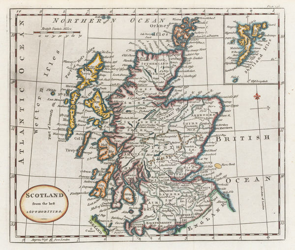
William Guthrie, Scotland from the best Authorities, 1792£ 115.00
-
James Rennell, Afghanistan, Pakistan, India and Turkestan, 1792£ 445.00
-
William Guthrie, A General Map of North America from the best Authorities, 1792£ 295.00
-
William Guthrie, Double Hemisphere World Map, 1792£ 295.00
-
Important map of the east coast of the United States and Canada, 1792 (c.)Antoine de SartineSeries: ParisAntoine de Sartine, Important map of the east coast of the United States and Canada, 1792 (c.)£ 3,250.00
-
Charles Cooke, North America with Captain Cook's discoveries, 1792 c.£ 695.00
-
A Plan of the Operations of the King's Army under the Command of Sir William Howe in New York and East New Jersey, 1793Charles StedmanSeries: LondonCharles Stedman, A Plan of the Operations of the King's Army under the Command of Sir William Howe in New York and East New Jersey, 1793£ 2,750.00
-
John Stockdale, Manchester, 1793£ 775.00
-
Jean Lattré, South America, 1793£ 165.00
-
John Cary, Essex, 1793£ 115.00
-
John Cary, Kent, 1793£ 115.00
-
J. Lindley and W. Crosley, Map of the County of Surrey, 1793£ 4,450.00
-
Plan of the Attack of the Forts Clinton & Montgomery, upon Hudsons River, 1793Charles StedmanSeries: LondonCharles Stedman, Plan of the Attack of the Forts Clinton & Montgomery, upon Hudsons River, 1793£ 2,450.00
-
Plan of the Position which the Army under Burgoine took at Saratoga, 1793Charles StedmanSeries: LondonCharles Stedman, Plan of the Position which the Army under Burgoine took at Saratoga, 1793£ 1,950.00


Page
46
of 130