-
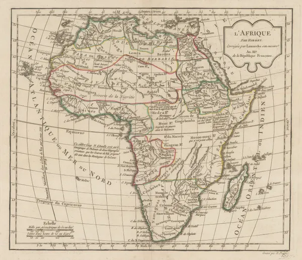
 Charles Francois Delamarche, Africa, 1795£ 345.00
 -
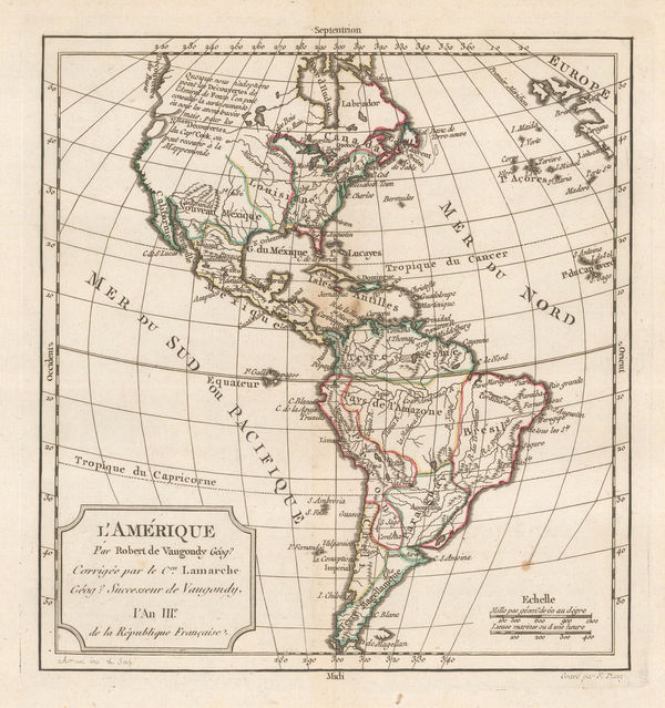
Charles Francois Delamarche, L'Amerique, 1795£ 495.00
-
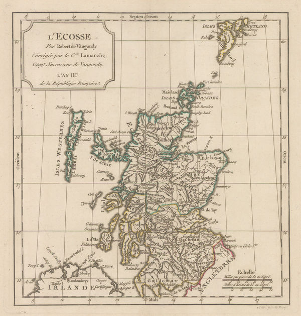
Charles Francois Delamarche, L'Ecosse, 1795£ 275.00
-
Charles Francois Delamarche, Italy, 1795£ 285.00
-
Charles Francois Delamarche, Southeast Asia, 1795£ 375.00
-
William Faden, Map of the Mediterranean Sea with the Adjacent Regions and Seas, 1795£ 3,750.00
-
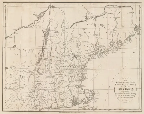
John Russell, Map of the Northern, or, New England States of America, 1795£ 525.00
-
John Russell, North America, 1795£ 145.00
-
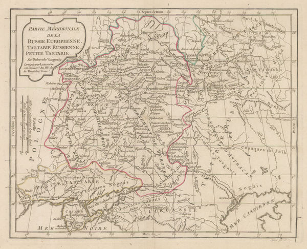
Charles Francois Delamarche, Southern part of European Russia, 1795£ 175.00
-
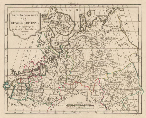
Charles Francois Delamarche, Northern part of European Russia, 1795£ 175.00
-
Charles Francois Delamarche, Kingdoms of Spain and Portugal, 1795£ 195.00
-
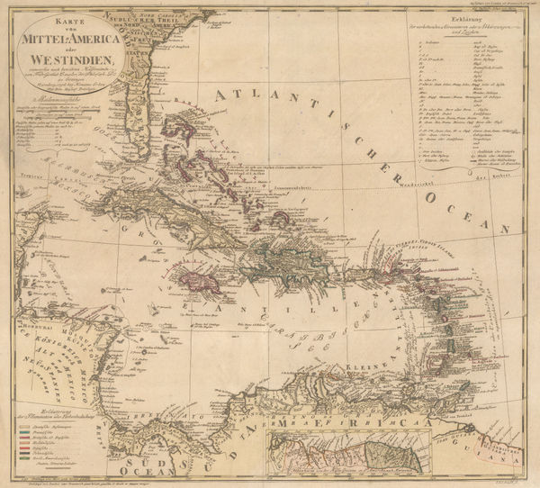
Antonio Zatta, Greater and Lesser Antilles, 1795£ 875.00
-
Charles Francois Delamarche, Northern half of South America, 1795£ 225.00
-
William Faden, The Dutch Colony of the Cape of Good Hope, 1795£ 1,550.00
-
John Russell, United Provinces, 1795£ 38.00
-
A Map of the States of Virginia, North Carolina, South Carolina and Georgia, 1795Joseph PurcellSeries: EdinburghJoseph Purcell, A Map of the States of Virginia, North Carolina, South Carolina and Georgia, 1795£ 1,925.00
-
William Faden, A Topographical Map of the County of Sussex, 1795£ 3,500.00
-
Jedediah Morse, A New Map of Africa from the best Authorities, 1795£ 185.00
-
Jacques-Nicolas Bellin, North Pacific, Alaska & the Bering Strait, 1795 c£ 3,450.00
-
Bowles & Carver, Asia with political divisions, 1795 c.£ 545.00
-
Bowles & Carver, Belgium, 1795 c.£ 195.00
-
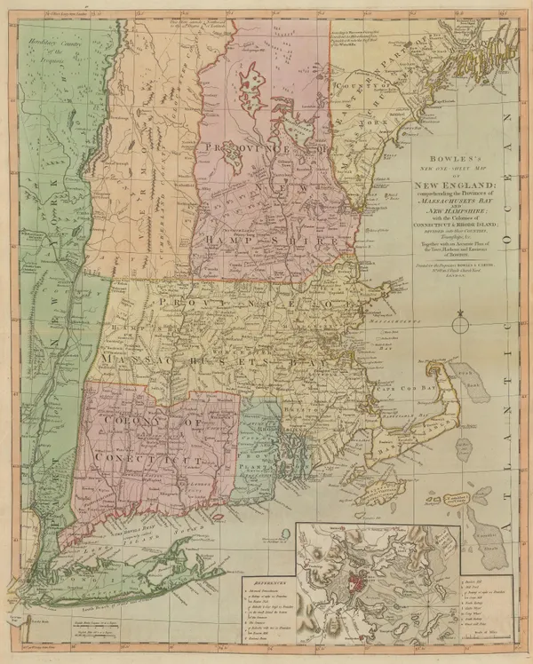
Bowles & Carver, Bowles's New One-Sheet Map of New England, 1795 c.£ 4,250.00
-
Bowles & Carver, Switzerland, 1795 c.£ 785.00
-
Bowles & Carver, Spain and Portugal, 1795 c.£ 245.00
-
John Meares, The North Pacific Ocean, 1795 c.£ 675.00
-
John Meares, Western Canada, 1795 c.£ 985.00
-
-
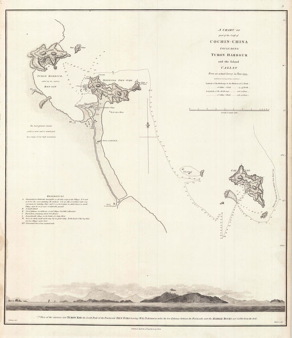
Sir George Staunton, Danang (Turon) Harbour, 1796£ 325.00
-
Sir George Staunton, Track of H.M.S. Clarence through the Zhoushan Archipelago, 1796£ 295.00
-
Sir George Staunton, Chart of the ship routes of Sir George Staunton expedition, 1796£ 725.00
-
William Faden, Chart of the West Indies, 1796£ 2,950.00
-
Sir George Staunton, A General Chart on Mercator's Projection, 1796£ 1,450.00
-
John Reid, A General Map of North America drawn from the Best Surveys, 1796£ 895.00
-
John Reid, A Map of the Tennassee Government formerly Part of North Carolina, 1796£ 1,450.00
-
Sir George Staunton, Coast of the Shandong peninsula, 1796£ 285.00
-
Sir George Staunton, Route map from Beijing to Hangzhou, 1796£ 985.00
-
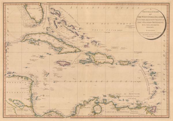
John Reid, The West Indies or Caribbean, 1796£ 495.00
-
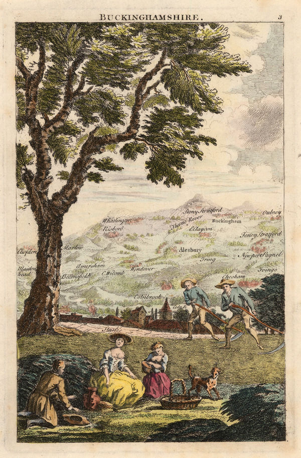
George Bickham, Buckinghamshire, 1796£ 175.00
-
Francois Levaillant, South Africa, 1796£ 3,450.00
-
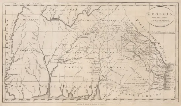
John Reid, Georgia from the Latest Authorities, 1796£ 1,550.00
-
George Bickham, Hertfordshire, 1796£ 185.00
-
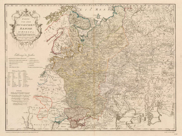
Franz Von Reilly, European Russia, 1796£ 295.00
-
Homann Heirs, West Indies and Florida, 1796£ 1,350.00
-
Friedrich Justin Bertuch, La Lune et ses Montagnes, 1796£ 450.00
-
John Wilkes, Modern Africa, 1796£ 245.00
-
William Faden, Spain and Portugal, 1796£ 445.00
-
William Faden, The North Sea with the Kattegat, 1796£ 1,450.00
-
John Reid, The State of New Hampshire Compiled chiefly from Actual Surveys, 1796£ 950.00
-
John Reid, The State of New Jersey compiled from the Most Accurate Surveys, 1796£ 745.00
-
John Reid, The State of New York, compiled from the Most Authentic Information, 1796£ 750.00
-
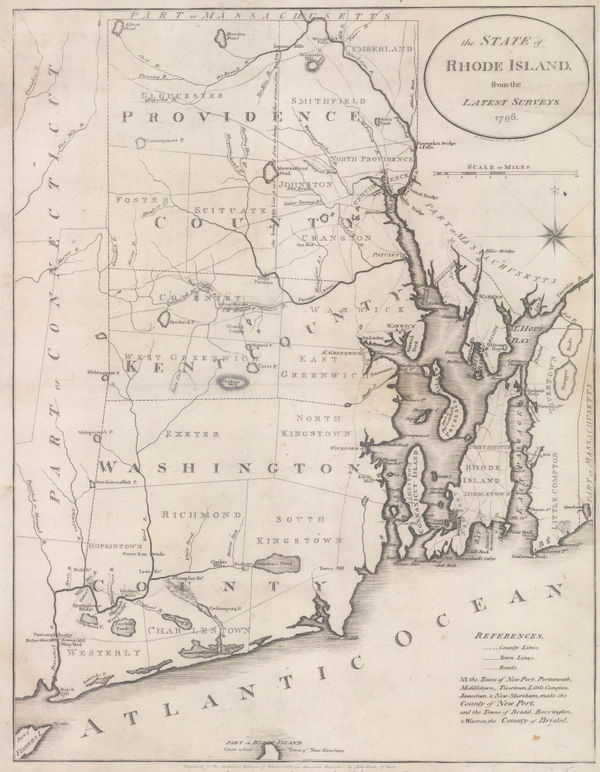
John Reid, The State of Rhode Island from the Latest Surveys, 1796£ 1,250.00
-
John Reid, The State of South Carolina from the Best Authorities, 1796£ 1,750.00
-
George Bickham, Bird's-Eye view of London, 1796£ 550.00
-
J. Denison, North and South Carolina, 1796£ 475.00
-
John Stockdale, The Proposed London Docks, 1796£ 650.00
-
John Stockdale, A Proposed Plan of Wet Docks in Wapping, 1796£ 850.00
-
Laurie & Whittle, Chart of Madagascar and Mozambique coast, 1797£ 1,250.00
-
Amos Doolittle, A Correct Map of Connecticut from an Actual Survey, 1797£ 985.00
-
Jedediah Morse, A Correct Map of the Georgia Western Territory, 1797£ 745.00
-
Samuel John Neele, A New Map of America, 1797£ 125.00
-
Daniel Beaufort, Civil and ecclesiastical map of Ireland, 1797£ 3,250.00
-
Andrew Bell, Asia, 1797£ 125.00
-
John Wilkes, British Colonies in North America, 1797£ 175.00
-
-
Chart of La Perouse's discoveries off the Pacific coast of Russia, 1797Jean Francois de La PerouseSeries: ParisJean Francois de La Perouse, Chart of La Perouse's discoveries off the Pacific coast of Russia, 1797£ 220.00
-
Chart of the coast of China, Korea, Japan, Taiwan and the Philippines, 1797Jean Francois de La PerouseSeries: ParisJean Francois de La Perouse, Chart of the coast of China, Korea, Japan, Taiwan and the Philippines, 1797£ 495.00
-
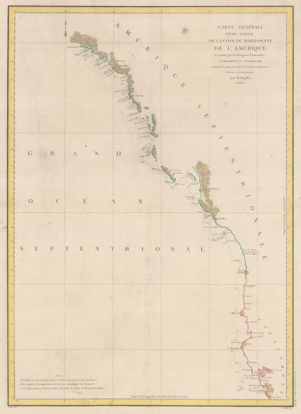
Comte de la Perouse's voyage, western coast of North America, 1797Jean Francois de La PerouseSeries: ParisJean Francois de La Perouse, Comte de la Perouse's voyage, western coast of North America, 1797£ 675.00
-
Lapérouse's Discoveries in China, Taiwan, Japan & Korea, 1797Jean Francois de La PerouseSeries: ParisJean Francois de La Perouse, Lapérouse's Discoveries in China, Taiwan, Japan & Korea, 1797£ 675.00
-
Andrew Bell, Denmark, Norway, Sweden and Finland, 1797£ 72.00
-
Geography Bewitched! or, a droll Caricature map of England & Wales, 1797Robert DightonSeries: LondonRobert Dighton, Geography Bewitched! or, a droll Caricature map of England & Wales, 1797£ 4,000.00
-
Robert Dighton, Rare caricature map of Ireland, 1797£ 4,000.00
-
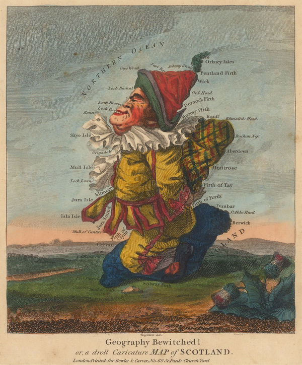
Robert Dighton, Geography Bewitched! or, a droll Caricature Map of Scotland, 1797£ 4,000.00
-
Giovanni Maria Cassini, Peninsular Southeast Asia, 1797£ 1,850.00
-
Abraham Bradley, Map of the Southern United States of America, 1797£ 850.00
-
William Faden, Kingdom of Portugal, 1797£ 220.00
-
Andrew Bell, Miniature map of North America, 1797£ 265.00
-
-
Chart of the Pacific, La Pérouse and the Spanish galleons routes, 1797Jean Francois de La PerouseSeries: ParisJean Francois de La Perouse, Chart of the Pacific, La Pérouse and the Spanish galleons routes, 1797£ 430.00
-
Earliest commercially available map of San Francisco Bay, 1797Jean Francois de La PerouseSeries: ParisJean Francois de La Perouse, Earliest commercially available map of San Francisco Bay, 1797£ 1,650.00
-
Laurie & Whittle, Plan of the Harbour of Colombo, on the West Coast of Ceylon, 1797£ 925.00


Page
48
of 130