-
 James Pigot, Lancashire, 1840£ 155.00
 -
James Wyld, Map of America, 1840£ 875.00
-
William Colling Hobson, Map of the County Palatine of Durham, 1840£ 950.00
-
James Wyld, Mexico and Central America showing the Position of the Mines, 1840£ 675.00
-
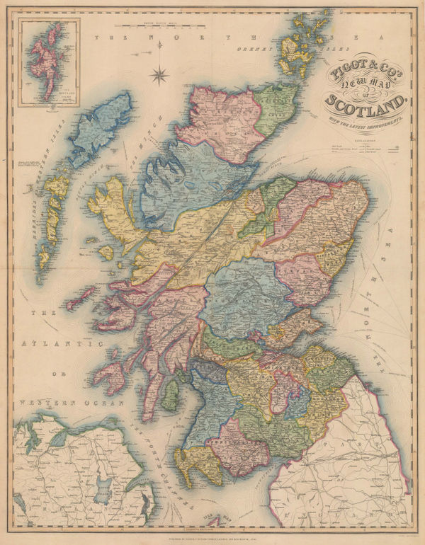
James Pigot, New Map of Scotland with the latest Improvements, 1840£ 750.00
-
James Pigot, Northumberland, 1840£ 115.00
-
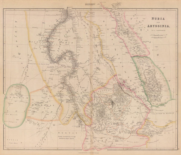
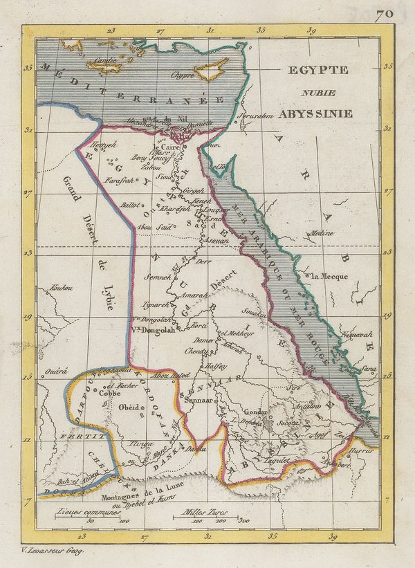
John Arrowsmith, Nubia and Abyssinia, 1840£ 375.00
-
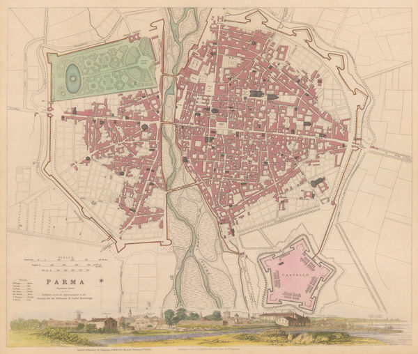
Society for the Diffusion of Useful Knowledge (SDUK), Parma, 1840£ 150.00
-
James Pigot, Suffolk, 1840£ 145.00
-
Society for the Diffusion of Useful Knowledge (SDUK), Istanbul (Constantinople), 1840£ 485.00
-
James Pigot, Somersetshire, 1840£ 185.00
-
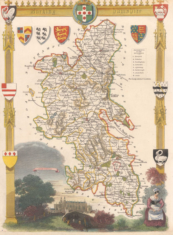
James Pigot, Berkshire, 1840£ 185.00
-
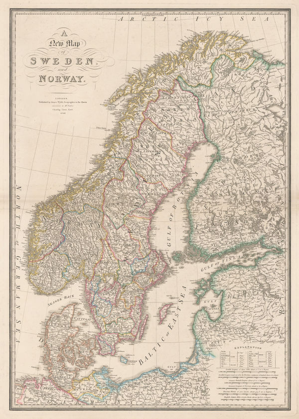
James Wyld, A New Map of Sweden and Norway, 1840£ 450.00
-
A.D. Noel and Louis Vivian de St. Martin, Ottoman Empire, 1840£ 3,250.00
-
Isaac Slater, Hertfordshire, 1840£ 135.00
-
Carl Flemming, United States of North America, 1840 (c.)£ 885.00
-
W. & A.K. Johnston, Australia, 1840 c£ 675.00
-
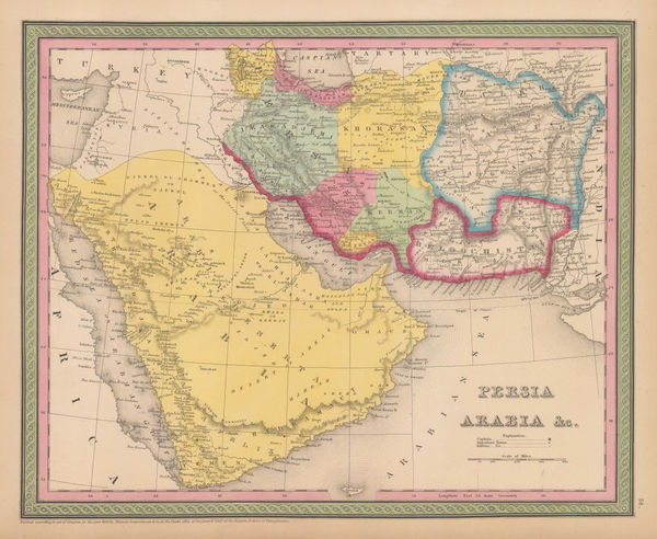
Samuel Augustus Mitchell, Arabia, Persia, 1840 c£ 575.00
-
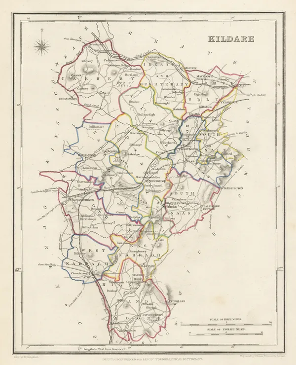
Samuel Lewis, Kildare, 1840 c£ 85.00
-
Samuel Lewis, Wicklow, 1840 c£ 95.00
-
James Wyld, A Map of the Province of Upper Canada, 1840 c.£ 925.00
-
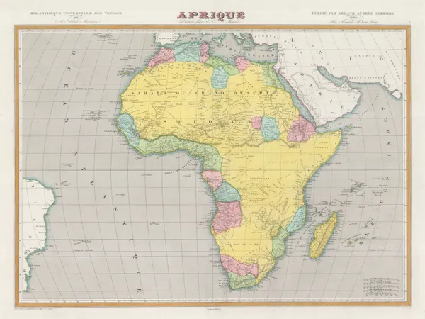
Charles V. Monin, Africa divided into states and colonies, 1840 c.£ 175.00
-
Sidney Hall, Asia, 1840 c.£ 60.00
-
Thomas Moule, Bedfordshire, 1840 c.£ 80.00
-
James Pigot, Bedfordshire, 1840 c.£ 85.00
-
Thomas Moule, Berk Shire, 1840 c.£ 125.00
-
John Dower, Birmingham, 1840 c.£ 95.00
-
Thomas Moule, Buckinghamshire, 1840 c.£ 110.00
-
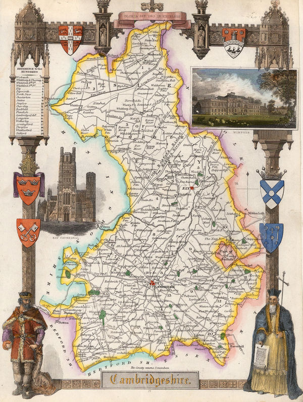
Thomas Moule, Cambridgeshire, 1840 c.£ 145.00
-
Samuel Lewis, Cambridgeshire, 1840 c.£ 35.00
-
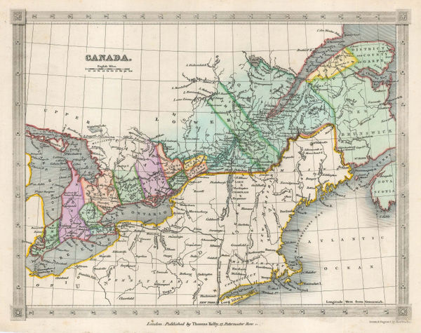
Thomas Kelly, Canada, 1840 c.£ 85.00
-
Samuel Lewis, Cavan, Westmeath, & Meath, 1840 c.£ 45.00
-
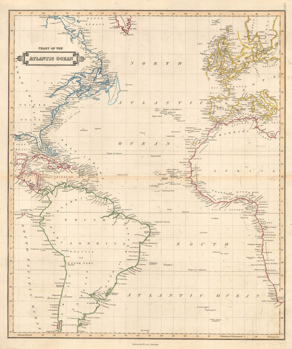
Daniel & William Lizars, Chart of the Atlantic Ocean, 1840 c.£ 145.00
-
Henry Teesdale, Colombia, Ecuador and Venezuela, 1840 c.£ 265.00
-
Compartative View of the Principal Mountains and Rivers in the World, 1840 c.Sidney HallSeries: LondonSidney Hall, Compartative View of the Principal Mountains and Rivers in the World, 1840 c.£ 475.00
-
Thomas Moule, Cornwall, 1840 c.£ 195.00
-
Thomas Moule, Devonshire, 1840 c.£ 175.00
-
Thomas Moule, Dorsetshire, 1840 c.£ 98.00
-
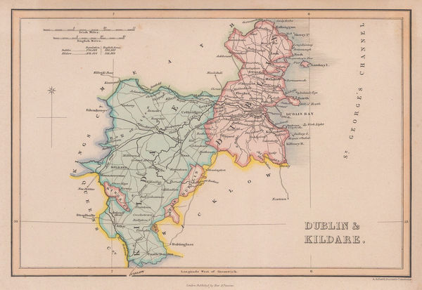
Samuel Lewis, Dublin & Kildare, 1840 c.£ 65.00
-
Thomas Moule, Durham, 1840 c.£ 95.00
-
James Pigot, Durham, 1840 c.£ 95.00
-
Victor Levasseur, Miniature map of north-eastern Africa, 1840 c.£ 35.00
-
Samuel Lewis, Essex, 1840 c.£ 68.00
-
Isaac Slater, Essex, 1840 c.£ 125.00
-
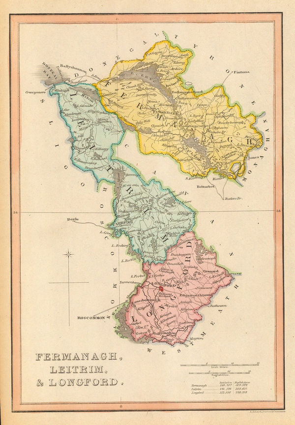
Samuel Lewis, Fermanagh, Leitrim & Longford, 1840 c.£ 50.00
-
Joshua Archer, Flintshire, 1840 c.£ 30.00
-
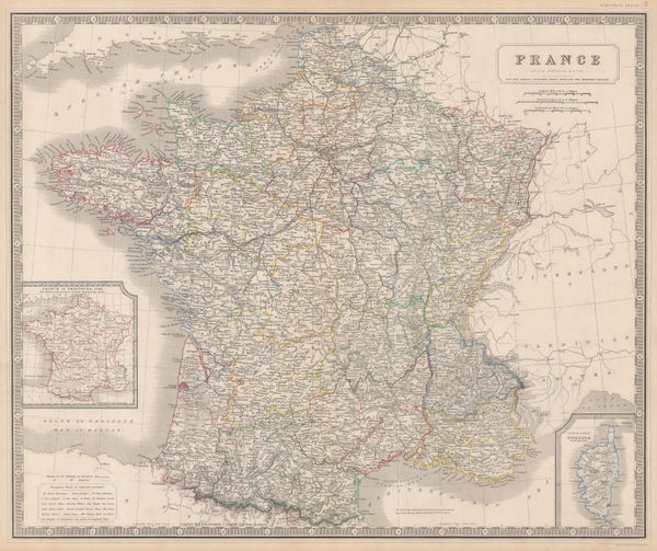
W. & A.K. Johnston, France, 1840 c.£ 85.00
-
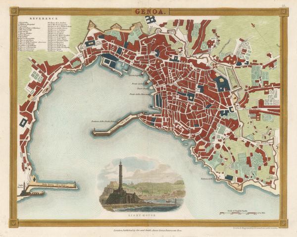
John Dower, Genoa, 1840 c.£ 175.00
-
Geographical Diagram of the Earth Adapted for Illustrating its Movements &c., 1840 c.James ReynoldsSeries: LondonJames Reynolds, Geographical Diagram of the Earth Adapted for Illustrating its Movements &c., 1840 c.£ 275.00
-
W. & A.K. Johnston, Asia, 1840 c.£ 140.00
-
James Pigot, Gloucestershire, 1840 c.£ 145.00
-
Thomas Moule, Hampshire, 1840 c.£ 185.00
-
Thomas Moule, Herefordshire, 1840 c.£ 68.00
-
Thomas Kelly, Holland & Belgium, 1840 c.£ 30.00
-
Thomas Moule, Huntingdonshire, 1840 c.£ 45.00
-
Northeastern India - Bahar and Orissa, 1840 c.Society for the Diffusion of Useful Knowledge (SDUK)Series: LondonSociety for the Diffusion of Useful Knowledge (SDUK), Northeastern India - Bahar and Orissa, 1840 c.£ 45.00
-
W. & A.K. Johnston, Islands of the Pacific Ocean, 1840 c.£ 80.00
-
Thomas Moule, Isle of Wight, 1840 c.£ 135.00
-
Thomas Kelly, Italy, 1840 c.£ 125.00
-
W. & A.K. Johnston, Southern Italy and Sicily, 1840 c.£ 145.00
-
Samuel Lewis, Kent, 1840 c.£ 68.00
-
Thomas Moule, Lancashire, 1840 c.£ 175.00
-
Thomas Moule, Leicestershire, 1840 c.£ 95.00
-
Samuel Lewis, Leicestershire, 1840 c.£ 40.00
-
Thomas Moule, Lincolnshire, 1840 c.£ 118.00
-
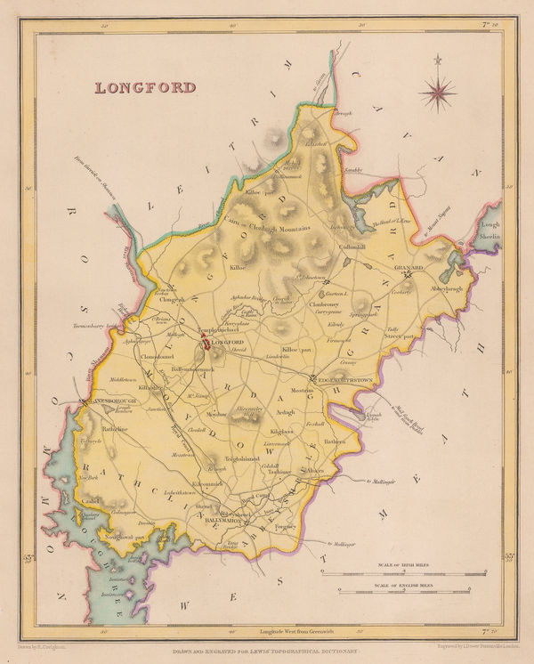
Samuel Lewis, Longford, 1840 c.£ 62.00
-
James Wyld, Sierra Leone, 1840 c.£ 1,250.00
-
James Wyld, Map of the Peninsula of India, 1840 c.£ 695.00
-
Thomas Moule, Monmouthshire, 1840 c.£ 82.00
-
James Pigot, Norfolk, 1840 c.£ 175.00
-
Thomas Moule, Oxfordshire, 1840 c.£ 145.00
-
Thomas Moule, Boston, 1840 c.£ 65.00
-
Sidney Hall, Portugal, 1840 c.£ 125.00
-
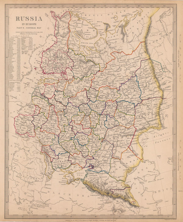
Society for the Diffusion of Useful Knowledge (SDUK), Russia in Europe, 1840 c.£ 95.00
-
Thomas Moule, Rutlanshire, 1840 c.£ 68.00
-
Daniel & William Lizars, Scandinavia, 1840 c.£ 175.00
-
Thomas Moule, Shropshire, 1840 c.£ 85.00
-
Thomas Moule, Somersetshire, 1840 c.£ 118.00
-
Society for the Diffusion of Useful Knowledge (SDUK), Bolivia and Peru, 1840 c.£ 70.00
-
W. & A.K. Johnston, Spain and Portugal, 1840 c.£ 115.00


Page
66
of 130