-
 Samuel Lewis, Dorset, 1842£ 68.00
 -
Robert Wilkinson, Ancient Greece, 1842£ 125.00
-
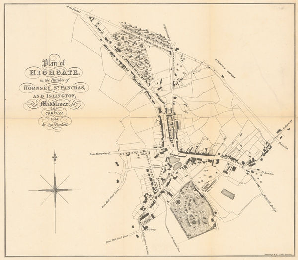
George Prickett, Plan of Highgate, 1842£ 595.00
-
Robert Wilkinson, Six Chrono-Genealogical Charts of Biblical History, 1842£ 240
-
Robert Wilkinson, The Heart of the Roman Empire, 1842£ 125.00
-
Robert Wilkinson, The Empire of Charlemagne, 1842£ 95.00
-
Robert Wilkinson, Ancient Anatolia, 1842£ 85.00
-
Robert Wilkinson, Syria and Assyria, 1842£ 85.00
-
John Arrowsmith, Australia, 1842£ 2,850.00
-
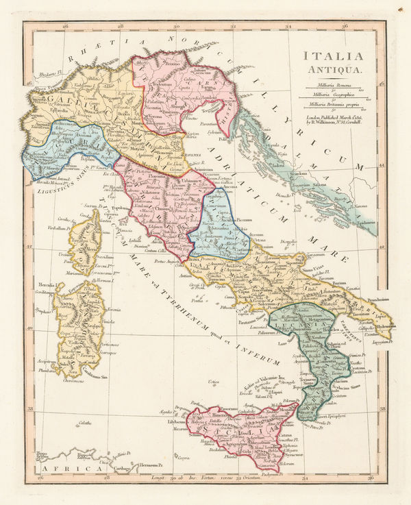
Robert Wilkinson, Ancient Italy, 1842£ 95.00
-
Robert Wilkinson, The March of the Ten Thousand Greeks, 1842£ 135.00
-
-
Robert Wilkinson, King Solomon's Twelve Purveyors, 1842£ 85.00
-
Robert Wilkinson, Parthian Empire, 1842£ 125.00
-
Samuel Lewis, Northumberland, 1842£ 65.00
-
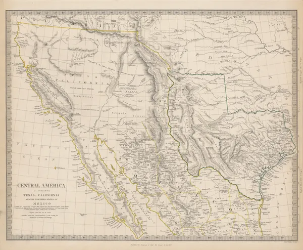
Central America II. Including Texas, California and the Northern States of Mexico, 1842Society for the Diffusion of Useful Knowledge (SDUK)Series: LondonSociety for the Diffusion of Useful Knowledge (SDUK), Central America II. Including Texas, California and the Northern States of Mexico, 1842£ 775.00
-
Robert Wilkinson, Canaan from the Time of Joshua to the Babylonish Captivity, 1842£ 195.00
-
John Arrowsmith, Cape of Good Hope, 1842£ 850.00
-
Robert Wilkinson, The Route of St. Paul, 1842£ 125.00
-
Samuel Lewis, Hertfordshire, 1842£ 68.00
-
John Arrowsmith, South Italy, 1842£ 195.00
-
George Prickett, Highgate and Hornsey Park, 1842£ 395.00
-
-
W. & A.K. Johnston, Austrian Empire, 1842 c.£ 95.00
-
Joshua Archer, Asia, 1843£ 78.00
-
Thomas Kelly, Asia, 1843£ 50.00
-
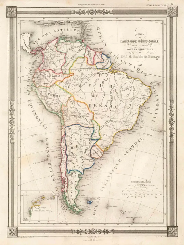
Jean-Denis Barbié du Bocage, South America, 1843£ 140.00
-
French Admiralty, Chart of the Gulf of Mexico, 1843£ 885.00
-
British Admiralty, France South Coast: Port Vendre, 1843£ 50.00
-
Hydrographical Basin of the Upper Mississippi River, 1843Joseph Nicolas NicolletSeries: Washington, D.C.Joseph Nicolas Nicollet, Hydrographical Basin of the Upper Mississippi River, 1843£ 3,450.00
-
Charles Frederick Cheffins, Map of the English and Scottish Railways, 1843£ 475.00
-
Joseph Meyer, West Indies and Central America, 1843£ 165.00
-
J. & C. Walker, Northamptonshire, 1843£ 75.00
-
Otranto to Monopoli in Italy and Ragusa to Port Palermo in Albania, 1843British AdmiraltySeries: LondonBritish Admiralty, Otranto to Monopoli in Italy and Ragusa to Port Palermo in Albania, 1843£ 185.00
-
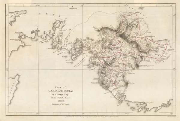
Royal Geographical Society (RGS), Part of Caria and Lycia / Muğla Province, 1843£ 115.00
-
Eugenio Rodriguez, Chart of Rio de Janeiro, 1843£ 2,950.00
-
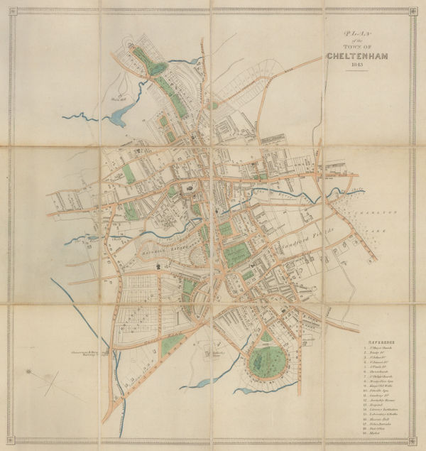
John Lee, Cheltenham, 1843£ 125.00
-
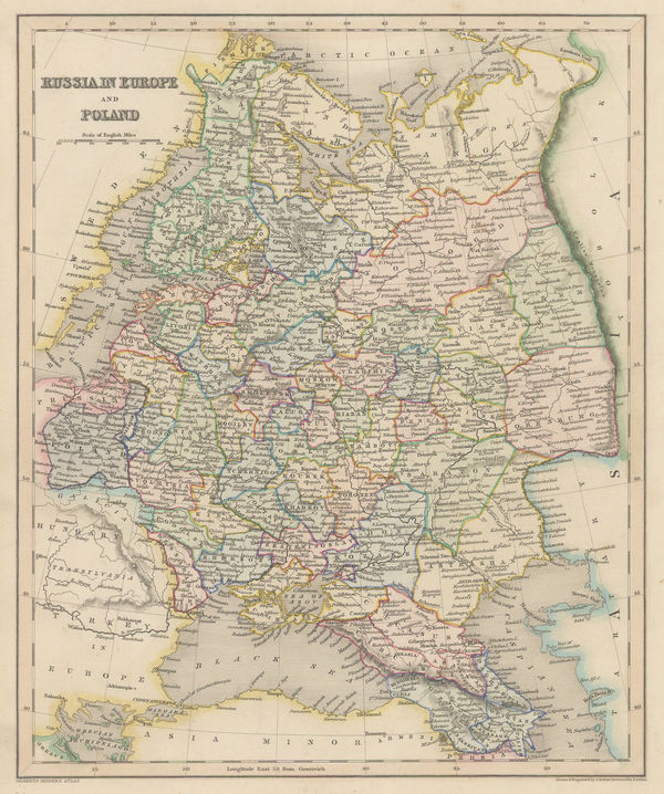
Joshua Archer, Russia in Europe and Poland, 1843£ 66.00
-
Thomas Tegg, United States, 1843£ 55.00
-
Royal Geographical Society (RGS), Natron Lakes of Egypt, 1843£ 145.00
-
Edward Wallis, Wallis's Guide for Strangers through London, 1843£ 1,350.00
-
Joseph Meyer, America, 1843£ 145.00
-
James Hall, Geological Map of the Middle and Western States, 1843£ 1,250.00
-
W. & A.K. Johnston, United States and Texas, 1843£ 1,150.00
-
Alexandre Vuillemin, Pictorial plan of Paris, 1843£ 650.00
-
James Wyld, A New Topographical Map of the Country in the vicinity of London, 1843£ 2,650.00
-
James Wyld, Map of India, 1843£ 2,250.00
-
Samuel Augustus Mitchell, National Map of the American Republic, 1843£ 1,450.00
-
Samuel Augustus Mitchell, US Cities and Statistics, 1843£ 1,150.00
-
Society for the Diffusion of Useful Knowledge (SDUK), Ancient Britain, 1843£ 95.00
-
Richard Holmes Laurie, Laurie's Plan of London, Westminster, and Southwark, 1843£ 3,450.00
-
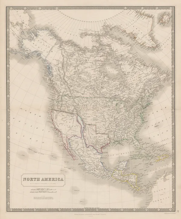
W. & A.K. Johnston, North America, 1843£ 925.00
-
A Set of Celestial Maps intended to assist Students in Astronomy, and Seamen in general, In acquiring a knowledge of the Principal Fixed Stars in the Heavens., 1844John William NorieSeries: LondonJohn William Norie, A Set of Celestial Maps intended to assist Students in Astronomy, and Seamen in general, In acquiring a knowledge of the Principal Fixed Stars in the Heavens., 1844£ 875.00
-
John Arrowsmith, America, 1844£ 1,950.00
-
Joseph Meyer, Brazil and Guyana, 1844£ 195.00
-
W. & A.K. Johnston, Chart of the World on Mercator's Projection, 1844£ 575.00
-
J. & C. Walker, Cheshire, 1844£ 75.00
-
J. & C. Walker, Leicestershire, 1844£ 44.00
-
Map Illustrating Dr. Beke's Journey through Abyssinia, 1844Royal Geographical Society (RGS)Series: LondonRoyal Geographical Society (RGS), Map Illustrating Dr. Beke's Journey through Abyssinia, 1844£ 175.00
-
James Wyld, Map of Africa, 1844£ 1,250.00
-
James Wyld, Map of Europe, 1844£ 895.00
-
James Wyld, German Confederation, 1844£ 375.00
-
Charles J. Muggeridge, Map of the Hop District of Kent and Sussex, 1844£ 1,200.00
-
John Arrowsmith, Map of the Ionian Islands and Malta, 1844£ 325.00
-
-
James Gilbert, Map of the World on Mercator's Projection, 1844£ 4,850.00
-
Joseph Meyer, The Greater Antilles, 1844£ 225.00
-
Joseph Meyer, Egypt, the Nile and Nubia (Sudan), 1844£ 115.00
-
Joseph Meyer, German map of Arkansas, 1844£ 245.00
-
Joseph Meyer, Sweden & Norway, 1844£ 175.00
-
Joseph Meyer, Quebec Province, 1844£ 88.00
-
Joseph Meyer, State of New York, 1844£ 385.00
-
Joseph Meyer, Tunisia, 1844£ 175.00
-
Joseph Meyer, Morocco, 1844£ 195.00
-
Thomas Oliver, Newcastle & Gateshead, 1844£ 1,850.00
-
Joseph Meyer, City plan of Madrid, 1844£ 295.00
-
Joseph Meyer, New York City, 1844£ 845.00
-
Joseph Meyer, City plan of St. Petersburg, 1844£ 950.00
-
Joseph Meyer, Stockholm, 1844£ 625.00
-
Royal Geographical Society (RGS), South Australia, east of the Flinders Range, 1844£ 98.00


Page
68
of 130