-
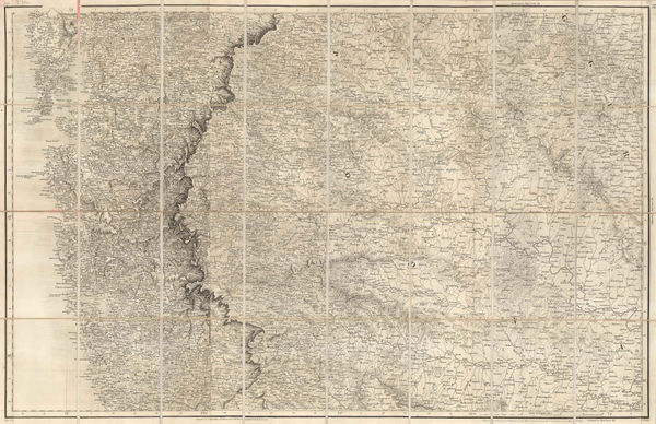
 Map No. 4 - From The Coo-Che-To-Pa Pass to the Wahsatch Mountains, 1855United States Pacific Railroad Expeditions (USPRR)Series: Washington, D.C.United States Pacific Railroad Expeditions (USPRR), Map No. 4 - From The Coo-Che-To-Pa Pass to the Wahsatch Mountains, 1855£ 595.00
 -
Map No.3 - From the Santa Fe Crossing to the Coo Che To Pa Pass, 1855United States Pacific Railroad Expeditions (USPRR)Series: Washington, D.C.United States Pacific Railroad Expeditions (USPRR), Map No.3 - From the Santa Fe Crossing to the Coo Che To Pa Pass, 1855£ 525.00
-
-
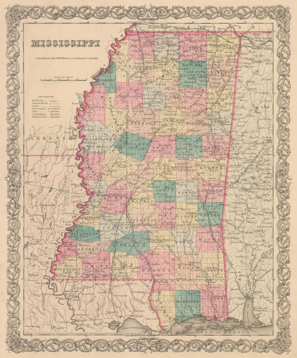
George Woolworth Colton, Mississippi, 1855£ 85.00
-
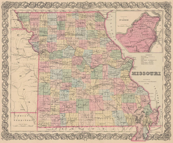
George Woolworth Colton, Missouri, 1855£ 88.00
-
George Woolworth Colton, New Jersey, 1855£ 195.00
-
George Frederick Cruchley, Folding wall map of Europe, 1855£ 2,750.00
-
Pierre Tardieu, Paris showing Districts & Quarters, 1855£ 595.00
-
Joseph Hutchins Colton, Pennsylvania, 1855£ 185.00
-
George Woolworth Colton, Prussia and Saxony, 1855£ 40.00
-
George Frederick Cruchley, Railway map of Hampshire, 1855£ 225.00
-
Sir Archibald Alison, Siege of Saragossa, 1855£ 75.00
-
Sir Archibald Alison, Siege of St. Jean d'Acre, 1855£ 65.00
-
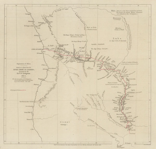
Royal Geographical Society (RGS), Livingstone's route from Botswana to Angola, 1855£ 225.00
-
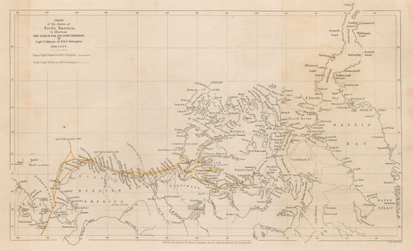
Sketch of the Shores of Arctic America to illustrate the Discovery of the Northwest Passage, 1855Royal Geographical Society (RGS)Series: LondonRoyal Geographical Society (RGS), Sketch of the Shores of Arctic America to illustrate the Discovery of the Northwest Passage, 1855£ 375.00
-
Joseph Hutchins Colton, Southern Regions, 1855£ 450.00
-
John Tallis, Spain and Portugal, 1855£ 245.00
-
British Admiralty, St. Petersburg Bay, 1855£ 675.00
-
Edward Stanford, Chart of the Sea of Azov, 1855£ 545.00
-
Joseph Hutchins Colton, Pittsburgh and Cincinnati, 1855£ 88.00
-
Royal Geographical Society (RGS), The Rivers Kwora & Chadda or Binue, 1855£ 115.00
-
John Walker, Mumbai & Western Maharashtra, 1855£ 595.00
-
Justus Perthes, Heinrich Barth's Route from Saraijamo to Timbukto, 1855£ 145.00
-
Sir Archibald Alison, Lines of Torres Vedras, 1855£ 72.00
-
Sir Archibald Alison, Battle of Malo-Jaroslawitz, 1855£ 58.00
-
Sir Archibald Alison, Battle of Camperdown, 1855£ 115.00
-
Sir Archibald Alison, Battle of Krasnoi, 1855£ 68.00
-
The Northwest Passage and the Search for Sir John Franklin, 1855Royal Geographical Society (RGS)Series: LondonRoyal Geographical Society (RGS), The Northwest Passage and the Search for Sir John Franklin, 1855£ 395.00
-
Justus Perthes, Geological Map of India, 1855£ 145.00
-
Joseph Meyer, Baltic Sea, 1855£ 145.00
-
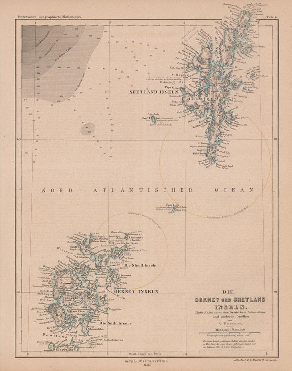
Justus Perthes, Orkney & Shetland Islands, 1855£ 75.00
-
Justus Perthes, Queen Elizabeth Islands (Parry Archipelago), 1855£ 595.00
-
W. & A.K. Johnston, Geological Map of the World, 1855£ 750.00
-
W. & A.K. Johnston, The Crop Distribution of the World, 1855£ 375.00
-
William P. Blake, Geological Map of California, 1855£ 795.00
-
Sir Archibald Alison, Battle of Cape St. Vincent, 1855£ 225.00
-
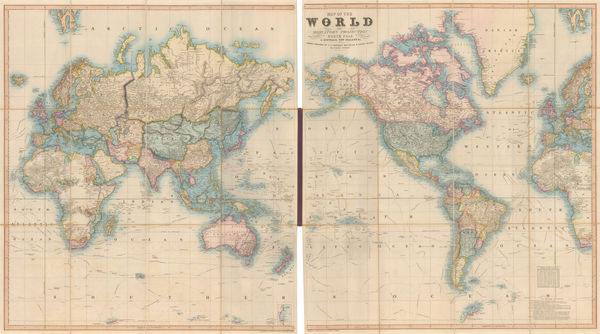
W. & A.K. Johnston, Commercial Chart of the World, 1855£ 4,500.00
-
Sir Archibald Alison, Battle of Wavre, 1855£ 68.00
-
Justus Perthes, Tristan da Cunha, 1855£ 95.00
-
George Philip & Son Ltd., Liverpool, 1855 (c.)£ 850.00
-
Society for the Diffusion of Useful Knowledge (SDUK), London, 1855 c£ 1,250.00
-
A New Map for Travellers through the United States of America showing the Railways Canals and Stage Roads, 1855 c.George Philip & Son Ltd.Series: LiverpoolGeorge Philip & Son Ltd., A New Map for Travellers through the United States of America showing the Railways Canals and Stage Roads, 1855 c.£ 1,250.00
-
Sidney Hall, Myanmar (Burma), northeast India and western Thailand, 1855 c.£ 395.00
-
John Dower, Geneva, 1855 c.£ 240.00
-
Joseph Meyer, Canada, Alaska and Greenland, 1855 c.£ 165.00
-
Joseph Meyer, Spain and Portugal, 1855 c.£ 95.00
-
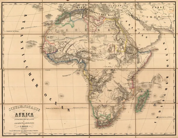
Leinhert Holle, Very rare German educational map of Africa, 1855 c.£ 1,950.00
-
Joseph Meyer, Nigeria, Cameroon & Chad, 1855 c.£ 165.00
-
William Mogg, Twenty Four Miles Round London, 1855 c.£ 1,200.00
-
Joseph Meyer, Peru and Bolivia, 1855 c.£ 95.00
-
John Rapkin, Africa, 1855 c.£ 185.00
-
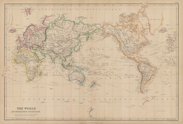
Blackie & Son, The World on Mercator's Projection, 1855 c.£ 325.00
-
Justus Perthes, Arabia, Ethiopia and Egypt, 1855 c.£ 445.00
-
Edward Quin, A.D. 1660. At the Restoration of the Stuarts, 1856£ 385.00
-
A. & C. Black, Arctic Regions and British America, 1856£ 325.00
-
A. & C. Black, Asia, 1856£ 48.00
-
George Philip & Son Ltd., Australia, 1856£ 550.00
-
George Philip, Canada, Nova Scotia & New Brunswick &c., 1856£ 220.00
-
The Route of Sir John Franklin's Doomed Arctic Expedition, 1856Royal Geographical Society (RGS)Series: LondonRoyal Geographical Society (RGS), The Route of Sir John Franklin's Doomed Arctic Expedition, 1856£ 595.00
-
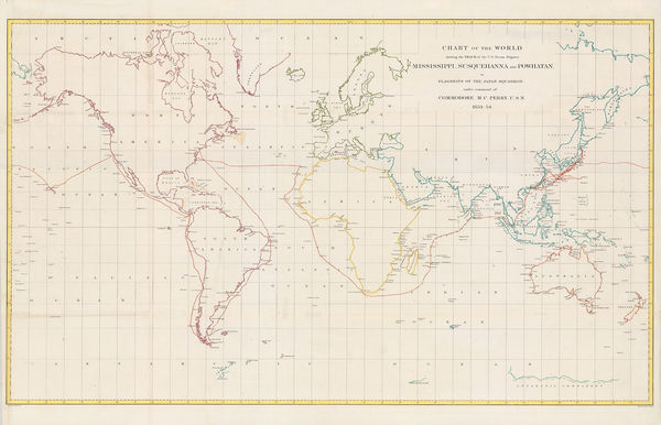
Matthew Perry, Chart of the World, 1856£ 950.00
-
Royal Geographical Society (RGS), Discoveries of the American Expedition, 1856£ 295.00
-
W. & A.K. Johnston, Geological Map of Europe, 1856£ 3,500.00
-
George Philip, Netherlands, 1856£ 180.00
-
George Philip, Pacific Ocean Islands, 1856£ 250.00
-
George Philip, Isle of Man, 1856£ 95.00
-
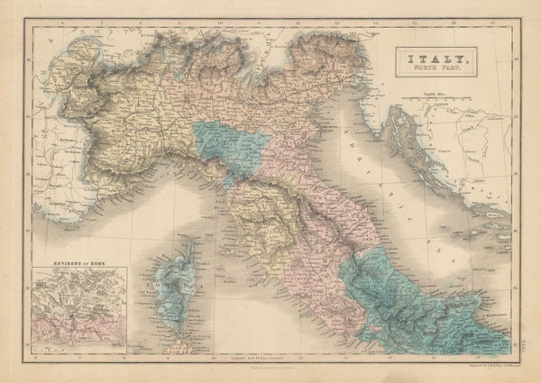
George Philip, Italy, 1856£ 285.00
-
A. & C. Black, Northern Italy and Corsica, 1856£ 42.00
-
George Philip & Son Ltd., Jamaica, 1856£ 250.00
-
Archibald Fullarton, Java - according to Van De Velde, 1856£ 76.00
-
Heinrich Keller, Road Map of Switzerland, 1856£ 135.00
-
A. & C. Black, Maine, 1856£ 68.00
-
Royal Geographical Society (RGS), Southern Iraq and Iranian border, 1856£ 145.00
-
Royal Geographical Society (RGS), Southern Central Africa, 1856£ 225.00
-
David H. Burr, Map Showing the Surveys in the Territory of Utah, 1856£ 1,550.00
-
Map to illustrate A Visit to Moselekatse, King of the Matebele, 1856Royal Geographical Society (RGS)Series: LondonRoyal Geographical Society (RGS), Map to illustrate A Visit to Moselekatse, King of the Matebele, 1856£ 145.00
-
Royal Geographical Society (RGS), Western Australia from Shark Bay to Perth, 1856£ 85.00
-
George Philip, Martinique & Dominica, 1856£ 140.00
-
Lallemand, Tourist map of Paris, 1856£ 445.00
-
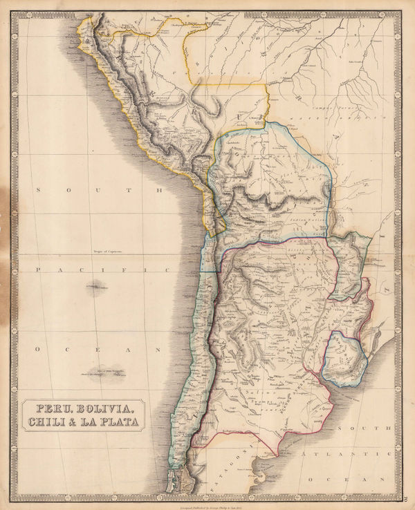
George Philip & Son Ltd., Peru, Bolivia, Chili & La Plata, 1856£ 295.00
-
Jean Andriveau-Goujon, Plan of Paris, 1856£ 695.00


Page
77
of 130